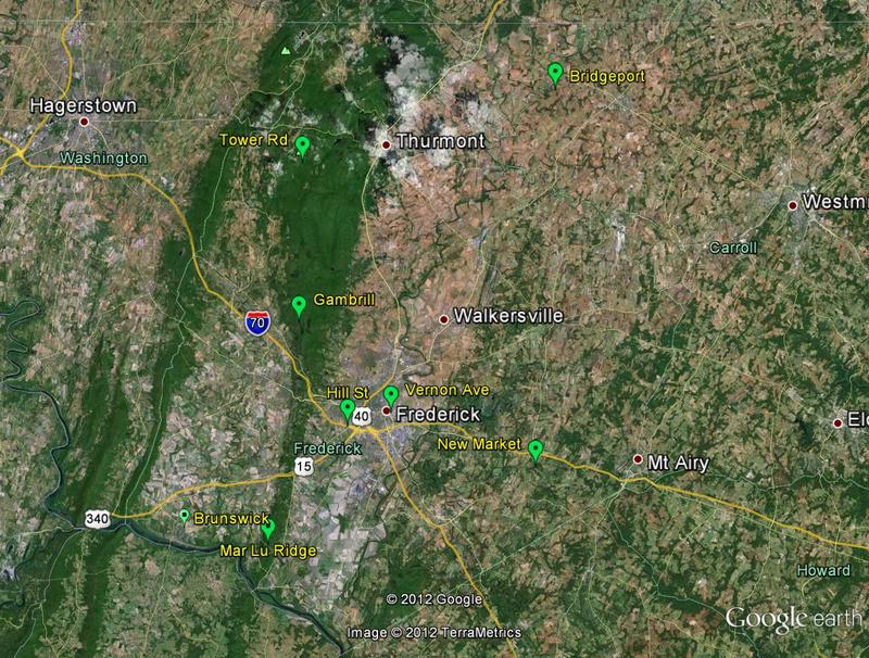
Fred County Towers.jpg
From The RadioReference Wiki
Size of this preview: 792 × 600 pixels. Other resolutions: 317 × 240 pixels | 800 × 606 pixels.
Original file (800 × 606 pixels, file size: 141 KB, MIME type: image/jpeg)
Google Earth pic of location of the Frederick County P25 system towers
File history
Click on a date/time to view the file as it appeared at that time.
| Date/Time | Thumbnail | Dimensions | User | Comment | |
|---|---|---|---|---|---|
| current | 20:55, 9 February 2013 | | 800 × 606 (141 KB) | Ka3jjz (talk | contribs) | Google Earth pic of location of the Frederick County P25 system towers |
- You cannot overwrite this file.
File usage
The following page uses this file: