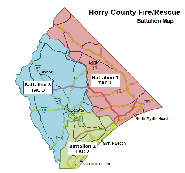
HCFR Batt Map.png
From The RadioReference Wiki
No higher resolution available.
HCFR_Batt_Map.png (598 × 561 pixels, file size: 57 KB, MIME type: image/png)
Horry Co (SC) Fire/Rescue Battalion Map
File history
Click on a date/time to view the file as it appeared at that time.
| Date/Time | Thumbnail | Dimensions | User | Comment | |
|---|---|---|---|---|---|
| current | 22:43, 13 December 2011 | | 598 × 561 (57 KB) | Brycel (talk | contribs) | Horry Co (SC) Fire/Rescue Battalion Map |
- You cannot overwrite this file.
File usage
The following page uses this file: