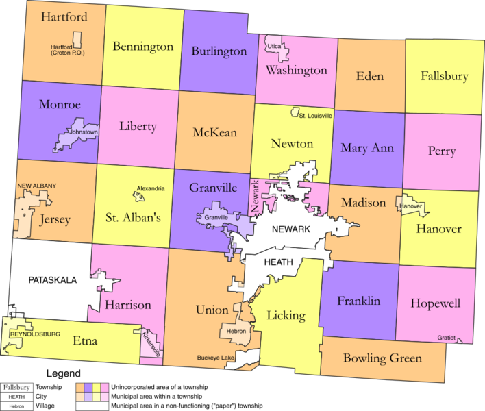
Licking County Map.png
From The RadioReference Wiki

Size of this preview: 708 × 600 pixels. Other resolutions: 283 × 240 pixels | 1,000 × 847 pixels.
Original file (1,000 × 847 pixels, file size: 226 KB, MIME type: image/png)
File history
Click on a date/time to view the file as it appeared at that time.
| Date/Time | Thumbnail | Dimensions | User | Comment | |
|---|---|---|---|---|---|
| current | 18:23, 27 August 2013 | | 1,000 × 847 (226 KB) | Ibagli (talk | contribs) | Change Buckeye Lake |
| 19:33, 14 February 2012 | 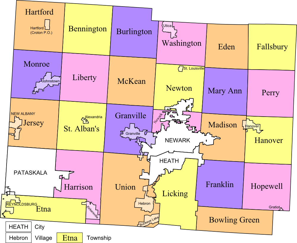 | 1,000 × 817 (225 KB) | Ibagli (talk | contribs) | Updates | |
| 02:27, 18 April 2009 | 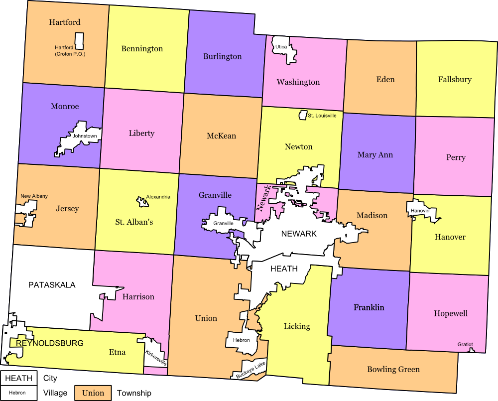 | 1,000 × 805 (195 KB) | Ibagli (talk | contribs) |
- You cannot overwrite this file.
File usage
The following page uses this file: