TRVA Map I77 320px.png
From The RadioReference Wiki
No higher resolution available.
TRVA_Map_I77_320px.png (320 × 187 pixels, file size: 18 KB, MIME type: image/png)
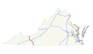
Map of I-77 in Virginia
License: http://en.wikipedia.org/wiki/File:I-77_%28VA%29_map.svg
Creator: http://commons.wikimedia.org/wiki/User:25or6to4
Source: ImgFile=
File history
Click on a date/time to view the file as it appeared at that time.
| Date/Time | Thumbnail | Dimensions | User | Comment | |
|---|---|---|---|---|---|
| current | 02:06, 24 February 2015 | | 320 × 187 (18 KB) | QDP2012 (talk | contribs) | Map of I-77 in Virginia License: http://en.wikipedia.org/wiki/File:I-77_%28VA%29_map.svg Creator: http://commons.wikimedia.org/wiki/User:25or6to4 Source: ImgFile=http://upload.wikimedia.org/wikipedia/commons/thumb/5/58/I-77_%28VA%29_map.svg/320px-I-77_ |
- You cannot overwrite this file.
File usage
The following page uses this file: