File list
This special page shows all uploaded files.
| Date | Name | Thumbnail | Size | User | Description | Versions |
|---|---|---|---|---|---|---|
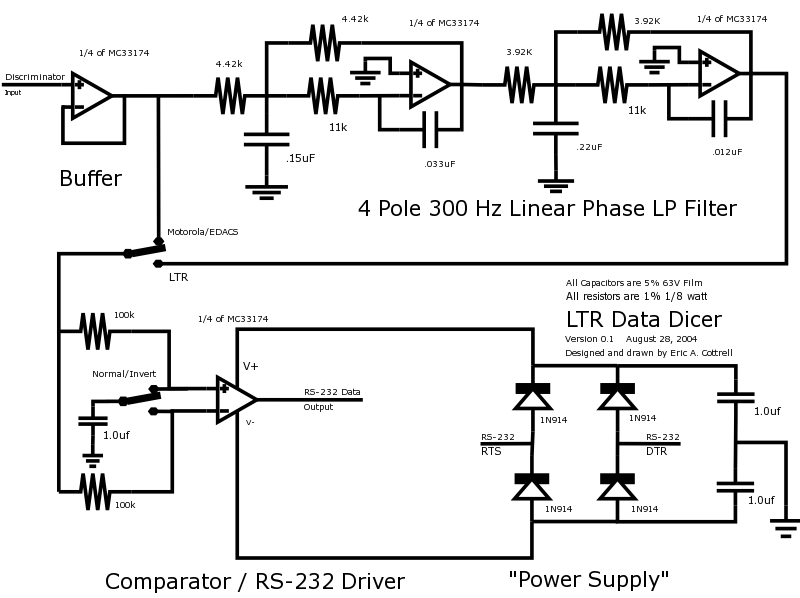
| 01:06, 5 February 2006 | LTRDicer1.png (file) |  |
53 KB | Mikeag | This is a schematic showing modifications necessary to a discriminator output to make it work better when using LTRTrunk and similar LTR utilities | 1 |
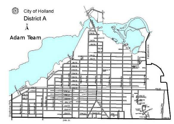
| 18:31, 28 April 2009 | Adam.png (file) |  |
251 KB | Slash | Zone A (Adam) | 1 |
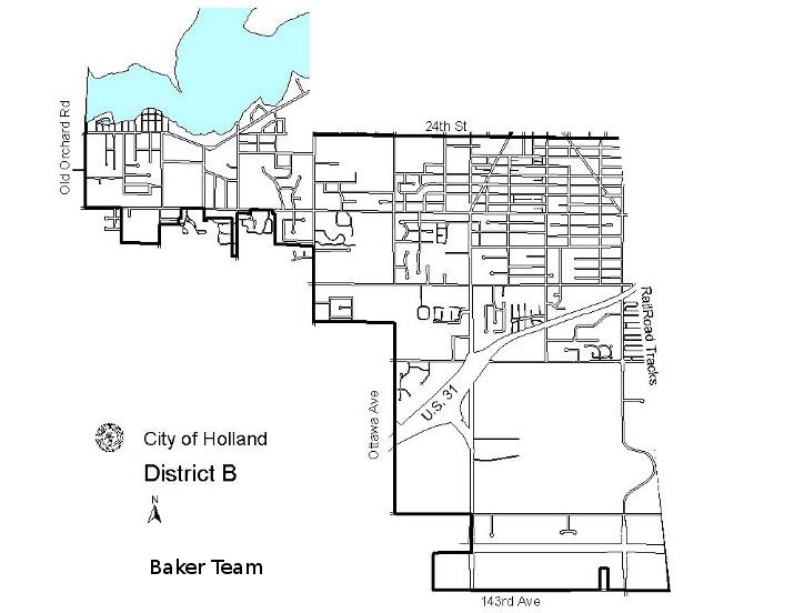
| 18:33, 28 April 2009 | Baker.png (file) |  |
177 KB | Slash | Zone B (Baker) | 1 |
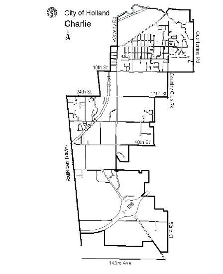
| 18:33, 28 April 2009 | Charlie.png (file) |  |
111 KB | Slash | Zone C (Charlie) | 1 |
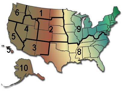
| 11:35, 31 May 2009 | UNITED STATES FOREST SERVICE REGION MAP.png (file) |  |
116 KB | Gvranchosbill | UNITED STATES FOREST SERVICE REGION MAP | 1 |
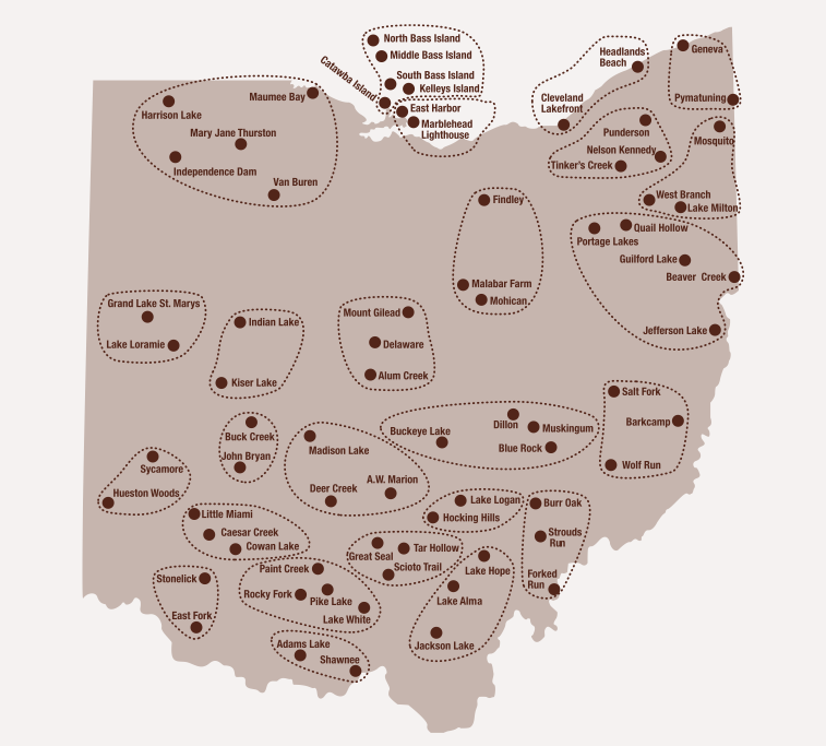
| 17:55, 31 May 2009 | Stateregion.png (file) |  |
127 KB | Wa8pyr | Ohio DNR statewide regions showing park locations | 1 |
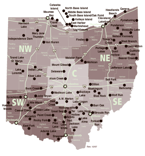
| 17:56, 31 May 2009 | Parkregion.png (file) |  |
165 KB | Wa8pyr | Ohio DNR Parks & Recreation regions, showing parks grouped by region | 1 |
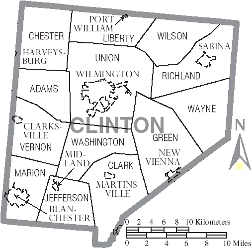
| 15:36, 1 June 2009 | Map of Clinton County Ohio With Municipal and Township Labels.PNG (file) |  |
41 KB | Radioscan | Map of Clinton County, Ohio showing townships and municipalities. | 1 |
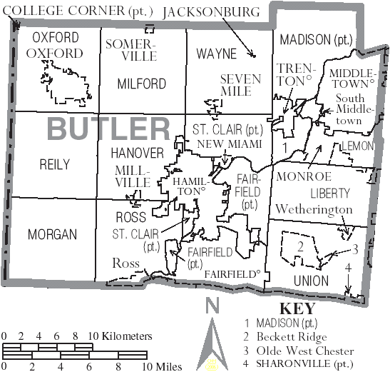
| 15:54, 10 June 2009 | Map of Butler County Ohio With Municipal and Township Labels.PNG (file) |  |
54 KB | Radioscan | Map of Butler County, Ohio | 1 |
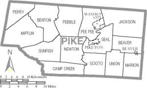
| 00:47, 11 June 2009 | Map of Pike County Ohio With Municipal and Township Labels.PNG (file) |  |
38 KB | Radioscan | 1 | |
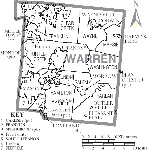
| 03:32, 11 June 2009 | Map of Warren County Ohio With Municipal and Township Labels.PNG (file) |  |
59 KB | Radioscan | 1 | |
| 06:31, 14 June 2009 | Licking County Police.png (file) |  |
194 KB | Ibagli | 1 | |
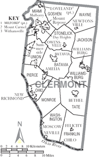
| 13:59, 11 July 2009 | 200px-Map of Clermont County Ohio With Municipal and Township Labels.PNG (file) |  |
68 KB | Radioscan | Map of Clermont County showing Municipalities and Townships | 1 |
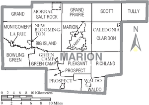
| 16:07, 12 July 2009 | Map of Marion County Ohio With Municipal and Township Labels.PNG (file) |  |
50 KB | Radioscan | Map of Marion County, Ohio showing municipalities and townships. | 1 |
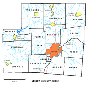
| 17:11, 12 July 2009 | 300px-Shelbytownships.PNG (file) |  |
63 KB | Radioscan | Map of townships in Shelby County, Ohio | 1 |
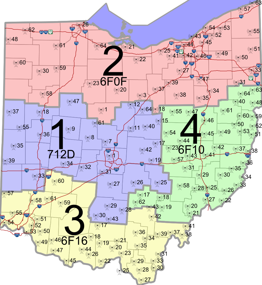
| 00:19, 16 July 2009 | Zones.png (file) |  |
94 KB | Wa8pyr | Ohio MARCS zones | 1 |
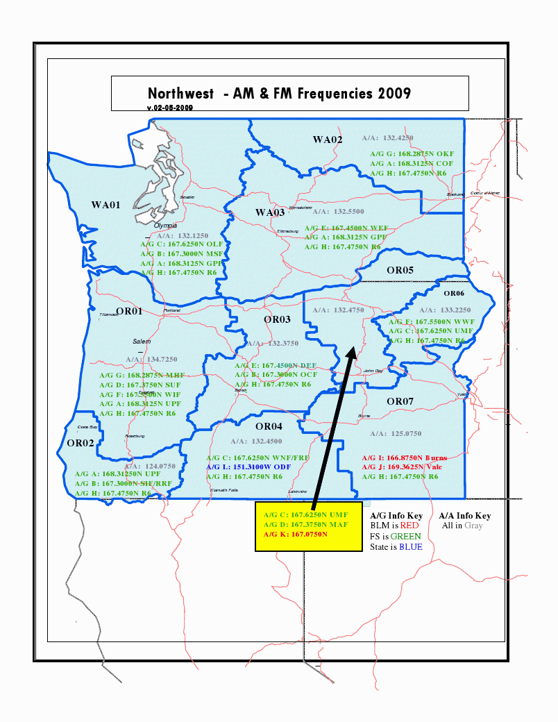
| 21:25, 12 August 2009 | USFS R6 Aircraft.png (file) |  |
125 KB | Kd7kdc | Forest Service Region 6 Aircraft Freq by District Map Circa 2009 | 1 |
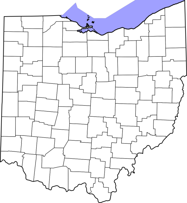
| 08:04, 17 August 2009 | Ohio County Map Blank.png (file) | 92 KB | Ibagli | 1 | ||
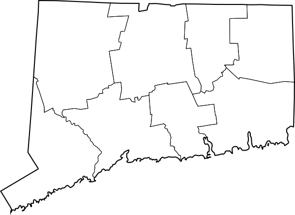
| 07:27, 19 August 2009 | Connecticut County Map Blank.png (file) | 38 KB | Ibagli | 1 | ||
| 05:07, 20 August 2009 | MARCS Map with Roads.png (file) |  |
473 KB | Ibagli | 2 | |
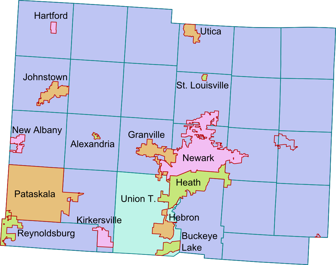
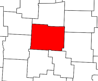
| 02:51, 27 August 2009 | Licking County (OH) Blank.png (file) | 19 KB | Ibagli | 2 | ||
| 04:20, 27 August 2009 | Collaboration Category Map.png (file) |  |
83 KB | Ibagli | 1 | |
| 02:26, 28 August 2009 | Firedept.png (file) |  |
3 KB | Ibagli | 1 | |
| 02:26, 28 August 2009 | Hospitals.png (file) |  |
942 bytes | Ibagli | 1 | |
| 02:26, 28 August 2009 | Police.png (file) |  |
3 KB | Ibagli | 1 | |
| 02:26, 28 August 2009 | Schools.png (file) |  |
2 KB | Ibagli | 1 | |
| 21:13, 8 September 2009 | PS1.png (file) |  |
191 KB | Blantonl | 1 | |
| 21:14, 8 September 2009 | PS2.png (file) |  |
82 KB | Blantonl | 1 | |
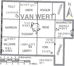
| 17:52, 20 September 2009 | Map of Van Wert County Ohio With Municipal and Township Labels.PNG (file) |  |
61 KB | Radioscan | Map of Van Wert County, Ohio including villages and townships. | 1 |
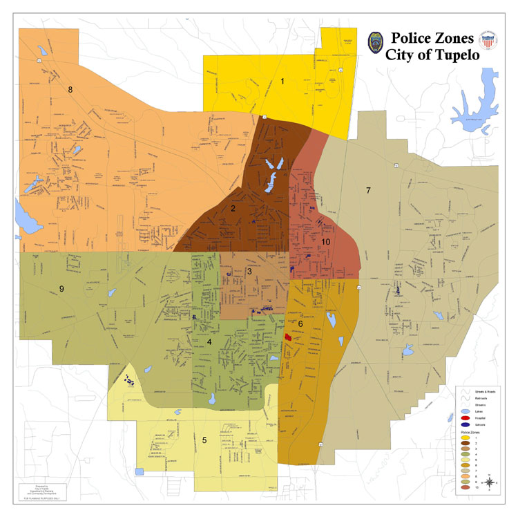
| 23:03, 23 September 2009 | Tupelopdzones.png (file) |  |
611 KB | Milf | Map of the City of Tupelo PD Zones | 1 |
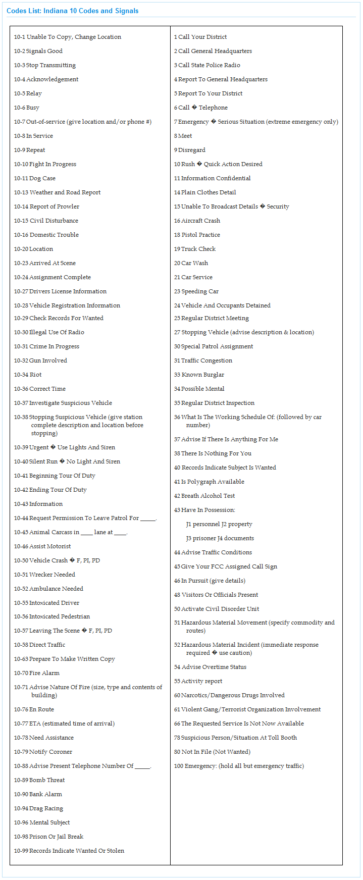
| 01:28, 29 September 2009 | Indiana 10 codes and signals.png (file) |  |
120 KB | Ka3jjz | 1 | |
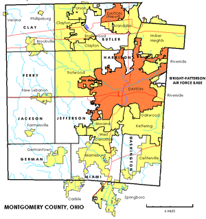
| 19:15, 11 October 2009 | 300px-Montgomerytownships.PNG (file) |  |
100 KB | Radioscan | Map of Montgomery County, Ohio townships, cities and villages. | 1 |
| 19:11, 12 October 2009 | Ellis County Call Signals.PNG (file) |  |
32 KB | Ka3jjz | 1 | |
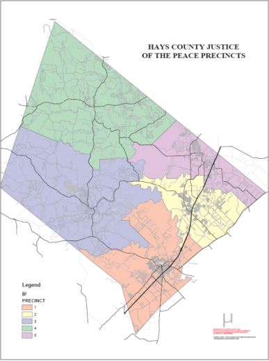
| 05:11, 18 October 2009 | Precint-map.png (file) |  |
142 KB | Texasemt13 | Hays County Precinct Map | 1 |
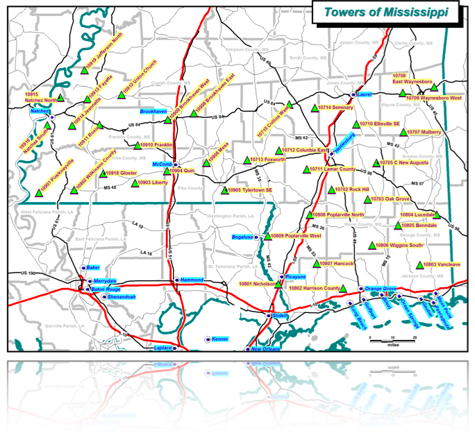
| 01:48, 19 October 2009 | MSWIN Current Towers.png (file) |  |
402 KB | Ke5tlf | 1 | |
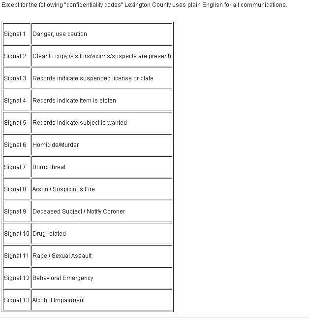
| 16:32, 25 October 2009 | Lexington County Public Safety Signal Codes.png (file) |  |
12 KB | Ka3jjz | 1 | |
| 16:42, 25 October 2009 | York County Fire Tones.png (file) |  |
4 KB | Ka3jjz | 1 | |
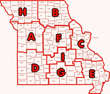
| 00:18, 27 October 2009 | Mshpmap.png (file) |  |
31 KB | Starcom21 | missouRi hIHgway patrol map with troop areas | 1 |
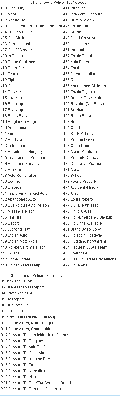
| 01:58, 31 October 2009 | Chattanooga Police 400 Codes & D Codes.png (file) |  |
25 KB | Ka3jjz | 1 | |
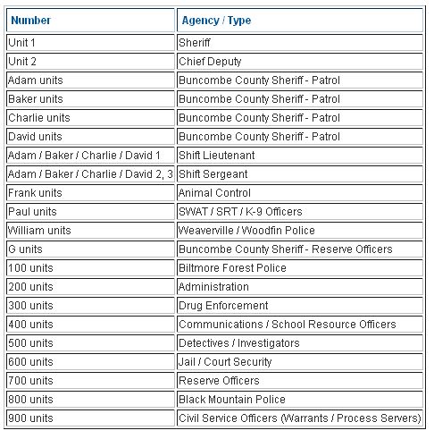
| 10:36, 3 November 2009 | Buncombe county LE Unit Numbers.png (file) |  |
12 KB | Ka3jjz | 1 | |
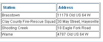
| 22:44, 4 November 2009 | Clay County Fire Stations.png (file) |  |
3 KB | Ka3jjz | 1 | |
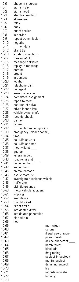
| 00:55, 5 November 2009 | Orangeburg Co. 10-codes.png (file) |  |
19 KB | Ka3jjz | 1 | |
| 00:56, 5 November 2009 | Orangeburg Co. Signals.png (file) |  |
8 KB | Ka3jjz | 1 | |
| 00:57, 5 November 2009 | Orangeburg Co. Status Codes.png (file) |  |
2 KB | Ka3jjz | 1 | |
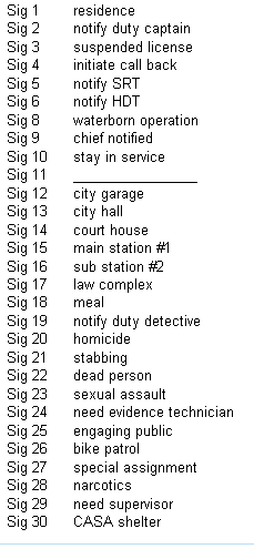
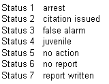
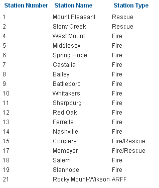
| 12:36, 7 November 2009 | Nash County Fire and Rescue.png (file) |  |
6 KB | Ka3jjz | 1 | |
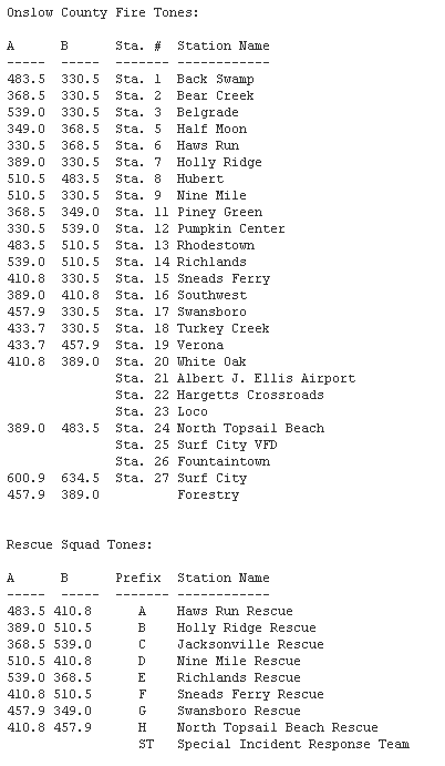
| 01:09, 8 November 2009 | Onslow County Fire EMS Tones.png (file) |  |
14 KB | Ka3jjz | 1 | |
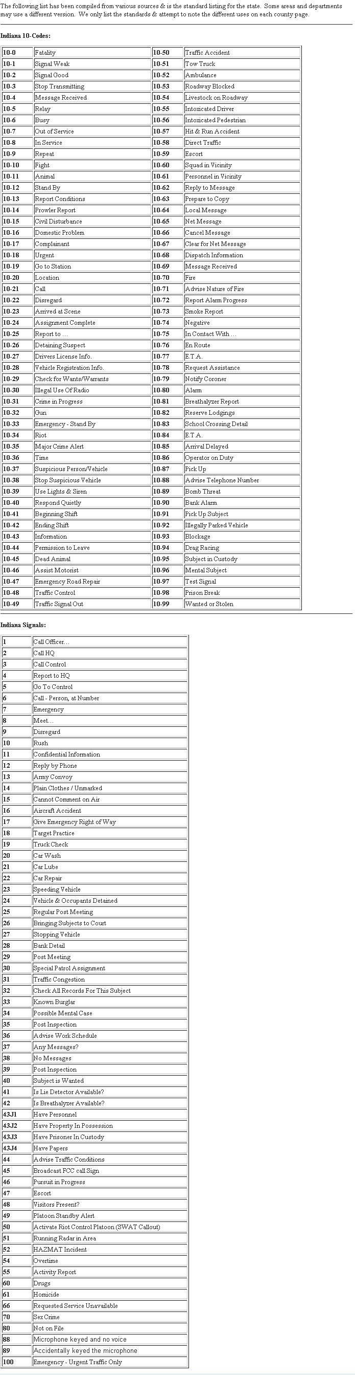
| 17:48, 8 November 2009 | Indiana 10-Codes and Signals.png (file) |  |
72 KB | Ka3jjz | 1 | |
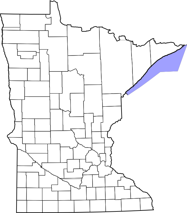
| 05:27, 17 November 2009 | Minnesota County Map Blank.png (file) | 69 KB | Ibagli | 1 | ||
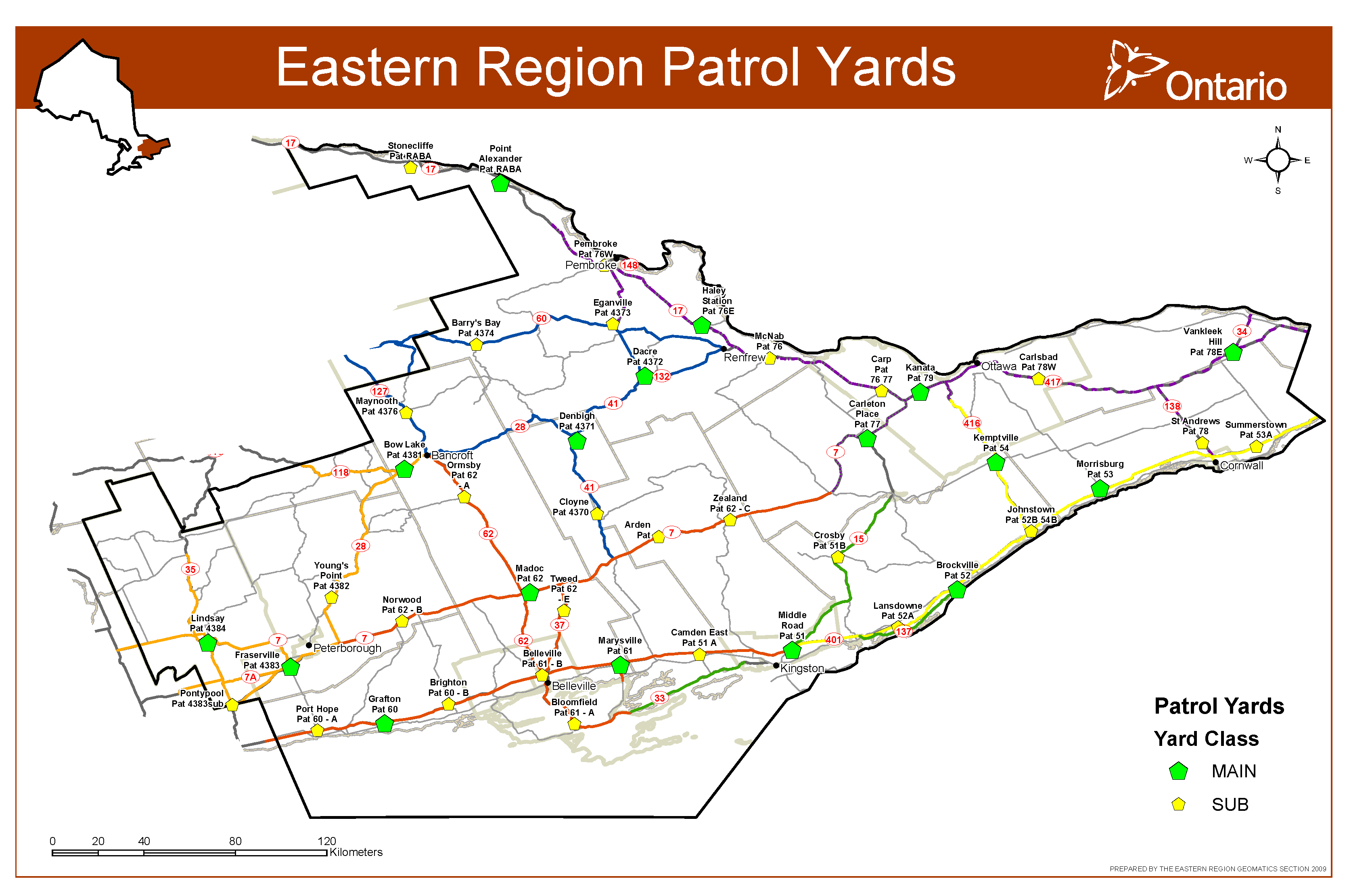
| 19:54, 25 November 2009 | Eastern Region Patrol Yards.png (file) |  |
243 KB | Bezking | 1 | |
| 12:09, 28 November 2009 | RR Browser Preview.png (file) |  |
43 KB | Ka3jjz | 1 |
_Blank.png)