Difference between revisions of "Idaho Counties"
From The RadioReference Wiki
| (9 intermediate revisions by 4 users not shown) | |||
| Line 1: | Line 1: | ||
| − | * [[Benewah County (ID)]] | + | http://www.digital-topo-maps.com/county-map/idaho-county-map.gif<br>Map Courtesy of [http://www.digital-topo-maps.com/county-map/idaho.shtml Digital-Topo-Maps.com] |
| + | |||
| + | {| width="100%" style="vertical-align:top" | ||
| + | |width="25%"| | ||
| + | * [[Ada County (ID)|Ada]] | ||
| + | * [[Adams County (ID)|Adams]] | ||
| + | * [[Bannock County (ID)|Bannock]] | ||
| + | * [[Bear Lake County (ID)|Bear Lake]] | ||
| + | * [[Benewah County (ID)|Benewah]] | ||
| + | * [[Bingham County (ID)|Bingham]] | ||
| + | * [[Blaine County (ID)|Blaine]] | ||
| + | * [[Boise County (ID)|Boise]] | ||
| + | * [[Bonner County (ID)|Bonner]] | ||
| + | * [[Bonneville County (ID)|Bonneville]] | ||
| + | * [[Boundary County (ID)|Boundary]] | ||
| + | |width="25%"| | ||
| + | * [[Butte County (ID)|Butte]] | ||
| + | * [[Camas County (ID)|Camas]] | ||
| + | * [[Canyon County (ID)|Canyon]] | ||
| + | * [[Caribou County (ID)|Caribou]] | ||
| + | * [[Cassia County (ID)|Cassia]] | ||
| + | * [[Clark County (ID)|Clark]] | ||
| + | * [[Clearwater County (ID)|Clearwater]] | ||
| + | * [[Custer County (ID)|Custer]] | ||
| + | * [[Elmore County (ID)|Elmore]] | ||
| + | * [[Franklin County (ID)|Franklin]] | ||
| + | * [[Fremont County (ID)|Fremont]] | ||
| + | |width="25%"| | ||
| + | * [[Gem County (ID)|Gem]] | ||
| + | * [[Gooding County (ID)|Gooding]] | ||
| + | * [[Idaho County (ID)|Idaho]] | ||
| + | * [[Jefferson County (ID)|Jefferson]] | ||
| + | * [[Jerome County (ID)|Jerome]] | ||
| + | * [[Kootenai County (ID)|Kootenai]] | ||
| + | * [[Latah County (ID)|Latah]] | ||
| + | * [[Lemhi County (ID)|Lemhi]] | ||
| + | * [[Lewis County (ID)|Lewis]] | ||
| + | * [[Lincoln County (ID)|Lincoln]] | ||
| + | * [[Madison County (ID)|Madison]] | ||
| + | |width="25%"| | ||
| + | * [[Minidoka County (ID)|Minidoka]] | ||
| + | * [[Nez Perce County (ID)|Nez Perce]] | ||
| + | * [[Oneida County (ID)|Oneida]] | ||
| + | * [[Owyhee County (ID)|Owyhee]] | ||
| + | * [[Payette County (ID)|Payette]] | ||
| + | * [[Power County (ID)|Power]] | ||
| + | * [[Shoshone County (ID)|Shoshone]] | ||
| + | * [[Teton County (ID)|Teton]] | ||
| + | * [[Twin Falls County (ID)|Twin Falls]] | ||
| + | * [[Valley County (ID)|Valley]] | ||
| + | * [[Washington County (ID)|Washington]] | ||
| + | |- | ||
| + | |} | ||
| − | [[Category: | + | ==Surrounding Counties== |
| + | {{Geographic Location | ||
| + | | Northwest = [[Washington Counties]] | ||
| + | | North = [[British Columbia (CA)]] | ||
| + | | Northeast = [[Montana Counties]] | ||
| + | | West = [[Oregon Counties]] | ||
| + | | Center = Idaho Counties | ||
| + | | East = [[Wyoming Counties]] | ||
| + | | Southwest = [[Nevada Counties]] | ||
| + | | South = | ||
| + | | Southeast = [[Utah Counties]] | ||
| + | }} | ||
| + | |||
| + | |||
| + | |||
| + | |||
| + | |||
| + | Return to DB page: {{DB|st|16|Idaho (US)}}<br/> | ||
| + | Return to Wiki page: [[Idaho (US)]]<br/> | ||
| + | |||
| + | [[Category:Idaho]] | ||
Latest revision as of 07:19, 7 June 2015
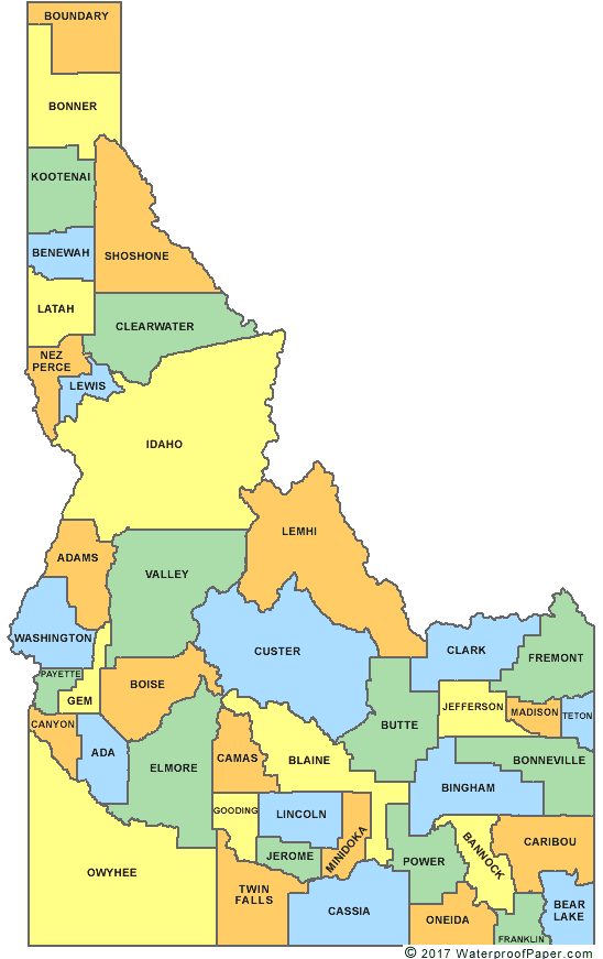
Map Courtesy of Digital-Topo-Maps.com
Surrounding Counties

|
Washington Counties | British Columbia (CA) | Montana Counties |
|
| Oregon Counties | Wyoming Counties | |||
| Nevada Counties | Utah Counties |
Return to DB page: Idaho (US)
Return to Wiki page: Idaho (US)