File list
This special page shows all uploaded files.
| Date | Name | Thumbnail | Size | User | Description | Versions |
|---|---|---|---|---|---|---|
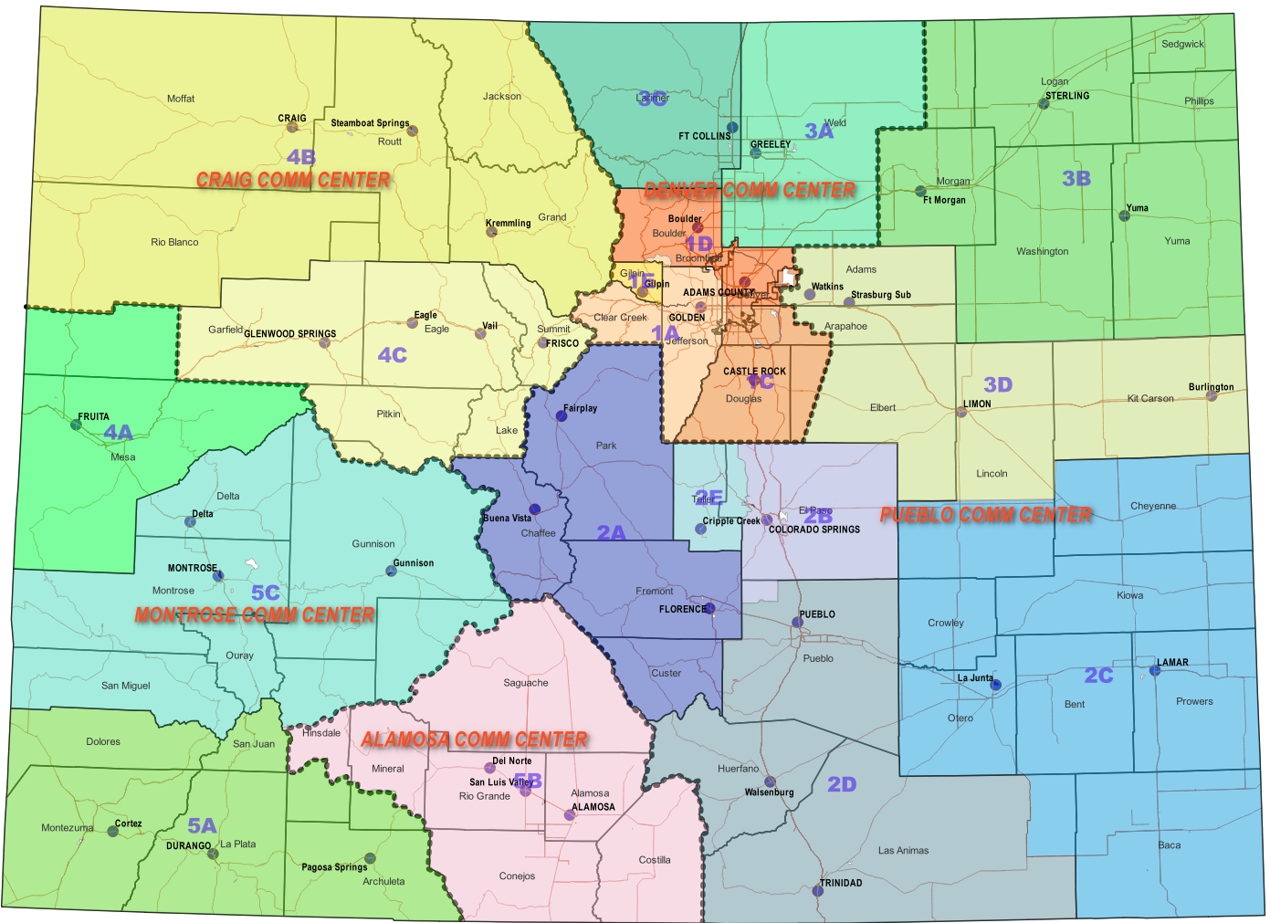
| 01:53, 24 May 2024 | CSP Map.png (file) |  |
720 KB | Rbuxton | Map of Colorado State Patrol Comm Center and Troop boundaries. And, office locations of Troop and Posts | 1 |
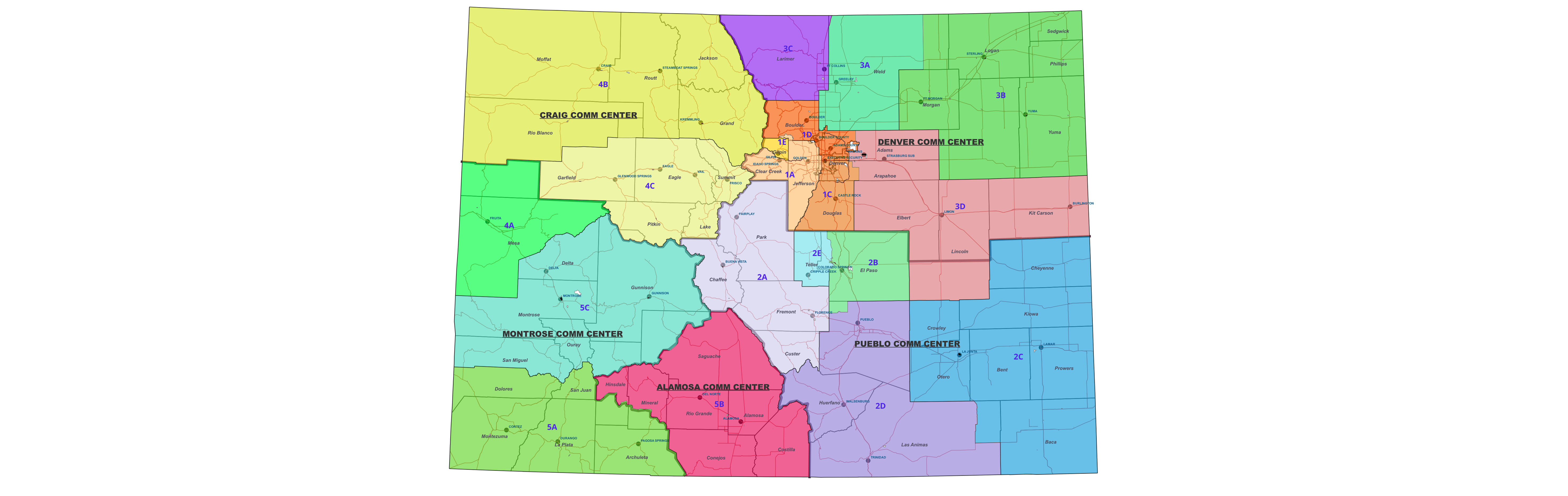
| 02:20, 15 May 2024 | CSP Boundaries3.png (file) |  |
1.13 MB | Rbuxton | 1 | |
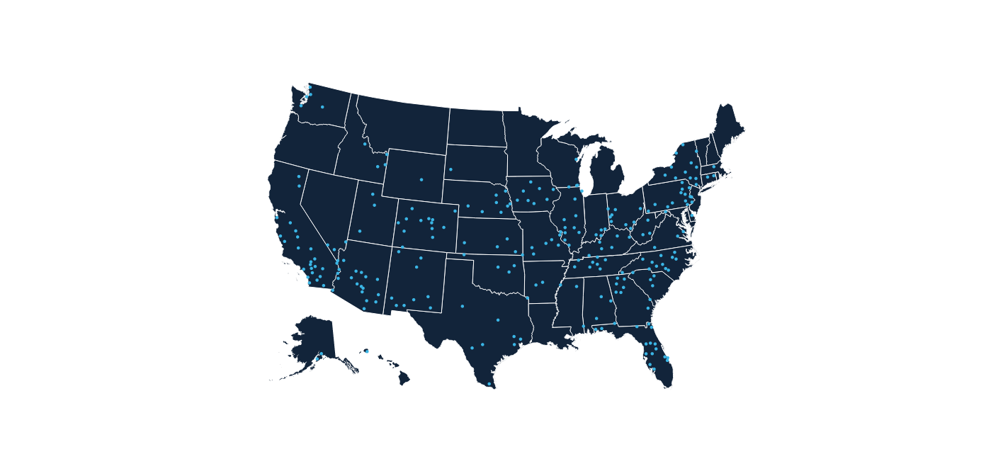
| 21:31, 29 April 2024 | AirCom-BasesUS-AirMethods.png (file) |  |
98 KB | Starcom21 | AirCom US Bases Air Methods | 1 |
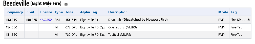
| 18:58, 16 March 2024 | Eight mile.png (file) | 12 KB | Drbeede | 1 | ||
| 21:19, 5 February 2024 | Portlandops2-qr.png (file) |  |
579 bytes | A417 | QR code with embedded link to FD Ops 2feed on zello.com | 1 |
| 21:07, 5 February 2024 | Portlandme-fd-dispatch-qr.png (file) |  |
490 bytes | A417 | QR code with embedded link to FD dispatch feed on zello.com | 1 |
| 22:13, 19 January 2024 | WCDPS.png (file) |  |
299 KB | Seagravebuff60 | WCPD Patch | 1 |
| 15:22, 17 January 2024 | White Plains Police badge.png.89c560bc1b3c75e40d0506ad4e084e71 1 .png (file) | 113 KB | Seagravebuff60 | 1 | ||
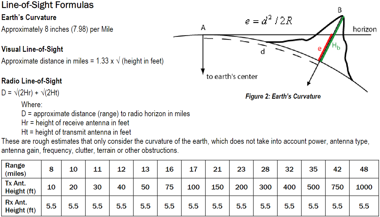
| 01:31, 14 January 2024 | Line-of-site-formulas.png (file) |  |
108 KB | Starcom21 | Line-of-Sight Formulas Earth’s Curvature Approximately 8 inches (7.98) per Mile Visual Line-of-Sight Approximate distance in miles = 1.33 x √ (height in feet) Radio Line-of-Sight D = √(2Hr) + √(2Ht) Where: D = approximate distance (range) to radio horizon in miles Hr = height of receive antenna in feet Ht = height of transmit antenna in feet These are rough estimates that only consider the curvature of the earth, which does not take into account power, antenna type, antenna gain, frequency, c... | 1 |
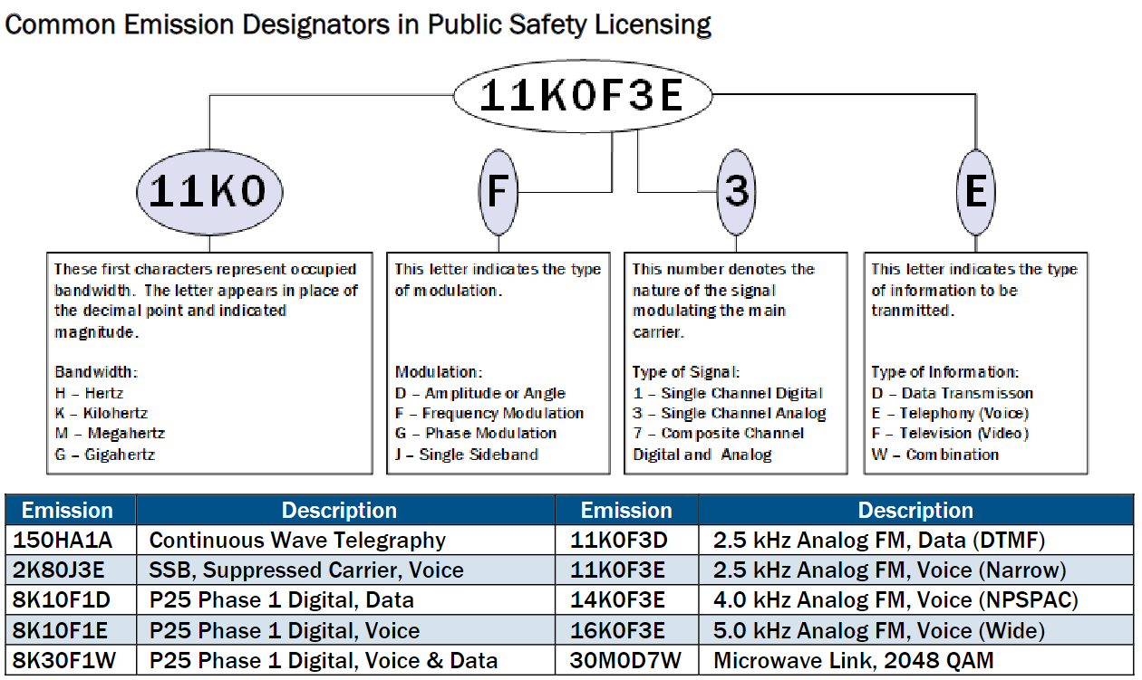
| 00:42, 14 January 2024 | Common Emission Designators.png (file) |  |
126 KB | Starcom21 | Common Emission Designators in Public Safety Licensing Emission Description Emission Description 150HA1A Continuous Wave Telegraphy 11K0F3D 2.5 kHz Analog FM, Data (DTMF) 2K80J3E SSB, Suppressed Carrier, Voice 11K0F3E 2.5 kHz Analog FM, Voice (Narrow) 8K10F1D P25 Phase 1 Digital, Data 14K0F3E 4.0 kHz Analog FM, Voice (NPSPAC) 8K10F1E P25 Phase 1 Digital, Voice 16K0F3E 5.0 kHz Analog FM, Voice (Wide) 8K30F1W P25 Phase 1 Digital, Voice & Data 30M0D7W Microwave Link, 2048 QAM | 1 |
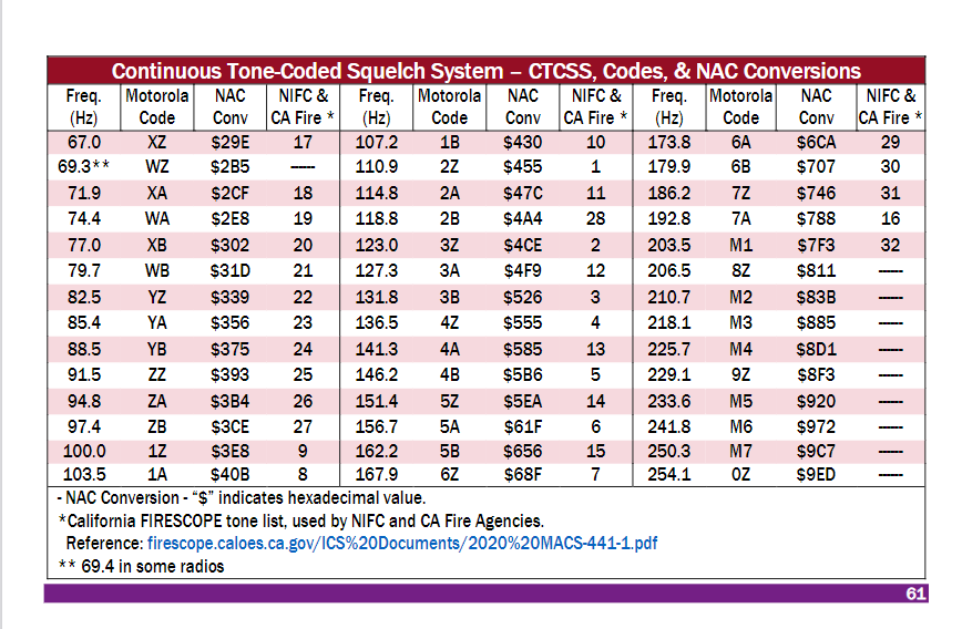
| 00:20, 14 January 2024 | CTCSS-NAC-codes.png (file) |  |
76 KB | Starcom21 | Continuous Tone-Coded Squelch System – CTCSS, Codes, & NAC Conversions Freq. (Hz) Motorola Code NAC Conv NIFC & CA Fire * Freq. (Hz) Motorola Code NAC Conv NIFC & CA Fire * Freq. (Hz) Motorola Code NAC Conv NIFC & CA Fire * 67.0 XZ $29E 17 107.2 1B $430 10 173.8 6A $6CA 29 69.3** WZ $2B5 ------ 110.9 2Z $455 1 179.9 6B $707 30 71.9 XA $2CF 18 114.8 2A $47C 11 186.2 7Z $746 31 74.4 WA $2E8 19 118.8 2B $4A4 28 192.8 7A $788 16 77.0 XB $302 20 123.0 3Z $4CE 2 203.5 M1 $7F3 32 79.7 WB $31D 21 127... | 1 |
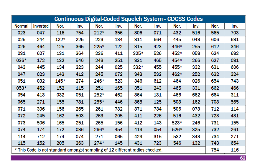
| 00:18, 14 January 2024 | CDCSS-tones.png (file) |  |
68 KB | Starcom21 | Continuous Tone-Coded Squelch System – CTCSS, Codes, & NAC Conversions Freq. (Hz) Motorola Code NAC Conv NIFC & CA Fire * Freq. (Hz) Motorola Code NAC Conv NIFC & CA Fire * Freq. (Hz) Motorola Code NAC Conv NIFC & CA Fire * 67.0 XZ $29E 17 107.2 1B $430 10 173.8 6A $6CA 29 69.3** WZ $2B5 ------ 110.9 2Z $455 1 179.9 6B $707 30 71.9 XA $2CF 18 114.8 2A $47C 11 186.2 7Z $746 31 74.4 WA $2E8 19 118.8 2B $4A4 28 192.8 7A $788 16 77.0 XB $302 20 123.0 3Z $4CE 2 203.5 M1 $7F3 32 79.7 WB $31D 21 127... | 1 |
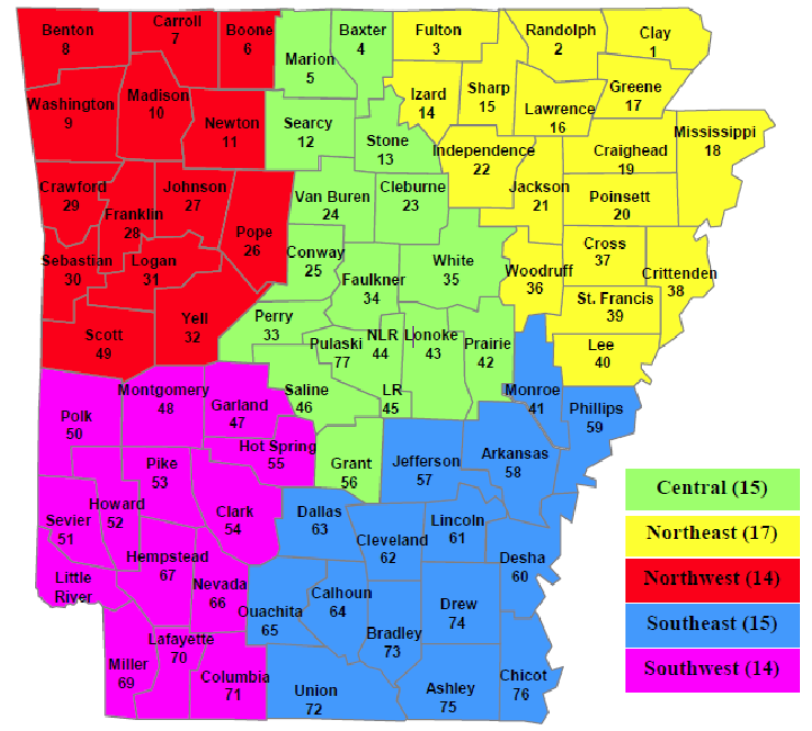
| 19:03, 13 January 2024 | ADEM Emergency Management Area Map.png (file) |  |
147 KB | Starcom21 | Arkansas ADEM Emergency Management Area Map 2021 | 1 |
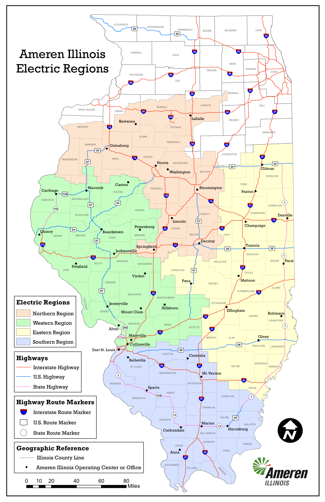
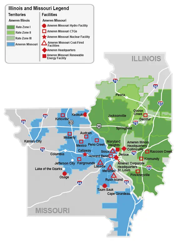
| 14:56, 11 January 2024 | AmerenIllinois-2023-service-territory-map-electric.png (file) |  |
463 KB | Starcom21 | Ameren Illinois 2023 service territory map electric | 1 |
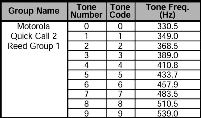
| 05:26, 2 January 2024 | Moto-QCII-Group1.png (file) |  |
53 KB | Rneals | 1 | |
| 23:36, 26 December 2023 | HDN CT.png (file) |  |
17 KB | Seagravebuff60 | 2 | |
| 23:36, 26 December 2023 | Marcus Com.png (file) |  |
4 KB | Seagravebuff60 | 2 | |
| 22:35, 26 December 2023 | A1logo.png (file) |  |
67 KB | Seagravebuff60 | 2 | |
| 14:01, 28 November 2023 | Triangle-logo-trans orig.png (file) | 7 KB | Seagravebuff60 | 3 | ||
| 17:10, 25 November 2023 | Goosetown Communications.png (file) |  |
15 KB | Seagravebuff60 | Goosetown Communications Logo | 1 |
| 21:14, 17 November 2023 | 1677775644677.png (file) | 181 KB | Michaelbrown2018 | 1 | ||
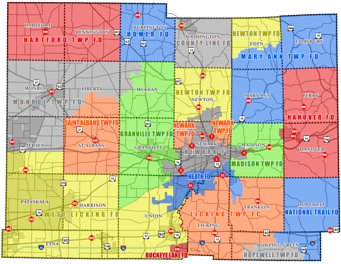
| 19:39, 8 November 2023 | LickingCountyFire.png (file) |  |
494 KB | Andrewtv08 | Small city annexations. Anticipating forming of County Line Fire District from former Utica Fire Department and Utica Emergency Squad beginning Jan 1, 2024. | 2 |
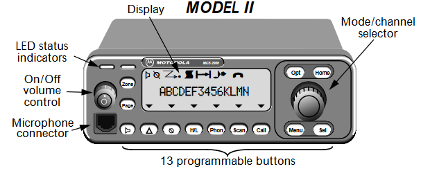
| 15:22, 5 November 2023 | Mcs2kmod2.png (file) |  |
36 KB | A417 | errant black line removed | 2 |
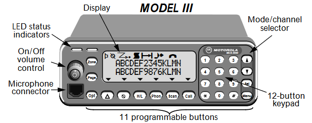
| 15:18, 5 November 2023 | Mcs2kmod3.png (file) |  |
32 KB | A417 | 1 | |
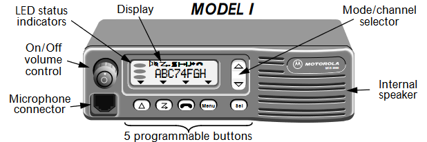
| 15:17, 5 November 2023 | Mcs2kmod1.png (file) |  |
30 KB | A417 | 1 | |
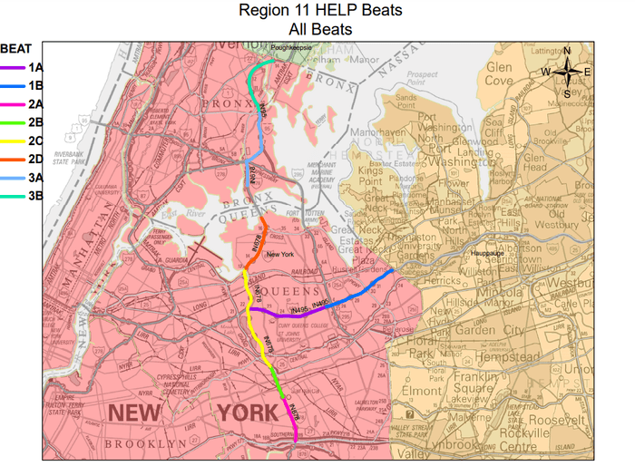
| 18:17, 23 October 2023 | R11 HELP.png (file) |  |
144 KB | Seagravebuff60 | NYSDOT HELP R11 Sector Map | 1 |
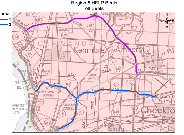
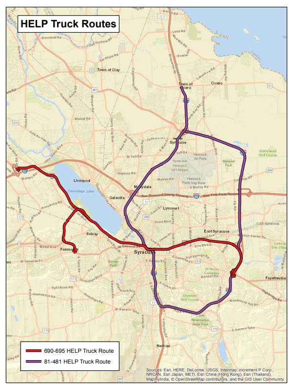
| 18:14, 23 October 2023 | R3 Help.png (file) |  |
733 KB | Seagravebuff60 | NYSDOT HELP R3 Trucks Sector Map | 1 |
| 17:26, 23 October 2023 | R11 Help.png (file) |  |
185 KB | Seagravebuff60 | NYSDOT R11 Help Sector Map | 1 |
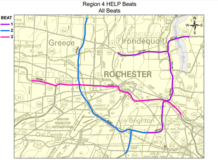
| 17:21, 23 October 2023 | R4 HELP.png (file) |  |
159 KB | Seagravebuff60 | 2 | |
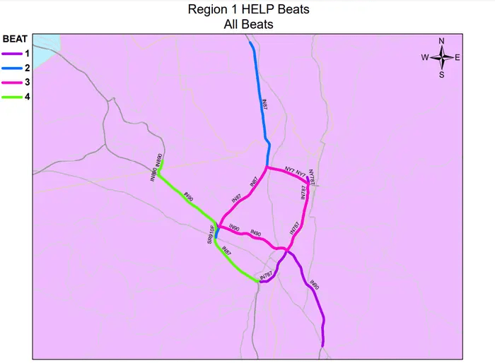
| 16:47, 23 October 2023 | 2023-10-23 12 37 44-HELP Map.mxd 700x514.png (file) |  |
94 KB | Seagravebuff60 | NYS DOT R1 Sector Map NEW | 1 |
| 16:19, 23 October 2023 | Help2.png (file) | 70 KB | Seagravebuff60 | NYSDOT HElP Trucks Logo | 1 | |
| 20:47, 17 October 2023 | Hazelwood-business-park-layout-with-idi-warehouse.png (file) |  |
1.19 MB | Starcom21 | Hazelwood-business-park-layout-with-idi-warehouse. | 1 |
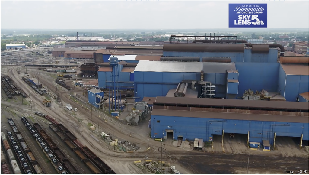
| 17:35, 3 October 2023 | Us-steel-granite-city-works-aerial-100223-ksdk.png (file) |  |
1.16 MB | Starcom21 | US Steel Granite City 2023 | 1 |
| 13:05, 19 September 2023 | Moswin sm.png (file) |  |
13 KB | Starcom21 | MOSWIN logo | 1 |
| 18:09, 27 August 2023 | Iemaohs.png (file) | 370 KB | Starcom21 | Illinois Emergency Management Agency and Office of Homeland Security logo | 1 | |
| 22:00, 25 August 2023 | Washu-297e3c194f501001b82869ee77820000.png (file) |  |
14 KB | Starcom21 | wash u logo st louis mo | 1 |
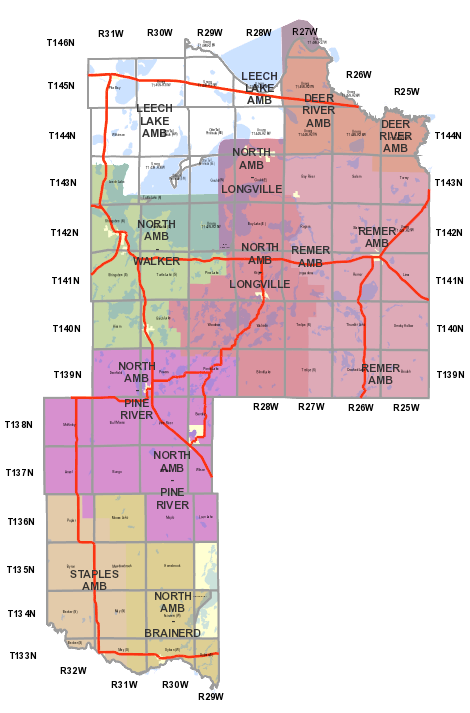
| 19:54, 24 August 2023 | Cass Co MN EMS Map.png (file) |  |
123 KB | Mmtstc | 2 | |
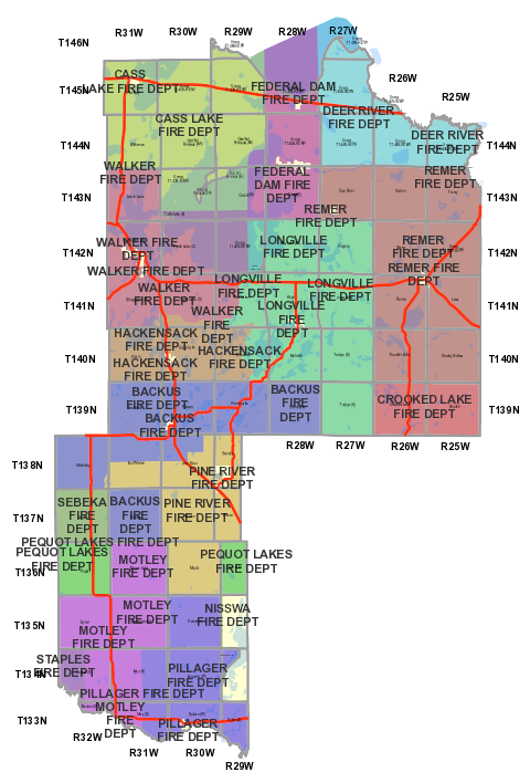
| 19:54, 24 August 2023 | Cass Co MN Fire Map.png (file) |  |
161 KB | Mmtstc | 2 | |
| 18:01, 8 August 2023 | ISP SOG MapPNG.png (file) |  |
935 KB | Starcom21 | Illinois State Police Strategic Operations Command 2023 | 1 |
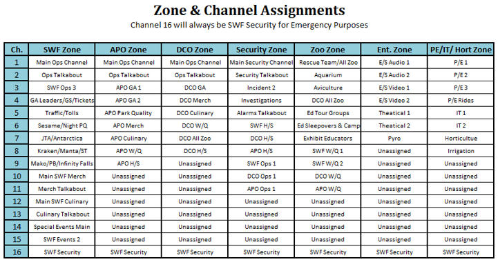
| 18:36, 4 August 2023 | Swf zones and channels.png (file) |  |
129 KB | Statcoaster | 1 | |
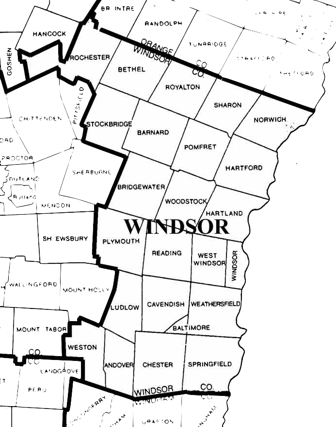
| 21:30, 21 July 2023 | Windsor County VT Map.png (file) |  |
272 KB | Battalion3leb | 1 | |
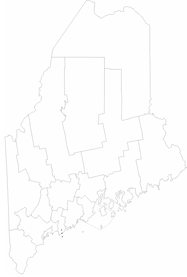
| 12:07, 19 July 2023 | Maine-counties.png (file) |  |
87 KB | A417 | 2 | |
| 18:17, 29 March 2023 | PeoriaStarkCountyJointETSBlogo.png (file) | 96 KB | Starcom21 | Peoria Stark County Joint ETSB logo | 1 | |
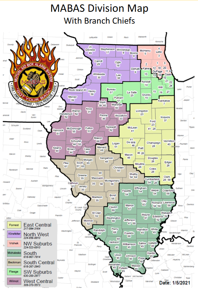
| 00:51, 21 March 2023 | MABAS2021.png (file) |  |
468 KB | Starcom21 | MABAS IL Fire Division Map 2021 by county | 1 |
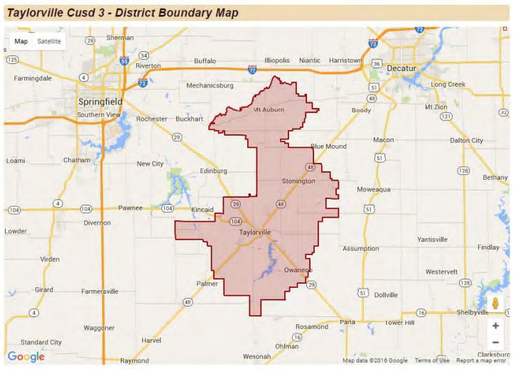
| 15:24, 16 March 2023 | TaylorvilleCUSD3map.png (file) |  |
490 KB | Starcom21 | Taylorville IL School District #3 Boundary Map | 1 |
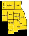
| 11:15, 27 January 2023 | ISP-Troop3.png (file) |  |
19 KB | Starcom21 | Illinois State Police Troop 3 Metro Chicago 2023 | 1 |
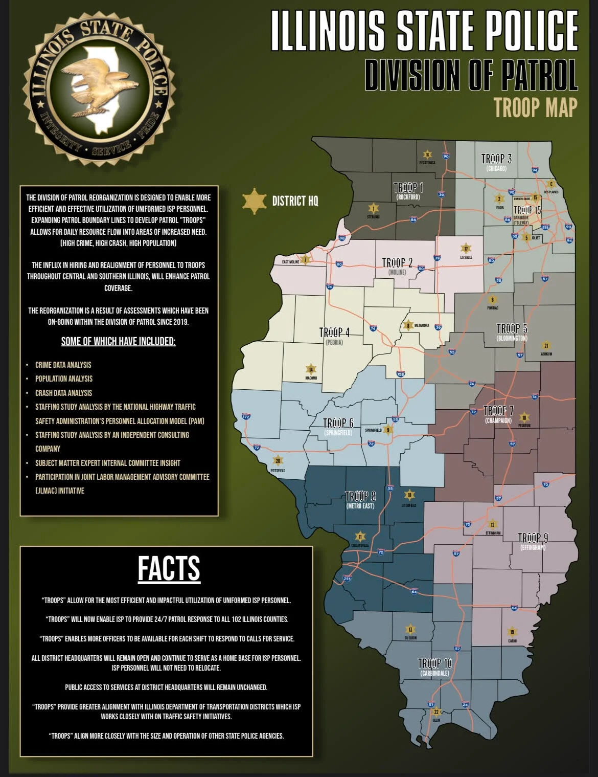
| 16:53, 3 January 2023 | ISP Troop Map.png (file) |  |
1.53 MB | Spitfire8520 | Higher resolution image. | 2 |
| 21:49, 18 December 2022 | Ameren.png (file) |  |
266 KB | Starcom21 | 1 | |
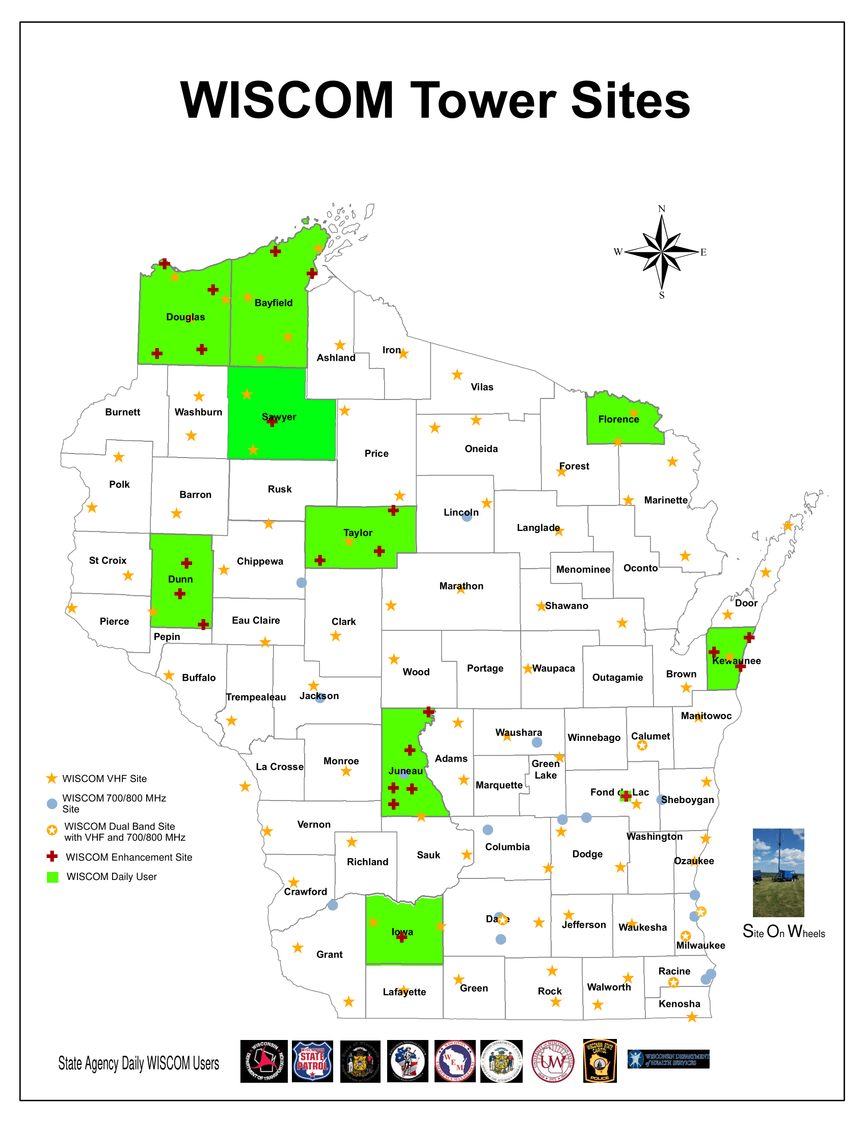
| 05:06, 18 November 2022 | WISCOM-2020.png (file) |  |
249 KB | DVINTHEHOUSEMAN | Latest WISCOM map | 1 |
| 19:03, 8 September 2022 | Firetg.png (file) |  |
113 KB | Kd7jfv | 1 |