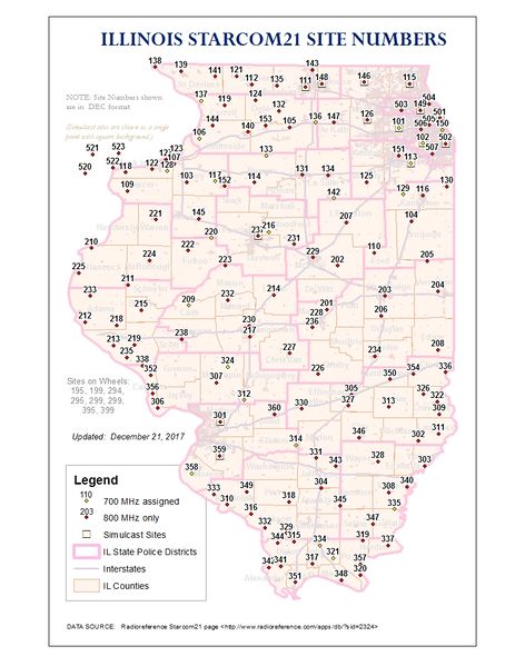
Starcom21 Site Numbers Map.jpg
From The RadioReference Wiki
Revision as of 01:18, 22 December 2017 by Cubn (talk | contribs) (uploaded a new version of "File:Starcom21 Site Numbers Map.jpg": Cartographic changes (thickened interstates, added city boundaries, made county name font bigger, made towers more prominent and ISP boundaries less prominent))
Revision as of 01:18, 22 December 2017 by Cubn (talk | contribs) (uploaded a new version of "File:Starcom21 Site Numbers Map.jpg": Cartographic changes (thickened interstates, added city boundaries, made county name font bigger, made towers more prominent and ISP boundaries less prominent))

Size of this preview: 463 × 599 pixels. Other resolutions: 185 × 240 pixels | 816 × 1,056 pixels.
Original file (816 × 1,056 pixels, file size: 493 KB, MIME type: image/jpeg)
Illinois Starcom21 Site Numbers Map
File history
Click on a date/time to view the file as it appeared at that time.
(newest | oldest) View (newer 10 | older 10) (10 | 20 | 50 | 100 | 250 | 500)
| Date/Time | Thumbnail | Dimensions | User | Comment | |
|---|---|---|---|---|---|
| 18:44, 21 June 2010 | 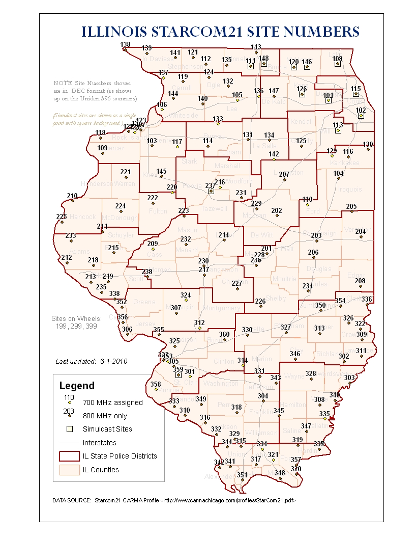 | 816 × 1,056 (452 KB) | Cubn (talk | contribs) | Updated map based on the Starcom21 CARMA profile | |
| 22:02, 6 August 2009 | 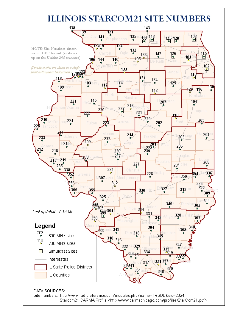 | 816 × 1,056 (451 KB) | Cubn (talk | contribs) | Updated sites. Added a unique symbol for simulcast sites |
- You cannot overwrite this file.
File usage
The following page uses this file: