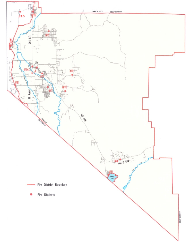
File:EAST FORK FIRE & PARAMEDIC DISTRICT BOUNDRY & STATION MAP.jpg
From The RadioReference Wiki
Revision as of 11:32, 31 May 2009 by Gvranchosbill (talk | contribs) (EAST FORK FIRE & PARAMEDIC DISTRICT,DOUGLAS COUNTY,NEVADA BOUNDRY MAP)
Revision as of 11:32, 31 May 2009 by Gvranchosbill (talk | contribs) (EAST FORK FIRE & PARAMEDIC DISTRICT,DOUGLAS COUNTY,NEVADA BOUNDRY MAP)
Size of this preview: 462 × 599 pixels. Other resolutions: 185 × 240 pixels | 650 × 843 pixels.
Original file (650 × 843 pixels, file size: 114 KB, MIME type: image/jpeg)
EAST FORK FIRE & PARAMEDIC DISTRICT,DOUGLAS COUNTY,NEVADA BOUNDRY MAP
File history
Click on a date/time to view the file as it appeared at that time.
| Date/Time | Thumbnail | Dimensions | User | Comment | |
|---|---|---|---|---|---|
| current | 11:32, 31 May 2009 | | 650 × 843 (114 KB) | Gvranchosbill (talk | contribs) | EAST FORK FIRE & PARAMEDIC DISTRICT,DOUGLAS COUNTY,NEVADA BOUNDRY MAP |
- You cannot overwrite this file.
File usage
The following page uses this file: