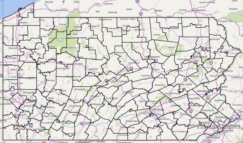
PGCmap2019.JPG
From The RadioReference Wiki

Size of this preview: 800 × 472 pixels. Other resolutions: 320 × 189 pixels | 1,083 × 639 pixels.
Original file (1,083 × 639 pixels, file size: 230 KB, MIME type: image/jpeg)
Summary
Map generated from PASDA file of 2019 PGC districts.
File history
Click on a date/time to view the file as it appeared at that time.
| Date/Time | Thumbnail | Dimensions | User | Comment | |
|---|---|---|---|---|---|
| current | 23:02, 8 July 2020 | | 1,083 × 639 (230 KB) | HM1529 (talk | contribs) | Map generated from PASDA file of 2019 PGC districts. |
- You cannot overwrite this file.
File usage
The following page uses this file: