File list
This special page shows all uploaded files.
| Date | Name | Thumbnail | Size | Description | Versions |
|---|---|---|---|---|---|
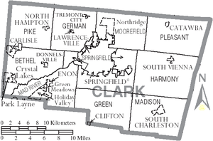
| 23:18, 8 April 2010 | 300px-Map of Clark County Ohio With Municipal and Township Labels.PNG (file) |  |
68 KB | Map of Clark County, Ohio | 1 |
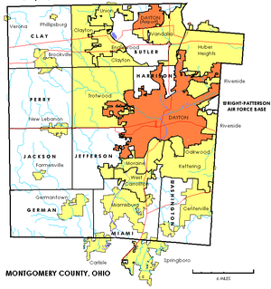
| 19:15, 11 October 2009 | 300px-Montgomerytownships.PNG (file) |  |
100 KB | Map of Montgomery County, Ohio townships, cities and villages. | 1 |
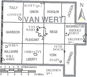
| 17:52, 20 September 2009 | Map of Van Wert County Ohio With Municipal and Township Labels.PNG (file) |  |
61 KB | Map of Van Wert County, Ohio including villages and townships. | 1 |
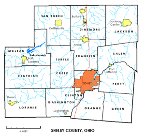
| 17:11, 12 July 2009 | 300px-Shelbytownships.PNG (file) |  |
63 KB | Map of townships in Shelby County, Ohio | 1 |
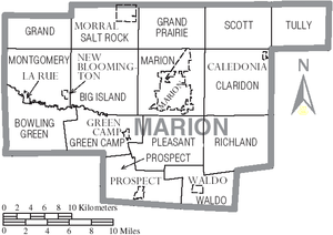
| 16:07, 12 July 2009 | Map of Marion County Ohio With Municipal and Township Labels.PNG (file) |  |
50 KB | Map of Marion County, Ohio showing municipalities and townships. | 1 |
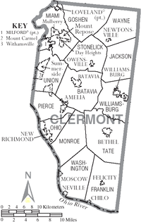
| 13:59, 11 July 2009 | 200px-Map of Clermont County Ohio With Municipal and Township Labels.PNG (file) |  |
68 KB | Map of Clermont County showing Municipalities and Townships | 1 |
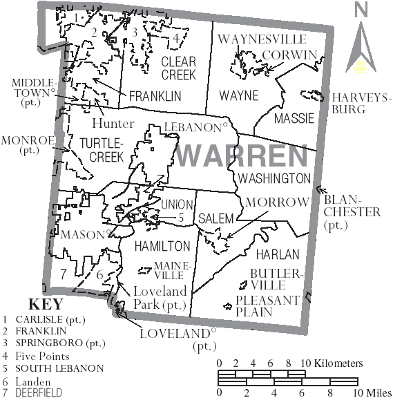
| 03:32, 11 June 2009 | Map of Warren County Ohio With Municipal and Township Labels.PNG (file) |  |
59 KB | 1 | |
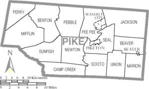
| 00:47, 11 June 2009 | Map of Pike County Ohio With Municipal and Township Labels.PNG (file) |  |
38 KB | 1 | |
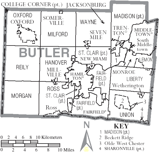
| 15:54, 10 June 2009 | Map of Butler County Ohio With Municipal and Township Labels.PNG (file) |  |
54 KB | Map of Butler County, Ohio | 1 |
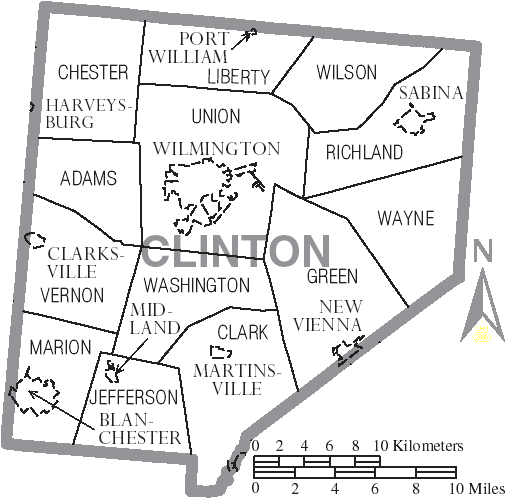
| 15:36, 1 June 2009 | Map of Clinton County Ohio With Municipal and Township Labels.PNG (file) |  |
41 KB | Map of Clinton County, Ohio showing townships and municipalities. | 1 |