BCD996T Lat-Lon
From The RadioReference Wiki
Introduction
- For multi-site systems, the Lat/Lon/Range should be centered on the coverage area of the site (usually the tower location unless you have better info on coverage). This site location info can be found by clicking on the site ID in RRDB, then following the link to the FCC license info. Be forewarned: Some licenses include multiple sites, so you might have to compare the site frequencies against RRDB to get the correct location.
- For cities/towns/counties, the Lat/Lon/Range should be centered over the geopolitical center of the covered area, which will not necessarily be the tower itself.
- The "philosophy" of the data is to limit the range of the system to the area where the system is relevent. For example, you might be able to hear a town from 30 miles away. But, if the town is only 1 mile across, the range should be no more than 1-3 miles.
- The format of the Lat/Lon is DDDMMSS.sss. Range can be .5, 1, 3, 5, 10, 20, 30, or 50 miles. The coordinates+range define a circle centered on the Lat/Lon with a radius of Range.
- To convert Decimal Degrees to the DDDMMSS.sss format, see the converter at this link
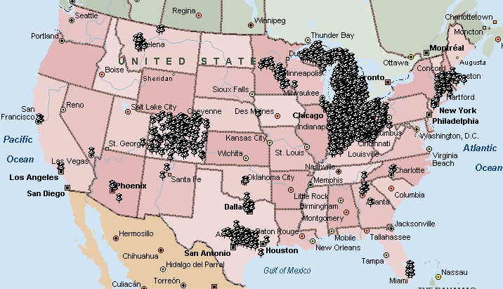
- I used Microsoft Streets and Trips to plot out the sites I've completed. It has a nice circle draw tool that makes visualizing the desired reception range much easier. I believe that Delorme Street Atlas also has such a tool.
- Here's how to proceed (and, sorry, but you'll need to edit this page and grasp a little bit of arcane coding, but it is pretty straightforward).
- To "claim" a site, before going out and getting the data, put your name in the "Who" column of the table, below. This will keep multiple people from working on the same site. I'd only claim 5-10 at a time.
- Once you get the data, put it in the Lat/Lon/Range columns just like the ones already completed.
Related Pages
- BCD996T Lat-Lon - Sorted A-H
- BCD996T Lat-Lon - Sorted I-M
- BCD996T Lat-Lon - Sorted N-Z
- BCD996T Lat-Lon - GPS Center of Every Alabama County
- BCD996T Lat-Lon - GPS Locations of Airports and Heliports in Alabama
- BCD996T Lat-Lon - GPS Center of Every Georgia County
- BCD996T Lat-Lon - GPS Locations of Georgia Public Safety Trunking Systems
- BCD996T Lat-Lon - GPS Locations of Airports and Heliports in Georgia
- BCD996T Lat-Lon - GPS Center of Every Mississippi County
Return to Wiki pages: BCD996T, Uniden DMA FAQ, Freescan Advanced Options
(No matching DB page)
Categories:
- DMA Radios Hints and Kinks
- Alabama Location Based Scanning
- Alaska Location Based Scanning
- Arizona Location Based Scanning
- Arkansas Location Based Scanning
- California Location Based Scanning
- Colorado Location Based Scanning
- Connecticut Location Based Scanning
- Georgia Location Based Scanning
- Illinois Location Based Scanning
- Indiana Location Based Scanning
- Massachusetts Location Based Scanning
- Michigan Location Based Scanning
- Minnesota Location Based Scanning
- Mississippi Location Based Scanning
- Montana Location Based Scanning
- Nebraska Location Based Scanning
- New Mexico Location Based Scanning
- New York Location Based Scanning
- North Carolina Location Based Scanning
- Ohio Location Based Scanning
- Oklahoma Location Based Scanning
- Pennsylvania Location Based Scanning
- Texas Location Based Scanning
- Virginia Location Based Scanning
- Washington Location Based Scanning
- West Virginia Location Based Scanning
