Difference between revisions of "Douglas County (CO)"
From The RadioReference Wiki
m (updated categories) |
Spitfire8520 (talk | contribs) (Revising and cleaning formatting. Some reorganization of sections. Adding additional information.) |
||
| Line 1: | Line 1: | ||
| − | Douglas County is located between Denver and Colorado Springs. | + | Douglas County is located between the City of Denver and the City of Colorado Springs. Municipalities within Douglas County include parts of the City of Aurora, City of Castle Pines North, Town of Castle Rock, Town of Larkspur, parts of the City of Littleton, City of Lone Tree, and Town of Parker. |
http://www.weichert.com/images/counties/CO-Douglas.gif | http://www.weichert.com/images/counties/CO-Douglas.gif | ||
| − | ==Communications== | + | == Communications == |
| − | A majority of public safety communications located within Douglas County can be found on the [[APCO Project 25]] | + | |
| + | A vast majority of public safety communications located within Douglas County can be found on the [[APCO Project 25]] [http://www.radioreference.com/apps/db/?sid=329 State of Colorado Digital Trunked Radio System (DTRS)]. | ||
| + | |||
| + | There are exceptions for areas on the northern and western edges of the county. These areas include Roxborough Park area of northwest Douglas County which is served by West Metro Fire operating on [http://www.radioreference.com/apps/db/?sid=6616 Metro Area Radio Cooperative (MARC)], City of Aurora in northeast Douglas County which operates on [http://www.radioreference.com/apps/db/?sid=3235 Aurora EDACS], and the southwest portions of Douglas County which is served by North Fork Fire and Mountain Communities Fire on conventional VHF. | ||
| + | |||
| + | Normal users of DTRS may occasionally use VHF/800 conventional frequencies, especially in the more rural and mountainous parts of western Douglas County where DTRS coverage is insufficient or not used as the primary means of communications. | ||
| + | |||
| + | === DTRS Sites to Monitor === | ||
| − | |||
[[Image:DenverMetro.jpg|500px]] | [[Image:DenverMetro.jpg|500px]] | ||
| Line 21: | Line 27: | ||
'''South''' | '''South''' | ||
| − | [[Individual CO DTRS Sites/West Creek| | + | [[Individual CO DTRS Sites/West Creek|Douglas County South Simulcast (Denver Metro) (1-014)]] |
'''East''' | '''East''' | ||
| Line 30: | Line 36: | ||
[[Individual CO DTRS Sites/Riley|Riley Peak (Denver Metro) (1-002)]] | [[Individual CO DTRS Sites/Riley|Riley Peak (Denver Metro) (1-002)]] | ||
| + | |||
| + | [[Individual_CO_DTRS_Sites/Squaw|Squaw Mountain (Denver Metro) (1-006)]] | ||
'''Central''' | '''Central''' | ||
| Line 35: | Line 43: | ||
[[Individual CO DTRS Sites/Silver Heights|Silver Heights (Denver Metro) (1-003)]] | [[Individual CO DTRS Sites/Silver Heights|Silver Heights (Denver Metro) (1-003)]] | ||
| − | ===DTRS Talkgroups=== | + | === DTRS Talkgroups === |
<tg>329|2393</tg> | <tg>329|2393</tg> | ||
| − | == | + | === Other Systems & Frequencies === |
| − | |||
| − | |||
| − | |||
| − | = | ||
| − | |||
| − | |||
| − | |||
| − | |||
| − | |||
| − | |||
| − | + | {{DB|ct|258#scid-24768|Douglas County Agencies on Conventional}} | |
| − | + | {{DB|s|3235|Aurora on Aurora EDACS}} | |
| − | |||
| − | |||
| − | |||
| − | |||
| − | |||
| − | |||
| − | |||
| − | |||
| − | |||
| − | |||
| − | |||
| − | |||
| − | |||
| − | |||
| − | |||
| − | |||
| − | |||
| − | |||
| − | |||
| − | |||
| − | |||
| − | |||
| − | |||
| − | |||
| − | |||
| − | |||
| − | |||
| − | |||
| − | |||
| − | |||
| − | |||
| − | |||
| − | |||
| − | |||
| − | |||
| − | |||
| − | |||
| − | |||
| − | |||
| − | |||
| − | |||
| − | |||
| − | |||
| − | |||
| − | |||
| − | |||
| − | |||
| − | |||
| − | |||
| − | |||
| − | |||
| − | |||
| − | |||
| − | |||
| − | |||
| − | |||
| − | |||
| − | |||
| − | |||
| − | |||
| − | |||
| − | |||
| − | |||
| − | |||
| − | |||
| − | |||
| − | |||
| − | |||
| − | |||
| − | |||
| − | |||
| − | |||
| − | |||
| − | |||
| − | |||
| − | |||
| − | |||
| − | |||
| − | |||
| − | |||
| − | |||
| − | |||
| − | |||
| − | |||
| − | |||
| − | |||
| − | |||
| − | |||
| − | |||
| − | |||
| − | |||
| − | |||
| − | |||
| − | |||
| − | |||
| − | |||
| − | |||
| − | {| | ||
| − | | | ||
| − | |||
| − | |||
| − | |||
| − | |||
| − | |||
| − | |||
| − | |||
| − | |||
| − | |||
| − | |||
| − | | | ||
| − | |||
| − | |||
| − | |||
| − | |||
| − | |||
| − | |||
| − | |||
| − | |||
| − | |||
| − | |||
| − | |||
| − | |||
| − | |||
| − | |||
| − | |||
| − | |||
| − | |||
| − | |||
| − | |||
| − | |||
| − | |||
| − | |||
| − | |||
| − | |||
| − | |||
| − | |||
| − | |||
| − | |||
| − | |||
| − | |||
| − | |||
| − | |||
| − | |||
| − | |||
| − | |||
| − | |||
| − | |||
| − | |||
| − | |||
| − | |||
| − | |||
| − | |||
| − | |||
| − | |||
| − | |||
| − | |||
| − | |||
| − | |||
| − | + | {{DB|ct|243#scid-40913|Littleton Fire on VHF & 800 MHz Conventional}} | |
| − | + | {{DB|ct|270#scid-42312|North Fork Fire on VHF Conventional}} | |
| − | + | {{DB|ct|243#scid-48974|South Metro Fire on 800 MHz Conventional}} | |
| − | + | {{DB|s|6616#tgCid-16580|West Metro Fire on MARC}} | |
| − | + | == Fire Departments == | |
| − | |||
| − | |||
| − | |||
| − | |||
| − | |||
| − | |||
| − | |||
| − | |||
| − | |||
| − | |||
| − | |||
| − | |||
| − | |||
| − | |||
| − | |||
| − | |||
| − | |||
| − | |||
| − | + | Douglas County is protected by 11 different fire departments which include the [https://www.auroragov.org/Departments/Fire/ Aurora Fire Department], [http://www.crgov.com/fire Castle Rock Fire Department], [http://www.franktownfire.org/ Franktown Fire Protection District], Jackson 105 Fire Protection District, [http://www.larkspurfire.org/ Larkspur Fire Protection District], [http://www.littletongov.org/index.aspx?page=109 Littleton Fire Rescue], [http://mountaincommunitiesvfd.com/ Mountain Communities Volunteer Fire Department], [http://www.northforkfire.org/ North Fork Volunteer Fire Department], [http://southmetro.org/ South Metro Fire Rescue Authority], [http://westdouglasfire.org/ West Douglas Fire Protection District], and [http://www.westmetrofire.org/ West Metro Fire Rescue]. A detailed map of these fire district boundaries can be found [http://www.douglas.co.us/documents/fire-district-map.pdf here (PDF)]. | |
| − | + | === Dispatch === | |
| − | + | Multiple dispatching agencies provide fire dispatching services for fire departments located both within and outside of the county. The two primary agencies that provide fire dispatching services in Douglas County are [http://www.dcsheriff.net/sheriffs-office/divisions/support-services/communications/ Douglas Regional 911 Communication’s Center] and [http://www.metcom911.org/ Metropolitan Area Communications Center (MetCom)]. Douglas Regional 911 dispatches for Castle Rock, Franktown, Jackson 105, Larkspur, and fire departments located within Elbert County on TG 1053. MetCom dispatches for South Metro on TG 1786 and West Douglas on TG 1791. | |
| − | + | Remaining agencies not listed are generally dispatched by their own centers located outside of the county. Aurora is dispatched by their own [https://www.auroragov.org/Departments/PublicSafetyCommunications/index.htm Aurora Public Safety Communications Department] on Aurora EDACS TG 529, Littleton is dispatched by [http://www.littletongov.org/index.aspx?page=277 Littleton Fire Rescue Communications Center] on TG 1851, Mountain Communities is dispatched by Teller County on VHF conventional, North Folk is dispatched by [http://www.evergreenfirerescue.com/ Evergreen Fire Rescue] on VHF conventional, and West Metro is dispatched by [http://www.westmetrofire.org/index.aspx?NID=102 West Metro Fire Rescue's 911 Emergency Dispatch Center] on MARC TG 37107. | |
| − | + | All above dispatch agencies work on DTRS with exception of Aurora, Evergreen, Teller, and West Metro. Most agencies utilize radio operation channels as assigned by their own communications center unless they are responding to aid another agency. In the latter case, the aiding agency will likely switch directly to the requesting agency's operations channel if operating on similar systems or use a mutual aid channel such as Red SE/SW for dissimilar systems. | |
| − | === | + | ==== Unit Designators ==== |
| − | Douglas County fire units use many numerical designators that can be used to help determine general location and departments responding to an incident. Note that not all departments operate entirely in Douglas County | + | Douglas County fire units use many numerical designators that can be used to help determine general location and departments responding to an incident. Note that not all departments operate entirely in Douglas County. These departments have station numbers that are physically located in the county in parenthesis. Other notes may also apply. |
{| | {| | ||
| Line 290: | Line 112: | ||
<small> *** Department operates in multiple counties and is unknown if there is a set designator for within the county. </small> | <small> *** Department operates in multiple counties and is unknown if there is a set designator for within the county. </small> | ||
| − | ===Fire Radio Definitions=== | + | ==== Fire Tone Out ==== |
| + | |||
| + | Douglas Regional 911 provides fire paging on 151.115 MHz mostly using Motorola Quick Call 2 tones. These pages are a simulcast of their dispatch talkgroup located on DTRS. Any scanner with the [[Fire Tone Out]] feature can be use the following tones to provide specific department notifications of calls dispatched within the county. | ||
| + | |||
| + | {| | ||
| + | | align="center" style="background:#BADFF6;"|'''Department''' | ||
| + | | align="center" style="background:#BADFF6;"|'''First Tone''' | ||
| + | | align="center" style="background:#BADFF6;"|'''Second Tone''' | ||
| + | |- | ||
| + | | Castle Rock Fire Department || align="center" | 349.0 || align="center" | 410.8 | ||
| + | |- | ||
| + | | Franktown Fire Protection District || align="center" | 368.5 || align="center" | 433.7 | ||
| + | |- | ||
| + | | Jackson 105 Fire Protection District || align="center" | 368.5 || align="center" | 539.0 | ||
| + | |- | ||
| + | | Larkspur Fire Protection District || align="center" | 349.0 || align="center" | 368.5 | ||
| + | |} | ||
| + | |||
| + | MetCom provides fire paging for the West Douglas Fire Protection District on 151.025 MHz and is patched to the West Douglas Fire Protection District talkgroup on DTRS. | ||
| + | |||
| + | Littleton provides call alerting using a single tone department wide on 154.340 MHz and is a simulcast of their DTRS channel. | ||
| + | |||
| + | === Locations === | ||
| + | |||
| + | * '''Castle Rock Fire Department''' | ||
| + | ** '''Station 151''' (HQ) - 300 N Perry St (@ Third St), Castle Rock | ||
| + | ** '''Station 152''' | ||
| + | *** Former - 1469 S Columbine Dr (@ S Valley Dr), Castle Rock | ||
| + | ** '''Station 153''' - 5463 E Sovereign St (@ Cherry St), Castle Rock - ''WZJ358'' | ||
| + | ** '''Station 154''' - 3801 Prairie Hawk Dr (@ New Hope Way), Castle Rock | ||
| + | ** '''Station 155''' - 3833 Crowfoot Valley Rd (Between Sapphire Pointe Blvd & Diamond Ridge Pkwy), Castle Rock | ||
| + | * '''Franktown Fire Protection District''' | ||
| + | ** '''Station 181''' (HQ) - 1959 N Highway 83 (@ Kelty Rd), Franktown - ''WNIL229'' | ||
| + | ** '''Station 182''' - 10605 S Highway 83 (Between Oak Springs Trl & E Greenland Rd), Franktown | ||
| + | ** '''Station 183''' - 565 Flintwood Rd (@ E Highway 86), Franktown | ||
| + | ** '''Station 184''' - 6120 Bridle Path Ln (@ Bayou Gulch Rd), Parker | ||
| + | * '''Jackson 105 Fire Protection District''' | ||
| + | ** '''Station 141''' (HQ) - 8767 Jackson Creek Rd (S of Hidden Valley Rd at 39.335192 N, 105.044282 W), Sedalia | ||
| + | ** '''Station 142''' - 435 N Perry Park Rd (@ Pine Cliff Ave), Sedalia - ''WPDS899'' | ||
| + | ** '''Station 143''' - 4333 Greenwood Rd (@ S Perry Park Rd), Sedalia | ||
| + | * '''Larkspur Fire Protection District''' | ||
| + | ** '''Station 161''' (HQ) - 9414 Spruce Mountain Rd (Between W Plum Creek Ave & W Fox Farm Rd), Larkspur - ''WPXA253'' | ||
| + | ** '''Station 162''' - 5672 Red Rock Dr (Between Perry Park Blvd & Dead End at the end of Dead End), Larkspur | ||
| + | ** '''Station 164''' - 15205 Furrow Rd (Between Estates Cir & Ray Dr), Larkspur | ||
| + | * '''Littleton Fire Rescue''' - ''WNZM430'' | ||
| + | ** '''Station 11-12 & 14-15''' - located in [[Arapahoe County (CO)|Arapahoe County]] | ||
| + | ** '''Station 13''' - located in [[Jefferson County (CO)|Jefferson County]] | ||
| + | ** '''Station 16''' - 8119 Blakeland Dr (Between N US-85 & Riverview Pkwy), Littleton | ||
| + | ** '''Station 17''' - 9554 S University Blvd (Between E Highlands Ranch Pkwy & Teal Ridge Ct), Highlands Ranch | ||
| + | ** '''Station 18''' - 401 Timbervale Trl (@ Lucent Blvd), Highlands Ranch | ||
| + | * '''Mountain Communities Fire Protection District''' | ||
| + | ** '''Station 1 & 3''' - located in [[Teller County (CO)|Teller County]] | ||
| + | ** '''Station 2''' - 15000 Westcreek Rd (@ Stump Rd), Sedalia | ||
| + | * '''North Fork Fire Protection District''' - ''WPUB215'' | ||
| + | ** '''Station 1-3''' - located in [[Jefferson County (CO)|Jefferson County]] | ||
| + | * '''South Metro Fire Rescue Authority''' | ||
| + | ** '''Station 31-33, 35, 37-38, & 42''' - located in [[Arapahoe County (CO)|Arapahoe County]] | ||
| + | ** '''Station 34''' - 8871 Maximus Dr (@ S Yosemite St), Lone Tree | ||
| + | ** '''Station 36''' - 421 Castle Pines Pkwy (@ 1st Ave), Castle Pines | ||
| + | ** '''Station 39''' - 475 W Happy Canyon Rd (Between Castle Pines Dr N & Country Club Dr), Castle Rock | ||
| + | ** '''Station 40''' - 10297 N Chatfield Dr (Between W Chatfield Ln & US-85), Littleton | ||
| + | ** '''Station 41''' | ||
| + | *** Current - 10795 Pine Dr (Between Summerset Ln & E Main St), Parker | ||
| + | *** Former - Main St @ Louviers Dr, Louviers | ||
| + | ** '''Station 43''' - 8165 N Pinery Pkwy (@ Hillcrest Way), Parker | ||
| + | ** '''Station 44''' - 12625 E Lincoln Ave (@ S Peoria St), Parker | ||
| + | ** '''Station 45''' - 16801 Northgate Dr (@ Keystone Blvd), Parker | ||
| + | ** '''Station 46''' - 19310 Stroh Rd (@ J Morgan Blvd), Parker | ||
| + | ** '''Station 47''' - 11685 Tomahawk Rd (Between Beechwood Dr & Cherrywood Dr), Parker | ||
| + | * '''West Douglas County Fire Protection District''' - ''WPTN227'' | ||
| + | ** '''Station 131''' - 310 N Highway 67 (Between N Rampart Range Rd & Pine Creek Rd), Sedalia - ''KNAK730'' | ||
| + | ** '''Station 132''' | ||
| + | *** Current - 3305 N Highway 67 (Between Oak Valley Rd & Madge Gulch Rd), Sedalia - ''KNAK730'' | ||
| + | *** Former - 3307 N Highway 67 (Between Oak Valley Rd & Rainbow Creek Rd), Sedalia | ||
| + | ** '''Station 133''' - 7149 Cherokee Dr (Between Piute Dr & Hopi Dr), Sedalia - ''KNAK730'' | ||
| + | ** '''Station 134''' (HQ) - 4037 Platte Ave (Between Manhart St & Victor St), Sedalia - ''KNAK730'' | ||
| + | * '''West Metro Fire Protection District''' - ''WPXT498'' | ||
| + | ** '''Station 1-14''' - located in [[Jefferson County (CO)|Jefferson County]] | ||
| + | ** '''Station 15''' - 6222 Roxborough Park Rd (@ E Roxborough Dr), Littleton | ||
| + | |||
| + | === Fire Radio Definitions === | ||
Adopted from the Douglas County Sheriff's Office | Adopted from the Douglas County Sheriff's Office | ||
| Line 346: | Line 248: | ||
|} | |} | ||
| − | ==Law Enforcement== | + | == Law Enforcement == |
| − | Law enforcement for Douglas County is provided by the [ | + | Law enforcement for Douglas County is provided by the [https://www.colorado.gov/csp State Patrol], [http://www.dcsheriff.net/ Douglas County Sheriff's Office], [http://www.crgov.com/police Castle Rock Police Department], [http://www.cityoflonetree.com/index.aspx?nid=146 Lone Tree Police Department], and [http://www.parkeronline.org/index.aspx?nid=194 Parker Police Department]. |
| − | + | The Colorado State Patrol Troop 1C operates in Douglas County on TG 2301. Note that this talkgroup is often patched and may require additional programming to properly monitor. Additional information can be found at [[Colorado State Patrol (CO)]]. | |
| − | |||
| − | + | Other agencies can be found operating entirely within the county on their own respective channels with exception of Lone Tree which is dispatched by Parker. | |
| − | |||
| − | |||
| − | + | === Douglas County Sheriff's Office (DCSO) === | |
| − | + | DCSO is dispatched by their own in-house communications center on TG 1033. Patrol units are typically identified with three digits followed by a letter. The first digit of a unit's number represents the shift. | |
| − | * | + | * '''1''': Day |
| + | * '''2''': Swing | ||
| + | * '''3''': Graves | ||
| − | ====Codes==== | + | This is followed by two additional numbers that represents the beat which the unit is assigned to, which can be found [http://www.dcsheriff.net/documents/patrol-beats.pdf here (PDF)]. Beats range from 01 to 10 unless they are a Supervisor which are assigned 00. All patrol units are also assigned an additional letter that designate which car they inside the beat, starting with the letter A. Some examples are 203A (203 Adam) which is a swing unit in the 03 beat and is the first car of the beat or 300B (300 Boy) which is a graves supervisor and is the second supervisor of that shift. |
| − | * A( | + | |
| − | * ''BR'' stands for "Bulletin Report". The term bulletin comes from the old days when things were typed on a typewriter and then put on a clip board for interested persons to view, whether it be private citizens, the press or whoever. The codes are a quick way of giving the dispatcher the final disposition of the call so it can be closed with a disposition in the report. | + | |
| − | ** | + | Specialized units typically do not follow the above example and are assigned unique identifiers. |
| − | ** 2 | + | |
| − | ** 3 | + | * '''500''': Community Service Volunteer |
| − | ** 4 | + | * '''600''': Traffic |
| − | ** 5 | + | ** '''Mary''': Motorcycle |
| − | ** 6 | + | * '''800''': School Resource Officer |
| − | ** 7 | + | * '''Command''': Admin (Lower number means higher rank) |
| − | ** 8 | + | * '''Ida''': Investigations |
| − | ** 9 | + | * '''King''': K9 |
| + | * '''Lincoln''': Lieutenant | ||
| + | * '''Paul''': Off Duty | ||
| + | |||
| + | ==== Codes ==== | ||
| + | |||
| + | * '''A(dam)''': Dead Body | ||
| + | * '''BR''' stands for "Bulletin Report". The term bulletin comes from the old days when things were typed on a typewriter and then put on a clip board for interested persons to view, whether it be private citizens, the press or whoever. The codes are a quick way of giving the dispatcher the final disposition of the call so it can be closed with a disposition in the report. | ||
| + | ** '''1''': Gone on arrival | ||
| + | ** '''2''': No criminal activity | ||
| + | ** '''3''': False alarm | ||
| + | ** '''4''': No response (used by a supervisor only, they do not have, or do not want to commit a resource) | ||
| + | ** '''5''': Handled by other agency (Fire Department, State Patrol, Police Department, etc.) | ||
| + | ** '''6''': Field Interview card made on subject(s) | ||
| + | ** '''7''': Citation or ticket issued | ||
| + | ** '''8''': Not used | ||
| + | ** '''9''': Warning given | ||
<small>Note: DCSO has generally phased out code usage, but certain units may be found to occasionally refer to CRPD codes as they were once commonly used in DCSO.</small> | <small>Note: DCSO has generally phased out code usage, but certain units may be found to occasionally refer to CRPD codes as they were once commonly used in DCSO.</small> | ||
| − | ===Castle Rock Police Department (CRPD)=== | + | === Castle Rock Police Department (CRPD) === |
| − | CRPD is dispatched by their own communications division. Patrol units are | + | |
| + | CRPD is dispatched by their own communications division on TG 2201. Patrol units are identified using a three digit identifier. The first digit of the identifier represents shift, the second is the district, and the third typically also represents shift. | ||
| + | |||
| + | * '''1''': Day | ||
| + | * '''2''': Swing | ||
| + | * '''3''': Graves | ||
| + | |||
| + | Castle Rock is is split into 4 patrol districts that are divided into quarters. District 1 covers the Northwest with Wolfensberger Rd and I-25 as borders, District 2 covers Northeast with I-25 and Highway 86 as borders, District 3 is Southwest with Wolfensberger Rd and S Gilbert St as borders, and District 4 is Southeast with S Gilbert and Highway 86 as borders. | ||
| + | |||
| + | |||
| + | Specialized units do not follow the above numbering system and use a letter follow by two digits. | ||
| + | |||
| + | * '''Adam''': School Marshal | ||
| + | * '''Charlie''': Corporal | ||
| + | * '''David''': Detective | ||
| + | * '''Edward''': Explorer | ||
| + | * '''King''': K9 unit | ||
| + | * '''Sam''': Sergeant | ||
| + | * '''Tom''': Traffic | ||
| + | * '''Victor''': Community Service Volunteer | ||
| + | * '''X-Ray''': Off Duty | ||
| + | |||
| + | ==== Codes ==== | ||
| − | * 1 | + | * '''1''': Emergency/Situational Radio Traffic Only |
| − | * 2 | + | * '''2''': Routine Response |
| − | * 3 | + | * '''3''': Emergency Response |
| + | * '''4''': Officer / Situation is okay | ||
| + | * '''5''': Traffic Contact | ||
| + | * '''6''': Warrant | ||
| + | ** '''M(ary)''': Misdemeanor | ||
| + | ** '''F(rank)''': Felony | ||
| + | * '''7''': Meal Break | ||
| + | * '''8''': On Scene | ||
| + | * '''9''': Intoxicated | ||
| + | * '''10''': Officer Need Assistance | ||
| − | + | === Lone Tree Police Department (LTPD) & Parker Police Department (PPD) === | |
| − | + | LTPD and PPD are dispatched by Parker Police Department's communications section on TG 2103. | |
| − | |||
| − | |||
| − | |||
| − | |||
| − | |||
| − | |||
| − | |||
| − | |||
| − | |||
| − | |||
| − | |||
| − | |||
| − | |||
| − | |||
| − | |||
| − | |||
| − | |||
| − | + | Parker patrol units are identified using a three digit identifier. The first digit of the identifier represents shift, the second is the district, and the third is the unit within the district. | |
| − | |||
| − | * 1 | + | * '''1''': Day |
| − | * 2 | + | * '''2''': Swing |
| − | * 3 | + | * '''3''': Graves |
| − | + | Parker is split into 3 patrol districts. District 1 is North with a southern boundary ending roughly at Lincoln Ave, District 2 is Central, and District 3 is Southeast. | |
| − | |||
| − | |||
| − | |||
| − | |||
| − | |||
| − | |||
| − | |||
| − | |||
| − | |||
| − | |||
| − | |||
| − | ==Amateur Radio== | + | Lone Tree patrol units are identified using a letter followed by a two digit identifier. The first letter identifier is the unit's shift and followed by two additional digits. |
| + | |||
| + | * '''Adam''': Day | ||
| + | * '''Boy''': Swing | ||
| + | * '''Charlie''': Graves | ||
| + | |||
| + | |||
| + | Beyond the patrol assignments, additional designators are given to distinguish other units. | ||
| + | |||
| + | * '''Lone Tree Police Department''' | ||
| + | ** '''Mike''': Mall | ||
| + | ** '''Paul''': Unknown | ||
| + | ** '''Sam''': Sergeant | ||
| + | ** '''Tom''': Traffic | ||
| + | ** '''Victor''': Community Service Volunteer | ||
| + | * '''Parker Police Department''' | ||
| + | ** '''500''': Traffic | ||
| + | ** '''600''': Animal Services | ||
| + | ** '''700''': Unknown | ||
| + | ** '''Command''': Admin | ||
| + | ** '''Cruiser''': Sergeant | ||
| + | ** '''Edward''': Unknown | ||
| + | ** '''Lincoln''': Unknown | ||
| + | ** '''X-Ray''': Investigations | ||
| + | |||
| + | |||
| + | Former identifiers that were once used include the following: | ||
| + | |||
| + | * '''Lima Tango''': Lone Tree Patrol | ||
| + | * '''Lima Mike''': Lone Tree Mall | ||
| + | * '''Lima Delta''': Lone Tree Detective | ||
| + | |||
| + | == Amateur Radio == | ||
Colorado ARES Regional Coordination Repeaters | Colorado ARES Regional Coordination Repeaters | ||
| Line 437: | Line 388: | ||
Repeaters are open, but are not "ragchew" machines. Traffic should be limited to ARES or emergency communications related administration, coordination, exercises, training, and incidents. 525 Alpha has wide area coverage from Pueblo County in the south to the Wyoming Border. Coverage due east is limited due to main peak of Devils Head, but there is good coverage of Pike National Forest and back country around North and South Forks of the Platte River. | Repeaters are open, but are not "ragchew" machines. Traffic should be limited to ARES or emergency communications related administration, coordination, exercises, training, and incidents. 525 Alpha has wide area coverage from Pueblo County in the south to the Wyoming Border. Coverage due east is limited due to main peak of Devils Head, but there is good coverage of Pike National Forest and back country around North and South Forks of the Platte River. | ||
| − | + | == External Links == | |
| − | |||
| − | |||
| + | [http://5280fire.com/?page_id=1931 5280FIRE Douglas County Fire Apparatus] | ||
[[Category:Colorado]] | [[Category:Colorado]] | ||
Revision as of 16:02, 20 December 2015
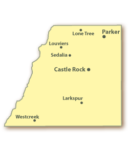
Douglas County is located between the City of Denver and the City of Colorado Springs. Municipalities within Douglas County include parts of the City of Aurora, City of Castle Pines North, Town of Castle Rock, Town of Larkspur, parts of the City of Littleton, City of Lone Tree, and Town of Parker.
Communications
A vast majority of public safety communications located within Douglas County can be found on the APCO Project 25 State of Colorado Digital Trunked Radio System (DTRS).
There are exceptions for areas on the northern and western edges of the county. These areas include Roxborough Park area of northwest Douglas County which is served by West Metro Fire operating on Metro Area Radio Cooperative (MARC), City of Aurora in northeast Douglas County which operates on Aurora EDACS, and the southwest portions of Douglas County which is served by North Fork Fire and Mountain Communities Fire on conventional VHF.
Normal users of DTRS may occasionally use VHF/800 conventional frequencies, especially in the more rural and mountainous parts of western Douglas County where DTRS coverage is insufficient or not used as the primary means of communications.
DTRS Sites to Monitor

North
Arapahoe Admin (Denver Metro) (1-001)
Smoky Hill (Denver Metro) (1-007)
Lookout Mountain (Denver Metro) (1-008)
Chevron Plaza Tower (Denver Metro) (1-064)
South
Douglas County South Simulcast (Denver Metro) (1-014)
East
West
Riley Peak (Denver Metro) (1-002)
Squaw Mountain (Denver Metro) (1-006)
Central
Silver Heights (Denver Metro) (1-003)
DTRS Talkgroups
| DEC | HEX | Mode | Alpha Tag | Description |
|---|---|---|---|---|
| 507 | 1fb | D | Douglas HRLETF | Sheriff - Highlands Ranch Law Enforcement Training Facility |
| 1001 | 3e9 | D | DouglasCo SAR Ad | SAR Admin |
| 1003 | 3eb | D | DouglasCo SAR Op | SAR Ops |
| 1005 | 3ed | D | DouglasCo MedCnt | County Medical Control |
| 1007 | 3ef | D | Douglas SO 1007 | Sheriff (1007) |
| 1009 | 3f1 | D | Douglas SO SIS | Special Investigations |
| 1011 | 3f3 | D | Douglas SO 1011 | Sheriff (1011) |
| 1013 | 3f5 | D | DouglasCo DEC | County Emergency Communications |
| 1015 | 3f7 | D | Douglas SO Adm | Sheriff Administration |
| 1017 | 3f9 | D | Douglas Co Cornr | County Coroner |
| 1019 | 3fb | D | DouglasCo Buildn | Building Department |
| 1021 | 3fd | D | DouglasCo R&B | Road & Bridge |
| 1023 | 3ff | D | Douglas SO Trng2 | Sheriff Training 2 |
| 1025 | 401 | D | DouglasCo R&B 1 | Road & Bridge 1 |
| 1027 | 403 | D | DouglasCo R&B 2 | Road & Bridge 2 |
| 1029 | 405 | D | DouglasCo R&B 3 | Road & Bridge 3 |
| 1031 | 407 | D | Douglas SO Supv | Sheriff Supervisors |
| 1033 | 409 | D | Douglas SO1 | Sheriff 1 Dispatch |
| 1035 | 40b | D | Douglas SO2 | Sheriff 2 |
| 1037 | 40d | D | Douglas SO3 | Sheriff 3 |
| 1039 | 40f | D | Douglas SO4 | Sheriff 4 |
| 1041 | 411 | D | DouglasCo Water | Water Department |
| 1042 | 412 | D | Douglas OEM | Office of Emergency Management |
| 1043 | 413 | D | DouglasCo MAC1 | County Mutual Aid 1 |
| 1045 | 415 | D | DouglasCo MAC2 | County Mutual Aid 2 |
| 1051 | 41b | D | DouglasCo FD RIT | Fire RIT Emergency |
| 1053 | 41d | D | DouglasCo FD 1 | Fire 1 Dispatch |
| 1055 | 41f | D | DouglasCo FD 2 | Fire 2 Administrative |
| 1057 | 421 | D | DouglasCo FD 3 | Fire 3 OPS-3 |
| 1059 | 423 | D | DouglasCo FD 5 | Fire 5 OPS-5 |
| 1061 | 425 | D | DouglasCo FD 7 | Fire 7 OPS-7 |
| 1063 | 427 | D | DouglasCo FD 9 | Fire 9 OPS-9 |
| 1065 | 429 | D | DouglasCo FD 11 | Fire 11 OPS-11 |
| 1067 | 42b | D | Douglas SO Inv | Sheriff Investigations |
| 1069 | 42d | D | Douglas SO Jail | Sheriff Jail |
| 1071 | 42f | D | Douglas SO JailT | Sheriff Jail Transport |
| 1073 | 431 | D | Douglas SO SA1 | Sheriff Special Assignment 1 |
| 1075 | 433 | D | Douglas SO SA2 | Sheriff Special Assignment 2 |
| 1077 | 435 | D | Douglas SO SA3 | Sheriff Special Assignment 3 |
| 1079 | 437 | D | Douglas SO SWAT | Sheriff SWAT |
| 1081 | 439 | D | Douglas SO 1081 | Sheriff (1081) |
| 1083 | 43b | D | Douglas SO SWATa | Sheriff SWAT Administration |
| 1085 | 43d | D | Douglas SO 1085 | Sheriff (1085) |
| 1087 | 43f | D | Douglas SO 1087 | Sheriff (1087) |
| 1089 | 441 | D | Douglas SO Trng1 | Sheriff Training 1 |
| 1091 | 443 | D | DouglasCo Wx | County Weather |
| 1093 | 445 | D | Douglas SO DTF | Sheriff Drug Task Force |
| 1791 | 6ff | D | West Douglas FPD | West Douglas County Fire Protection District |
| 1853 | 73d | D | DouglasCo FD T1 | Fire Training 1 |
| 1855 | 73f | D | DouglasCo FD SA2 | Fire Special Assignment (1855) |
| 1861 | 745 | D | DouglasCo FD 13 | Fire 13 OPS-13 |
| 1863 | 747 | D | DouglasCo Med 9 | County Medical Control 9 |
| 1867 | 74b | D | DouglasCo FD T2 | Fire Training 2 |
Other Systems & Frequencies
Douglas County Agencies on Conventional
Littleton Fire on VHF & 800 MHz Conventional
North Fork Fire on VHF Conventional
South Metro Fire on 800 MHz Conventional
Fire Departments
Douglas County is protected by 11 different fire departments which include the Aurora Fire Department, Castle Rock Fire Department, Franktown Fire Protection District, Jackson 105 Fire Protection District, Larkspur Fire Protection District, Littleton Fire Rescue, Mountain Communities Volunteer Fire Department, North Fork Volunteer Fire Department, South Metro Fire Rescue Authority, West Douglas Fire Protection District, and West Metro Fire Rescue. A detailed map of these fire district boundaries can be found here (PDF).
Dispatch
Multiple dispatching agencies provide fire dispatching services for fire departments located both within and outside of the county. The two primary agencies that provide fire dispatching services in Douglas County are Douglas Regional 911 Communication’s Center and Metropolitan Area Communications Center (MetCom). Douglas Regional 911 dispatches for Castle Rock, Franktown, Jackson 105, Larkspur, and fire departments located within Elbert County on TG 1053. MetCom dispatches for South Metro on TG 1786 and West Douglas on TG 1791.
Remaining agencies not listed are generally dispatched by their own centers located outside of the county. Aurora is dispatched by their own Aurora Public Safety Communications Department on Aurora EDACS TG 529, Littleton is dispatched by Littleton Fire Rescue Communications Center on TG 1851, Mountain Communities is dispatched by Teller County on VHF conventional, North Folk is dispatched by Evergreen Fire Rescue on VHF conventional, and West Metro is dispatched by West Metro Fire Rescue's 911 Emergency Dispatch Center on MARC TG 37107.
All above dispatch agencies work on DTRS with exception of Aurora, Evergreen, Teller, and West Metro. Most agencies utilize radio operation channels as assigned by their own communications center unless they are responding to aid another agency. In the latter case, the aiding agency will likely switch directly to the requesting agency's operations channel if operating on similar systems or use a mutual aid channel such as Red SE/SW for dissimilar systems.
Unit Designators
Douglas County fire units use many numerical designators that can be used to help determine general location and departments responding to an incident. Note that not all departments operate entirely in Douglas County. These departments have station numbers that are physically located in the county in parenthesis. Other notes may also apply.
| Identifier | Department | Staffing |
| 1-15 * ** | Aurora Fire Department | Career |
| 1-15 (15)* | West Metro Fire Protection District | Career |
| 11-18 (16-18)* | Littleton Fire Rescue | Career |
| 31-47 (34, 36, 39, 40-41, 43-47) | South Metro Fire Rescue Authority | Career |
| 130 | West Douglas Fire Protection District | Volunteer |
| 140 | Jackson 105 Fire Protection District | Volunteer |
| 150 | Castle Rock Fire Department | Combination |
| 160 | Larkspur Fire Protection District | Combination |
| 180 | Franktown Fire Protection District | Combination |
| 400 *** | Mountain Communities Fire Protection District | Volunteer |
| 1200 ** | North Fork Volunteer Fire Department | Volunteer |
* Department operates separate stations and units with the the same designator.
** Department does not have a station within the county, but provides coverage for parts of the county.
*** Department operates in multiple counties and is unknown if there is a set designator for within the county.
Fire Tone Out
Douglas Regional 911 provides fire paging on 151.115 MHz mostly using Motorola Quick Call 2 tones. These pages are a simulcast of their dispatch talkgroup located on DTRS. Any scanner with the Fire Tone Out feature can be use the following tones to provide specific department notifications of calls dispatched within the county.
| Department | First Tone | Second Tone |
| Castle Rock Fire Department | 349.0 | 410.8 |
| Franktown Fire Protection District | 368.5 | 433.7 |
| Jackson 105 Fire Protection District | 368.5 | 539.0 |
| Larkspur Fire Protection District | 349.0 | 368.5 |
MetCom provides fire paging for the West Douglas Fire Protection District on 151.025 MHz and is patched to the West Douglas Fire Protection District talkgroup on DTRS.
Littleton provides call alerting using a single tone department wide on 154.340 MHz and is a simulcast of their DTRS channel.
Locations
- Castle Rock Fire Department
- Station 151 (HQ) - 300 N Perry St (@ Third St), Castle Rock
- Station 152
- Former - 1469 S Columbine Dr (@ S Valley Dr), Castle Rock
- Station 153 - 5463 E Sovereign St (@ Cherry St), Castle Rock - WZJ358
- Station 154 - 3801 Prairie Hawk Dr (@ New Hope Way), Castle Rock
- Station 155 - 3833 Crowfoot Valley Rd (Between Sapphire Pointe Blvd & Diamond Ridge Pkwy), Castle Rock
- Franktown Fire Protection District
- Station 181 (HQ) - 1959 N Highway 83 (@ Kelty Rd), Franktown - WNIL229
- Station 182 - 10605 S Highway 83 (Between Oak Springs Trl & E Greenland Rd), Franktown
- Station 183 - 565 Flintwood Rd (@ E Highway 86), Franktown
- Station 184 - 6120 Bridle Path Ln (@ Bayou Gulch Rd), Parker
- Jackson 105 Fire Protection District
- Station 141 (HQ) - 8767 Jackson Creek Rd (S of Hidden Valley Rd at 39.335192 N, 105.044282 W), Sedalia
- Station 142 - 435 N Perry Park Rd (@ Pine Cliff Ave), Sedalia - WPDS899
- Station 143 - 4333 Greenwood Rd (@ S Perry Park Rd), Sedalia
- Larkspur Fire Protection District
- Station 161 (HQ) - 9414 Spruce Mountain Rd (Between W Plum Creek Ave & W Fox Farm Rd), Larkspur - WPXA253
- Station 162 - 5672 Red Rock Dr (Between Perry Park Blvd & Dead End at the end of Dead End), Larkspur
- Station 164 - 15205 Furrow Rd (Between Estates Cir & Ray Dr), Larkspur
- Littleton Fire Rescue - WNZM430
- Station 11-12 & 14-15 - located in Arapahoe County
- Station 13 - located in Jefferson County
- Station 16 - 8119 Blakeland Dr (Between N US-85 & Riverview Pkwy), Littleton
- Station 17 - 9554 S University Blvd (Between E Highlands Ranch Pkwy & Teal Ridge Ct), Highlands Ranch
- Station 18 - 401 Timbervale Trl (@ Lucent Blvd), Highlands Ranch
- Mountain Communities Fire Protection District
- Station 1 & 3 - located in Teller County
- Station 2 - 15000 Westcreek Rd (@ Stump Rd), Sedalia
- North Fork Fire Protection District - WPUB215
- Station 1-3 - located in Jefferson County
- South Metro Fire Rescue Authority
- Station 31-33, 35, 37-38, & 42 - located in Arapahoe County
- Station 34 - 8871 Maximus Dr (@ S Yosemite St), Lone Tree
- Station 36 - 421 Castle Pines Pkwy (@ 1st Ave), Castle Pines
- Station 39 - 475 W Happy Canyon Rd (Between Castle Pines Dr N & Country Club Dr), Castle Rock
- Station 40 - 10297 N Chatfield Dr (Between W Chatfield Ln & US-85), Littleton
- Station 41
- Current - 10795 Pine Dr (Between Summerset Ln & E Main St), Parker
- Former - Main St @ Louviers Dr, Louviers
- Station 43 - 8165 N Pinery Pkwy (@ Hillcrest Way), Parker
- Station 44 - 12625 E Lincoln Ave (@ S Peoria St), Parker
- Station 45 - 16801 Northgate Dr (@ Keystone Blvd), Parker
- Station 46 - 19310 Stroh Rd (@ J Morgan Blvd), Parker
- Station 47 - 11685 Tomahawk Rd (Between Beechwood Dr & Cherrywood Dr), Parker
- West Douglas County Fire Protection District - WPTN227
- Station 131 - 310 N Highway 67 (Between N Rampart Range Rd & Pine Creek Rd), Sedalia - KNAK730
- Station 132
- Current - 3305 N Highway 67 (Between Oak Valley Rd & Madge Gulch Rd), Sedalia - KNAK730
- Former - 3307 N Highway 67 (Between Oak Valley Rd & Rainbow Creek Rd), Sedalia
- Station 133 - 7149 Cherokee Dr (Between Piute Dr & Hopi Dr), Sedalia - KNAK730
- Station 134 (HQ) - 4037 Platte Ave (Between Manhart St & Victor St), Sedalia - KNAK730
- West Metro Fire Protection District - WPXT498
- Station 1-14 - located in Jefferson County
- Station 15 - 6222 Roxborough Park Rd (@ E Roxborough Dr), Littleton
Fire Radio Definitions
Adopted from the Douglas County Sheriff's Office
| Term | Definition |
| Air Unit | An apparatus that carries a machine to refill S.C.B.A. container at the fire ground/operation |
| Battalion Chief | Shift Command Officer |
| Brush | A light attack apparatus, typically 4 X 4, with less than 400 gallons of water, a booster pump of less than 500 GPM, and designed to respond to wildland fires. |
| Chief | The Fire Chief of the department or one of the department's executive officers. |
| Dive | A specialize unit that carries water and ice rescue equipment |
| Division Chief | Mid-management officer; Battalion Chief reports to Division Chief |
| Division | Organization level having responsibility for operations within a defined geographic area. This functional level falls between branch and crews, task forces, strike teams, and/or single resources. |
| Engine | An apparatus with a permanently mounted fire pump with a capacity of 500 GPM or greater, a water tank of at least 500 gallons, a hose bed, and contains NFPA minimum equipment for a class A pumper/engine. |
| Hazmat | A specially designed and equipped apparatus that responds to hazardous materials incidents. |
| Ladder | Generic terminology for an aerial apparatus. May be a Quint, Tower or Truck. |
| Light Unit | An apparatus that carries an on board light system used to provide scene illumination. |
| Medic | An apparatus that is staffed by fire fighters and carries basic or advanced life support (BLS/ALS) equipment and personnel; may or may not have transport capability; BLS usually staffed by EMT's; ALS staffed by a minimum of one paramedic and one EMT; most career department rescues are ALS. |
| Quint | An apparatus with a permanently mounted fire pump with a capacity of 500 GPM or greater, a water tank that may be less than 500 gallons, but typically not less than 200 gallons, a hose bed, all NFPA minimum equipment for a class A pumper/engine, carrying a full complement of ground ladders totaling 116 feet, and has a permanently mounted, power operated aerial ladder that may be less than 100 feet in length. Quints may function as either an engine or truck companies. |
| RED LEADER | Airport Crash Rescue apparatus |
| RIT | The Rapid Intervention Team is to be used to provide for the rescue of firefighters operating at emergency incidents if the need arises. |
| Rescue | An apparatus that carries specialized equipment that may include, but is not limited to heavy extrication, trench rescue, urban search and rescue, and confined space, and rapid intervention. |
| SCAT | A light attack apparatus with a booster pump of less than 400 GPM, limited personnel carrying capability equipped with limited structural firefighting equipment. Is usually limited to structural firefighting but may also respond on wildland fires. Scats may also be known as minipumpers. |
| Squad | A specialized apparatus that can carry equipment similar to a rescue, and may include equipment for mass casualty incidents. It may also include a mobile air unit, lighting capabilities, and additional hazmat equipment and supplies. |
| Squirt | Apparatus with a fire pump, a water tank, hose bed, and an aerial device usually less than 75 feet. Normally handles engine type assignments and is similar to a Quint |
| Tender | An apparatus that provides a mobile water supply, has a tank capacity greater than 1000 gallons, has a small capacity pump usually between 500 and 750 GPM and carries a limited supply of hose. |
| Tower | A platform ladder truck with a permanently mounted passenger carrying platform attached to a telescoping aerial ladder and carrying a full complement of ground ladders totaling 116 feet. |
| Truck | A ladder truck with a permanently mounted, power operated aerial ladder and carries a full complement of ground ladders totaling 116 feet. |
Law Enforcement
Law enforcement for Douglas County is provided by the State Patrol, Douglas County Sheriff's Office, Castle Rock Police Department, Lone Tree Police Department, and Parker Police Department.
The Colorado State Patrol Troop 1C operates in Douglas County on TG 2301. Note that this talkgroup is often patched and may require additional programming to properly monitor. Additional information can be found at Colorado State Patrol (CO).
Other agencies can be found operating entirely within the county on their own respective channels with exception of Lone Tree which is dispatched by Parker.
Douglas County Sheriff's Office (DCSO)
DCSO is dispatched by their own in-house communications center on TG 1033. Patrol units are typically identified with three digits followed by a letter. The first digit of a unit's number represents the shift.
- 1: Day
- 2: Swing
- 3: Graves
This is followed by two additional numbers that represents the beat which the unit is assigned to, which can be found here (PDF). Beats range from 01 to 10 unless they are a Supervisor which are assigned 00. All patrol units are also assigned an additional letter that designate which car they inside the beat, starting with the letter A. Some examples are 203A (203 Adam) which is a swing unit in the 03 beat and is the first car of the beat or 300B (300 Boy) which is a graves supervisor and is the second supervisor of that shift.
Specialized units typically do not follow the above example and are assigned unique identifiers.
- 500: Community Service Volunteer
- 600: Traffic
- Mary: Motorcycle
- 800: School Resource Officer
- Command: Admin (Lower number means higher rank)
- Ida: Investigations
- King: K9
- Lincoln: Lieutenant
- Paul: Off Duty
Codes
- A(dam): Dead Body
- BR stands for "Bulletin Report". The term bulletin comes from the old days when things were typed on a typewriter and then put on a clip board for interested persons to view, whether it be private citizens, the press or whoever. The codes are a quick way of giving the dispatcher the final disposition of the call so it can be closed with a disposition in the report.
- 1: Gone on arrival
- 2: No criminal activity
- 3: False alarm
- 4: No response (used by a supervisor only, they do not have, or do not want to commit a resource)
- 5: Handled by other agency (Fire Department, State Patrol, Police Department, etc.)
- 6: Field Interview card made on subject(s)
- 7: Citation or ticket issued
- 8: Not used
- 9: Warning given
Note: DCSO has generally phased out code usage, but certain units may be found to occasionally refer to CRPD codes as they were once commonly used in DCSO.
Castle Rock Police Department (CRPD)
CRPD is dispatched by their own communications division on TG 2201. Patrol units are identified using a three digit identifier. The first digit of the identifier represents shift, the second is the district, and the third typically also represents shift.
- 1: Day
- 2: Swing
- 3: Graves
Castle Rock is is split into 4 patrol districts that are divided into quarters. District 1 covers the Northwest with Wolfensberger Rd and I-25 as borders, District 2 covers Northeast with I-25 and Highway 86 as borders, District 3 is Southwest with Wolfensberger Rd and S Gilbert St as borders, and District 4 is Southeast with S Gilbert and Highway 86 as borders.
Specialized units do not follow the above numbering system and use a letter follow by two digits.
- Adam: School Marshal
- Charlie: Corporal
- David: Detective
- Edward: Explorer
- King: K9 unit
- Sam: Sergeant
- Tom: Traffic
- Victor: Community Service Volunteer
- X-Ray: Off Duty
Codes
- 1: Emergency/Situational Radio Traffic Only
- 2: Routine Response
- 3: Emergency Response
- 4: Officer / Situation is okay
- 5: Traffic Contact
- 6: Warrant
- M(ary): Misdemeanor
- F(rank): Felony
- 7: Meal Break
- 8: On Scene
- 9: Intoxicated
- 10: Officer Need Assistance
Lone Tree Police Department (LTPD) & Parker Police Department (PPD)
LTPD and PPD are dispatched by Parker Police Department's communications section on TG 2103.
Parker patrol units are identified using a three digit identifier. The first digit of the identifier represents shift, the second is the district, and the third is the unit within the district.
- 1: Day
- 2: Swing
- 3: Graves
Parker is split into 3 patrol districts. District 1 is North with a southern boundary ending roughly at Lincoln Ave, District 2 is Central, and District 3 is Southeast.
Lone Tree patrol units are identified using a letter followed by a two digit identifier. The first letter identifier is the unit's shift and followed by two additional digits.
- Adam: Day
- Boy: Swing
- Charlie: Graves
Beyond the patrol assignments, additional designators are given to distinguish other units.
- Lone Tree Police Department
- Mike: Mall
- Paul: Unknown
- Sam: Sergeant
- Tom: Traffic
- Victor: Community Service Volunteer
- Parker Police Department
- 500: Traffic
- 600: Animal Services
- 700: Unknown
- Command: Admin
- Cruiser: Sergeant
- Edward: Unknown
- Lincoln: Unknown
- X-Ray: Investigations
Former identifiers that were once used include the following:
- Lima Tango: Lone Tree Patrol
- Lima Mike: Lone Tree Mall
- Lima Delta: Lone Tree Detective
Amateur Radio
Colorado ARES Regional Coordination Repeaters
- 447.525MHz / - / 146.2Hz In / 146.2Hz Out "525 Alpha" Location: Devils Head, Pike National Forest
- 447.525MHz / - / 203.5Hz In / 146.2Hz Out "525 Bravo" Location: Hess Reservoir, Surrey Ridge
Repeaters are open, but are not "ragchew" machines. Traffic should be limited to ARES or emergency communications related administration, coordination, exercises, training, and incidents. 525 Alpha has wide area coverage from Pueblo County in the south to the Wyoming Border. Coverage due east is limited due to main peak of Devils Head, but there is good coverage of Pike National Forest and back country around North and South Forks of the Platte River.