File list
This special page shows all uploaded files.
| Date | Name | Thumbnail | Size | Description | Versions |
|---|---|---|---|---|---|
| 16:10, 2 May 2024 | Adams911.jpg (file) | 28 KB | Adams County Quincy IL 911 ETSB | 1 | |
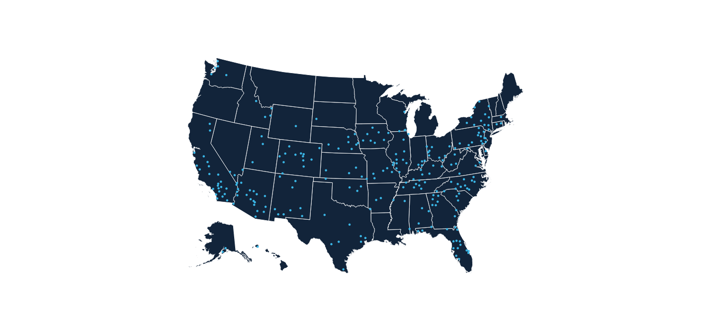
| 21:31, 29 April 2024 | AirCom-BasesUS-AirMethods.png (file) |  |
98 KB | AirCom US Bases Air Methods | 1 |
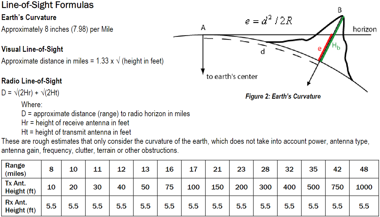
| 01:31, 14 January 2024 | Line-of-site-formulas.png (file) |  |
108 KB | Line-of-Sight Formulas Earth’s Curvature Approximately 8 inches (7.98) per Mile Visual Line-of-Sight Approximate distance in miles = 1.33 x √ (height in feet) Radio Line-of-Sight D = √(2Hr) + √(2Ht) Where: D = approximate distance (range) to radio horizon in miles Hr = height of receive antenna in feet Ht = height of transmit antenna in feet These are rough estimates that only consider the curvature of the earth, which does not take into account power, antenna type, antenna gain, frequency, c... | 1 |
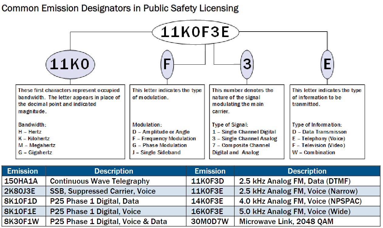
| 00:42, 14 January 2024 | Common Emission Designators.png (file) |  |
126 KB | Common Emission Designators in Public Safety Licensing Emission Description Emission Description 150HA1A Continuous Wave Telegraphy 11K0F3D 2.5 kHz Analog FM, Data (DTMF) 2K80J3E SSB, Suppressed Carrier, Voice 11K0F3E 2.5 kHz Analog FM, Voice (Narrow) 8K10F1D P25 Phase 1 Digital, Data 14K0F3E 4.0 kHz Analog FM, Voice (NPSPAC) 8K10F1E P25 Phase 1 Digital, Voice 16K0F3E 5.0 kHz Analog FM, Voice (Wide) 8K30F1W P25 Phase 1 Digital, Voice & Data 30M0D7W Microwave Link, 2048 QAM | 1 |
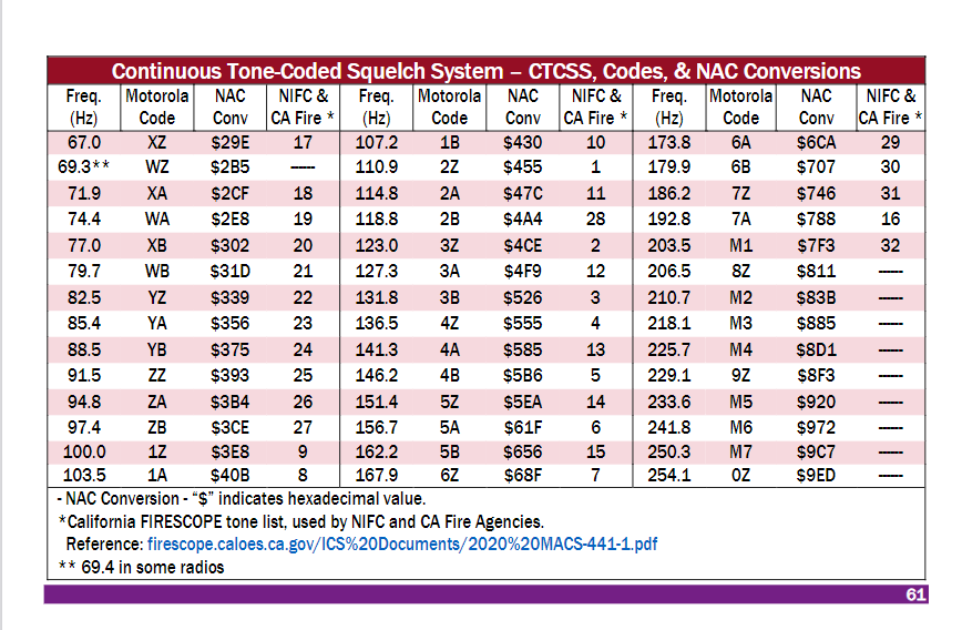
| 00:20, 14 January 2024 | CTCSS-NAC-codes.png (file) |  |
76 KB | Continuous Tone-Coded Squelch System – CTCSS, Codes, & NAC Conversions Freq. (Hz) Motorola Code NAC Conv NIFC & CA Fire * Freq. (Hz) Motorola Code NAC Conv NIFC & CA Fire * Freq. (Hz) Motorola Code NAC Conv NIFC & CA Fire * 67.0 XZ $29E 17 107.2 1B $430 10 173.8 6A $6CA 29 69.3** WZ $2B5 ------ 110.9 2Z $455 1 179.9 6B $707 30 71.9 XA $2CF 18 114.8 2A $47C 11 186.2 7Z $746 31 74.4 WA $2E8 19 118.8 2B $4A4 28 192.8 7A $788 16 77.0 XB $302 20 123.0 3Z $4CE 2 203.5 M1 $7F3 32 79.7 WB $31D 21 127... | 1 |
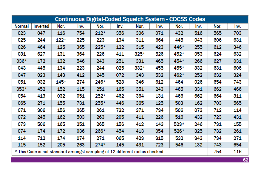
| 00:18, 14 January 2024 | CDCSS-tones.png (file) |  |
68 KB | Continuous Tone-Coded Squelch System – CTCSS, Codes, & NAC Conversions Freq. (Hz) Motorola Code NAC Conv NIFC & CA Fire * Freq. (Hz) Motorola Code NAC Conv NIFC & CA Fire * Freq. (Hz) Motorola Code NAC Conv NIFC & CA Fire * 67.0 XZ $29E 17 107.2 1B $430 10 173.8 6A $6CA 29 69.3** WZ $2B5 ------ 110.9 2Z $455 1 179.9 6B $707 30 71.9 XA $2CF 18 114.8 2A $47C 11 186.2 7Z $746 31 74.4 WA $2E8 19 118.8 2B $4A4 28 192.8 7A $788 16 77.0 XB $302 20 123.0 3Z $4CE 2 203.5 M1 $7F3 32 79.7 WB $31D 21 127... | 1 |
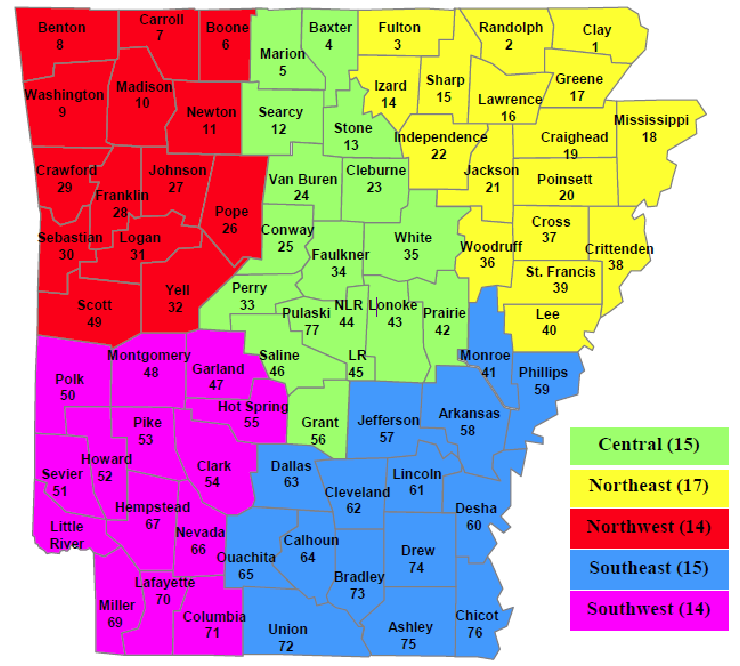
| 19:03, 13 January 2024 | ADEM Emergency Management Area Map.png (file) |  |
147 KB | Arkansas ADEM Emergency Management Area Map 2021 | 1 |
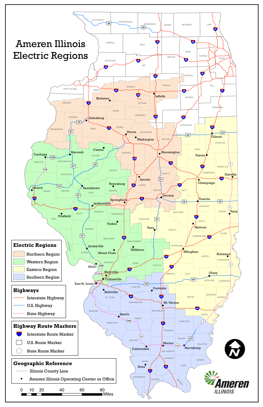
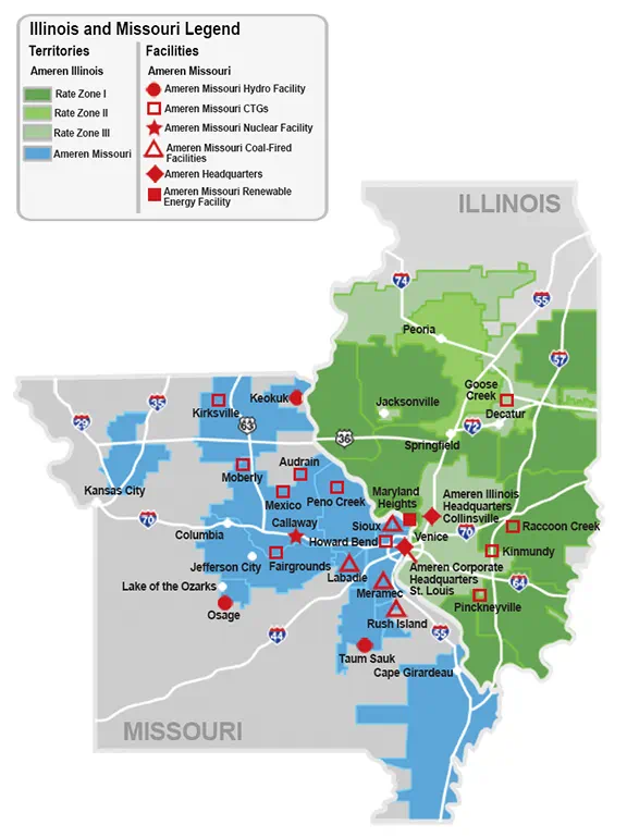
| 14:56, 11 January 2024 | AmerenIllinois-2023-service-territory-map-electric.png (file) |  |
463 KB | Ameren Illinois 2023 service territory map electric | 1 |
| 20:47, 17 October 2023 | Hazelwood-business-park-layout-with-idi-warehouse.png (file) |  |
1.19 MB | Hazelwood-business-park-layout-with-idi-warehouse. | 1 |
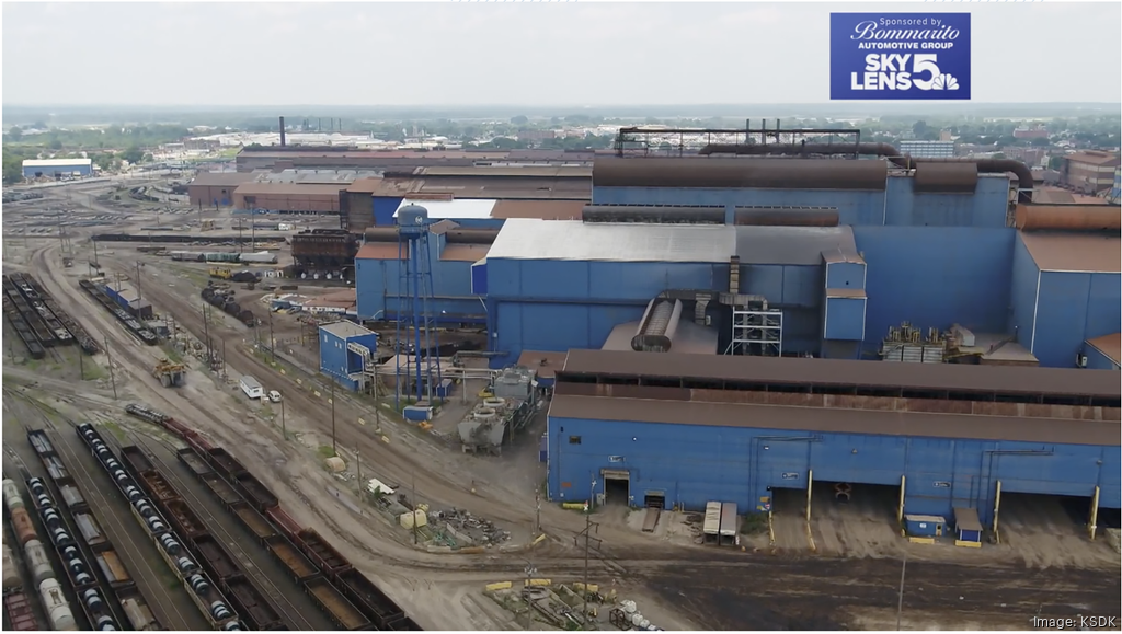
| 17:35, 3 October 2023 | Us-steel-granite-city-works-aerial-100223-ksdk.png (file) |  |
1.16 MB | US Steel Granite City 2023 | 1 |
| 13:05, 19 September 2023 | Moswin sm.png (file) |  |
13 KB | MOSWIN logo | 1 |
| 07:57, 5 September 2023 | HSHS-StElizabeths-Hospital.jpg (file) |  |
85 KB | HSHS St. Elizabeth's Hospital Shiloh IL | 1 |
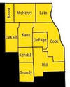
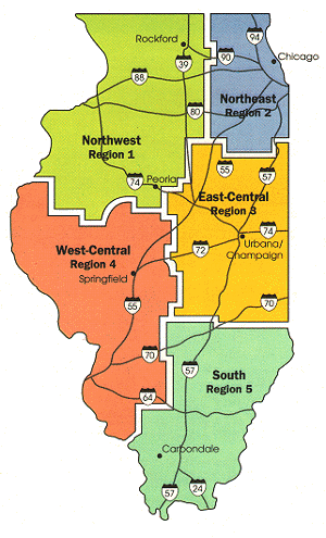
| 18:51, 27 August 2023 | IEMAregionaloffices-1.jpg (file) |  |
79 KB | IEMA IL Emergency Management region map | 1 |
| 18:09, 27 August 2023 | Iemaohs.png (file) | 370 KB | Illinois Emergency Management Agency and Office of Homeland Security logo | 1 | |
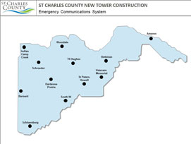
| 22:39, 25 August 2023 | SLATER-StCharles.jpg (file) |  |
9 KB | Missouri SLATER Digital Radio System for St Charles County Tower Sies | 1 |
| 22:00, 25 August 2023 | Washu-297e3c194f501001b82869ee77820000.png (file) |  |
14 KB | wash u logo st louis mo | 1 |
| 18:15, 8 August 2023 | Starcom21-400x123.jpg (file) |  |
10 KB | Illinois STARCOM21 logo | 1 |
| 18:01, 8 August 2023 | ISP SOG MapPNG.png (file) |  |
935 KB | Illinois State Police Strategic Operations Command 2023 | 1 |
| 17:58, 8 August 2023 | ISP SOG Map.pdf (file) | 1.62 MB | Illinois State Police Strategic Operations Command 2023 | 1 | |
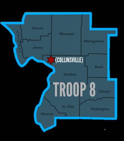
| 16:42, 22 April 2023 | ISP-Troop8.jpg (file) |  |
17 KB | Illinois State Police Troop 8 Map | 1 |
| 18:17, 29 March 2023 | PeoriaStarkCountyJointETSBlogo.png (file) | 96 KB | Peoria Stark County Joint ETSB logo | 1 | |
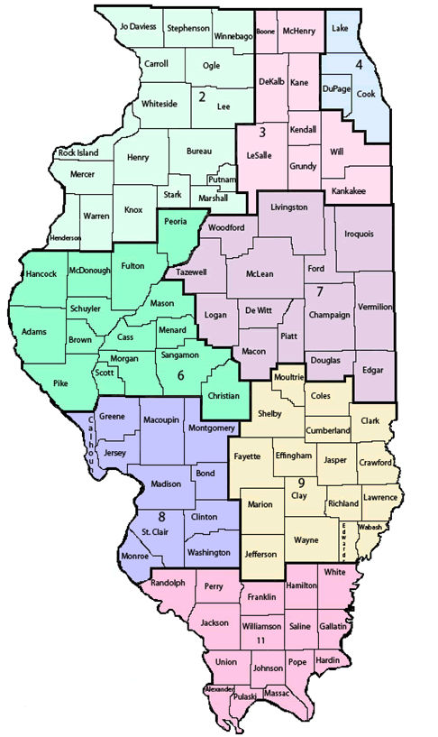
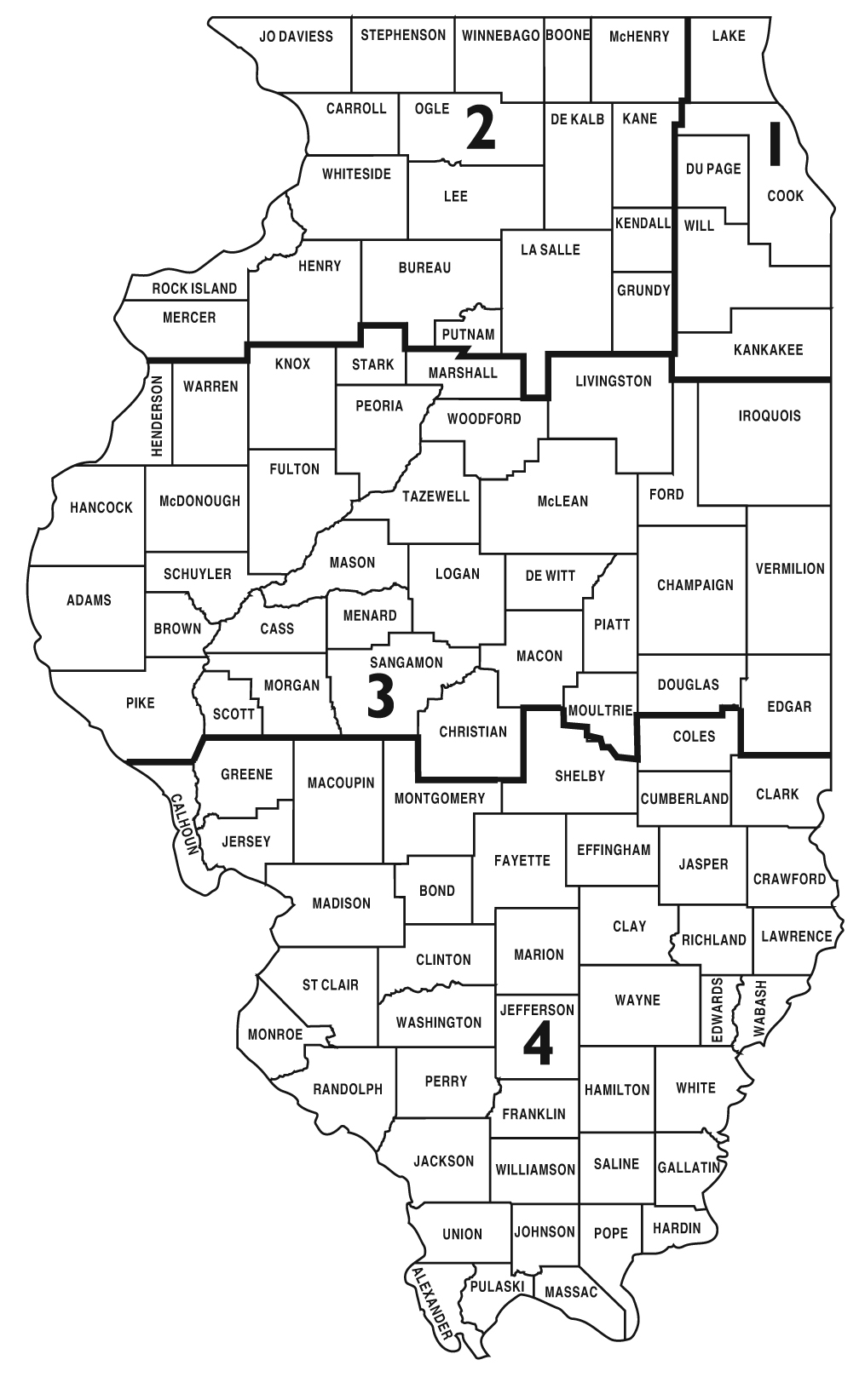
| 18:36, 24 March 2023 | Illinois-county-map.gif (file) |  |
35 KB | Illinois Map of Counties | 1 |
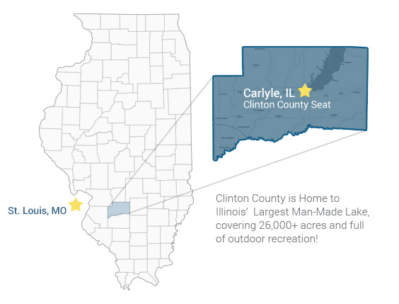
| 17:26, 24 March 2023 | Clinton -StateAndCounty.jpg (file) |  |
43 KB | Clinton County IL Map | 1 |
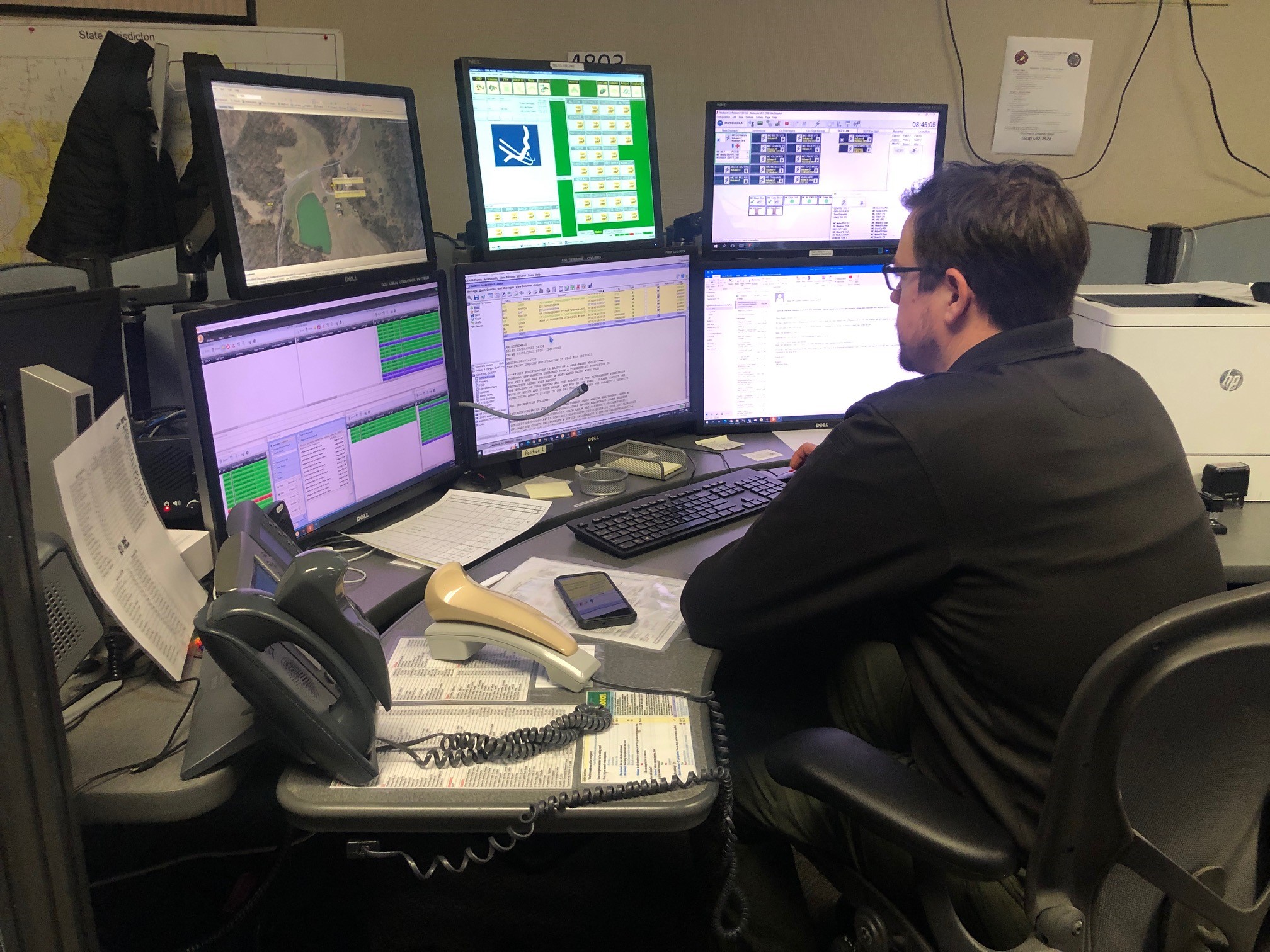
| 15:42, 21 March 2023 | MadisonCountySheriff911-dispatch.jpg (file) |  |
702 KB | Madison County IL Sheriff 911 Dispatch center console 2023 | 1 |
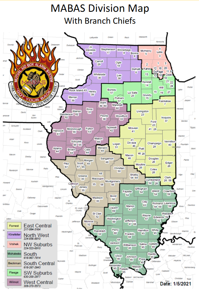
| 00:51, 21 March 2023 | MABAS2021.png (file) |  |
468 KB | MABAS IL Fire Division Map 2021 by county | 1 |
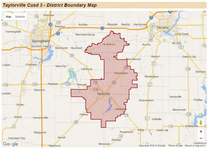
| 15:24, 16 March 2023 | TaylorvilleCUSD3map.png (file) |  |
490 KB | Taylorville IL School District #3 Boundary Map | 1 |
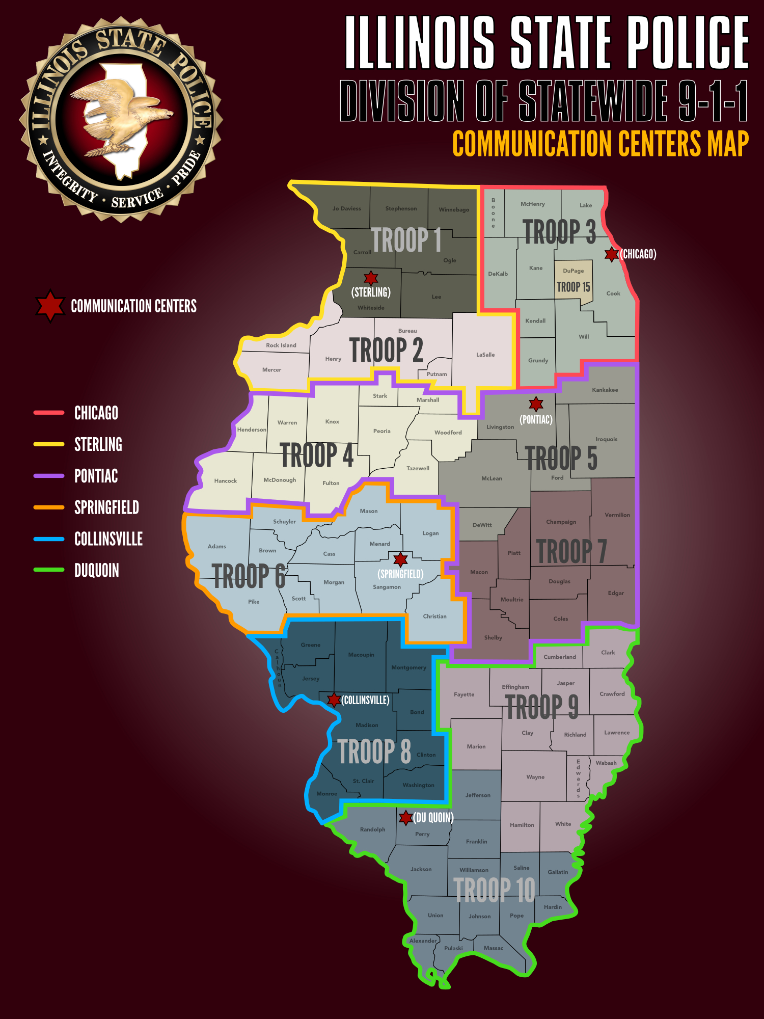
| 18:55, 12 March 2023 | ISP-TroopCommunicationCenters 010123.jpg (file) |  |
1.04 MB | ISP 911 Troop Communication Centers | 1 |
| 17:52, 12 March 2023 | ILSOSpolicedistricts.gif (file) |  |
134 KB | Illinois Secretary of State Police District Map | 1 |
| 13:21, 12 March 2023 | SpringfieldCMED-EMS.jpg (file) |  |
102 KB | 1 | |
| 11:15, 27 January 2023 | ISP-Troop3.png (file) |  |
19 KB | Illinois State Police Troop 3 Metro Chicago 2023 | 1 |
| 21:49, 18 December 2022 | Ameren.png (file) |  |
266 KB | 1 | |
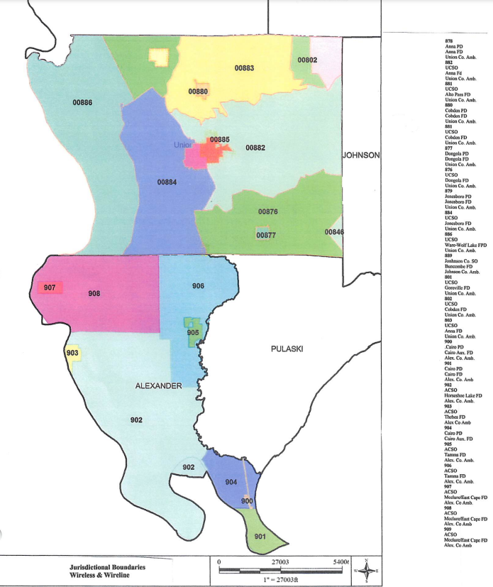
| 16:50, 1 August 2022 | Union.pdf 202281162839.png (file) |  |
420 KB | Union Pulaski Alexander County 911 Map | 2 |
| 23:32, 18 July 2022 | Jackson County Repeater System RFP.pdf (file) | 54 KB | Bid for June 2022 Jackson County 911/Sheriff/Carbondale Police Simulcast system | 1 | |
| 00:16, 10 November 2020 | DuPageSheriffPatrolBeats.png (file) |  |
710 KB | DuPageSheriffPatrolBeats.png | 1 |
| 23:59, 9 November 2020 | DuPageSheriffPatrolBeats.pdf (file) | 751 KB | Du Page Sheriff Patrol (IL) Beat Sector Map 11/9/20 | 1 | |
| 19:03, 6 June 2018 | ScanMacoupinCountyFBpageCover.png (file) |  |
273 KB | 1 | |
| 03:57, 25 January 2018 | ScanMacoupin.gif (file) | 5 KB | ScanMacoupin | 1 | |
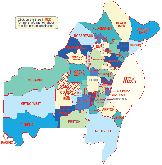
| 20:47, 14 September 2012 | Stlouiscounty-firedistricts.gif (file) |  |
63 KB | St Louis County Missouri MO Fire Districts Map | 1 |
| 20:54, 10 September 2012 | IDNR Law Map (Feb27 09).pdf (file) | 308 KB | Illinois Department of Natural Resources Map | 1 | |
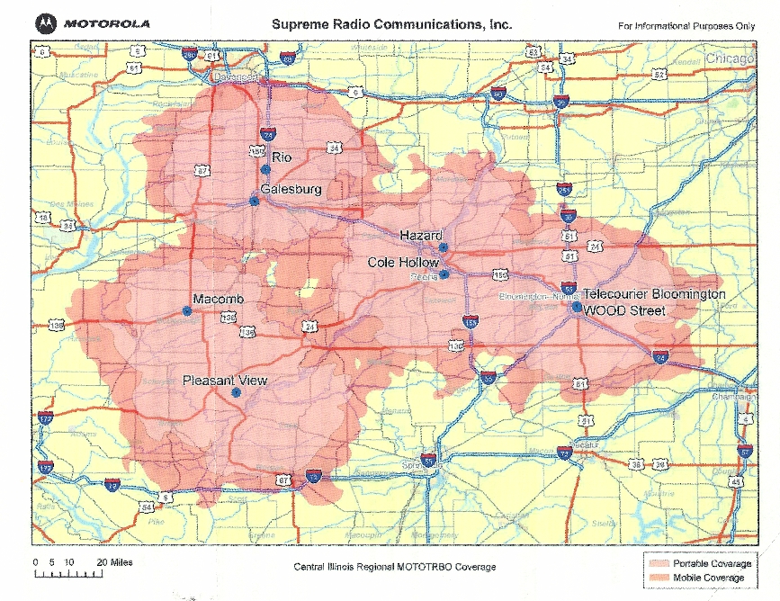
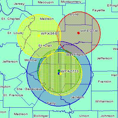
| 23:58, 5 September 2012 | SupremeRadioCommunications-MOTOTRBO-Coverage-Area-Map-SMALL.jpg (file) |  |
647 KB | 1 | |
| 01:18, 23 August 2012 | MJMElectricCooperative-map.jpg (file) |  |
329 KB | 1 | |
| 20:31, 21 May 2012 | AmerenMOedacs-beforeP25removals.pdf (file) | 23 KB | AmerenMO EDACS system before removing frequencies that are now on the P25 system. | 1 | |
| 16:15, 10 May 2012 | STLCounty-ExtendedImplementation.pdf (file) | 110 KB | 1 | ||
| 16:14, 10 May 2012 | STLCounty-Region13.pdf (file) | 98 KB | 1 | ||
| 16:12, 10 May 2012 | STLCounty-Region24.pdf (file) | 46 KB | 1 | ||
| 00:18, 27 October 2009 | Mshpmap.png (file) |  |
31 KB | missouRi hIHgway patrol map with troop areas | 1 |
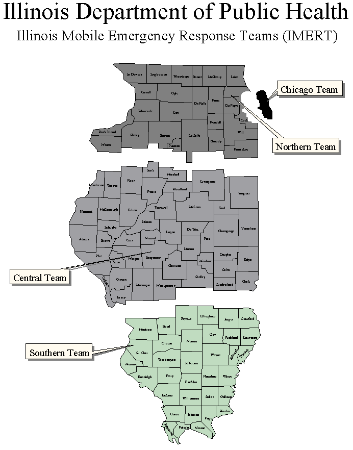
| 01:01, 18 October 2009 | Imert nodots.gif (file) |  |
18 KB | (IL) IMERT Regions (IDPH) | 1 |
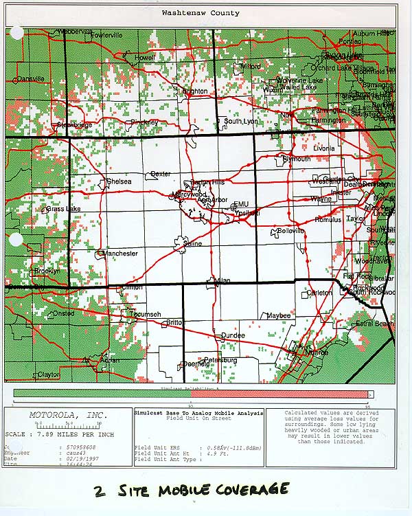
| 02:11, 1 August 2009 | Washtenaw-800mhz-coverageMap-em 800.jpg (file) |  |
140 KB | Washtenaw 800 MHz TRS Coverage Area Map | 1 |
| 01:31, 15 May 2009 | IL-medstar-fccmap.gif (file) |  |
14 KB | IL Medstar EMS Map | 1 |
| 17:45, 5 May 2009 | IL-IDNR region map.gif (file) |  |
58 KB | IL IDNR Conservation Region Map | 1 |