Difference between revisions of "US Forest Service - Pike National Forest (CO)"
From The RadioReference Wiki
m |
(Updated and reorganized/reformatted frequency table. Added short description of Pike NF (taken from description I wrote on Jeffco page). Added additional frequencies (work/tac).) |
||
| Line 1: | Line 1: | ||
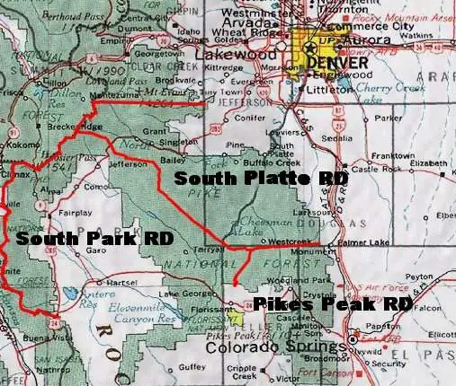
| − | = | + | The [https://www.fs.usda.gov/psicc Pike National Forest] encompasses approximately 1.2 million acres spread across Park, Jefferson, Douglas, Teller, and El Paso Counties in central Colorado. Because of its close proximity to both Denver and Colorado Springs, the Pike National Forest is one of the busiest forests in the region, boasting an annual visitation average of nearly 2.5 million people. The [https://www.fs.usda.gov/detail/psicc/about-forest/?cid=fseprd915453 South Platte Ranger District] is responsible for 450,000 acres of the Pike National Forest, covering the entirety of southern Jefferson County, western Park County, and western Douglas County. Two other Ranger Districts manage the forest, [https://www.fs.usda.gov/detail/psicc/about-forest/districts/?cid=fsm9_032731 Pikes Peak] to the south, covering the portions of the forest in Teller and El Paso Counties, and the [https://www.fs.usda.gov/detail/psicc/about-forest/districts/?cid=fsm9_032763 South Park Ranger District], covering the remaining portions of the forest which ring Park County. The Pike National Forest is managed jointly with the San Isabel National Forest and the [https://www.fs.usda.gov/detail/psicc/about-forest/districts/?cid=fseprd821814 Cimarron] and [https://www.fs.usda.gov/detail/psicc/about-forest/districts/?cid=fsm9_032695 Comanche] National Grasslands. Unlike the unified Arapahoe-Roosevelt, Pawnee radio system to the north, geographic disparities keep the operations of the PSICC radio systems separate, with each management unit operating their own net. |
| − | [ | ||
| − | === | + | |
| − | * | + | Dispatching and resource tracking on the Pike National Forest is handled by the [https://gacc.nifc.gov/rmcc/dispatch_centers/r2pbc/ Pueblo Interagency Dispatch Center]. |
| − | * | + | |
| − | {| | + | |
| − | | | + | * [http://www.wildcad.net/WCCOPBC.htm WildCAD CO-PBC Local Incident and Resource Status Tracking] |
| + | * [https://www.nifc.gov/nicc/logistics/references/Western_US_Federal_Dispatch_Boundaries/Colorado.pdf Federal Dispatch Boundary Maps for Colorado] | ||
| + | * [https://gacc.nifc.gov/rmcc/dispatch_centers/r2pbc/new_pages/ResponseAreaMaps.html Pike, San Isabel, Comanche, and Cimmarron Response Area Maps] | ||
| + | |||
| + | |||
| + | http://mapsof.net/uploads/static-maps/pike_nat_forest_vicinity_map.jpg | ||
| + | |||
| + | |||
| + | ===Radio Frequencies=== | ||
| + | |||
| + | ====Repeater Network==== | ||
| + | |||
| + | * Frequencies changed in July 2016 to comply with NITA directive to move repeater outputs to frequencies between 169.5125 and 173.9875. | ||
| + | |||
| + | * "Tone #" refers to the National Standard Tone Numbering System used by the USFS, BLM, and other land management agencies and is only applicable to TX tones. | ||
| + | |||
| + | {| class="wikitable sortable" | ||
| + | |- | ||
| + | ! CH !! TONE # !! RX FREQ !! RX TONE !! TX FREQ !! TX TONE !! Description !! Ranger District !! County !! Notes/Confirmation | ||
| + | |- | ||
| + | | Local/Direct || 1 || 171.1375 || 110.9 || 171.1375 || 110.9 || Forest-wide Simplex/Direct || || || 08/2021 | ||
| + | |- | ||
| + | | North Twin Cone || 2 || 171.1375 || 110.9 || 164.9875 || 123.0 || North Twin Cone Peak Repeater || S Platte / S Park|| Park || | ||
|- | |- | ||
| − | | | + | | Russell Ridge || 3 || 171.1375 || 110.9 || 164.9875 || 131.8 || Indian Creek/Russell Ridge Repeater || S Platte || Jefferson || 08/2021 |
| − | |||
| − | |||
|- | |- | ||
| − | | | + | | Mount Evans || 4 || 171.1375 || 110.9 || 164.9875 || 136.5 || Mount Evans Repeater || S Platte || Clear Creek || 08/2021 |
|- | |- | ||
| − | | | + | | Longwater Gulch || 5 || 171.1375 || 110.9 || 164.9875 || 146.2 || Longwater Gulch/Green Mountain Repeater || S Platte / S Park / Pikes Peak|| Douglas || 08/2021 |
|- | |- | ||
| − | | | + | | Devils Head || 6 || 171.1375 || 110.9 || 164.9875 || 156.7 || Devil's Head Peak Repeater || S Platte || Douglas || 08/2021 |
|- | |- | ||
| − | | | + | | Almagre || 7 || 171.1375 || 110.9 || 164.9875 || 167.9 || Almagre Mountain Repeater || Pikes Peak || Teller || 09/01/2016 |
|- | |- | ||
| − | | | + | | Stanley || 8 || 171.1375 || 110.9 || 164.9875 || 103.5 || Stanley Canyon Repeater || Pikes Peak || El Paso || |
|- | |- | ||
| − | | | + | | Cheyenne Creek || 9 || 171.1375 || 110.9 || 164.9875 || 100.0 || Cheyenne Creek/Mount Rosa Repeater || Pikes Peak || El Paso || |
|- | |- | ||
| − | | | + | | Lake George || 10 || 171.1375 || 110.9 || 164.9875 || 107.2 || Lake George Repeater || S Park || Park || |
|- | |- | ||
| − | | | + | | Topaz Mountain || 11 || 171.1375 || 110.9 || 164.9875 || 114.8 || Topaz Mountain Repeater || S Platte / S Park || Park || |
|- | |- | ||
| − | | | + | | Dicks Peak || 12 || 171.1375 || 110.9 || 164.9875 || 127.3 || Dicks Peak Repeater || S Park || Park || |
|- | |- | ||
| − | | | + | | Sheep Ridge || 13 || 171.1375 || 110.9 || 164.9875 || 141.3 || Sheep Ridge/Sacramento Gulch Repeater || S Park || Park || 09/01/2016 |
|- | |- | ||
| − | | | + | | Mount Bailey || 14 || 171.1375 || 110.9 || 164.9875 || 151.4 || Mount Bailey Repeater || S Platte / S Park || Park || |
|- | |- | ||
| − | | | + | | '''''(FUTURE)''''' || 15 || 171.1375 || 110.9 || 164.9875 || 162.2 || Badger Mountain Repeater || S Park || Park || (2020 - Not online yet) |
|- | |- | ||
| − | | ||171.1375||110.9||164.9875||192.8|| | + | | || 16 || 171.1375 || 110.9 || 164.9875 || 192.8 || Portable Repeater || || || |
| + | |} | ||
| + | |||
| + | |||
| + | ====Other Frequencies==== | ||
| + | {| class="wikitable" | ||
|- | |- | ||
| − | + | ! CH !! RX FREQ !! RX TONE !! TX FREQ !! TX TONE !! Description !! Notes | |
|- | |- | ||
| + | | WORK-1 || 163.7125 || || 163.7125 || 192.8 || Pike Intra-Crew/Work Ch 1 || Gov't Common 1, handheld use only. National Travel Net, IHC/Intra-Crew frequency. | ||
| + | |- | ||
| + | | WORK-2 || 168.6125 || || 168.6125 || || Pike Intra-Crew/Work Ch 2 || Gov't Common 3, handheld use only. Secondary IHC/Intra-Crew frequency. | ||
| + | |- | ||
| + | | GOVT WORK || 168.350 || || 168.350 || || "Government Work" Work/TAC Ch || Federal Common/Nationwide Itinerant. Old National Travel Net and R-2 TAC. | ||
| + | |- | ||
| + | | || 163.100 || || 163.100 || || General Use Work/TAC Ch || Federal Common/Nationwide Itinerant. Old National Logistics Channel, can be used as an input to 168.350 on portable repeaters. | ||
| + | |- | ||
| + | | TAC 1 || 168.050 || || 168.050 || || Pike TAC 1 || NIFC TAC 1. Used by Pike as a local/IA TAC. Referred to as "Group 5 Tac 1." | ||
| + | |- | ||
| + | | TAC 2 || 168.200 || || 168.200 || || Pike TAC 2 || NIFC TAC 2. Used by Pike as a local/IA TAC. Referred to as "Group 5 Tac 2." | ||
| + | |- | ||
| + | | TAC 3 || 168.600 || || 168.600 || || Pike TAC 3 || NIFC TAC 3. Used by Pike as a local/IA TAC. Referred to as "Group 5 Tac 3." | ||
| + | |- | ||
| + | | (UHF Link) || 406.325 || (Varies) || 415.325 || (Varies) || UHF Link to Pike Repeater Net (171.1375) || Used to link various repeaters. PL tone varies depending on repeater selected. | ||
| + | |- | ||
| + | | (UHF Link) || 408.9875 || 136.5 || 417.9875 || 110.9 || UHF Link to National Flight Following (168.650) || | ||
|} | |} | ||
| + | |||
===Related Links=== | ===Related Links=== | ||
Revision as of 02:27, 4 September 2021
The Pike National Forest encompasses approximately 1.2 million acres spread across Park, Jefferson, Douglas, Teller, and El Paso Counties in central Colorado. Because of its close proximity to both Denver and Colorado Springs, the Pike National Forest is one of the busiest forests in the region, boasting an annual visitation average of nearly 2.5 million people. The South Platte Ranger District is responsible for 450,000 acres of the Pike National Forest, covering the entirety of southern Jefferson County, western Park County, and western Douglas County. Two other Ranger Districts manage the forest, Pikes Peak to the south, covering the portions of the forest in Teller and El Paso Counties, and the South Park Ranger District, covering the remaining portions of the forest which ring Park County. The Pike National Forest is managed jointly with the San Isabel National Forest and the Cimarron and Comanche National Grasslands. Unlike the unified Arapahoe-Roosevelt, Pawnee radio system to the north, geographic disparities keep the operations of the PSICC radio systems separate, with each management unit operating their own net.
Dispatching and resource tracking on the Pike National Forest is handled by the Pueblo Interagency Dispatch Center.
- WildCAD CO-PBC Local Incident and Resource Status Tracking
- Federal Dispatch Boundary Maps for Colorado
- Pike, San Isabel, Comanche, and Cimmarron Response Area Maps
Radio Frequencies
Repeater Network
- Frequencies changed in July 2016 to comply with NITA directive to move repeater outputs to frequencies between 169.5125 and 173.9875.
- "Tone #" refers to the National Standard Tone Numbering System used by the USFS, BLM, and other land management agencies and is only applicable to TX tones.
| CH | TONE # | RX FREQ | RX TONE | TX FREQ | TX TONE | Description | Ranger District | County | Notes/Confirmation |
|---|---|---|---|---|---|---|---|---|---|
| Local/Direct | 1 | 171.1375 | 110.9 | 171.1375 | 110.9 | Forest-wide Simplex/Direct | 08/2021 | ||
| North Twin Cone | 2 | 171.1375 | 110.9 | 164.9875 | 123.0 | North Twin Cone Peak Repeater | S Platte / S Park | Park | |
| Russell Ridge | 3 | 171.1375 | 110.9 | 164.9875 | 131.8 | Indian Creek/Russell Ridge Repeater | S Platte | Jefferson | 08/2021 |
| Mount Evans | 4 | 171.1375 | 110.9 | 164.9875 | 136.5 | Mount Evans Repeater | S Platte | Clear Creek | 08/2021 |
| Longwater Gulch | 5 | 171.1375 | 110.9 | 164.9875 | 146.2 | Longwater Gulch/Green Mountain Repeater | S Platte / S Park / Pikes Peak | Douglas | 08/2021 |
| Devils Head | 6 | 171.1375 | 110.9 | 164.9875 | 156.7 | Devil's Head Peak Repeater | S Platte | Douglas | 08/2021 |
| Almagre | 7 | 171.1375 | 110.9 | 164.9875 | 167.9 | Almagre Mountain Repeater | Pikes Peak | Teller | 09/01/2016 |
| Stanley | 8 | 171.1375 | 110.9 | 164.9875 | 103.5 | Stanley Canyon Repeater | Pikes Peak | El Paso | |
| Cheyenne Creek | 9 | 171.1375 | 110.9 | 164.9875 | 100.0 | Cheyenne Creek/Mount Rosa Repeater | Pikes Peak | El Paso | |
| Lake George | 10 | 171.1375 | 110.9 | 164.9875 | 107.2 | Lake George Repeater | S Park | Park | |
| Topaz Mountain | 11 | 171.1375 | 110.9 | 164.9875 | 114.8 | Topaz Mountain Repeater | S Platte / S Park | Park | |
| Dicks Peak | 12 | 171.1375 | 110.9 | 164.9875 | 127.3 | Dicks Peak Repeater | S Park | Park | |
| Sheep Ridge | 13 | 171.1375 | 110.9 | 164.9875 | 141.3 | Sheep Ridge/Sacramento Gulch Repeater | S Park | Park | 09/01/2016 |
| Mount Bailey | 14 | 171.1375 | 110.9 | 164.9875 | 151.4 | Mount Bailey Repeater | S Platte / S Park | Park | |
| (FUTURE) | 15 | 171.1375 | 110.9 | 164.9875 | 162.2 | Badger Mountain Repeater | S Park | Park | (2020 - Not online yet) |
| 16 | 171.1375 | 110.9 | 164.9875 | 192.8 | Portable Repeater |
Other Frequencies
| CH | RX FREQ | RX TONE | TX FREQ | TX TONE | Description | Notes |
|---|---|---|---|---|---|---|
| WORK-1 | 163.7125 | 163.7125 | 192.8 | Pike Intra-Crew/Work Ch 1 | Gov't Common 1, handheld use only. National Travel Net, IHC/Intra-Crew frequency. | |
| WORK-2 | 168.6125 | 168.6125 | Pike Intra-Crew/Work Ch 2 | Gov't Common 3, handheld use only. Secondary IHC/Intra-Crew frequency. | ||
| GOVT WORK | 168.350 | 168.350 | "Government Work" Work/TAC Ch | Federal Common/Nationwide Itinerant. Old National Travel Net and R-2 TAC. | ||
| 163.100 | 163.100 | General Use Work/TAC Ch | Federal Common/Nationwide Itinerant. Old National Logistics Channel, can be used as an input to 168.350 on portable repeaters. | |||
| TAC 1 | 168.050 | 168.050 | Pike TAC 1 | NIFC TAC 1. Used by Pike as a local/IA TAC. Referred to as "Group 5 Tac 1." | ||
| TAC 2 | 168.200 | 168.200 | Pike TAC 2 | NIFC TAC 2. Used by Pike as a local/IA TAC. Referred to as "Group 5 Tac 2." | ||
| TAC 3 | 168.600 | 168.600 | Pike TAC 3 | NIFC TAC 3. Used by Pike as a local/IA TAC. Referred to as "Group 5 Tac 3." | ||
| (UHF Link) | 406.325 | (Varies) | 415.325 | (Varies) | UHF Link to Pike Repeater Net (171.1375) | Used to link various repeaters. PL tone varies depending on repeater selected. |
| (UHF Link) | 408.9875 | 136.5 | 417.9875 | 110.9 | UHF Link to National Flight Following (168.650) |
Related Links
- National Incident Radio Support Cache - These frequencies are also used for active fire operations.