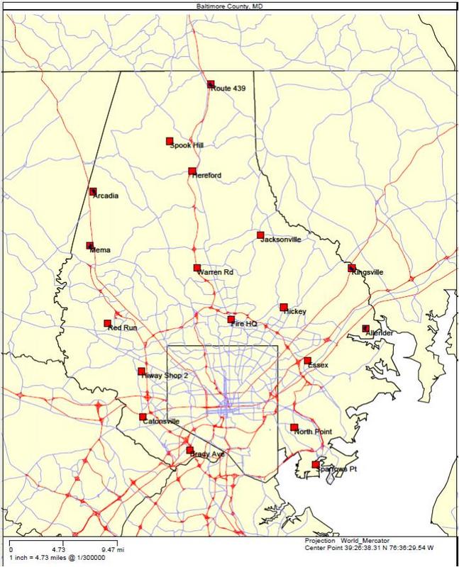
BaltCountyP25.jpg
From The RadioReference Wiki
Size of this preview: 485 × 600 pixels. Other resolutions: 194 × 240 pixels | 647 × 800 pixels.
Original file (647 × 800 pixels, file size: 89 KB, MIME type: image/jpeg)
rough map showing the locations of the Balt County P25 towers
File history
Click on a date/time to view the file as it appeared at that time.
| Date/Time | Thumbnail | Dimensions | User | Comment | |
|---|---|---|---|---|---|
| current | 14:55, 1 April 2012 | | 647 × 800 (89 KB) | Ka3jjz (talk | contribs) | rough map showing the locations of the Balt County P25 towers |
- You cannot overwrite this file.
File usage
The following page uses this file: