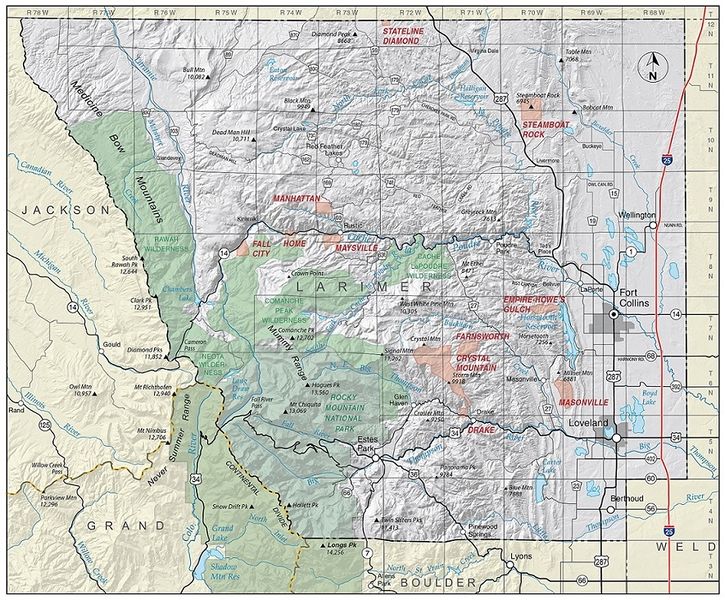
Larimer County mine districts map.jpg
From The RadioReference Wiki

Size of this preview: 725 × 600 pixels. Other resolutions: 290 × 240 pixels | 885 × 732 pixels.
Original file (885 × 732 pixels, file size: 423 KB, MIME type: image/jpeg)
File history
Click on a date/time to view the file as it appeared at that time.
| Date/Time | Thumbnail | Dimensions | User | Comment | |
|---|---|---|---|---|---|
| current | 23:12, 22 September 2019 | | 885 × 732 (423 KB) | Crazy88 (talk | contribs) | |
| 23:10, 22 September 2019 |  | 1,106 × 915 (614 KB) | Crazy88 (talk | contribs) | ||
| 23:07, 22 September 2019 | 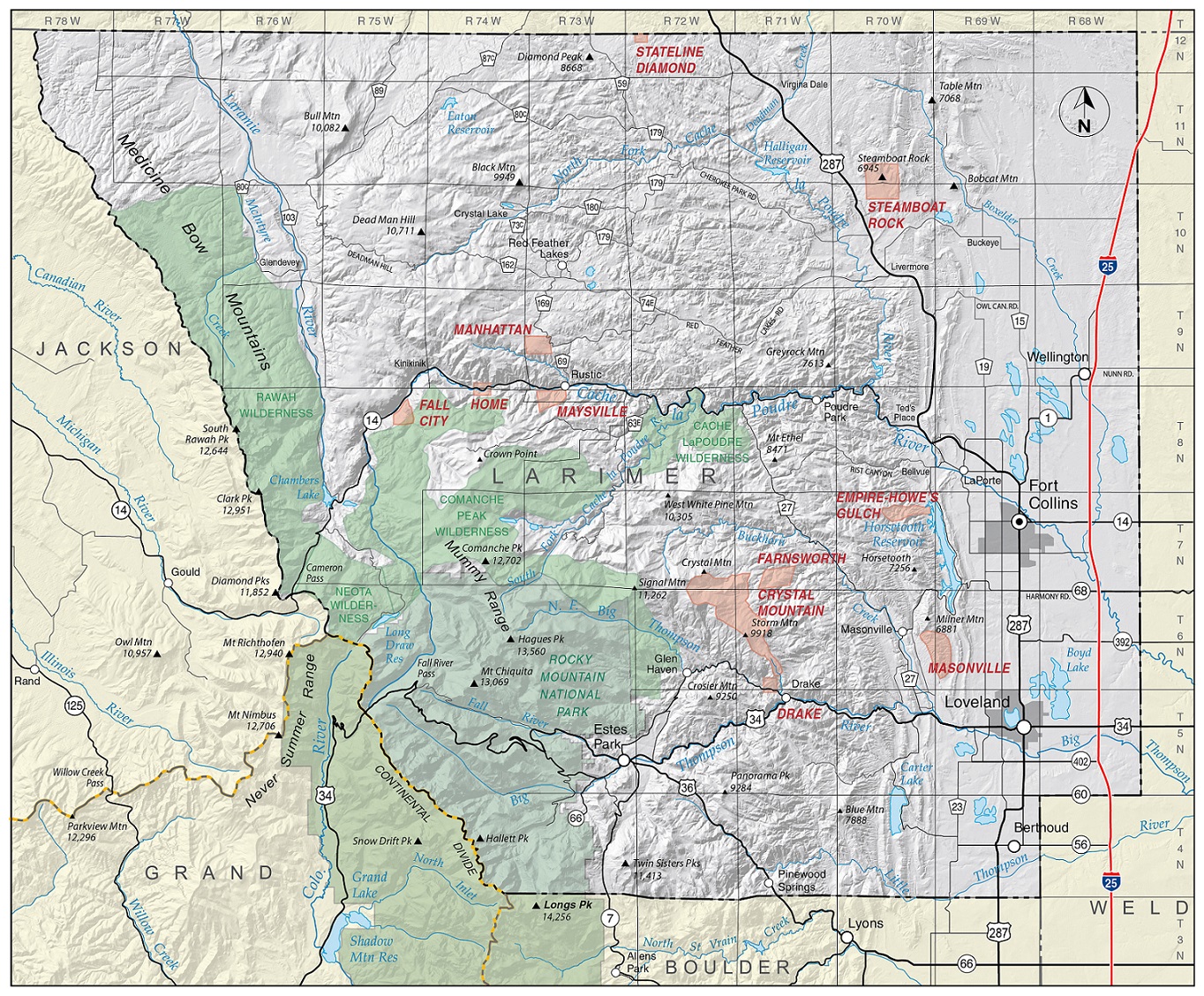 | 1,364 × 1,128 (890 KB) | Crazy88 (talk | contribs) |
- You cannot overwrite this file.
File usage
The following page uses this file: