MFC FY10 District County Lines.jpg
From The RadioReference Wiki
Size of this preview: 352 × 600 pixels. Other resolutions: 141 × 240 pixels | 1,055 × 1,797 pixels.
Original file (1,055 × 1,797 pixels, file size: 333 KB, MIME type: image/jpeg)
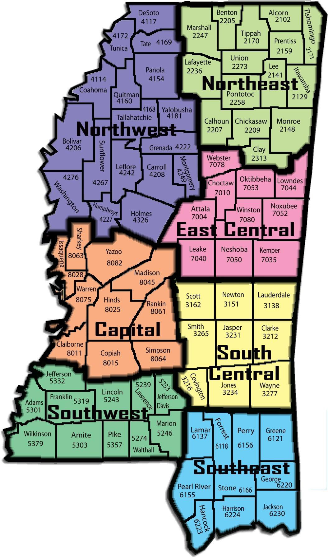
Mississippi Forestry Commission FY 2010 District Map
File history
Click on a date/time to view the file as it appeared at that time.
| Date/Time | Thumbnail | Dimensions | User | Comment | |
|---|---|---|---|---|---|
| current | 22:31, 29 March 2010 | | 1,055 × 1,797 (333 KB) | Ke5tlf (talk | contribs) | Mississippi Forestry Commission FY 2010 District Map |
- You cannot overwrite this file.
File usage
The following page uses this file: