Difference between revisions of "Cook County (MN)"
From The RadioReference Wiki
(→ARMER) |
|||
| Line 100: | Line 100: | ||
|} | |} | ||
| − | {{Geographic | + | {{Geographic Location |
|Center = Cook County, Minnesota | |Center = Cook County, Minnesota | ||
|North = [[Thunder Bay County (ON)|Thunder Bay District]], [[Ontario (CA)|Ontario]], Canada | |North = [[Thunder Bay County (ON)|Thunder Bay District]], [[Ontario (CA)|Ontario]], Canada | ||
Revision as of 13:08, 13 June 2011
Contents
Law Enforcement Agencies
- Cook County Sheriffs Office
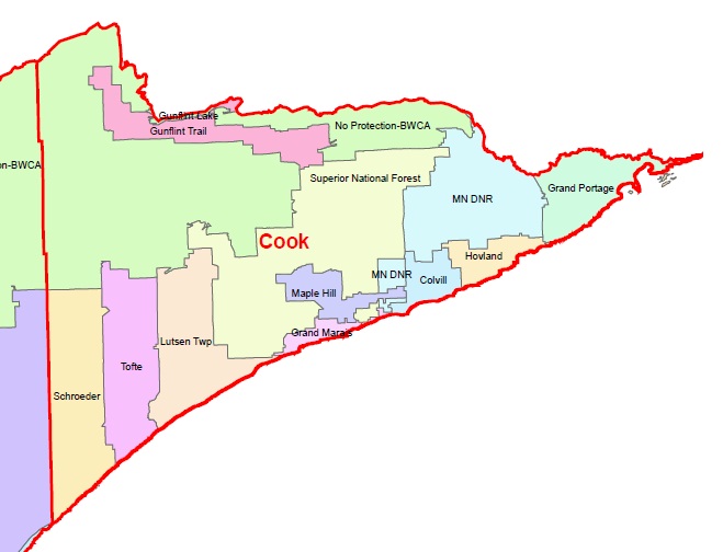
Fire Departments
- Gunflint Lake Fire
- Gunflint Trail Fire
- [www.gunflint911.org Gunflint Trail Fire & EMS Website]
- Schroeder Fire
- Tofte Fire
- Lutsen Twsp. Fire
- Superior National Forest Fire
- Maple Hill Fire
- Grand Marais Fire
- Minnesota DNR Fire
- Colvill Fire
- Hovland Fire
- Grand Portage Fire
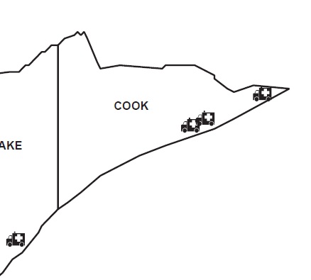
Emergency Medical Services
- Cook County Ambulance (BLS)
- Gunflint Trail Fire Department (BLS)
- [www.gunflint911.org Gunflint Trail Fire & EMS Website]
- Grand Portage Ambulance (BLS)
Trunked Radio Systems
- Allied Radio Matrix for Emergency Response (ARMER) - 800 MHz Project 25 Phase I
- Great River Energy - UHF Motorola Type II SmartZone OmniLink
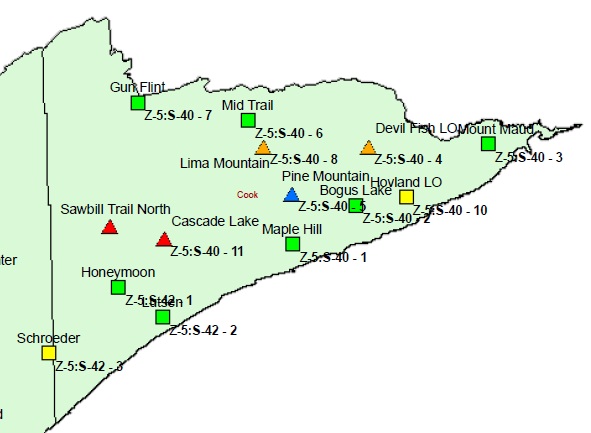
ARMER Migration
- Status - Planning Migration to ARMER
- Sites and Status:
Recommended Scanning
VHF
| Frequency | Tone | Usage |
|---|---|---|
| 155.7900 | 167.9 PL | Cook County Sheriff Dispatch |
| 158.7300 | 743 DPL | Cook County Sheriff Dispatch |
| 155.9250 | CSQ | Cook County Fire/EMS Dispatch |
ARMER
| TGID | Usage |
|---|---|
| 36500 | State Patrol Duluth |

|
Rainy River District, Ontario, Canada | Thunder Bay District, Ontario, Canada | 
| |
| Lake County, Minnesota | Keweenaw County, Michigan | |||
| Ontonagon County, Michigan |
Return to Minnesota


