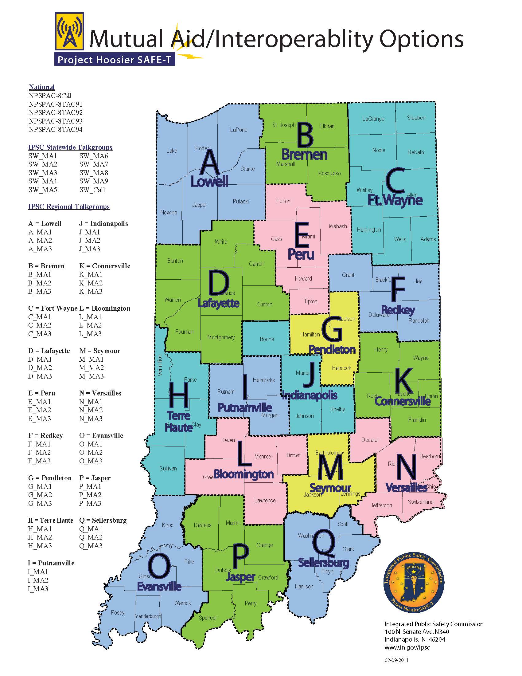
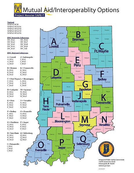
SAFE-T Regional Mutual Aid Map.jpg
From The RadioReference Wiki
Revision as of 02:35, 14 November 2012 by Scannerfreak (talk | contribs) (Map breakdown of the mutual aid regions)
Revision as of 02:35, 14 November 2012 by Scannerfreak (talk | contribs) (Map breakdown of the mutual aid regions)
Size of this preview: 463 × 599 pixels. Other resolutions: 185 × 240 pixels | 1,700 × 2,200 pixels.
Original file (1,700 × 2,200 pixels, file size: 339 KB, MIME type: image/jpeg)
Map breakdown of the mutual aid regions
File history
Click on a date/time to view the file as it appeared at that time.
| Date/Time | Thumbnail | Dimensions | User | Comment | |
|---|---|---|---|---|---|
| current | 02:35, 14 November 2012 | | 1,700 × 2,200 (339 KB) | Scannerfreak (talk | contribs) | Map breakdown of the mutual aid regions |
- You cannot overwrite this file.
File usage
The following page uses this file: