Difference between revisions of "Individual CO DTRS Sites/Goat Hill"
From The RadioReference Wiki
Soundchaser (talk | contribs) (new site map) |
Soundchaser (talk | contribs) |
||
| Line 12: | Line 12: | ||
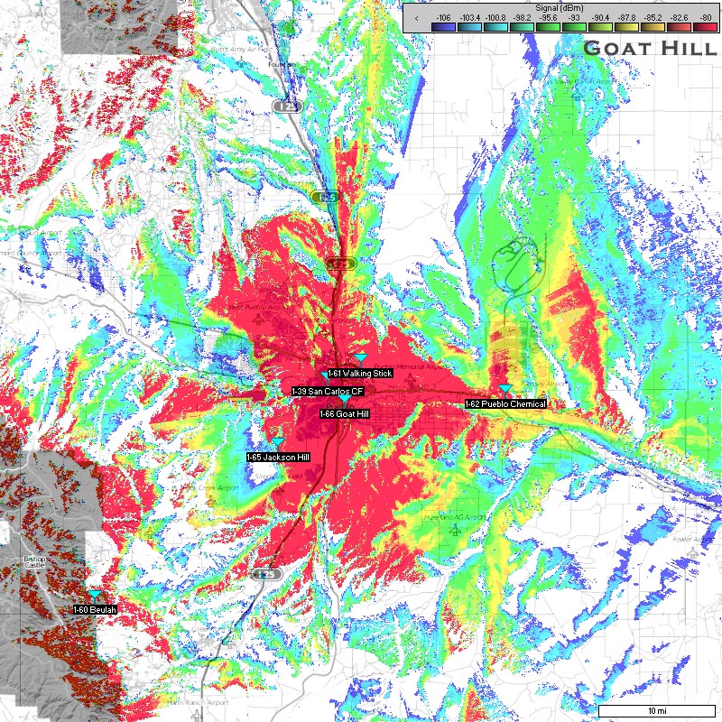
===Approximate Coverage Map=== | ===Approximate Coverage Map=== | ||
[[File:GoatHill.jpg|400px|thumb|left]] | [[File:GoatHill.jpg|400px|thumb|left]] | ||
| − | [[http://wiki.radioreference.com/images/ | + | [[http://wiki.radioreference.com/images/1/11/GoatHill.jpg Click here for full resolution]] |
[[Information on Coverage Maps]] | [[Information on Coverage Maps]] | ||
Revision as of 22:15, 8 August 2011
Goat Hill (1-066)
- County location: Pueblo
- Counties covered: Pueblo
- Frequent affiliations:
- Denied affiliations:
- Other notes:
- Frequencies:
| Site | Name | Freqs |
|---|
Refresh this page from the latest database entry
