Difference between revisions of "Individual CO DTRS Sites/Smokey Hill"
From The RadioReference Wiki
Soundchaser (talk | contribs) (New page) |
Soundchaser (talk | contribs) |
||
| Line 8: | Line 8: | ||
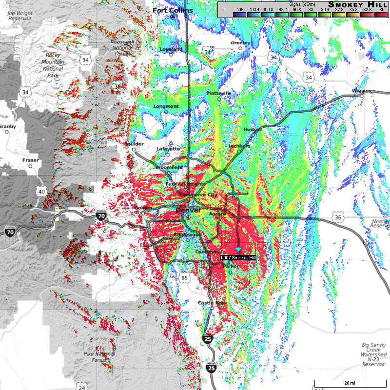
===Approximate Coverage Map=== | ===Approximate Coverage Map=== | ||
[[File:SmokeyHill.jpg|400px|thumb|left]] | [[File:SmokeyHill.jpg|400px|thumb|left]] | ||
| − | [[http://wiki.radioreference.com/images/ | + | [[http://wiki.radioreference.com/images/0/0c/SmokeyHill.jpg Click here for full resolution]] |
[[Information on Coverage Maps]] | [[Information on Coverage Maps]] | ||
Revision as of 10:40, 5 March 2011
Smokey Hill (1-007)
- County location: Arapahoe
- Counties covered: Arapahoe
- Primary agencies that use this site:
- Denied affiliations: City of Thornton, El Paso County, some Adams County talk groups (non public service except schools).
- Other notes:
