File list
This special page shows all uploaded files.
| Date | Name | Thumbnail | Size | User | Description | Versions |
|---|---|---|---|---|---|---|
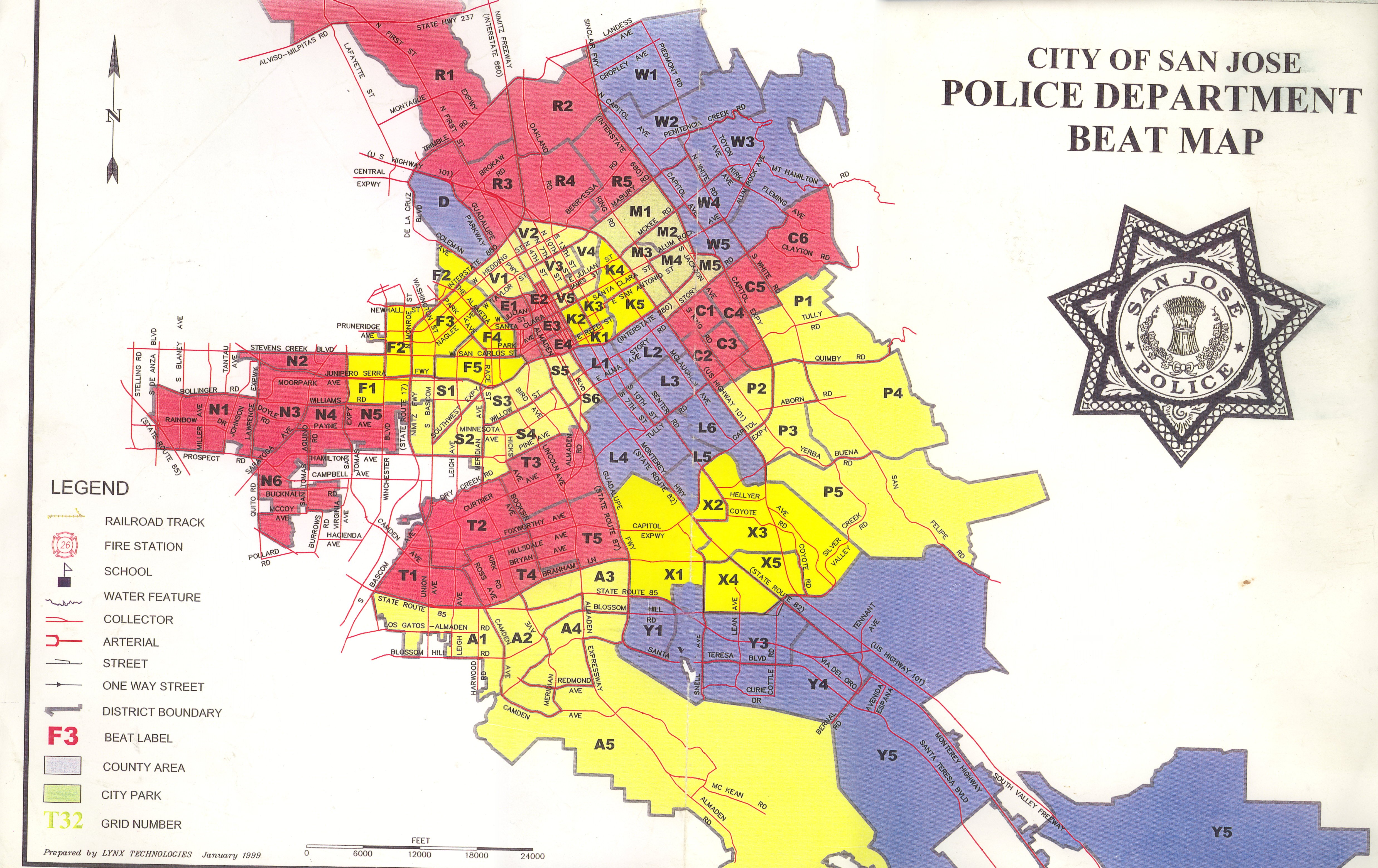
| 23:48, 5 July 2006 | MergedMap.1.jpg (file) | Error creating thumbnail: File with dimensions greater than 12.5 MP |
2.99 MB | Rogoway | San Jose, CA PD Beatmap | 1 |
| 15:27, 26 August 2009 | Img001.jpg (file) |  |
1.92 MB | Ibagli | 1 | |
| 15:33, 8 November 2009 | Indiana Railroads.pdf (file) | 1.82 MB | Ka3jjz | 1 | ||
| 14:34, 9 March 2010 | FireBoxes2010.pdf (file) | 1.81 MB | Fd2119 | Howard County Department of Fire & Rescue's new box areas. Effective 2/1/2010. | 1 | |
| 09:10, 19 April 2011 | KSICS Talkgroups 04-13-2011.pdf (file) | 1.8 MB | N0lqt | Complete "Official" list of Talk Group assignments as coordinated by the Ks Dept of Transportation as of 04/13/2011. Lists Talk Group: Long Name, Alias, and both decimal and hex Talk Group numbers. | 1 | |
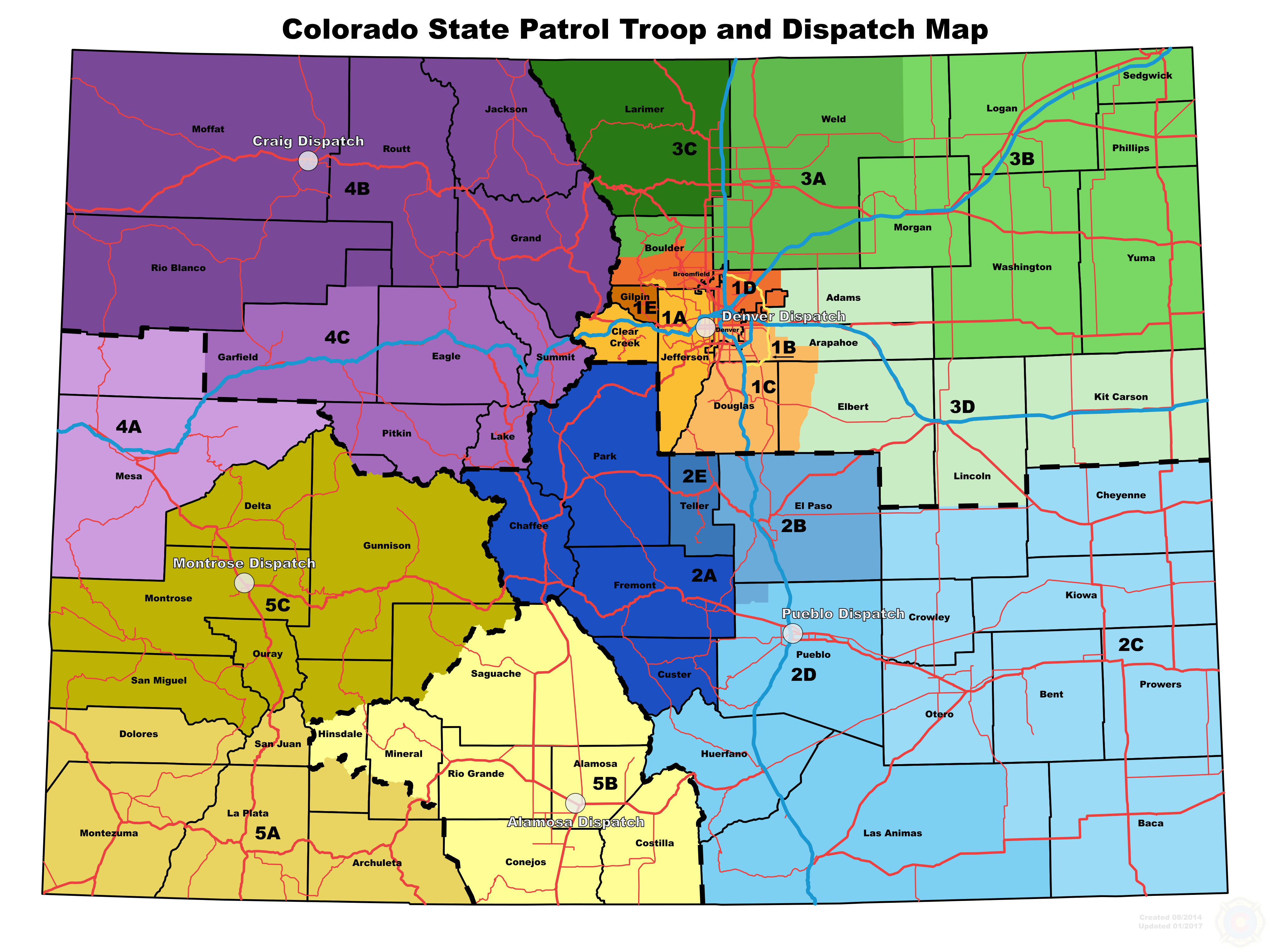
| 03:07, 28 January 2017 | CSP Troops.PNG (file) |  |
1.77 MB | Spitfire8520 | Changed resolution for thumbnail rendering. | 4 |
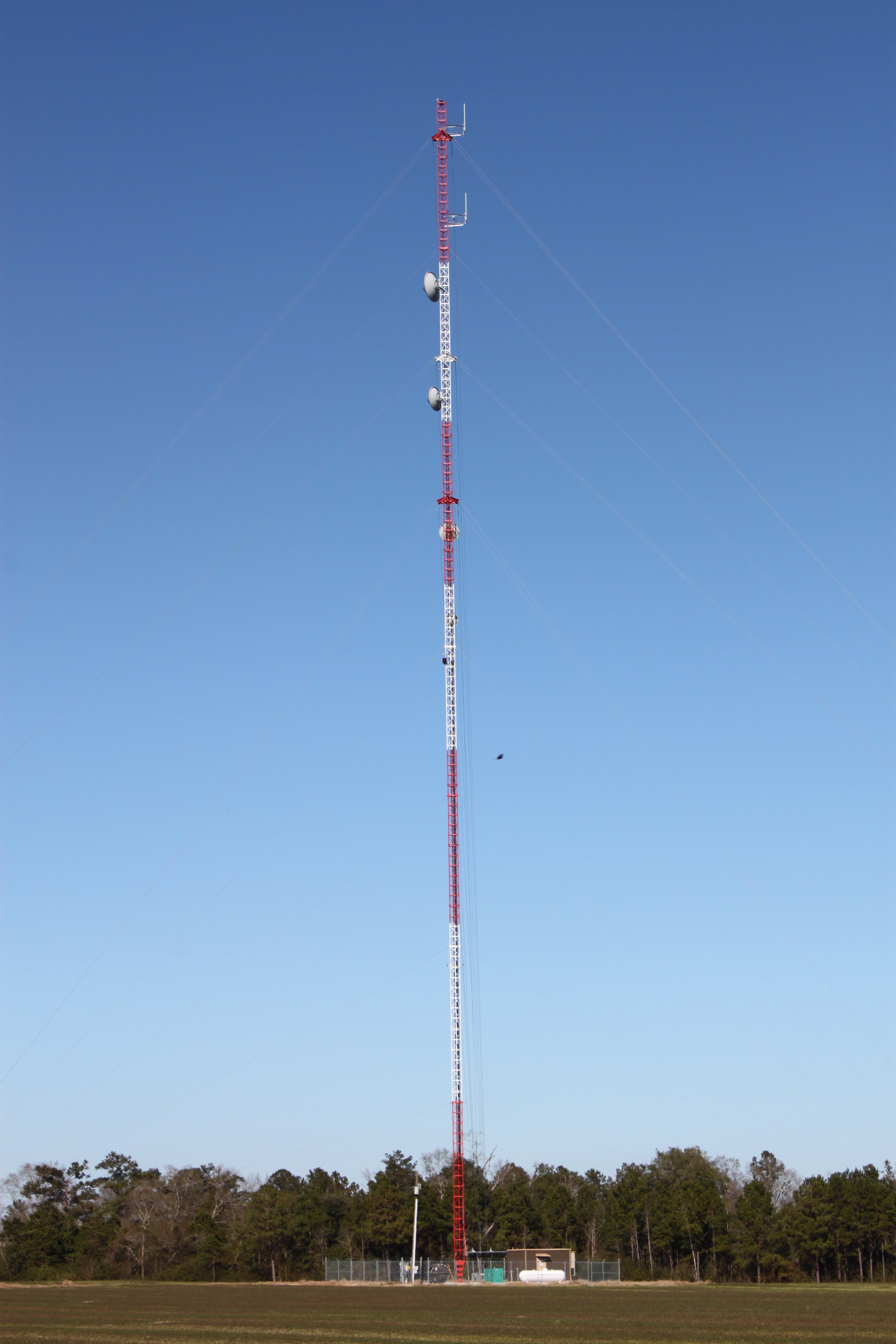
| 19:29, 16 October 2012 | MSWIN Harrisville.jpg (file) |  |
1.77 MB | Ke5tlf | An example of a typical free standing MSWIN tower. | 1 |
| 11:27, 14 February 2016 | DOW Wildlife Districts.pdf (file) | 1.73 MB | N0nhj | Wildlife Districts which also reflect the radio number for the officer assigned to that are. | 1 | |
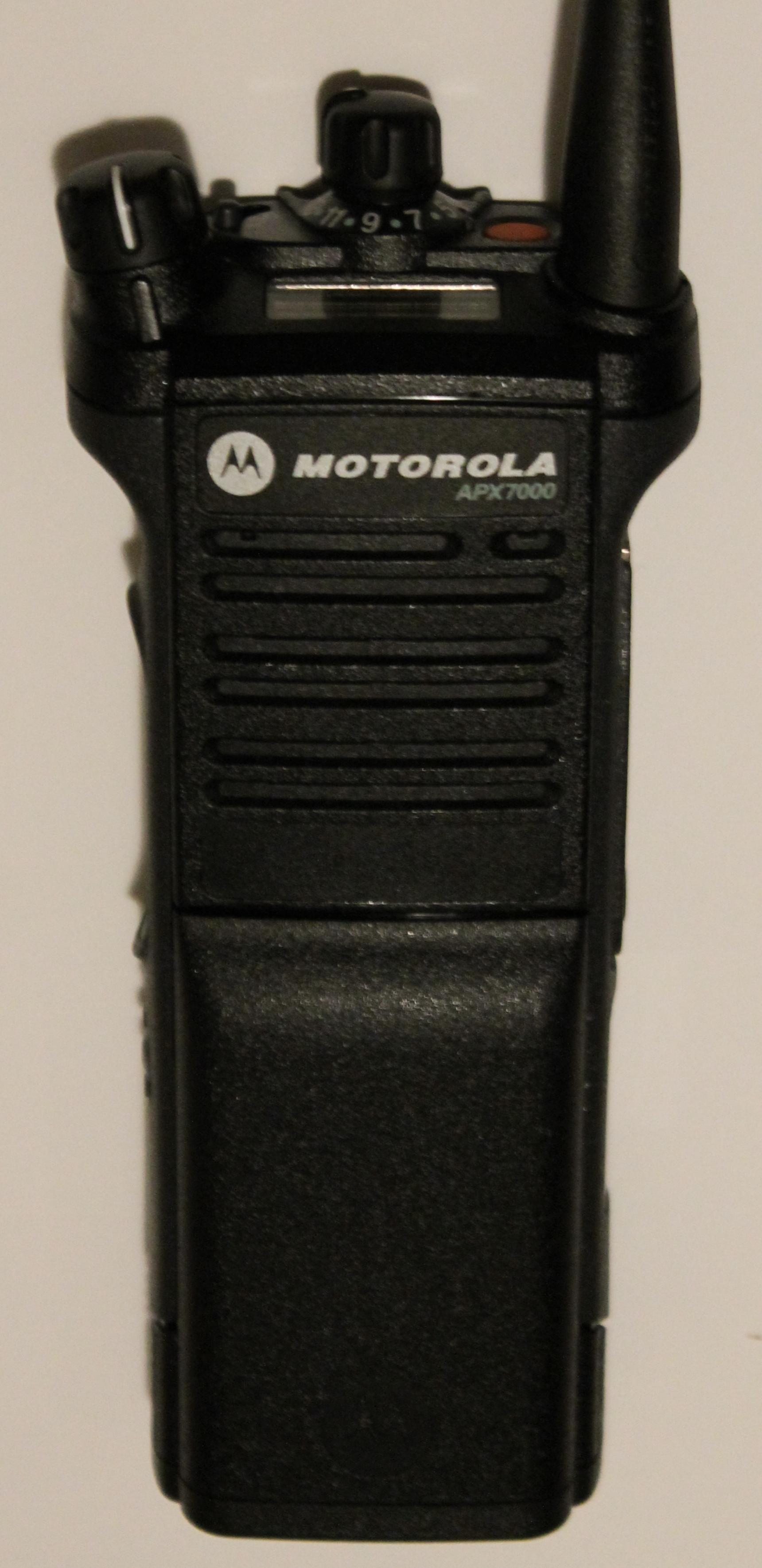
| 19:02, 7 November 2012 | APX7000housingtgriptopdisplay.jpg (file) |  |
1.73 MB | Wqoj972 | A view of the APX7000 showing the speaker-side, T-grip, top display and top controls. | 1 |
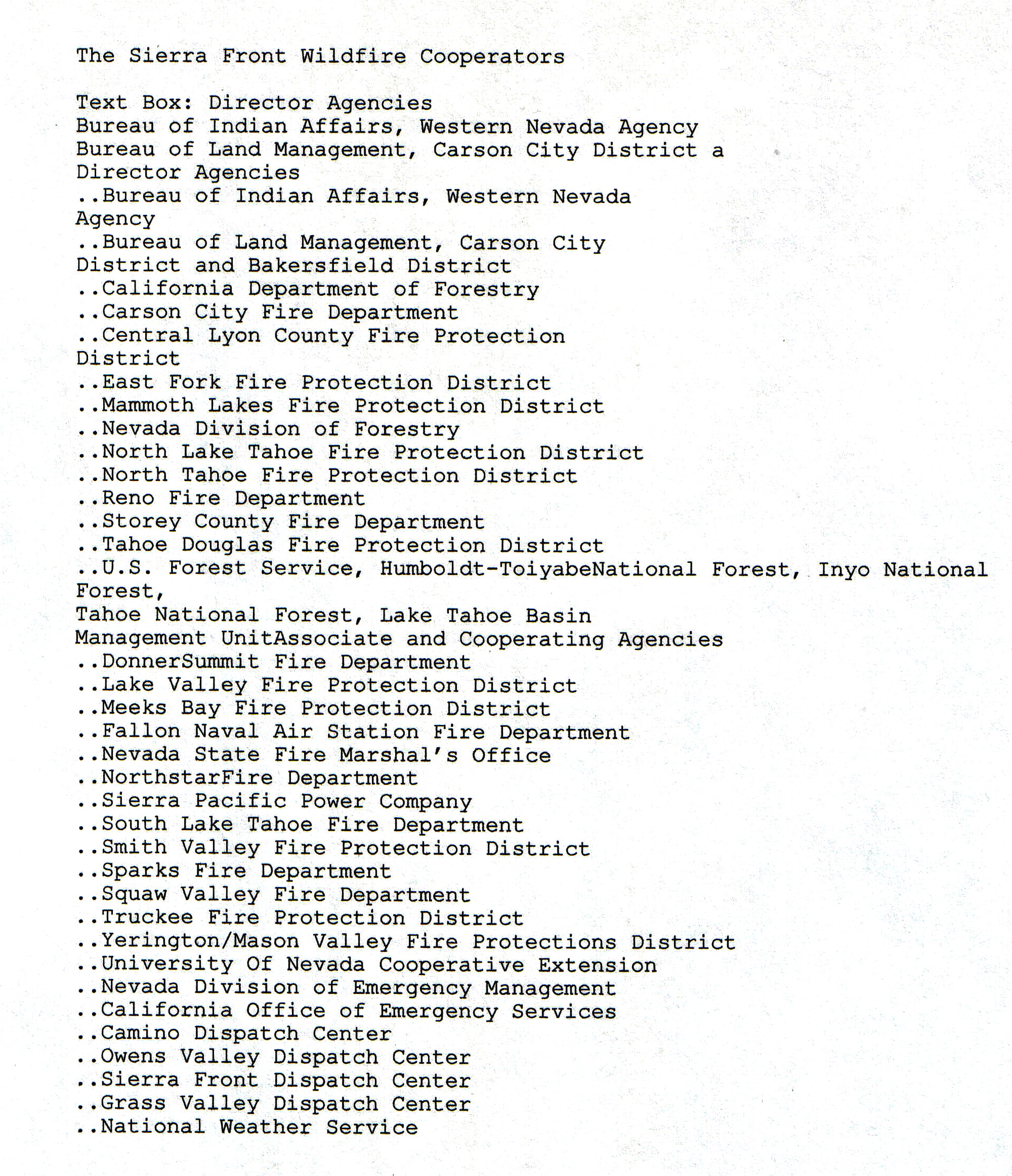
| 09:18, 31 May 2009 | GEOGRAPHIC AREA of JURISDICTION-SIERRA FRONT WILDFIRE COOPERATOR'S.jpg (file) |  |
1.68 MB | Gvranchosbill | SIERRA FRONT INTERAGENCY GEOGRAPHIC AREA | 3 |
| 15:50, 29 July 2022 | Fire-Comm-Plan 2019.pdf (file) | 1.68 MB | BuggyBoo | 1 | ||
| 11:24, 14 February 2016 | DOW Regions.pdf (file) | 1.67 MB | N0nhj | Map of the 4 DOW Regions | 1 | |
| 22:48, 31 July 2011 | PSEC Site map.PDF (file) | 1.66 MB | Markb | Map of proposed PSEC Sites | 1 | |
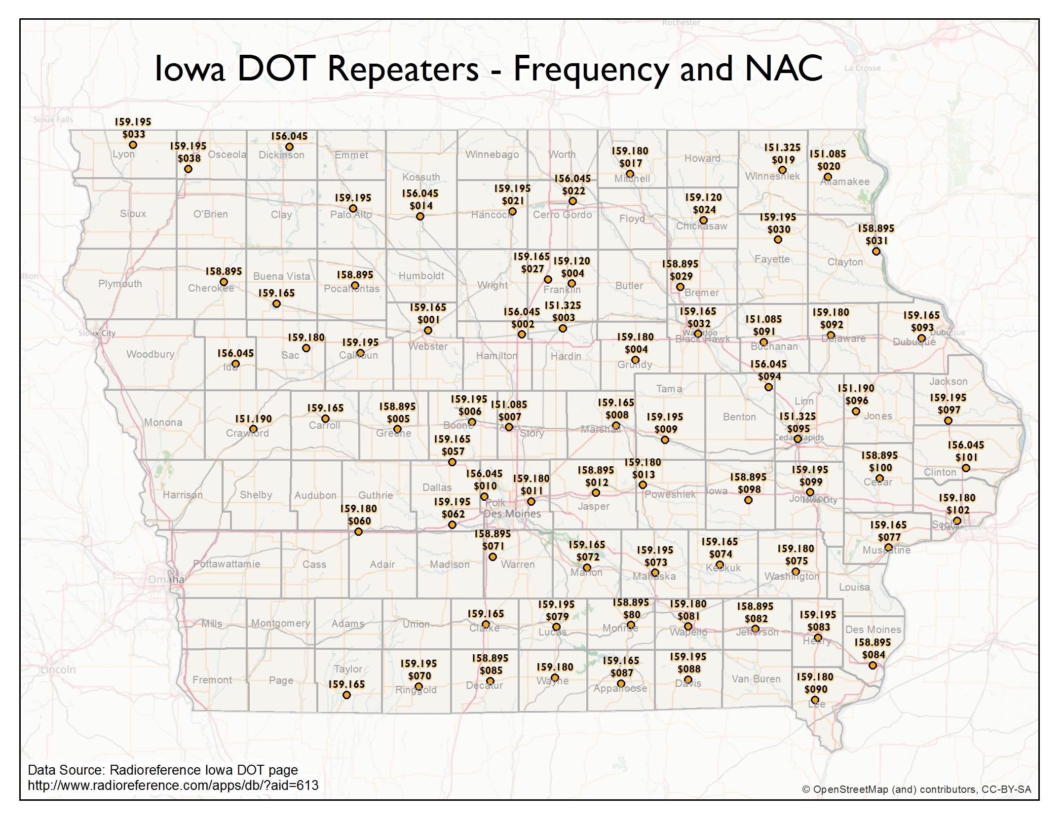
| 19:15, 8 March 2017 | IowaDOTRepeaters.jpg (file) |  |
1.66 MB | Cubn | Map of Repeaters and NACs for Iowa DOT | 1 |
| 10:30, 13 December 2019 | Key Bridge.png (file) |  |
1.65 MB | Jpeterson24 | 1 | |
| 12:27, 7 March 2011 | Region1.pdf (file) | 1.65 MB | Rbarker | APD Sector Map for Baker, George and Ida | 1 | |
| 12:58, 8 August 2023 | ISP SOG Map.pdf (file) | 1.62 MB | Starcom21 | Illinois State Police Strategic Operations Command 2023 | 1 | |
| 10:45, 7 April 2010 | DOW Areas.pdf (file) | 1.61 MB | N0nhj | Map of Division of Wildlife Areas - which correspond to the 'Area' Talkgroups. | 1 | |
| 15:15, 8 August 2020 | Modified M0AYF Loop Amplifier.pdf (file) | 1.61 MB | Ka3jjz | This is an article describing the modified M0AYF loop amp by Steve Ratzlaff AA7U | 1 | |
| 16:19, 6 March 2023 | MRA 2023-03-01-Sect-605.pdf (file) | 1.6 MB | Blantonl | 1 | ||
| 19:23, 4 September 2009 | Aurora Beat Map.pdf (file) | 1.59 MB | Ka3jjz | more detailed version of the Aurora Beat Map (PDF) | 1 | |
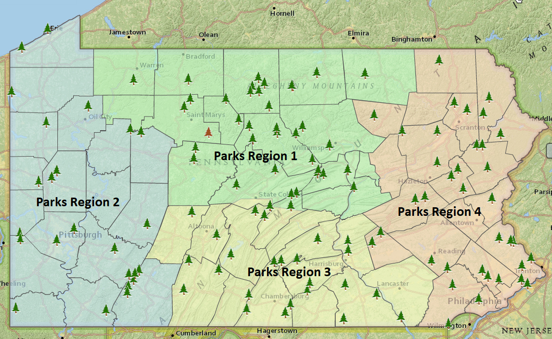
| 15:03, 25 February 2019 | Park Region Map.PNG (file) |  |
1.58 MB | HM1529 | 1 | |
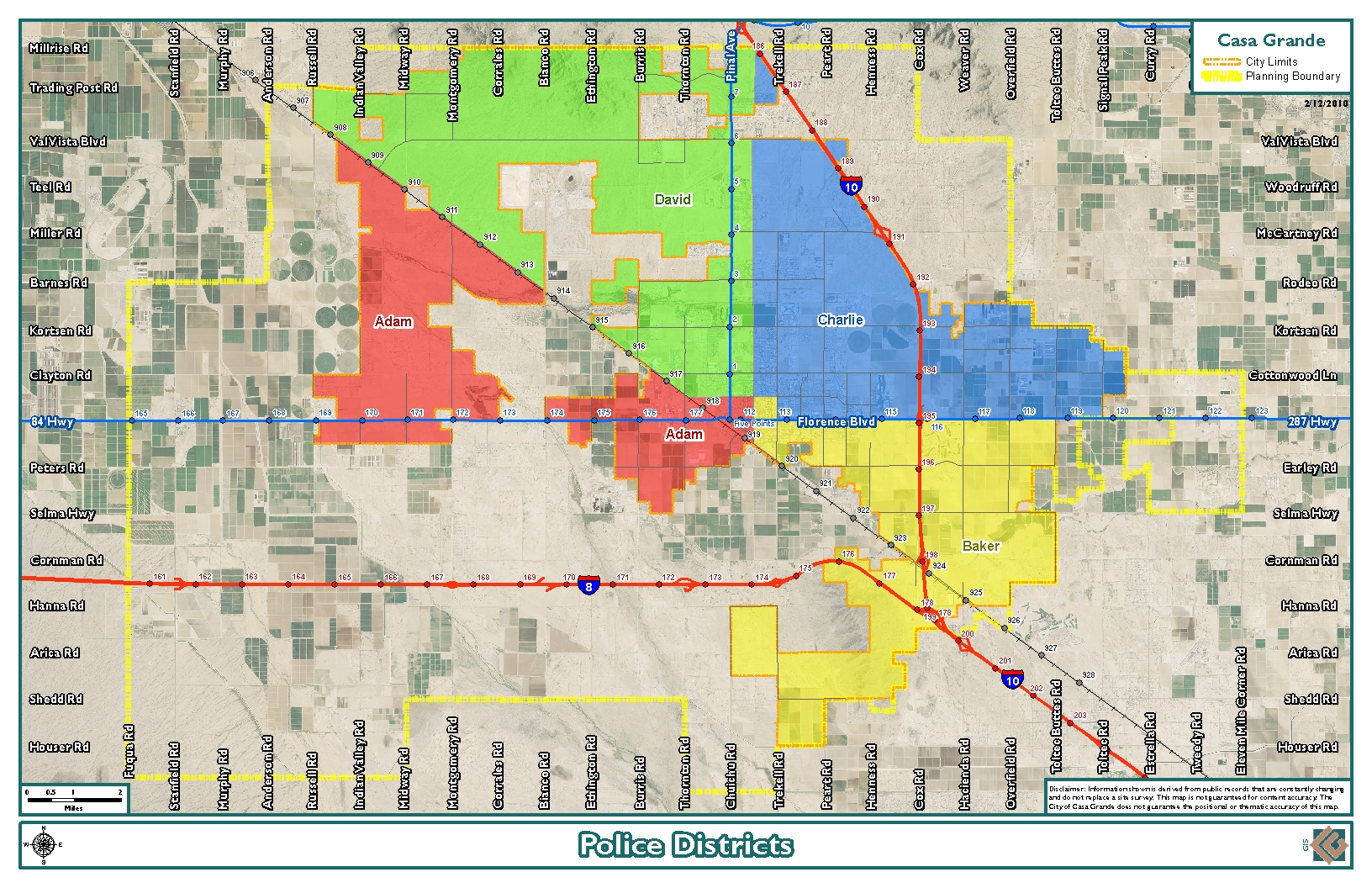
| 02:30, 4 June 2012 | Casa Grande District Map.jpg (file) |  |
1.57 MB | Bigjstud1108 | 1 | |
| 11:22, 6 May 2013 | VDOT Office List.pdf (file) | 1.56 MB | Rbuxton | 1 | ||
| 12:21, 7 April 2020 | TurlockPoliceBeats.pdf (file) | 1.54 MB | 2k1typeSH | 1 | ||
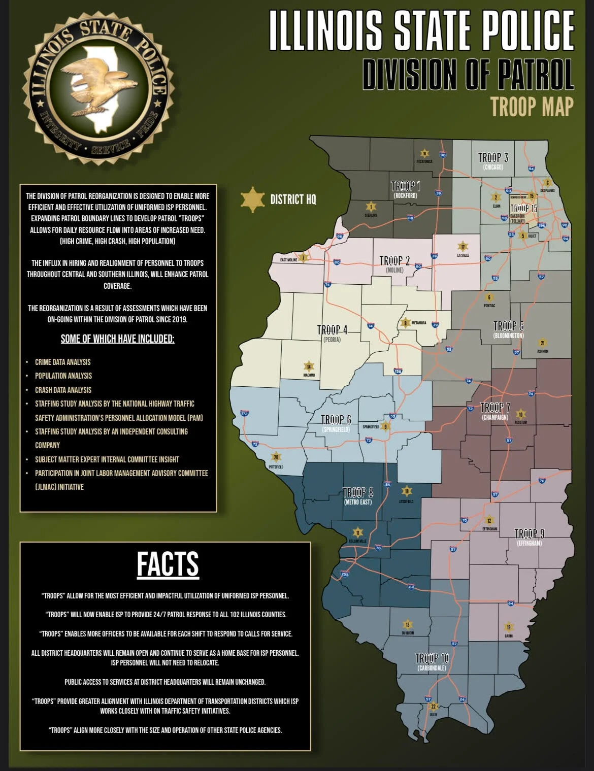
| 11:53, 3 January 2023 | ISP Troop Map.png (file) |  |
1.53 MB | Spitfire8520 | Higher resolution image. | 2 |
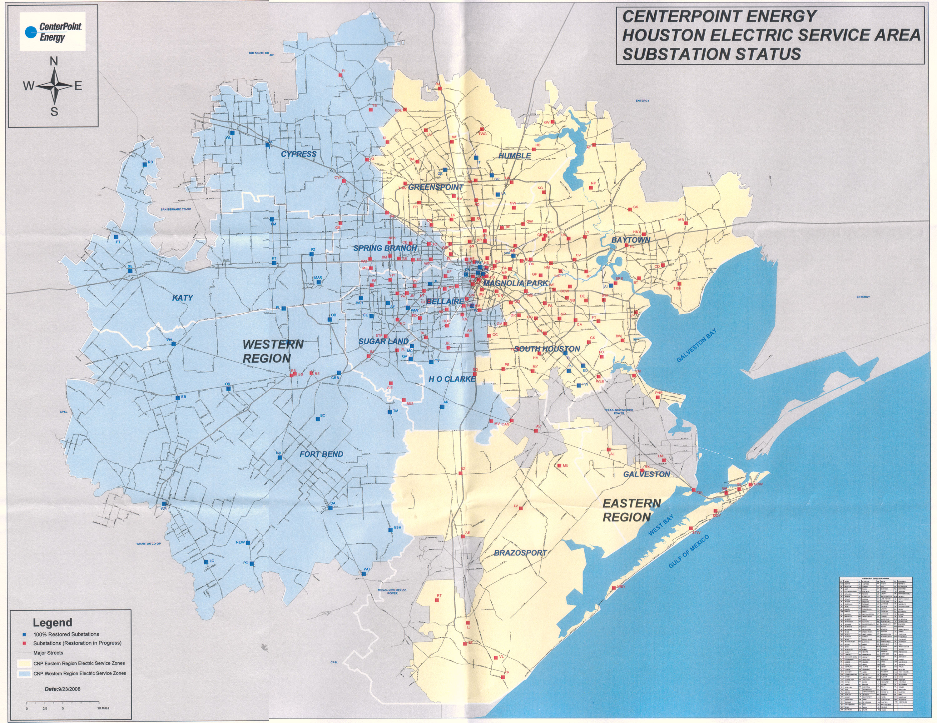
| 20:37, 29 August 2011 | Centerpoint SubstationStatus 9-23-2008.jpg (file) |  |
1.5 MB | Ericcarlson | CenterPoint Energy Substation Status Map showing the post-Hurricane Ike restoration status by substation as of September 23, 2008. | 1 |
| 18:12, 29 July 2009 | San Diego FR Districts.pdf (file) | 1.49 MB | Kd7kdc | San Diego County California Fire Rescue Districts | 1 | |
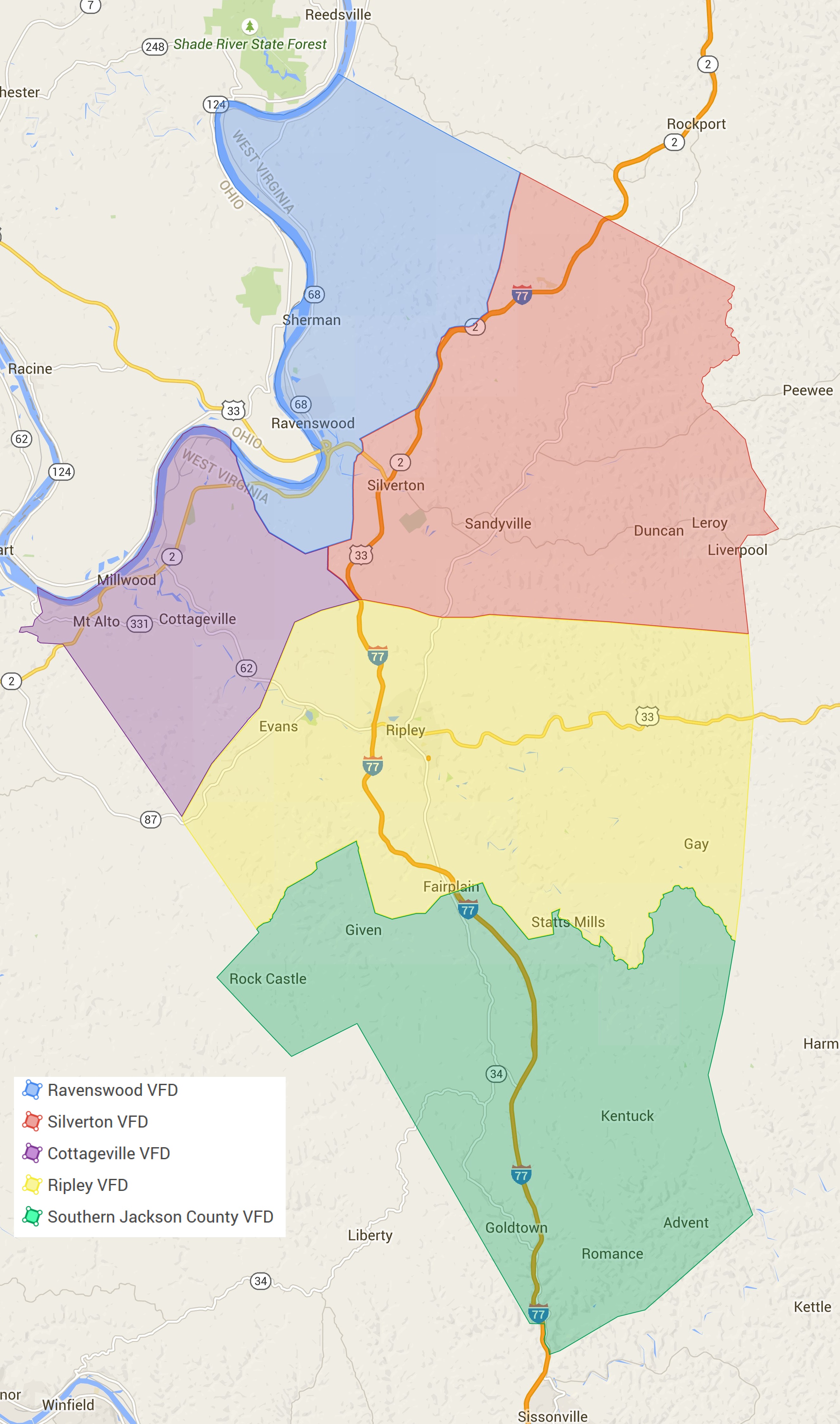
| 10:08, 18 July 2015 | JacksonCountyWV-FireMap.jpg (file) |  |
1.38 MB | Andrewtv08 | Jackson County, WV Fire Dept. Coverage Map | 1 |
| 16:51, 12 December 2019 | AACoFD Companies.pdf (file) | 1.38 MB | Jpeterson24 | 1 | ||
| 17:01, 12 December 2019 | AACoFD Battalions.pdf (file) | 1.38 MB | Jpeterson24 | 1 | ||
| 16:59, 12 December 2019 | AACoFD Fireboxes.pdf (file) | 1.38 MB | Jpeterson24 | 1 | ||
| 22:53, 2 March 2012 | Coshocton County Fire Map.pdf (file) | 1.37 MB | Ibagli | 1 | ||
| 09:49, 30 January 2022 | FireStations TMFPD CareerOnly 8.5x11 20210527.pdf (file) | 1.37 MB | Smokechaser87 | 1 | ||
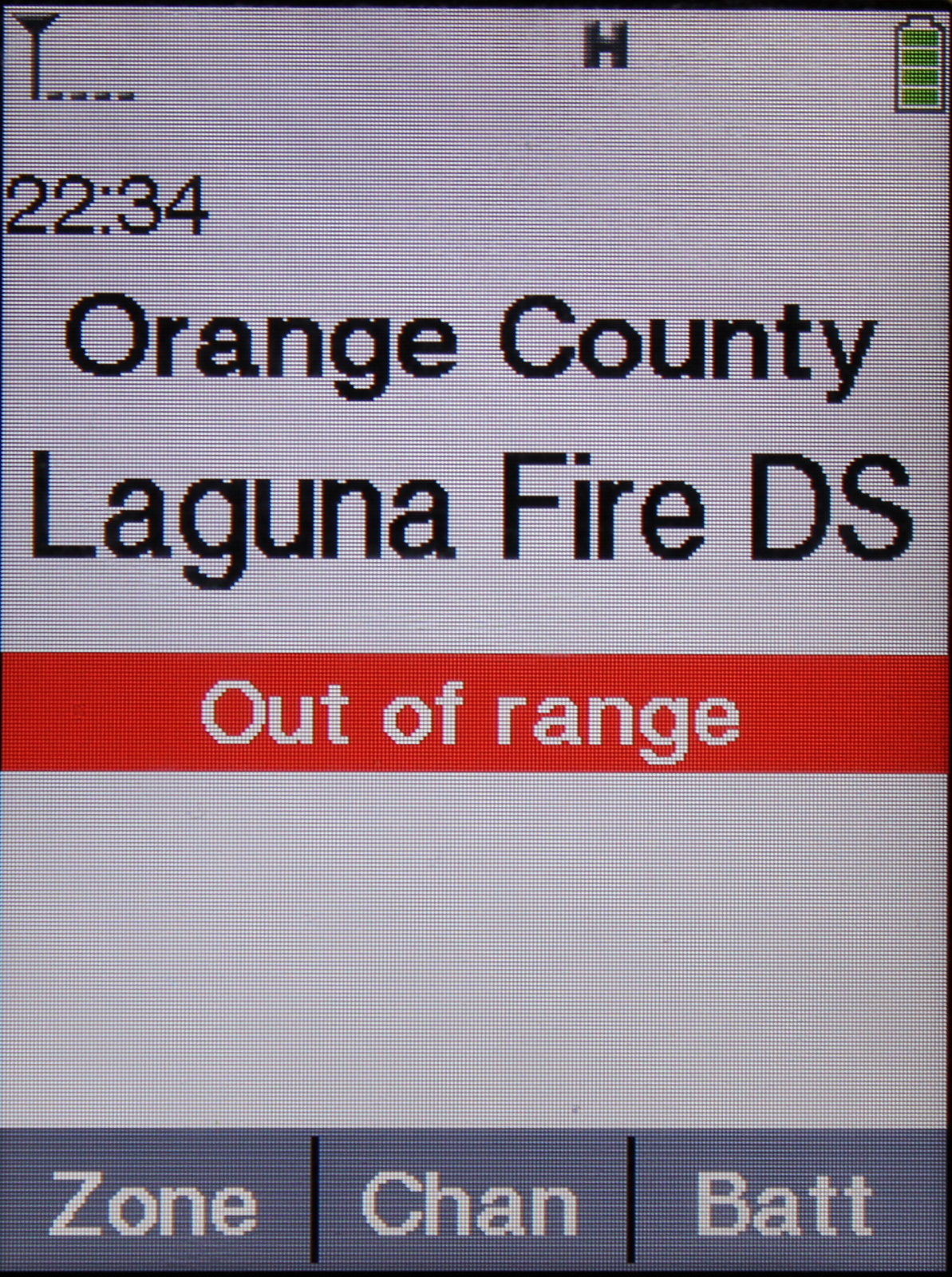
| 19:34, 7 November 2012 | APX7000 Main Display OutOfRange.jpg (file) |  |
1.36 MB | Wqoj972 | The APX7000 showing an out of range indication for a SmartZone system. | 1 |
| 19:53, 16 October 2012 | MSWIN Oak Grove.jpg (file) |  |
1.34 MB | Ke5tlf | An example of a typical MSWIN guyed tower. | 1 |
| 18:29, 11 November 2009 | TLH Digi Data.xls (file) | 1.33 MB | Chandom | Information collected from the new Tallahassee Digital system | 1 | |
| 18:06, 28 April 2022 | NAFD Area Served.png (file) |  |
1.33 MB | Avdrummerboy | 1 | |
| 10:11, 30 July 2020 | PRO 2096 VR3.jpg (file) |  |
1.32 MB | Ronaldski | 1 | |
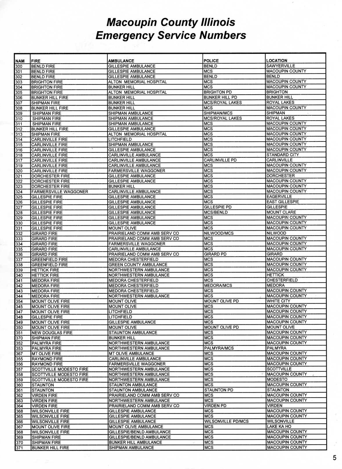
| 11:18, 20 April 2009 | Mac911esn-numbers005.jpg (file) |  |
1.31 MB | Starcom21 | Mac911 IL ESN - Emergency Service Number - Provider Coverage | 1 |
| 23:46, 21 January 2018 | Hpd beat map.pdf (file) | 1.3 MB | N5ams | Houston Police Department Patrol Divisions Map | 1 | |
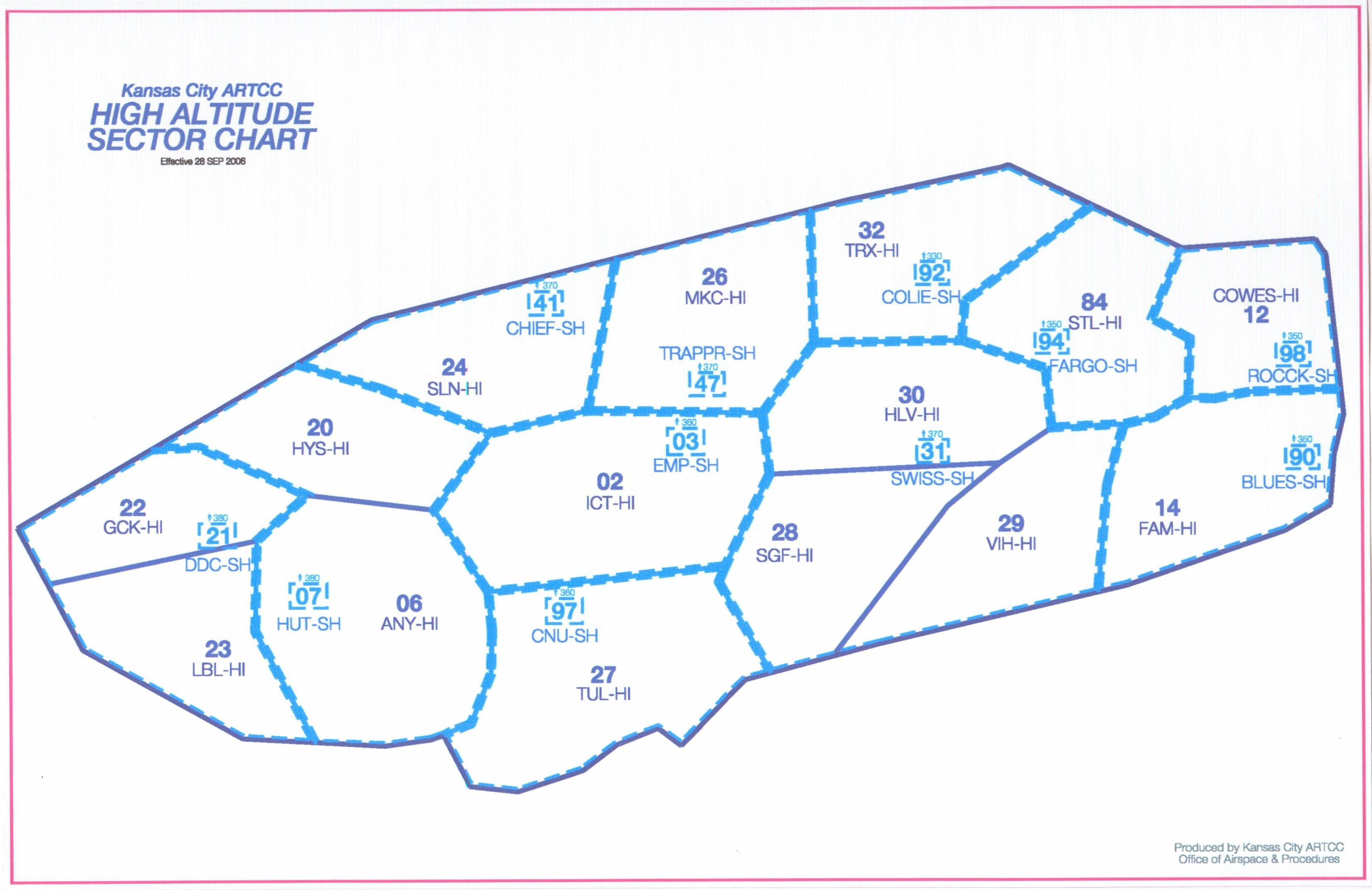
| 12:15, 19 October 2009 | Kansas City ARTCC High Sector Names.jpg (file) |  |
1.3 MB | Cubn | 1 | |
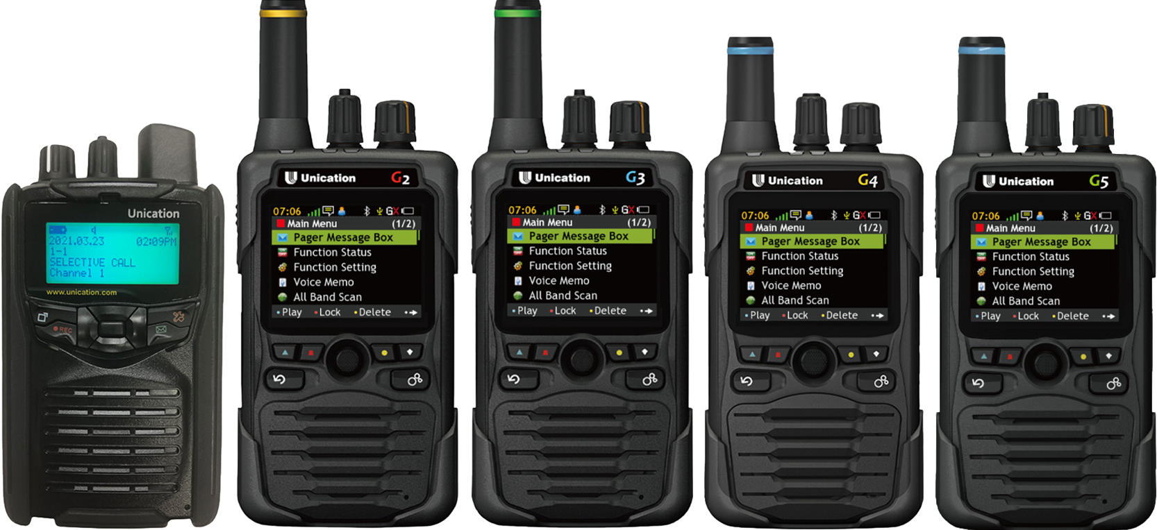
| 18:24, 5 June 2022 | GSeries Family.png (file) |  |
1.28 MB | Jabbeaux | 1 | |
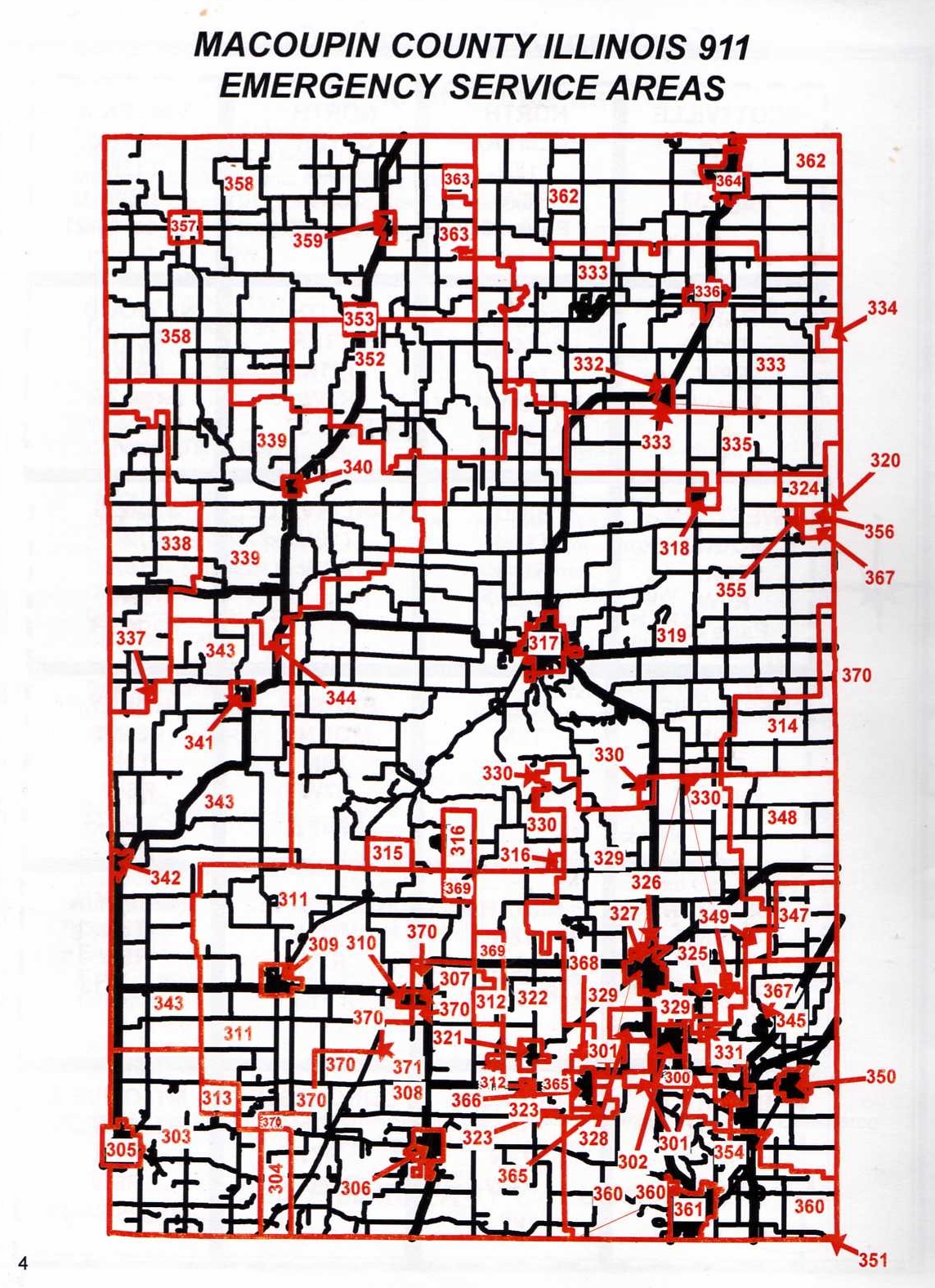
| 11:27, 20 April 2009 | Mac911esnmap003.jpg (file) |  |
1.28 MB | Starcom21 | Macoupin County 911 IL ESN Map | 1 |
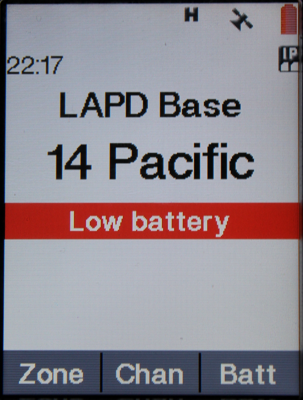
| 23:18, 7 November 2012 | APX7000LowBatteryMainDisplay.jpg (file) |  |
1.27 MB | Wqoj972 | An APX7000 showing a low battery indicator on the main display. | 1 |
| 05:38, 8 May 2009 | SIERRA FRONT WILDFIRE COOPERATOR'S.jpg (file) |  |
1.27 MB | Gvranchosbill | SUBMMISSION FOR SIERRA FRONT-THE SIERRA FRONT WILDFIRE COOPERATOR'S TEXT | 1 |
| 14:52, 14 November 2009 | WyoLink Site Map 22aug08.pdf (file) | 1.27 MB | Ka3jjz | 1 | ||
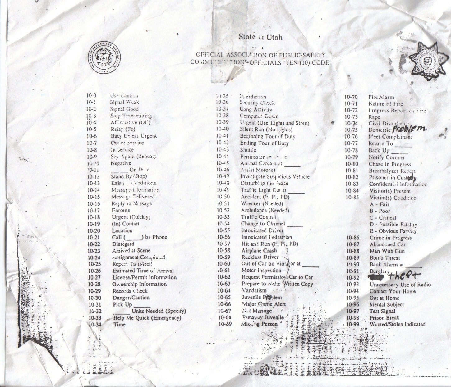
| 20:57, 20 December 2007 | 10 Codes.jpg (file) |  |
1.26 MB | Enosjones | Utah 10-Codes | 2 |
| 17:10, 27 June 2012 | PSR120 flyer.pdf (file) | 1.26 MB | Davein | 1 | ||
| 13:18, 9 January 2013 | District Map 7-12.jpg (file) |  |
1.24 MB | Hiyudurin | 1 |