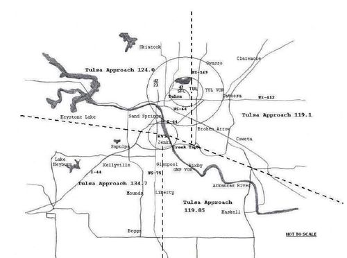
| VHF Frequency
|
UHF Frequency
|
Area of Control
|
Callsign
|
| 124.00
|
338.30
|
Northwest sector
|
Tulsa Approach/ Departure
|
| 119.10
|
351.80
|
East sector
|
Tulsa Approach/ Departure (Combined with Northwest Sector during times of low traffic)
|
| 134.70
|
n/a
|
Southwest sector
|
Tulsa Approach/ Departure (Combined with Northwest sector (124.00/338.30) during times of low traffic
|
| 119.85
|
381.20
|
East sector of inner class C airspace sector
|
Tulsa Approach/ Departure (Combined with East Sector (119.10/351.80) 99% of time)
|
| 132.10
|
319.90
|
West sector of inner class C airspace sector
|
Tulsa Approach/ Departure (Combined with Northwest sector (124.00/338.30) 99% of time)
|
