File list
This special page shows all uploaded files.
| Date | Name | Thumbnail | Size | Description | Versions |
|---|---|---|---|---|---|
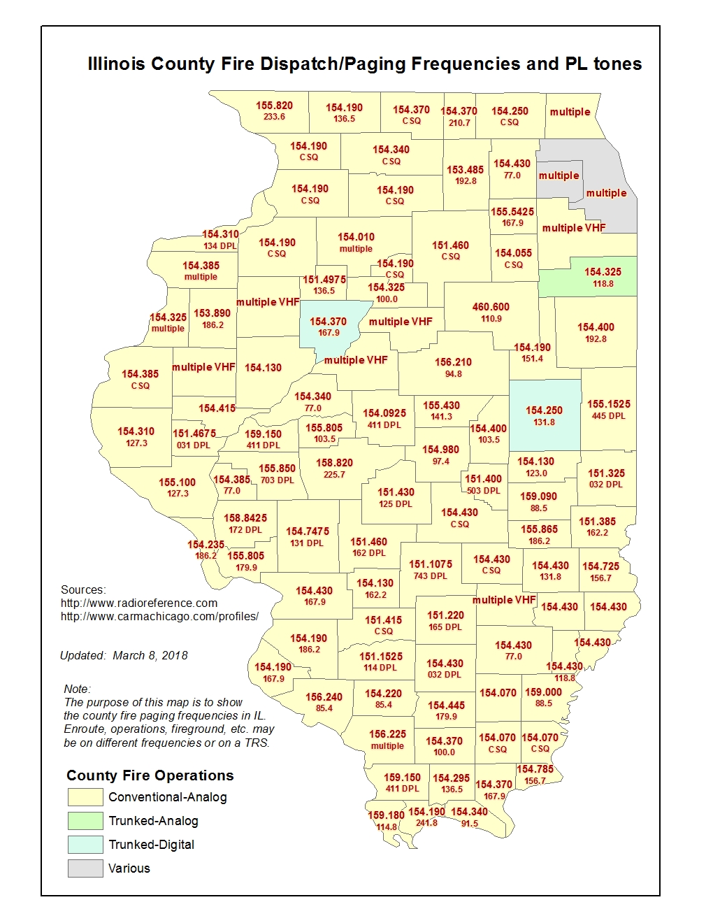
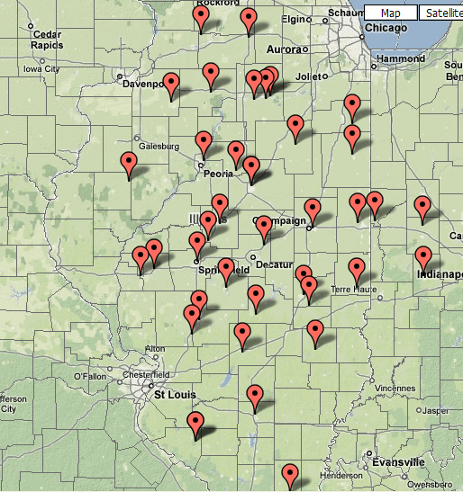
| 13:46, 12 February 2018 | IL County Fire Dispatch frequencies map.jpg (file) |  |
451 KB | Multiple freq/tone updates | 14 |
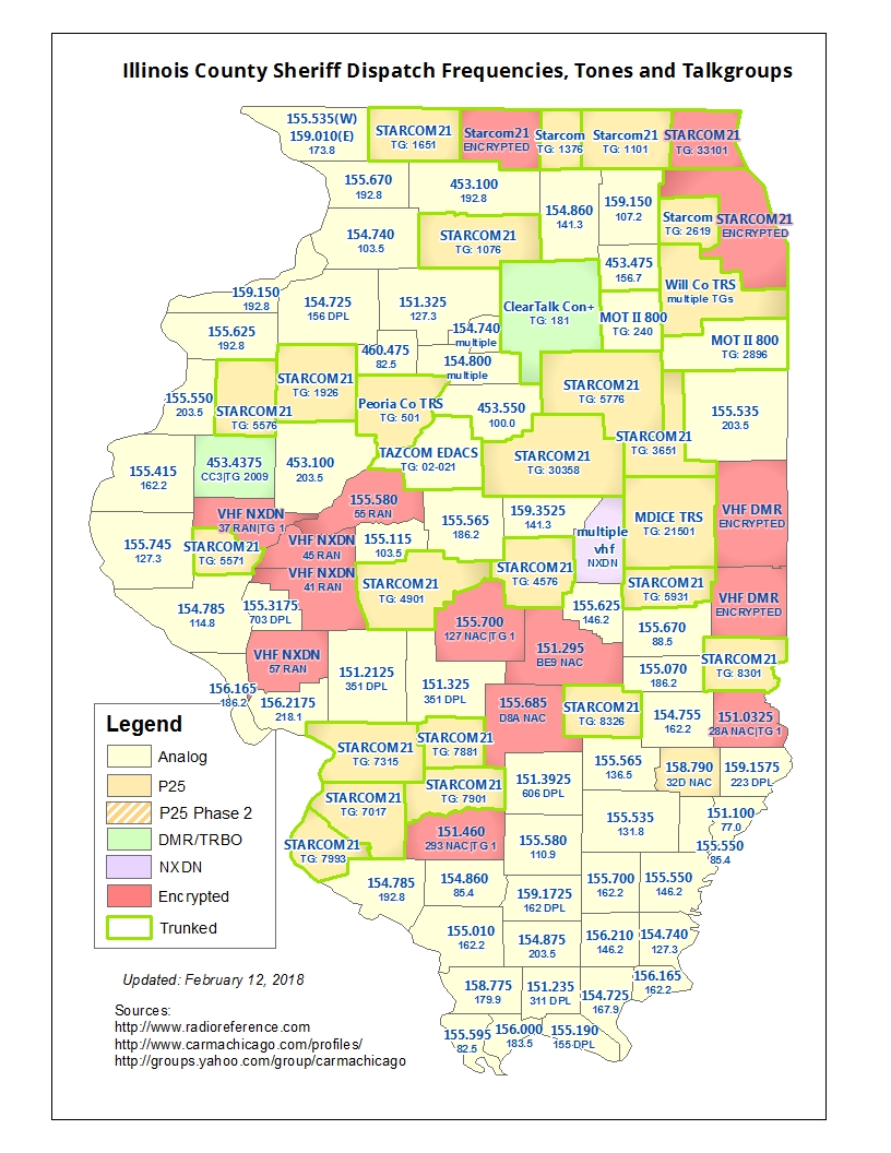
| 13:27, 12 February 2018 | IL County Sheriff Dispatch frequencies map.jpg (file) |  |
515 KB | changed Greene Co to NXDN enc | 56 |
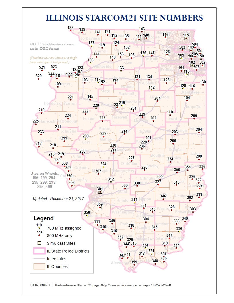
| 20:18, 21 December 2017 | Starcom21 Site Numbers Map.jpg (file) |  |
493 KB | Cartographic changes (thickened interstates, added city boundaries, made county name font bigger, made towers more prominent and ISP boundaries less prominent) | 13 |
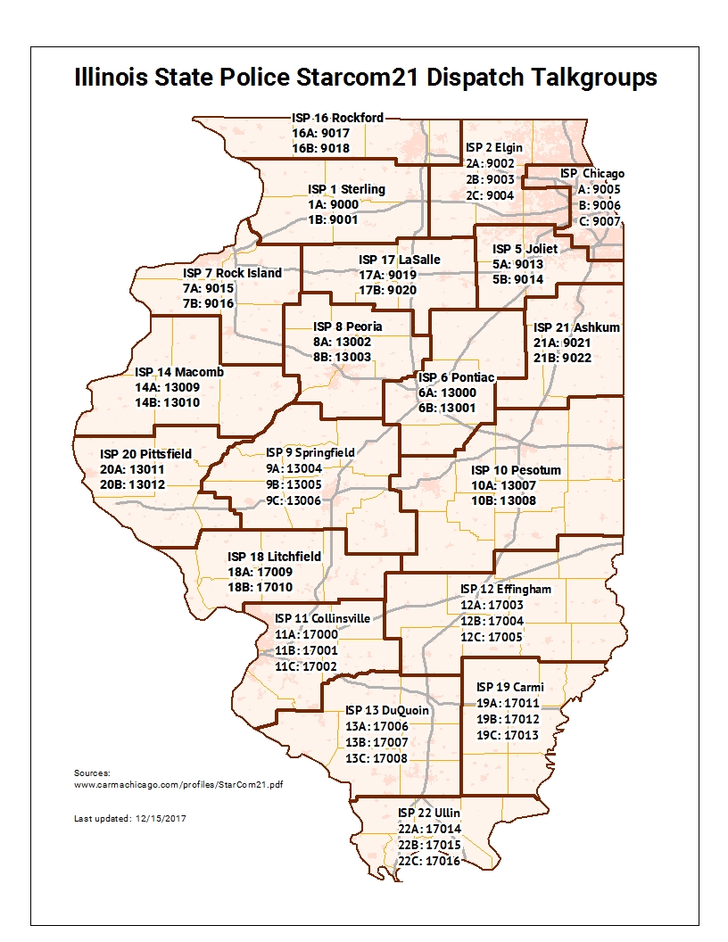
| 19:49, 21 December 2017 | ILStatePolice Dispatch Talkgroups Map.jpg (file) |  |
448 KB | Map showing the dispatch talkgroups for the Illinois State Police | 1 |
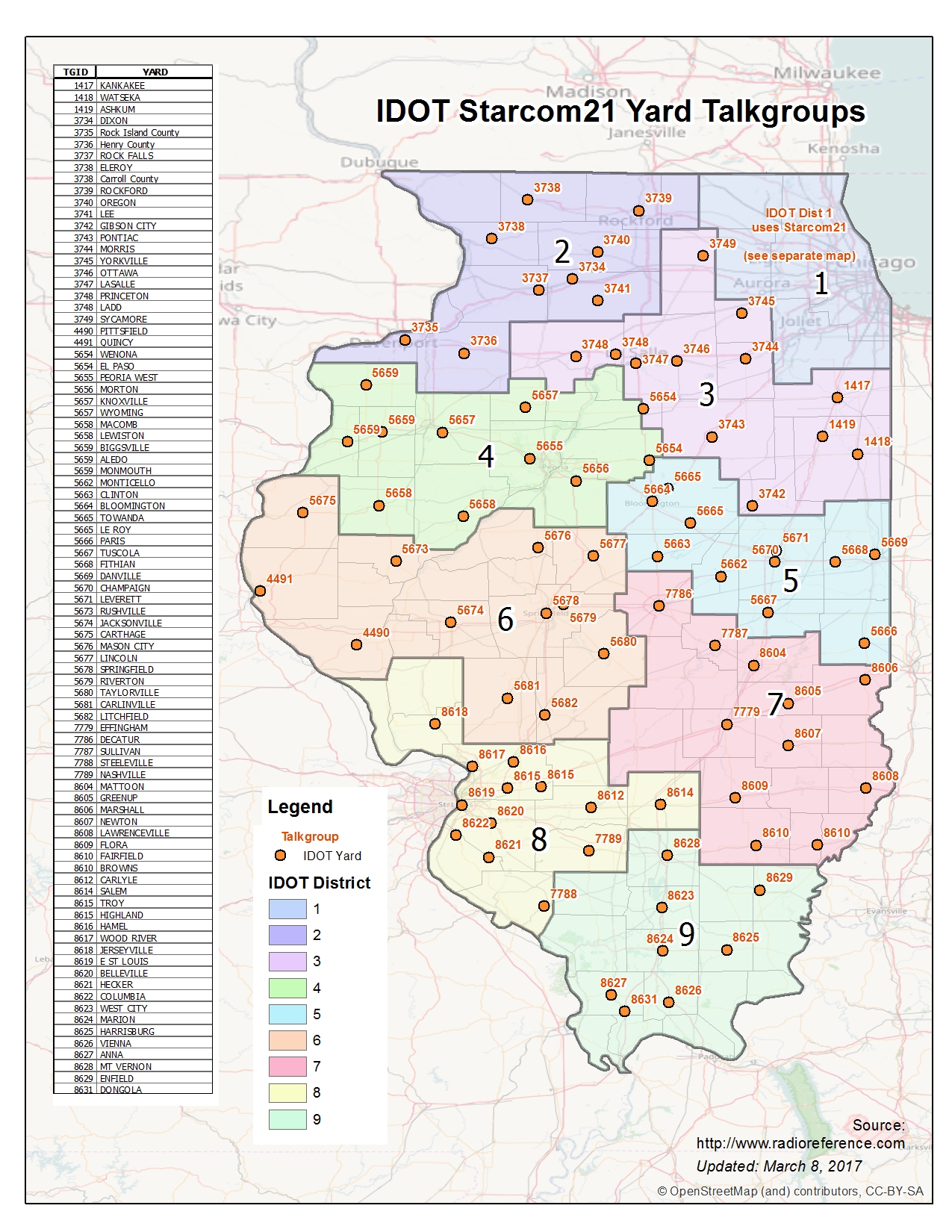
| 19:27, 8 March 2017 | IllinoisDOT Starcom21TalkgroupMap.jpg (file) |  |
1.2 MB | added Pittsfield and Quincy | 18 |
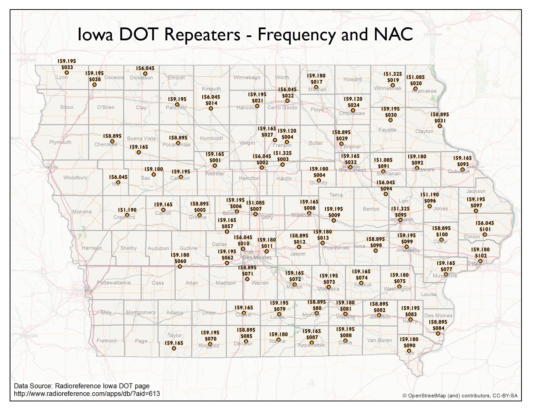
| 19:15, 8 March 2017 | IowaDOTRepeaters.jpg (file) |  |
1.66 MB | Map of Repeaters and NACs for Iowa DOT | 1 |
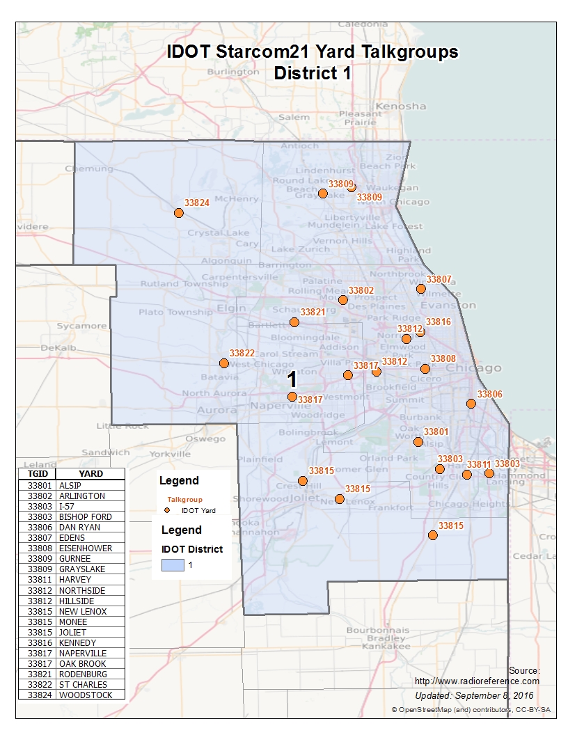
| 15:18, 9 September 2016 | IllinoisDOT Starcom21TalkgroupMap Dist1.jpg (file) |  |
483 KB | 4 | |
| 12:50, 19 October 2009 | ARCHAirMedicalService LandingZoneSafetyGuidelines.jpg (file) |  |
527 KB | 1 | |
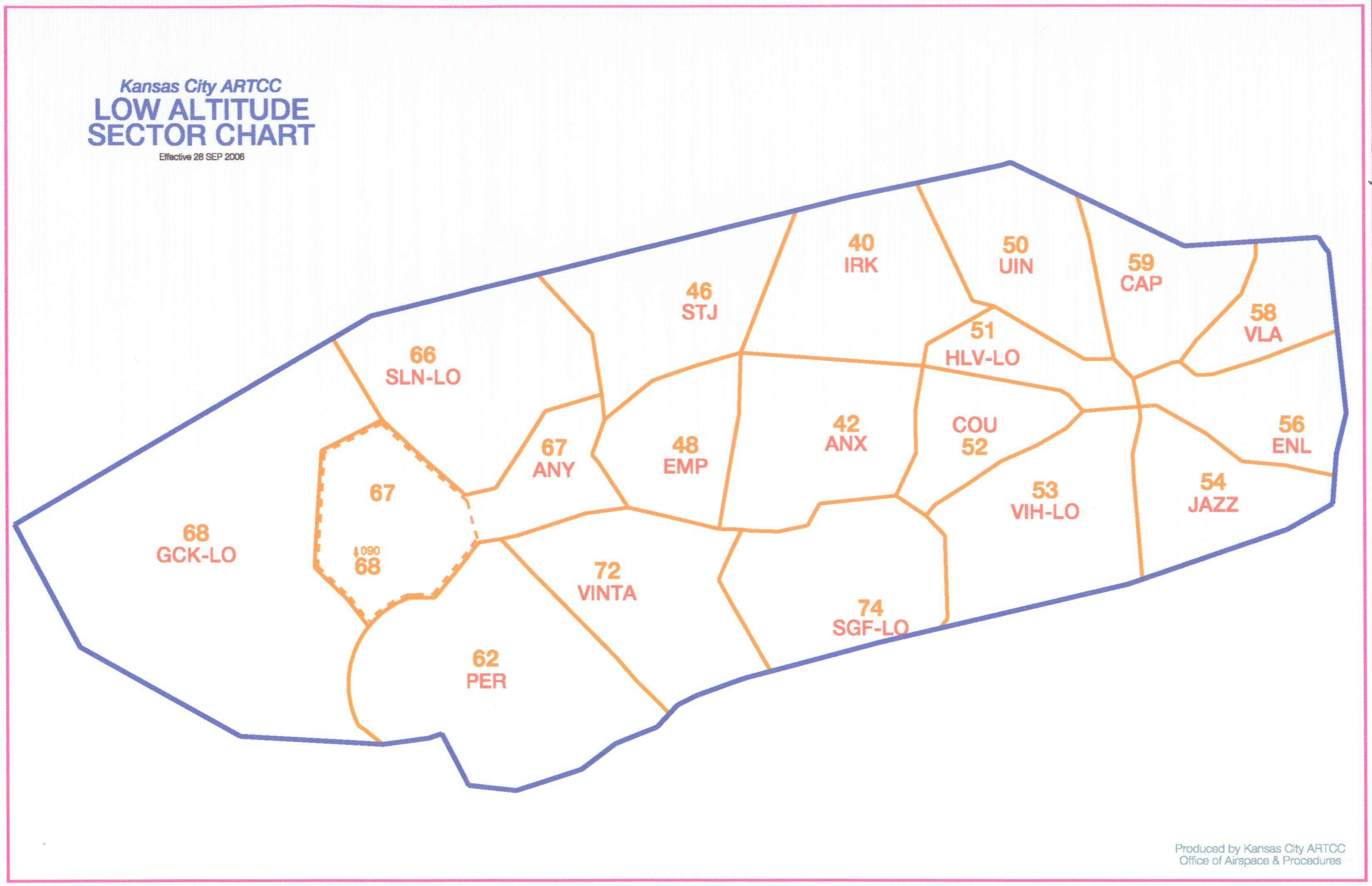
| 12:16, 19 October 2009 | Kansas City ARTCC Low Sector Names.jpg (file) |  |
956 KB | 1 | |
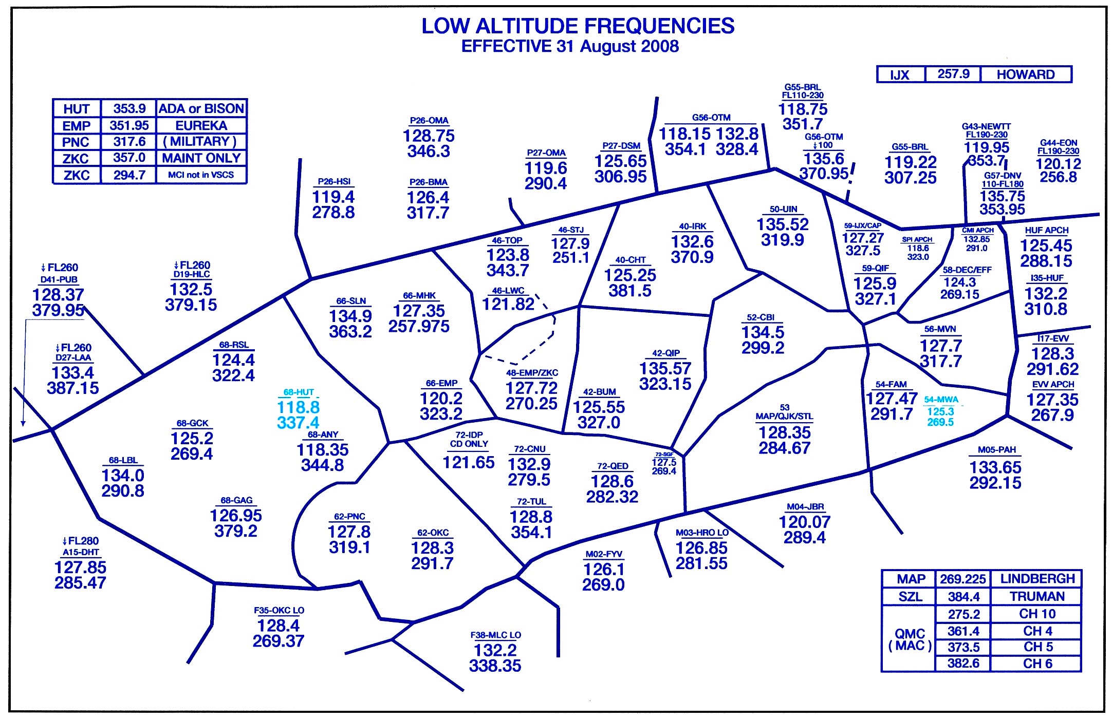
| 12:16, 19 October 2009 | Kansas City ARTCC Low Sector Freqs 2009.jpg (file) |  |
664 KB | 1 | |
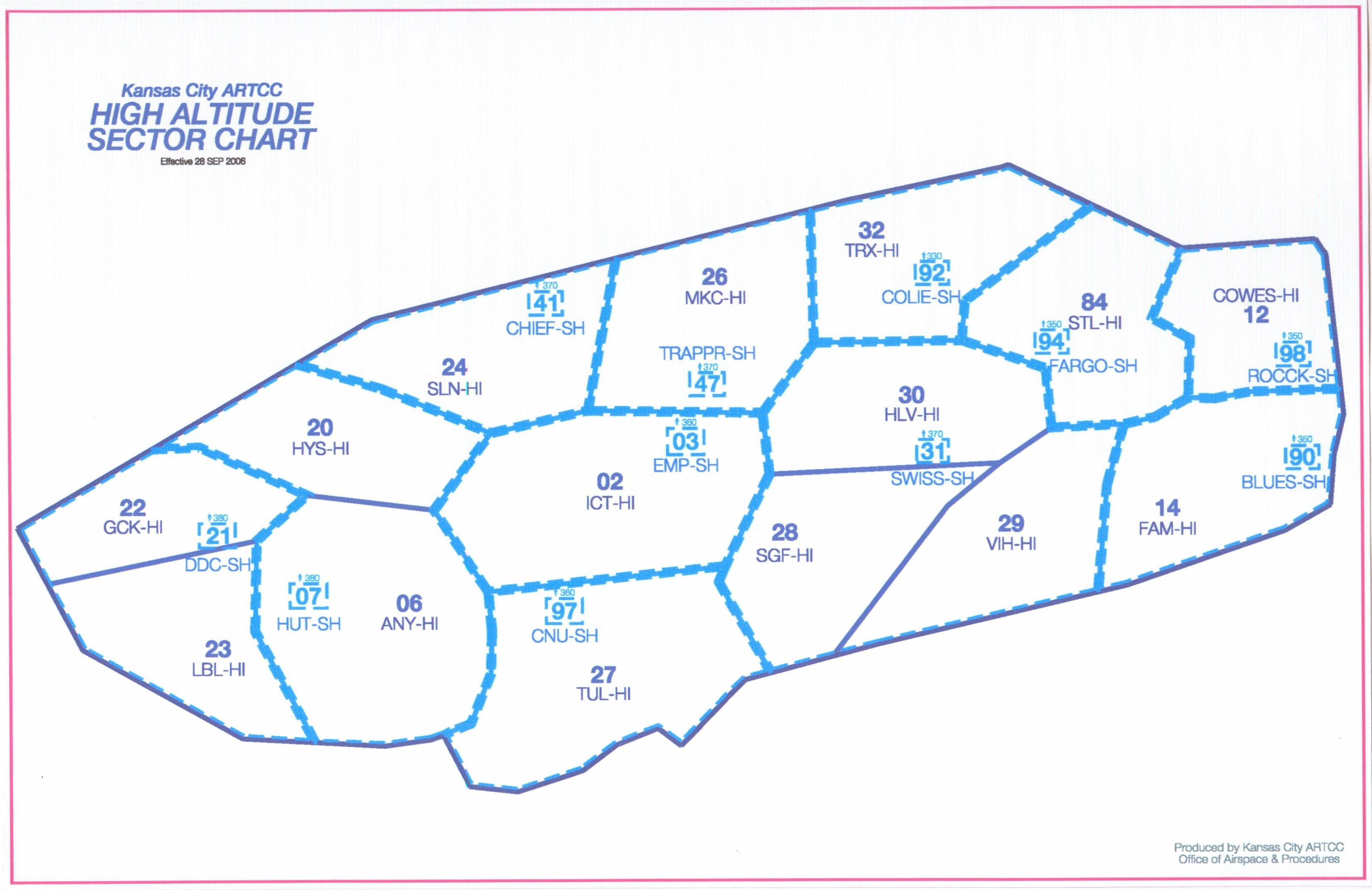
| 12:15, 19 October 2009 | Kansas City ARTCC High Sector Names.jpg (file) |  |
1.3 MB | 1 | |
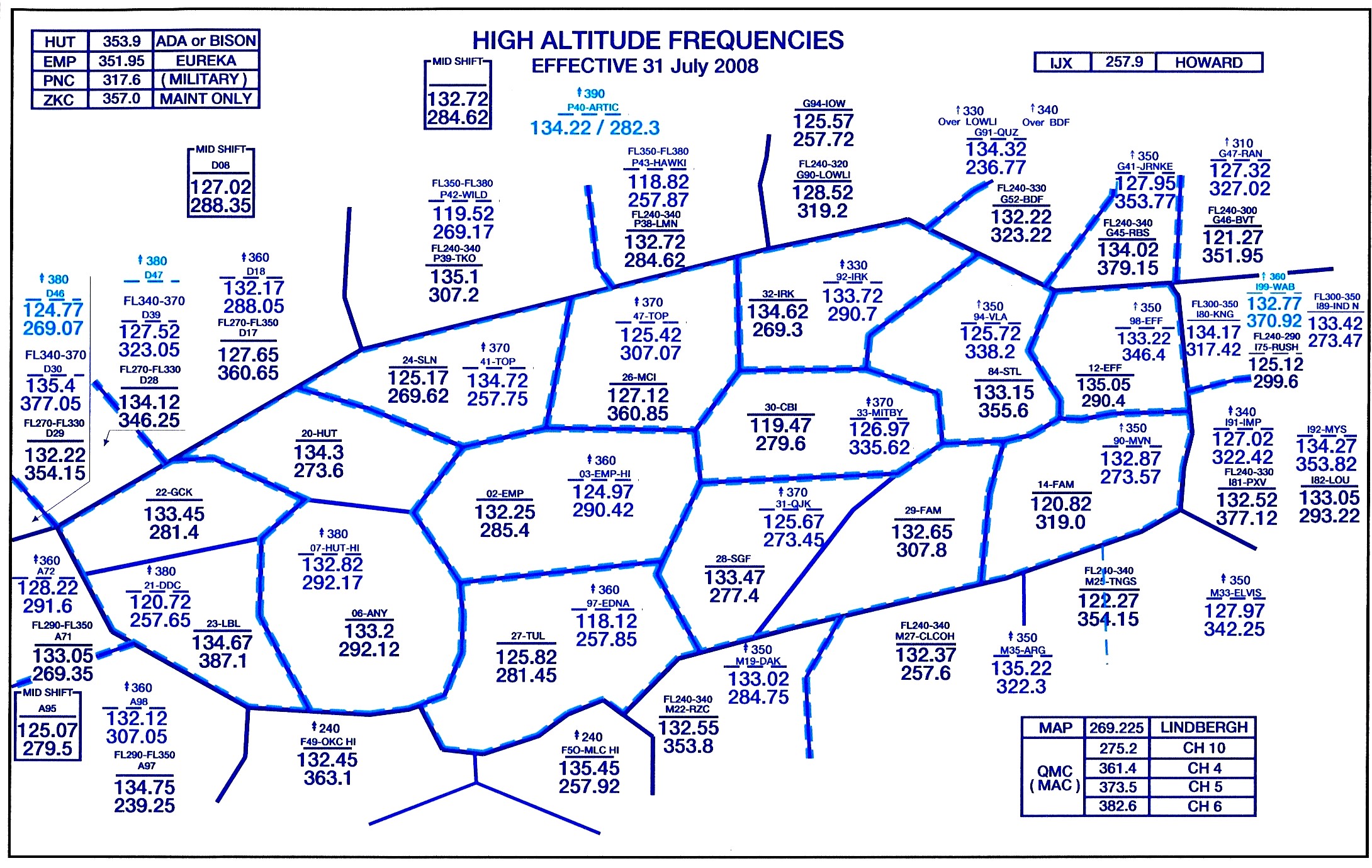
| 12:15, 19 October 2009 | Kansas City ARTCC High Sector Freqs 2009.jpg (file) |  |
779 KB | 1 | |
| 12:42, 16 October 2009 | ZIDHILOFREQS.pdf (file) | 296 KB | Hi/Lo VHF/UHF Sector Map for ZID | 1 | |
| 12:20, 16 October 2009 | CleartalkTRSTowerMap.gif (file) | 162 KB | Map of Cleartalk TRS Sites | 1 | |
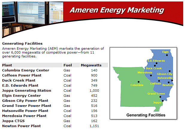
| 12:20, 16 October 2009 | Ameren-generating-facilities.gif (file) |  |
47 KB | 1 | |
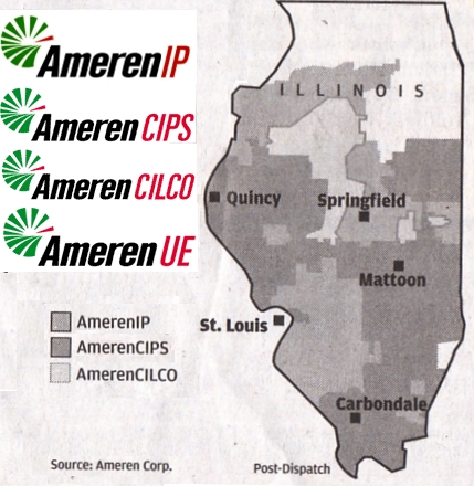
| 12:18, 16 October 2009 | AmerenUtilityCoverageMap.jpg (file) |  |
163 KB | 1 | |
| 12:56, 14 October 2009 | ShawneeViennaDistMap.pdf (file) | 90 KB | Map of Vienna District - Eastern Section Shawnee National Forest | 1 | |
| 12:43, 14 October 2009 | ShawneeJonesboroDistMap.pdf (file) | 101 KB | Map of Jonesboro District - Western Section Shawnee National Forest | 1 | |
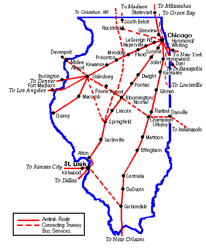
| 12:27, 14 October 2009 | Amtrak1 routes in IL.gif (file) |  |
10 KB | Amtrak Routes in Illinois | 1 |
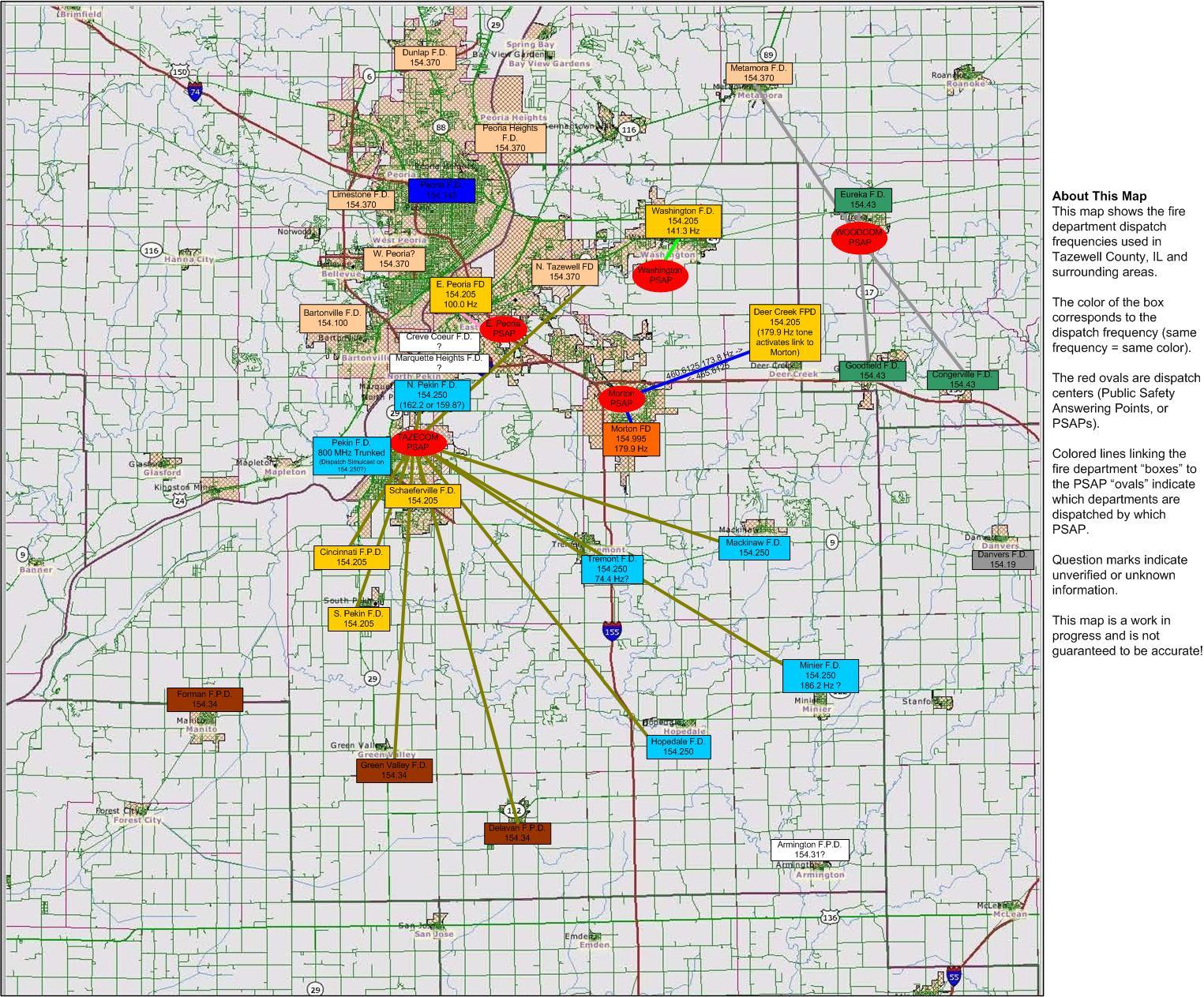
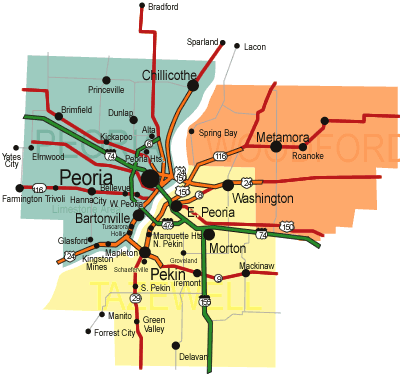
| 00:32, 16 May 2009 | Tazewell County Fire Dispatch Map.JPG (file) |  |
458 KB | Frequency and PL tone map for Tazewell County, IL | 1 |
| 12:39, 17 April 2009 | AMT-ambulance map.gif (file) |  |
27 KB | AMT District Coverage Map | 1 |