Difference between revisions of "New Hampshire Counties"
From The RadioReference Wiki
m (moved from New Hampshire (US); added map, etc.) |
m (compass) |
||
| Line 1: | Line 1: | ||
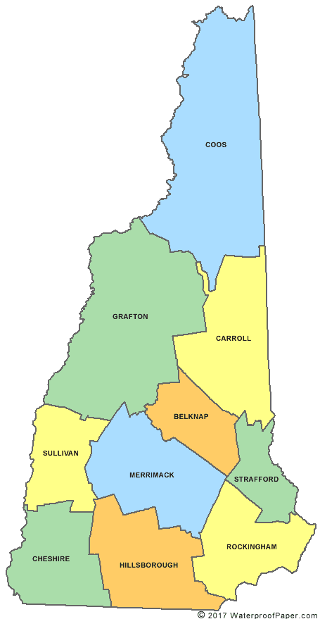
http://www.digital-topo-maps.com/county-map/new-hampshire-county-map.gif<br>Map Courtesy of [http://www.digital-topo-maps.com/county-map/new-hampshire.shtml Digital-Topo-Maps.com] | http://www.digital-topo-maps.com/county-map/new-hampshire-county-map.gif<br>Map Courtesy of [http://www.digital-topo-maps.com/county-map/new-hampshire.shtml Digital-Topo-Maps.com] | ||
| + | {| width="100%" style="vertical-align:top" | ||
| + | |width="25%"| | ||
*[[Belknap_County_(NH)|Belknap]] | *[[Belknap_County_(NH)|Belknap]] | ||
*[[Carroll_County_(NH)|Carroll]] | *[[Carroll_County_(NH)|Carroll]] | ||
| Line 6: | Line 8: | ||
*[[Coos_County_(NH)|Coos]] | *[[Coos_County_(NH)|Coos]] | ||
*[[Grafton_County_(NH)|Grafton]] | *[[Grafton_County_(NH)|Grafton]] | ||
| + | |width="25%"| | ||
*[[Hillsborough_County_(NH)|Hillsborough]] | *[[Hillsborough_County_(NH)|Hillsborough]] | ||
*[[Merrimack_County_(NH)|Merrimack]] | *[[Merrimack_County_(NH)|Merrimack]] | ||
| Line 11: | Line 14: | ||
*[[Strafford_County_(NH)|Strafford]] | *[[Strafford_County_(NH)|Strafford]] | ||
*[[Sullivan_County_(NH)|Sullivan]] | *[[Sullivan_County_(NH)|Sullivan]] | ||
| + | |} | ||
| − | + | ==Surrounding Counties== | |
| − | + | {{Geographic Location | |
| + | | Northwest = | ||
| + | | North = [[Quebec (CA)]] | ||
| + | | Northeast = | ||
| + | | West = [[Vermont Counties]] | ||
| + | | Center = New Hampshire Counties | ||
| + | | East = [[Maine Counties]] | ||
| + | | Southwest = | ||
| + | | South = [[Massachusetts Counties]] | ||
| + | | Southeast = | ||
| + | }} | ||
Latest revision as of 23:33, 7 June 2015
Map Courtesy of Digital-Topo-Maps.com
Surrounding Counties

|
Quebec (CA) |
| ||
| Vermont Counties | Maine Counties | |||
| Massachusetts Counties |
Return to DB page: New Hampshire
Return to Wiki page: New Hampshire (US)