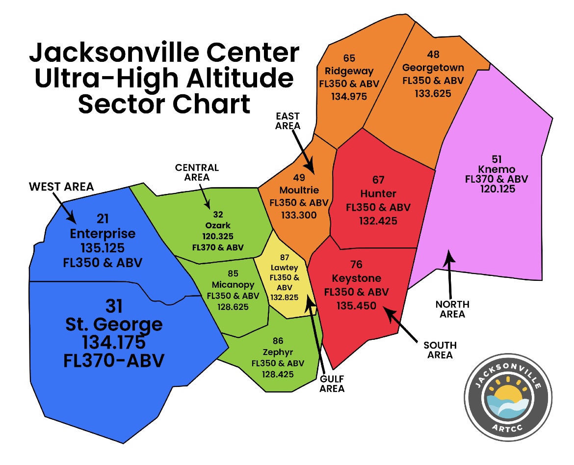
Jacksonville Center Ultra High Altitude Sector Map .jpg
From The RadioReference Wiki
Size of this preview: 741 × 600 pixels. Other resolutions: 297 × 240 pixels | 1,170 × 947 pixels.
Original file (1,170 × 947 pixels, file size: 251 KB, MIME type: image/jpeg)
Jacksonville Center Ultra High Altitude Sector Map current as of July 2025, extracted from public domain document.
File history
Click on a date/time to view the file as it appeared at that time.
| Date/Time | Thumbnail | Dimensions | User | Comment | |
|---|---|---|---|---|---|
| current | 18:03, 11 August 2025 | | 1,170 × 947 (251 KB) | Dgoodson (talk | contribs) |
- You cannot overwrite this file.
File usage
The following page uses this file: