Difference between revisions of "Toronto County (ON)"
From The RadioReference Wiki
m (added 10 Dundas Street East) |
|||
| Line 42: | Line 42: | ||
*[[10 Dundas Street East]] | *[[10 Dundas Street East]] | ||
| + | *[[Air Canada Center]] | ||
| + | *[[Eaton Centre]] | ||
[[Category:Province Data]] | [[Category:Province Data]] | ||
Revision as of 09:55, 30 May 2010
Toronto Public Safety
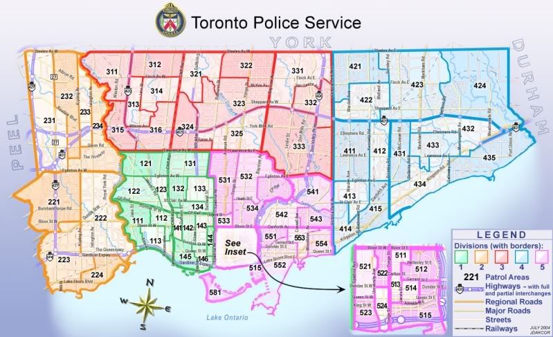
Toronto Police Service Divisional Map with Patrol Areas
Monitoring Toronto Emergency Services
talkgroups and frequency information at this link:
Toronto Fire Service
Fire Operations

Command and Division Map
Active Incidences Link
http://www.toronto.ca/fire/cadinfo/livecad.htm
(updated at five minute intervals)
Traffic Cameras/ Toronto Area
http://www.cbc.ca/toronto/traffic/FrameSet.htm
Toronto Expressway and Major Road Closures
http://www.toronto.ca/transportation/road_info/