Difference between revisions of "Toronto County (ON)"
From The RadioReference Wiki
| Line 28: | Line 28: | ||
[[Image:EAST.gif]] | [[Image:EAST.gif]] | ||
| + | |||
| + | ===Google Map of Stations=== | ||
| + | [http://maps.google.com/maps/ms?ie=UTF8&hl=en&msa=0&ll=43.739848,-79.341888&spn=0.305095,0.727158&t=h&z=11&msid=114001052992410372968.000492fe72310420312b9 Google Map of Toronto Fire Service Stations] | ||
===Active Incidences Link=== | ===Active Incidences Link=== | ||
Revision as of 20:53, 19 October 2010
Contents
Toronto Public Safety
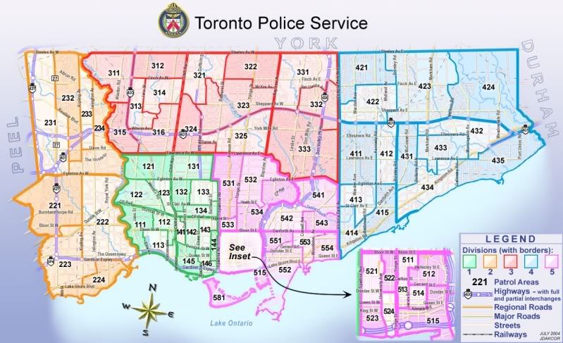
Toronto Police Service Divisional Map with Patrol Areas
Google Maps for TPS Stations
Google Maps Toronto Police Divisions
Monitoring Toronto Emergency Services
talkgroups and frequency information at this link:
Toronto Fire Service
Fire Operations

Command and Division Map
Google Map of Stations
Google Map of Toronto Fire Service Stations
Active Incidences Link
http://www.toronto.ca/fire/cadinfo/livecad.htm
(updated at five minute intervals)
Traffic Cameras/ Toronto Area
http://www.cbc.ca/toronto/traffic/FrameSet.htm
Toronto Expressway and Major Road Closures
http://www.toronto.ca/transportation/road_info/