Individual NM DTRS Sites
From The RadioReference Wiki
Revision as of 05:15, 30 June 2022 by KE5ZBG (talk | contribs) (→Individual New Mexico DTRS Site Information)
Revision as of 05:15, 30 June 2022 by KE5ZBG (talk | contribs) (→Individual New Mexico DTRS Site Information)
Contents
Individual New Mexico DTRS Site Information
The intent here is to include information that isn't in the Radio Reference Database. For other DTRS information for the state, see New Mexico Statewide Public Safety Radio System.
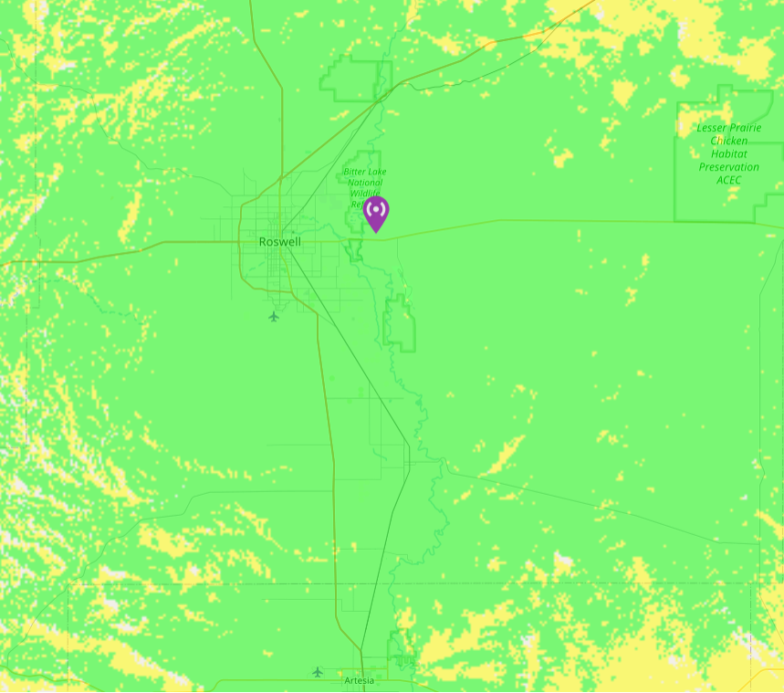
- Comanche Hill (1-001) (Roswell East)
- Roswell HD (1-002) (Roswell)
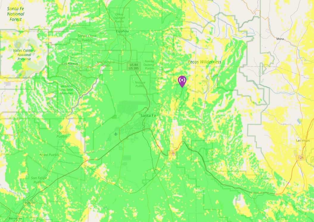
- Tesuque Peak (1-003) (Santa Fe)
- Sandia Crest (1-004) (Albuquerque)
- West Mesa (1-005) (defunct)
- Cedro Peak (1-006) (East Mountains)
- Transportable Site (1-007)
- Bataan Building (1-008) (Santa Fe)
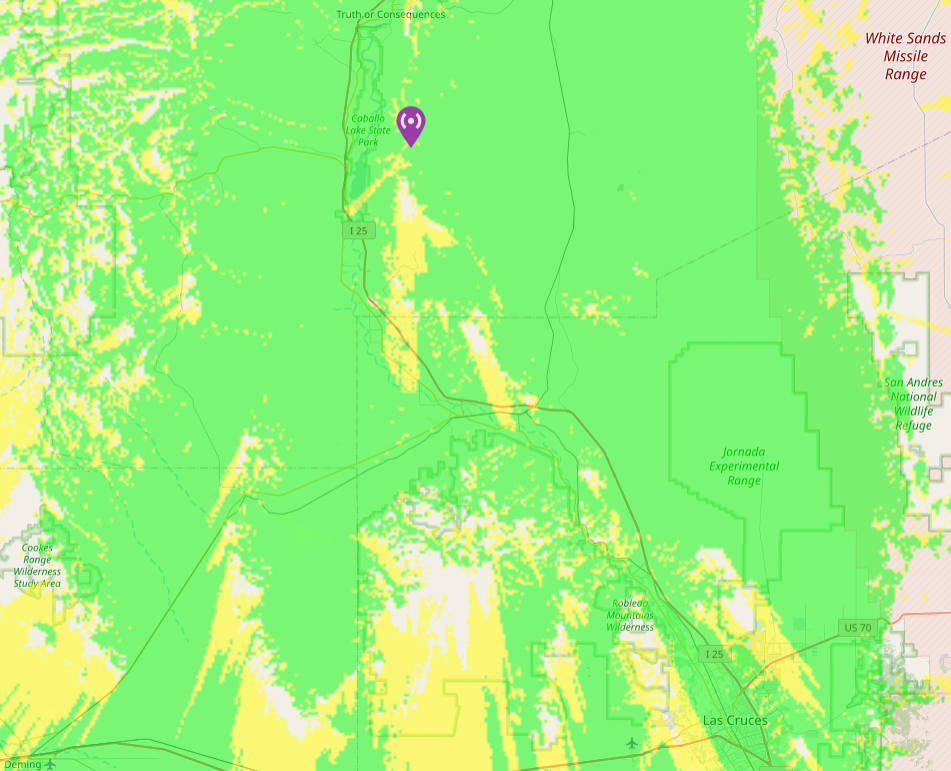
- Caballo Peak (1-009) (T or C)
- BC Landfill (1-010) (Albuquerque)
- Albuquerque Simulcast (1-011) (Albuquerque)
- Los Lunas Dispatch (1-015) (Los Lunas)
- x (1-016)
- Socorro - M Mountain (1-017) (Socorro)
- x (1-018)
- Capilla Peak (1-0) (Belen)
- Cerro Pelado (1-0) (Jemez)
- Mesa RS (1-0)
- Placitas (1-0) (Placitas)
- Pajarito Peak (1-0) (San Ysidro)
- BC-FS41 (1-0) (East Mountains, Oak Flats)
- RR-SC (1-0) (Rio Rancho)
- BC-SE (1-0)
Overview Maps of DTRS sites
Albuquerque Metro

[Click here for full resolution]
Note: Caballo (1-009) not shown.
Santa Fe

[Click here for full resolution]
Caballo

[Click here for full resolution]
