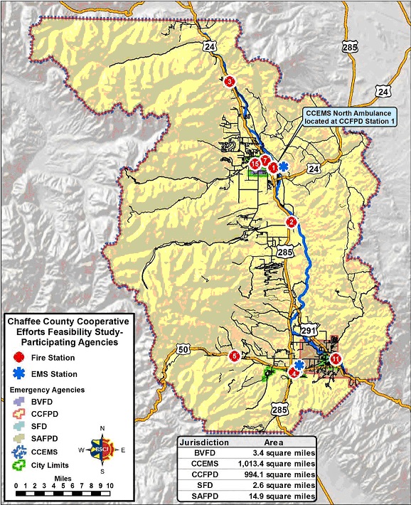
Chaffee fire map.jpg
From The RadioReference Wiki
Size of this preview: 488 × 599 pixels. Other resolutions: 195 × 240 pixels | 578 × 710 pixels.
Original file (578 × 710 pixels, file size: 253 KB, MIME type: image/jpeg)
Map of Chaffee County Fire Districts and stations.
File history
Click on a date/time to view the file as it appeared at that time.
| Date/Time | Thumbnail | Dimensions | User | Comment | |
|---|---|---|---|---|---|
| current | 01:42, 3 February 2015 | | 578 × 710 (253 KB) | N0nhj (talk | contribs) | Map of Chaffee County Fire Districts and stations. |
- You cannot overwrite this file.
File usage
The following page uses this file: