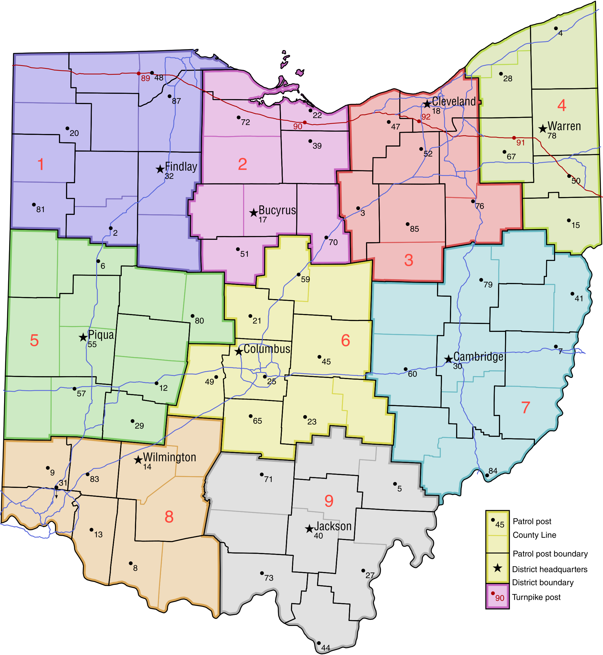
Ohio Highway Patrol Map.png
From The RadioReference Wiki
Revision as of 07:11, 25 May 2015 by Ibagli (talk | contribs) (uploaded a new version of "File:Ohio Highway Patrol Map.png": New version)
Revision as of 07:11, 25 May 2015 by Ibagli (talk | contribs) (uploaded a new version of "File:Ohio Highway Patrol Map.png": New version)
Size of this preview: 552 × 600 pixels. Other resolutions: 221 × 240 pixels | 2,056 × 2,234 pixels.
Original file (2,056 × 2,234 pixels, file size: 749 KB, MIME type: image/png)
File history
Click on a date/time to view the file as it appeared at that time.
(newest | oldest) View (newer 10 | older 10) (10 | 20 | 50 | 100 | 250 | 500)
| Date/Time | Thumbnail | Dimensions | User | Comment | |
|---|---|---|---|---|---|
| current | 04:54, 25 January 2016 | | 2,056 × 2,234 (749 KB) | Ibagli (talk | contribs) | new districts |
| 12:15, 31 May 2015 | 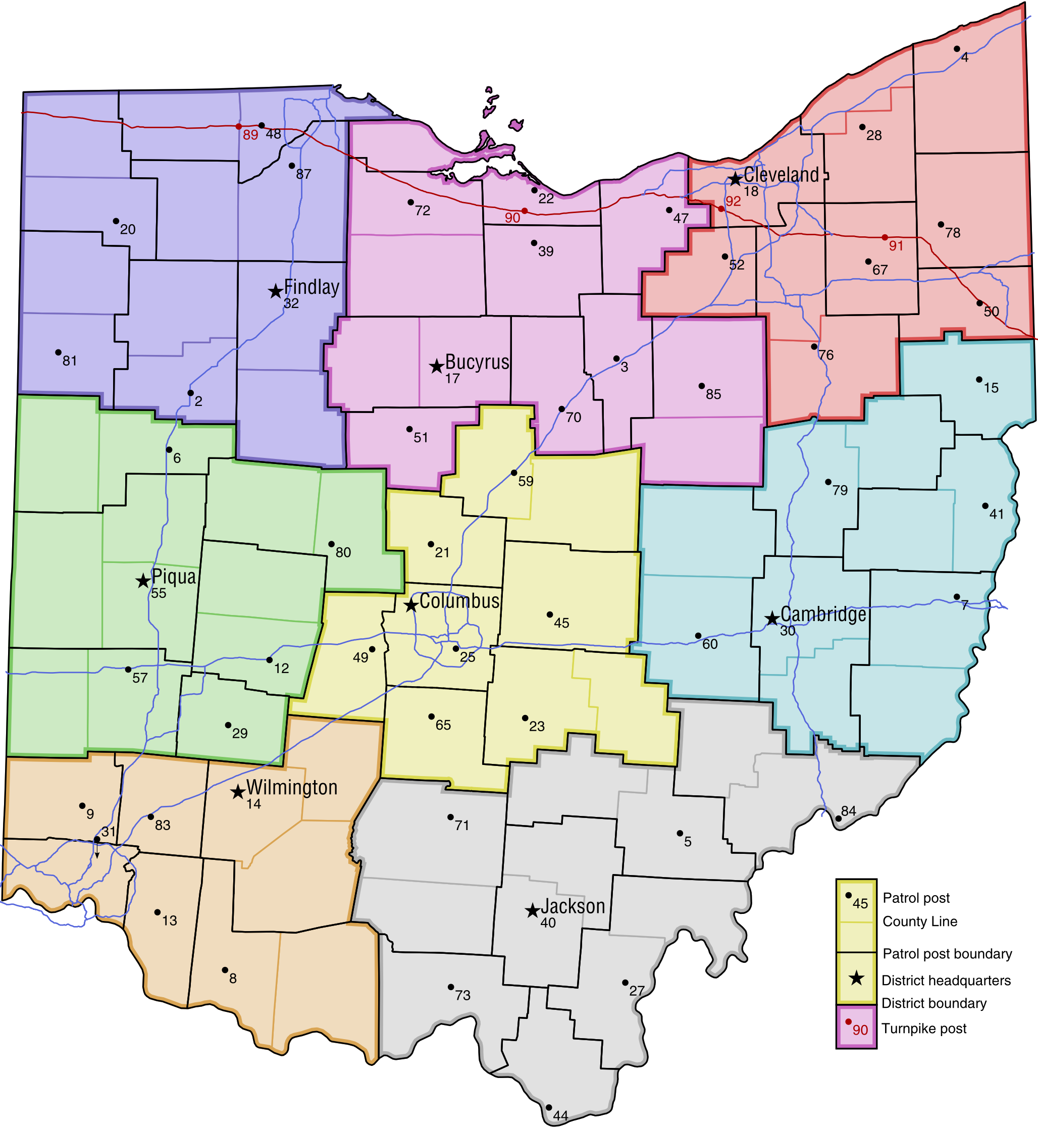 | 2,056 × 2,234 (728 KB) | Ibagli (talk | contribs) | ||
| 12:10, 31 May 2015 |  | 2,056 × 2,234 (728 KB) | Ibagli (talk | contribs) | ||
| 07:11, 25 May 2015 | 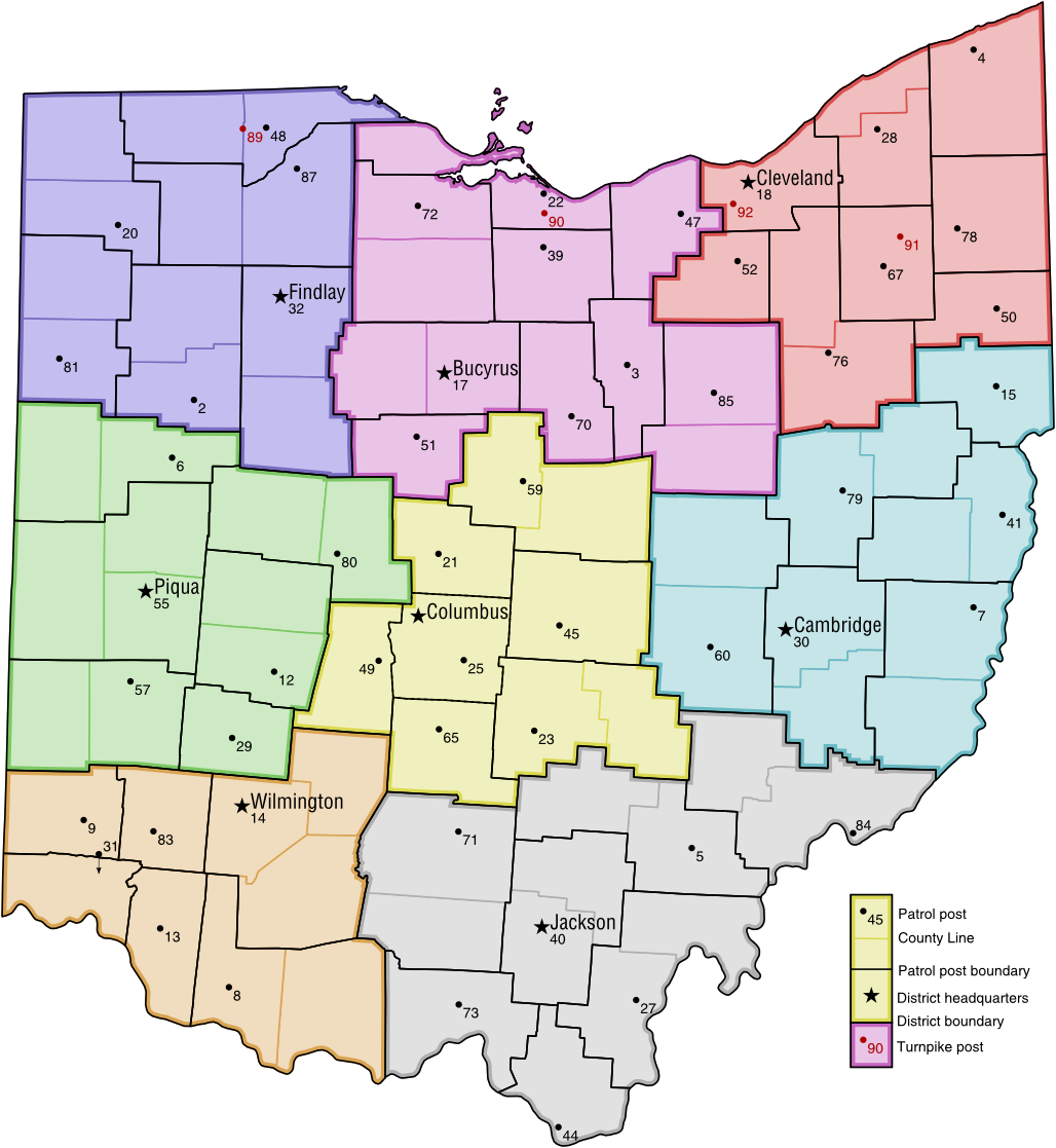 | 1,028 × 1,117 (267 KB) | Ibagli (talk | contribs) | New version | |
| 13:48, 10 May 2015 |  | 1,028 × 1,117 (194 KB) | Ibagli (talk | contribs) | Fix Pike County | |
| 13:48, 10 May 2015 | 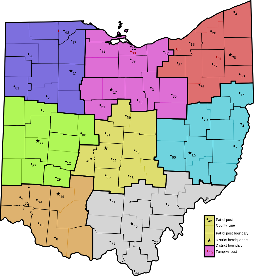 | 1,028 × 1,117 (194 KB) | Ibagli (talk | contribs) | Fix Pike County | |
| 08:32, 27 March 2013 | 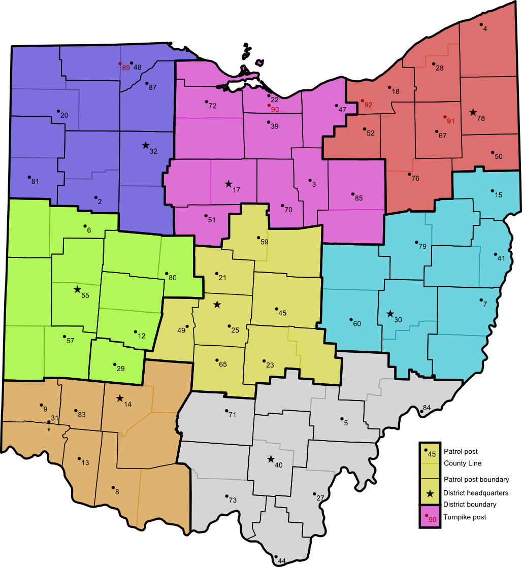 | 1,028 × 1,117 (202 KB) | Ibagli (talk | contribs) | Xenia | |
| 02:30, 19 January 2013 | 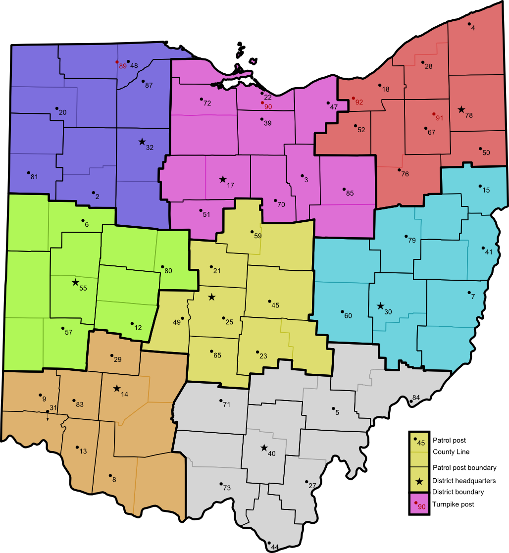 | 1,028 × 1,117 (202 KB) | Ibagli (talk | contribs) | ||
| 06:42, 6 July 2012 | 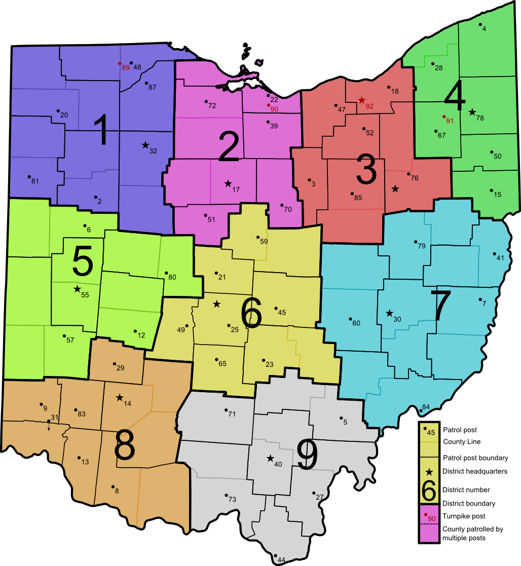 | 1,028 × 1,117 (222 KB) | Ibagli (talk | contribs) | Metro Posts | |
| 06:29, 28 May 2012 |  | 1,024 × 1,113 (221 KB) | Ibagli (talk | contribs) | OSP now seems to consider Cuyahoga County a part of District 3 |
- You cannot overwrite this file.
File usage
The following page uses this file: