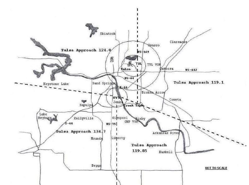
Tulsa Airspace Map.jpg
From The RadioReference Wiki
Revision as of 21:28, 28 December 2017 by Andy51edge (talk | contribs) (uploaded a new version of "File:Tulsa Airspace Map.jpg")
Revision as of 21:28, 28 December 2017 by Andy51edge (talk | contribs) (uploaded a new version of "File:Tulsa Airspace Map.jpg")

Size of this preview: 800 × 596 pixels. Other resolutions: 320 × 238 pixels | 1,414 × 1,053 pixels.
Original file (1,414 × 1,053 pixels, file size: 128 KB, MIME type: image/jpeg)
A map of the Tulsa Approach sector frequencies and locations published in "Riverside Tower Pilot Information Handbook" published 29 November, 2005.
File history
Click on a date/time to view the file as it appeared at that time.
| Date/Time | Thumbnail | Dimensions | User | Comment | |
|---|---|---|---|---|---|
| current | 21:40, 28 December 2017 | | 1,414 × 1,053 (128 KB) | Andy51edge (talk | contribs) | Reverted to version as of 21:28, 28 December 2017 |
| 21:37, 28 December 2017 | 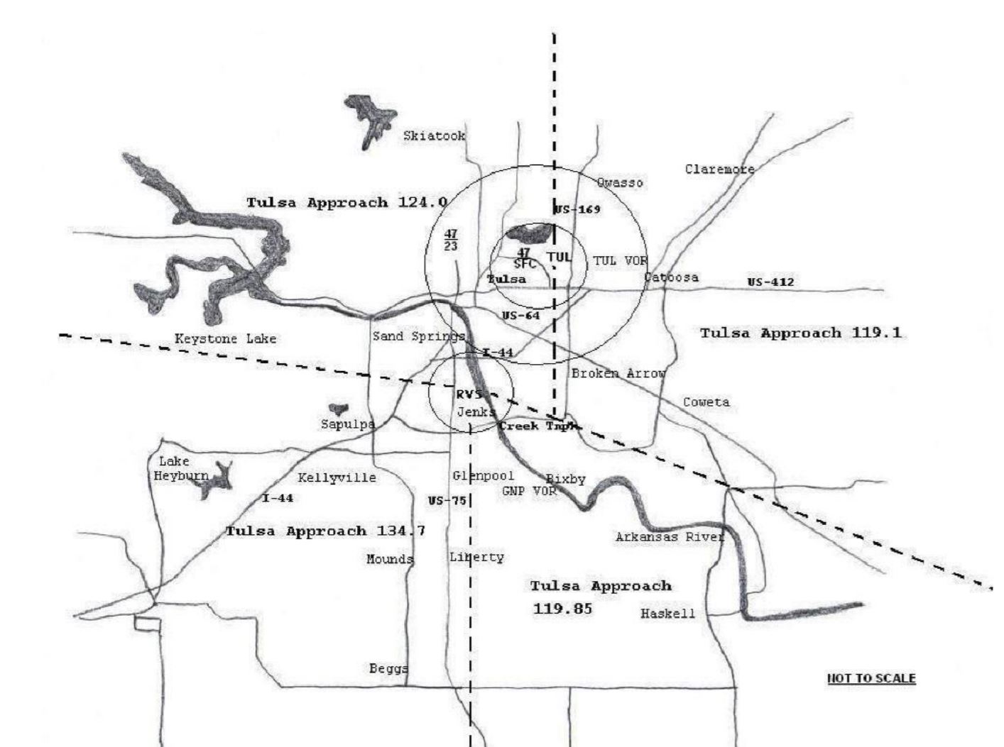 | 1,414 × 1,053 (128 KB) | Andy51edge (talk | contribs) | Updated | |
| 21:28, 28 December 2017 |  | 1,414 × 1,053 (128 KB) | Andy51edge (talk | contribs) | ||
| 16:21, 28 June 2014 | 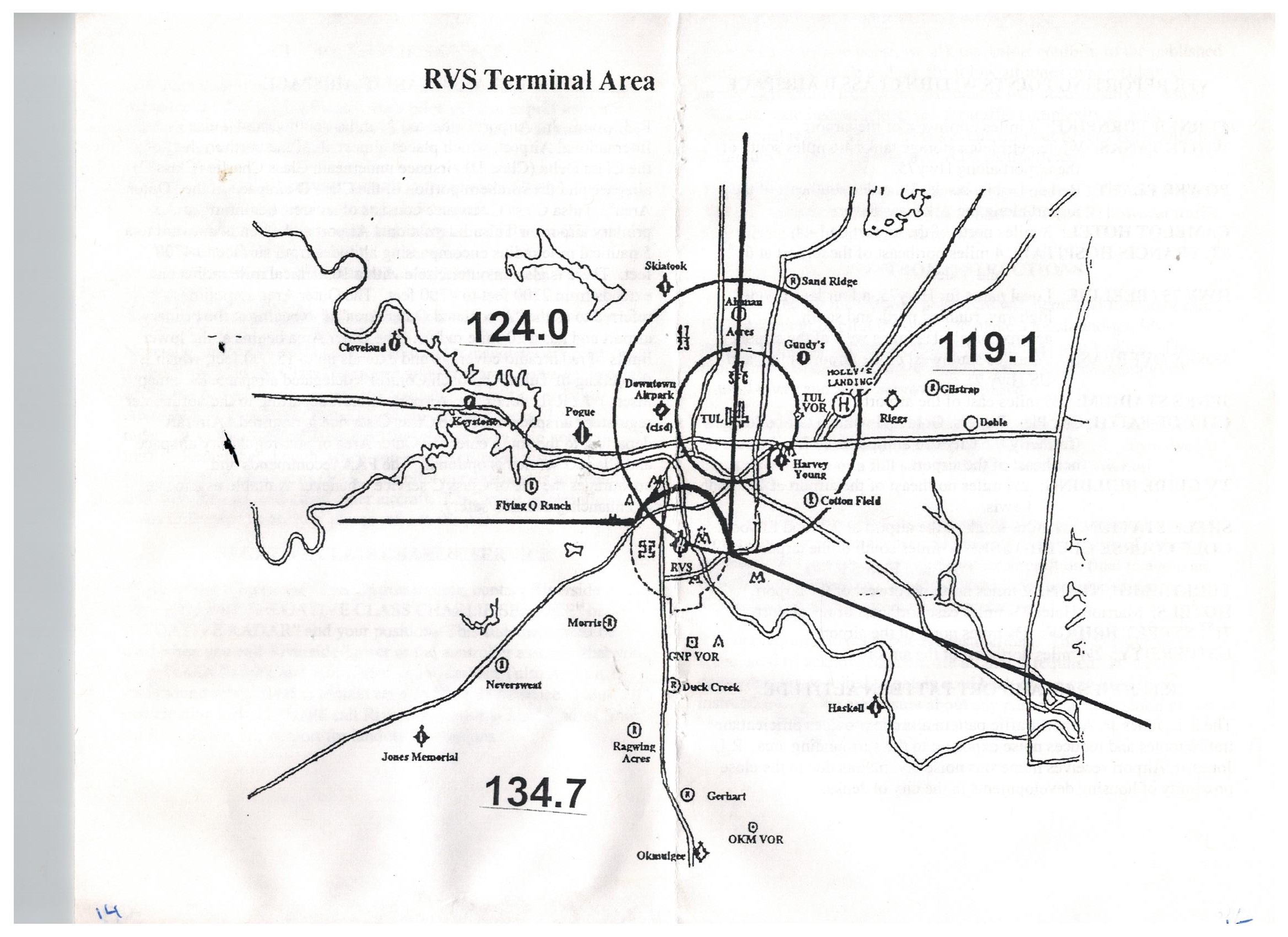 | 2,338 × 1,700 (546 KB) | Andy51edge (talk | contribs) | A map of the Tulsa Approach sector frequencies and locations published in "Riverside Tower Pilot Information Handbook" published 29 November, 2005. |
- You cannot overwrite this file.
File usage
The following file is a duplicate of this file (more details):
The following 2 pages uses this file: