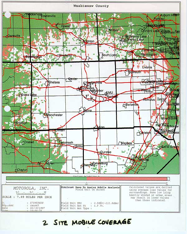
Washtenaw-800mhz-coverageMap-em 800.jpg
From The RadioReference Wiki
Size of this preview: 479 × 600 pixels. Other resolutions: 192 × 240 pixels | 600 × 751 pixels.
Original file (600 × 751 pixels, file size: 140 KB, MIME type: image/jpeg)
Washtenaw 800 MHz TRS Coverage Area Map
File history
Click on a date/time to view the file as it appeared at that time.
| Date/Time | Thumbnail | Dimensions | User | Comment | |
|---|---|---|---|---|---|
| current | 02:11, 1 August 2009 | | 600 × 751 (140 KB) | Starcom21 (talk | contribs) | Washtenaw 800 MHz TRS Coverage Area Map |
- You cannot overwrite this file.
File usage
The following page uses this file: