CMSMap.gif
From The RadioReference Wiki

Size of this preview: 448 × 599 pixels. Other resolutions: 179 × 240 pixels | 524 × 701 pixels.
Original file (524 × 701 pixels, file size: 16 KB, MIME type: image/gif)
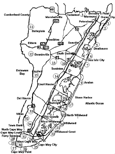
Cape May County Map
File history
Click on a date/time to view the file as it appeared at that time.
| Date/Time | Thumbnail | Dimensions | User | Comment | |
|---|---|---|---|---|---|
| current | 04:17, 11 June 2012 | | 524 × 701 (16 KB) | Elias1988 (talk | contribs) | Cape May County Map |
- You cannot overwrite this file.
File usage
The following page uses this file: