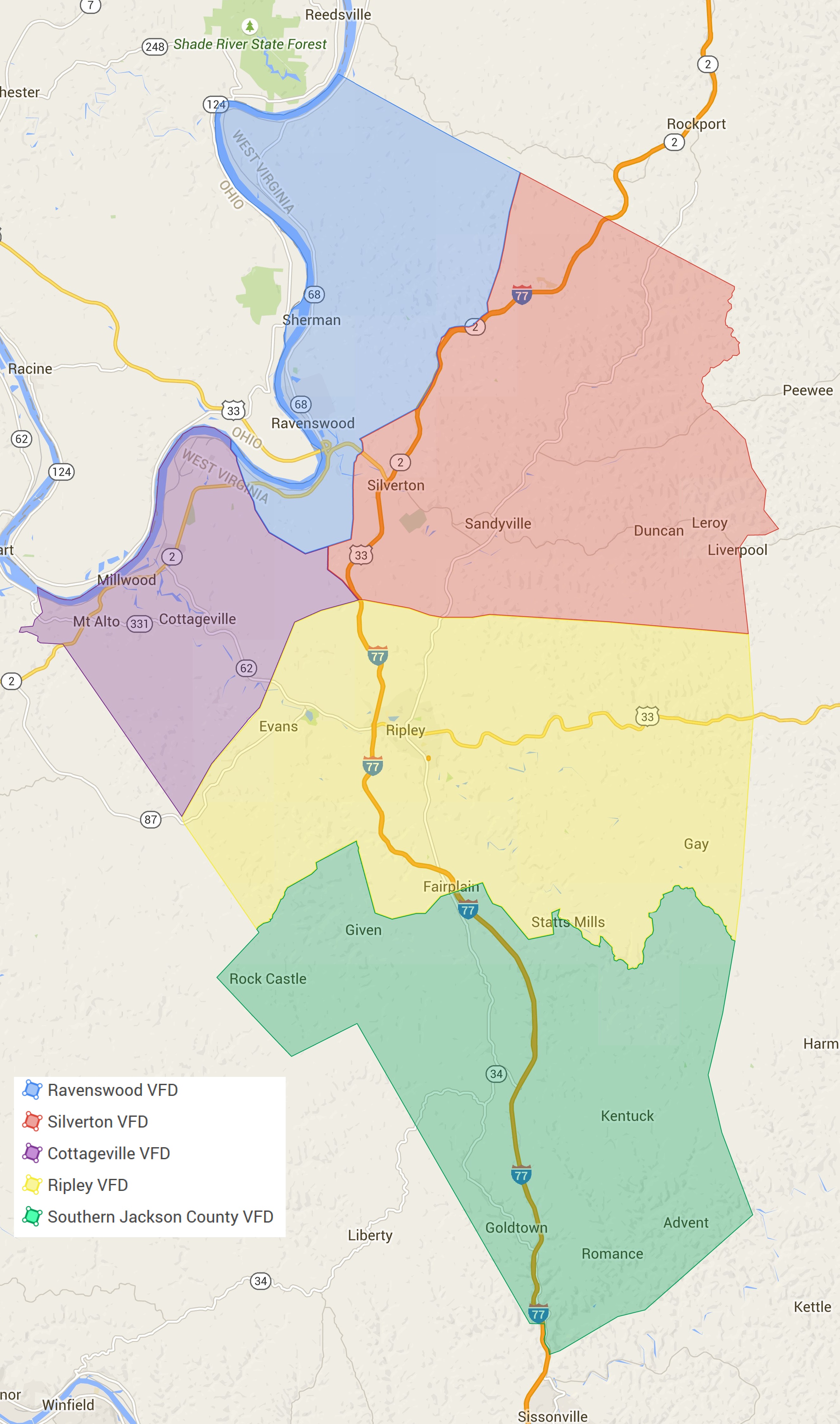
JacksonCountyWV-FireMap.jpg
From The RadioReference Wiki
Revision as of 10:08, 18 July 2015 by Andrewtv08 (talk | contribs) (Jackson County, WV Fire Dept. Coverage Map)
Revision as of 10:08, 18 July 2015 by Andrewtv08 (talk | contribs) (Jackson County, WV Fire Dept. Coverage Map)
Size of this preview: 353 × 598 pixels. Other resolutions: 141 × 240 pixels | 2,652 × 4,496 pixels.
Original file (2,652 × 4,496 pixels, file size: 1.38 MB, MIME type: image/jpeg)
Jackson County, WV Fire Dept. Coverage Map
File history
Click on a date/time to view the file as it appeared at that time.
| Date/Time | Thumbnail | Dimensions | User | Comment | |
|---|---|---|---|---|---|
| current | 10:08, 18 July 2015 | | 2,652 × 4,496 (1.38 MB) | Andrewtv08 (talk | contribs) | Jackson County, WV Fire Dept. Coverage Map |
- You cannot overwrite this file.
File usage
The following page uses this file: