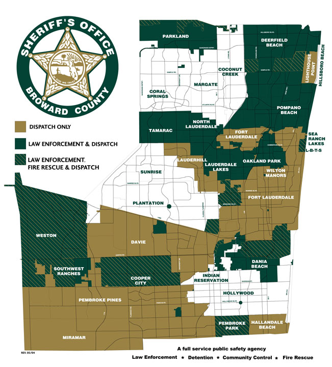
Map bso.jpg
From The RadioReference Wiki
Size of this preview: 542 × 599 pixels. Other resolutions: 217 × 240 pixels | 651 × 720 pixels.
Original file (651 × 720 pixels, file size: 121 KB, MIME type: image/jpeg)
Broward Sheriff's Office map showing which areas are provided dispatch, police, and fire services. From the BSO web site, valid in the mid-2000s
File history
Click on a date/time to view the file as it appeared at that time.
| Date/Time | Thumbnail | Dimensions | User | Comment | |
|---|---|---|---|---|---|
| current | 14:32, 16 May 2009 | | 651 × 720 (121 KB) | Bote (talk | contribs) | Broward Sheriff's Office map showing which areas are provided dispatch, police, and fire services. From the BSO web site, valid in the mid-2000s |
- You cannot overwrite this file.
File usage
The following page uses this file: