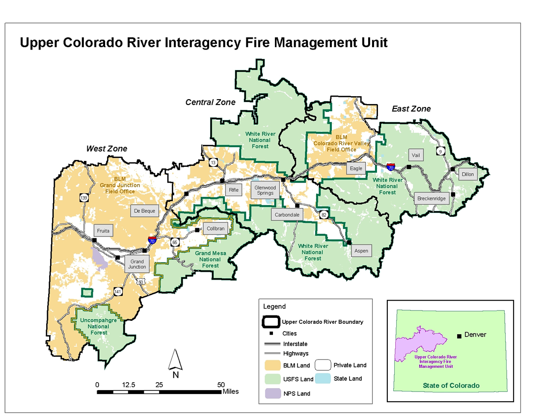
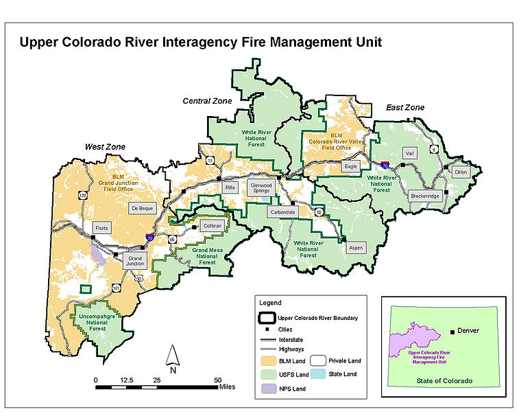
Ucrmap.jpg
From The RadioReference Wiki
Revision as of 08:47, 21 June 2011 by Soundchaser (talk | contribs) (Map of Upper Colorado River Interagency Fire Management Unit)
Revision as of 08:47, 21 June 2011 by Soundchaser (talk | contribs) (Map of Upper Colorado River Interagency Fire Management Unit)
Size of this preview: 776 × 600 pixels. Other resolutions: 311 × 240 pixels | 1,100 × 850 pixels.
Original file (1,100 × 850 pixels, file size: 403 KB, MIME type: image/jpeg)
Map of Upper Colorado River Interagency Fire Management Unit
File history
Click on a date/time to view the file as it appeared at that time.
| Date/Time | Thumbnail | Dimensions | User | Comment | |
|---|---|---|---|---|---|
| current | 08:47, 21 June 2011 | | 1,100 × 850 (403 KB) | Soundchaser (talk | contribs) | Map of Upper Colorado River Interagency Fire Management Unit |
- You cannot overwrite this file.
File usage
The following page uses this file: