Difference between revisions of "Individual CO DTRS Sites/State Capitol"
From The RadioReference Wiki
Soundchaser (talk | contribs) |
Soundchaser (talk | contribs) m (added site tags) |
||
| Line 5: | Line 5: | ||
*'''Denied affiliations:''' Jefferson County, Arapahoe County | *'''Denied affiliations:''' Jefferson County, Arapahoe County | ||
*'''Other notes:''' Data used for map was from WQLZ331 which is the site expansion for RTD, which will be completed by June, 2011. | *'''Other notes:''' Data used for map was from WQLZ331 which is the site expansion for RTD, which will be completed by June, 2011. | ||
| + | *'''Frequencies:''' | ||
| + | <site>329|10862</site> | ||
| + | {{Refreshpage | ||
| + | |Pageurl=http://wiki.radioreference.com/index.php/Individual_CO_DTRS_Sites/State_Capitol}} | ||
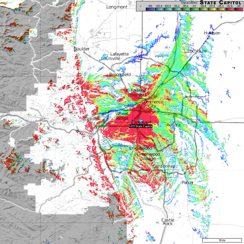
===Approximate Coverage Map=== | ===Approximate Coverage Map=== | ||
Revision as of 18:29, 29 March 2011
State Capitol (1-071)
- County location: Denver
- Counties covered: Denver
- Frequent affiliations:
- Denied affiliations: Jefferson County, Arapahoe County
- Other notes: Data used for map was from WQLZ331 which is the site expansion for RTD, which will be completed by June, 2011.
- Frequencies:
| Site | Name | Freqs | |||||||
|---|---|---|---|---|---|---|---|---|---|
| 071 (47) | State Capitol | 769.306250 | 769.531250 | 769.781250 | 770.581250 | 771.456250 | 772.206250 | 773.231250 | 773.481250 |
| 774.031250a | 774.281250a | 774.656250a | 774.906250c |
Refresh this page from the latest database entry
