Difference between revisions of "Individual CO DTRS Sites/West Creek"
From The RadioReference Wiki
Soundchaser (talk | contribs) (New page) |
Soundchaser (talk | contribs) |
||
| Line 8: | Line 8: | ||
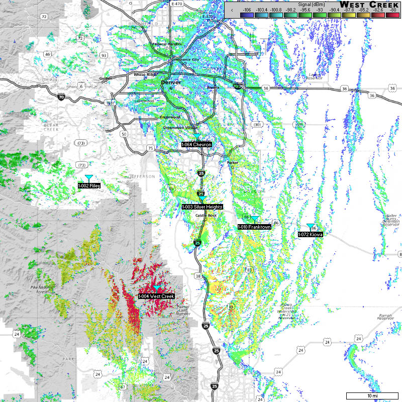
===Approximate Coverage Map=== | ===Approximate Coverage Map=== | ||
[[File:WestCreek.jpg|400px|thumb|left]] | [[File:WestCreek.jpg|400px|thumb|left]] | ||
| − | [[http://wiki.radioreference.com/images/ | + | [[http://wiki.radioreference.com/images/1/17/WestCreek.jpg Click here for full resolution]] |
[[Information on Coverage Maps]] | [[Information on Coverage Maps]] | ||
Revision as of 02:25, 11 March 2011
West Creek (1-004)
- County location: Douglas
- Counties covered: Douglas, Denver, Jefferson
- Frequent affiliations:
- Denied affiliations: El Paso County, Teller County, CSU, City of Thornton, Colorado Springs PD and FD, Colorado Springs/Pueblo AMR, Adams County non-PS
- Other notes:
