File list
This special page shows all uploaded files.
| Date | Name | Thumbnail | Size | Description | Versions |
|---|---|---|---|---|---|
| 09:12, 20 April 2016 | CPD Zones.pdf (file) | 45 KB | Cincinnati Police radio zone map | 1 | |
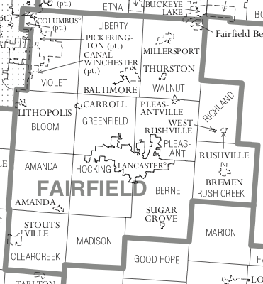
| 13:00, 13 May 2019 | Fairfield County Ohio Map.png (file) |  |
79 KB | 1 | |
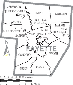
| 12:55, 13 May 2019 | Fayette County Ohio Map.png (file) |  |
58 KB | 1 | |
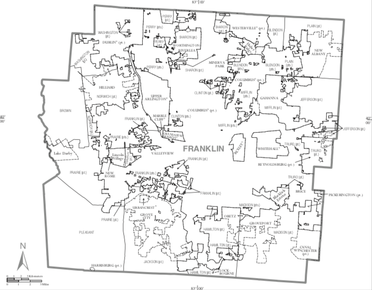
| 11:23, 13 May 2019 | Franklin County Ohio Map.png (file) |  |
211 KB | Map of Franklin County | 1 |
| 16:17, 14 July 2014 | MARCS-IPMap061614.pdf (file) | 826 KB | Map of Ohio MARCS-IP Sites and status June 16, 2014 | 1 | |
| 20:59, 24 July 2014 | MARCS-IPMap071414.pdf (file) | 825 KB | MARCS-IP Sites and status July 14, 2014 | 1 | |
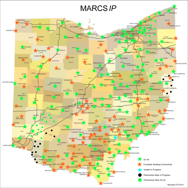
| 21:00, 24 July 2014 | MARCS-IPMap071414.png (file) |  |
339 KB | Ohio MARCS-IP Sites and status July 14, 2014 | 1 |
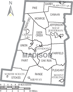
| 11:27, 13 May 2019 | Madison County Ohio Map.png (file) |  |
63 KB | 1 | |
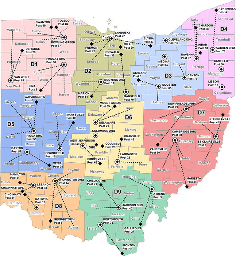
| 17:22, 3 April 2016 | OSP Dispatcher Map.png (file) |  |
571 KB | 1 | |
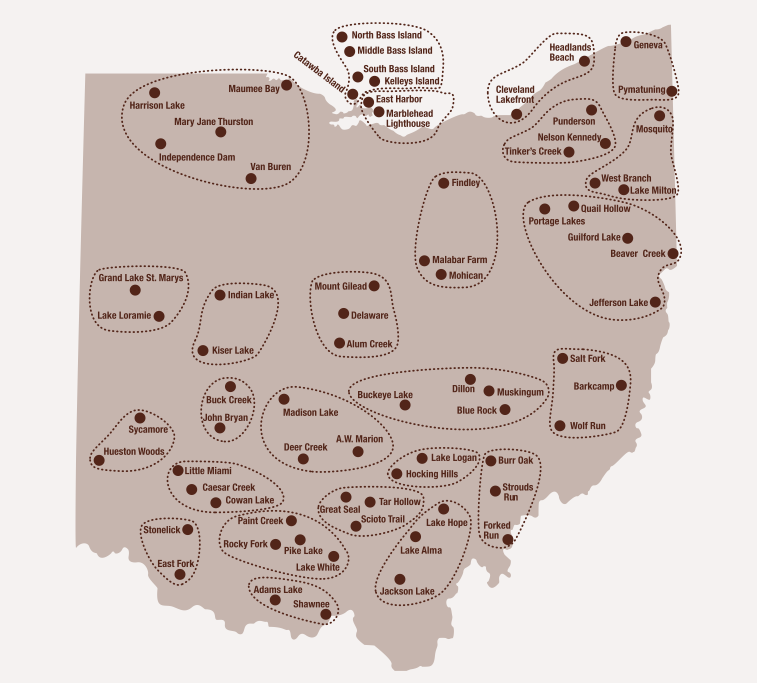
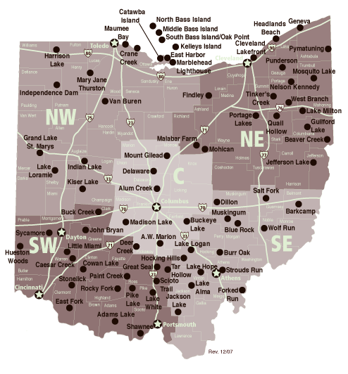
| 12:56, 31 May 2009 | Parkregion.png (file) |  |
165 KB | Ohio DNR Parks & Recreation regions, showing parks grouped by region | 1 |
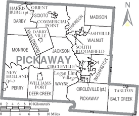
| 15:25, 12 May 2019 | Pickaway County Ohio Map.png (file) |  |
73 KB | Pickaway County Ohio | 1 |
| 13:04, 8 March 2015 | RadioReference.com Database Administrator Handbook 1.8.pdf (file) | 511 KB | Minor corrections and edits | 2 | |
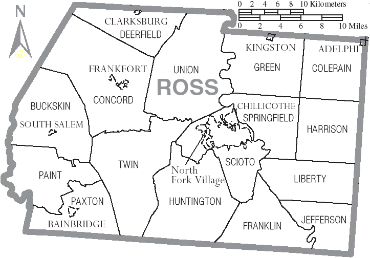
| 12:53, 9 May 2019 | Ross County Ohio.png (file) |  |
47 KB | Ross County map with townships | 1 |
| 12:55, 31 May 2009 | Stateregion.png (file) |  |
127 KB | Ohio DNR statewide regions showing park locations | 1 |
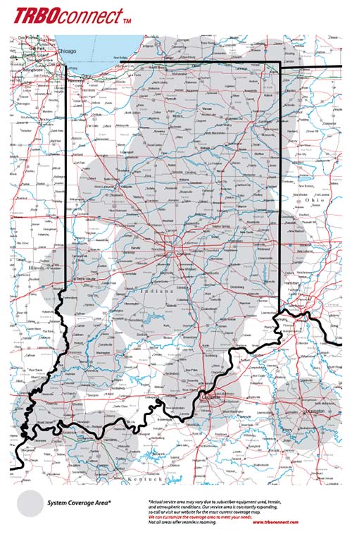
| 09:49, 29 January 2018 | TRBOconnect-map.jpg (file) |  |
93 KB | Coverage map for ERS-OCT TRBOconnect system | 1 |
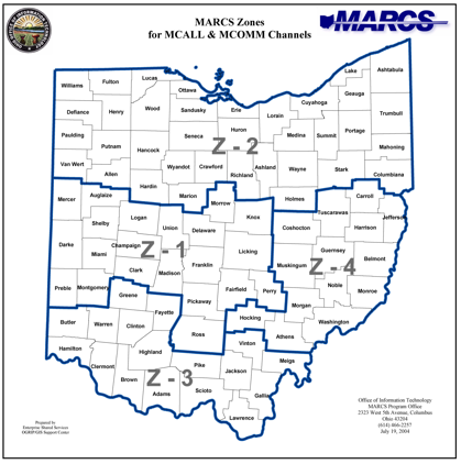
| 19:19, 15 July 2009 | Zones.png (file) |  |
94 KB | Ohio MARCS zones | 1 |