Arkansas SKYWARN Net
From The RadioReference Wiki
(Redirected from Arkansas Skywarn Net)
Arkansas SKYWARN Net (WX5LZK)
operates from, and at the request of, the
North Little Rock Forecast Office
of the National Weather Service
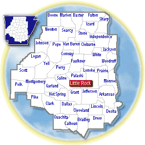
The focus of Arkansas SKYWARN Net is to provide severe weather coverage for the County Warning Area of the North Little Rock Forecast Office (see county map)
Arkansas SKYWARN Net is hosted on the
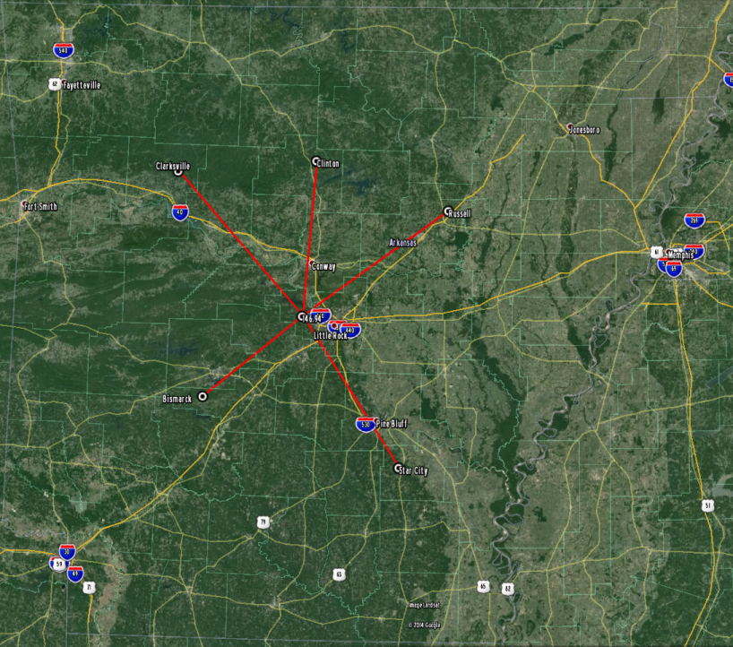
W5DI Linked Repeater System
(see system map below) which is owned and maintained by
Central Arkansas Radio Emergency Net (CAREN)
A monthly training net is held the 2nd Tuesday night of each month at 7pm local time
An audio stream can be heard here on Broadcastify
The following repeaters are linked together during any Arkansas SKYWARN Net activation:
Little Rock, W5DI
146.94-, no tone (also linked to 444.2+)
SKYWARN coverage counties:
Arkansas, Cleburne, Conway, Dallas, Faulkner, Garland,
Hot Spring, Jefferson, Lonoke, Monroe, Perry, Pope,
Prairie, Pulaski, Saline, White, Woodruff
Bismarck, W5DI
147.27+, 114.8
SKYWARN coverage counties:
Calhoun, Clark, Dallas, Garland, Grant, Hot Spring,
Montgomery, Ouachita, Pike
Russell, WA5OOY
147.315+, 114.8
SKYWARN coverage counties:
Cleburne, Independence, Jackson, Lonoke, Monroe, Prairie,
White, Woodruff
Clinton, W5DI
145.37-, 114.8
SKYWARN coverage counties:
Cleburne, Conway, Searcy, Stone, Van Buren
Clarksville, W5OI
147.285+, 114.8
SKYWARN coverage counties:
Conway, Johnson, Logan, Newton, Pope, Scott, Yell
Star City, W5DI
(not currently linked, but monitored directly from the NWS office during activations)
146.67-, 114.8
SKYWARN coverage counties:
Arkansas, Bradley, Calhoun, Cleveland, Dallas, Desha,
Drew, Grant, Jefferson, Lincoln, Lonoke
Disclaimer: repeater coverage may not be complete for every location in a listed county but has substantial coverage for the counties listed
Associated links:
Central Arkansas Radio Emergency Net's SKYWARN page
Return to DB page: Amateur Radio (AR)
Return to Wiki page: Arkansas (US), Severe Weather (AR)


