Department of Conservation and Natural Resources (PA)
From The RadioReference Wiki
Contents
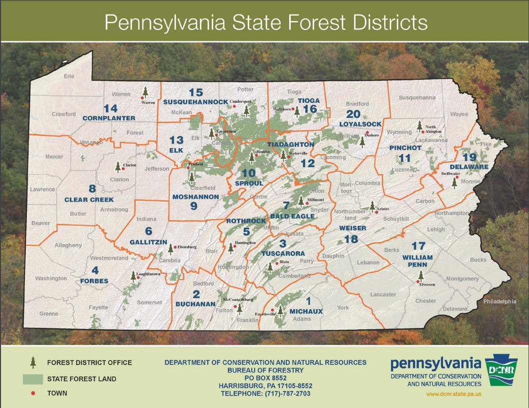
Bureau of Forestry Maps
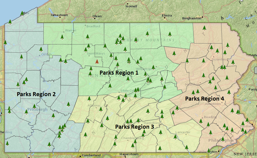
Bureau of State Parks Map
State Parks Region 1
Parks in bold have been noted on P25 talkgroups at least some of the time.
- Bald Eagle
- Bendigo Complex
- Elk
- Kinzua Bridge
- Black Moshannon
- Bucktail
- Chapman
- Hills Creek Complex
- Colton Point
- Leonard Harrison
- Cherry Springs (Lyman Run)
- Denton Hill (Lyman Run)
- Lyman Run (Lyman Run)
- Patterson (Lyman Run)
- Prouty Place (Lyman Run)
- Kettle Creek Complex
- Ole Bull
- Little Pine Complex
- Upper Pine Bottom
- Hyner Run (Hyner Run)
- Hyner View (Hyner Run)
- Mount Pisgah
- Parker Dam Complex
- S.B. Elliot
- R.B. WinterComplex
- McCall's Dam
- Ravensburg
- Sand Bridge
- Reeds Gap Complex
- Poe Paddy
- Poe Valley
- Shikellamy Complex
- Milton
- Susquehanna (operated by Williamsport Chamber of Commerce)
- Sinnemahoning
- Sizerville
State Parks Region 2
Parks in bold have been noted on P25 talkgroups at least some of the time.
- Cook Forest Complex
- Clear Creek
- Jennings EEC
- Keystone
- Laurel Hill Complex
- Kooser
- Laurel Ridge
- Linn Run Complex
- Laurel Mountain
- Laurel Summit
- M.K. Goddard
- Moraine Complex
- McConnell's Mill
- Ohiopyle
- Oil Creek
- Point Complex
- Allegheny Islands
- Presque Isle Complex
- Erie Bluffs
- Pymatuning
- Raccoon Creek
- Hillman
- Ryerson Station
- Yellow Creek
State Parks Region 3
Parks in bold have been noted on P25 talkgroups at least some of the time.
- Caledonia Complex
- Mont Alto
- Canoe Creek Complex
- Trough Creek
- Warriors Path (Trough Creek)
- Codorus
- Colonel Denning Complex
- Big Spring
- Fowlers Hollow
- Cowan's Gap Complex
- Buchanan's Birthplace
- Gifford Pinchot
- Greenwood Furnace Complex
- Penn Roosevelt
- Whipple Dam
- Kings Gap EEC
- Little Buffalo
- Boyd Big Tree
- Joseph Ibberson
- Pine Grove Furnace
- Prince Gallitzin
- Shawnee Complex
- Blue Knob
- Susquehannock Complex
- Samuel Lewis
State Parks Region 4
Parks in bold have been noted on P25 talkgroups at least some of the time.
- Beltzville
- Delaware Canal Complex
- Ralph Stover
- French Creek Complex
- Marsh Creek
- Fort Washington Complex
- Evansburg
- Frances Slocum
- Hickory Run Complex
- Lehigh Gorge
- Nescopeck
- Jacobsburg EEC
- Lackawanna Complex
- Archbald Pothole
- Prompton
- Salt Springs
- Memorial Lake Complex
- Swatara
- Norristown Farm Park (operated by Montgomery Co Parks Dept)
- Neshaminy Complex
- Benjamin Rush
- Nockamixon
- Nolde Forest EEC
- Promised Land Complex
- Varden
- Ricketts Glen
- Ridley Creek
- Tobyhanna Complex
- Big Pocono
- Gouldsboro
- Tuscarora Complex
- Locust Lake
- Tyler
- White Clay Creek
- World's End

