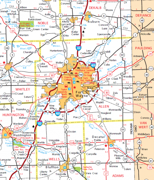
Allen County Transportation Map.jpg
From The RadioReference Wiki

Size of this preview: 512 × 599 pixels. Other resolutions: 205 × 240 pixels | 705 × 825 pixels.
Original file (705 × 825 pixels, file size: 307 KB, MIME type: image/png)
A sliced shot of the Indiana DOT Transportation Map, showing Allen County and surrounding counties.
File history
Click on a date/time to view the file as it appeared at that time.
| Date/Time | Thumbnail | Dimensions | User | Comment | |
|---|---|---|---|---|---|
| current | 16:43, 19 September 2011 | | 705 × 825 (307 KB) | Nbuuck (talk | contribs) | A sliced shot of the Indiana DOT Transportation Map, showing Allen County and surrounding counties. |
- You cannot overwrite this file.
File usage
The following page uses this file: