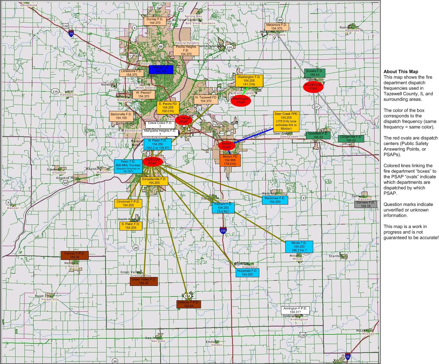
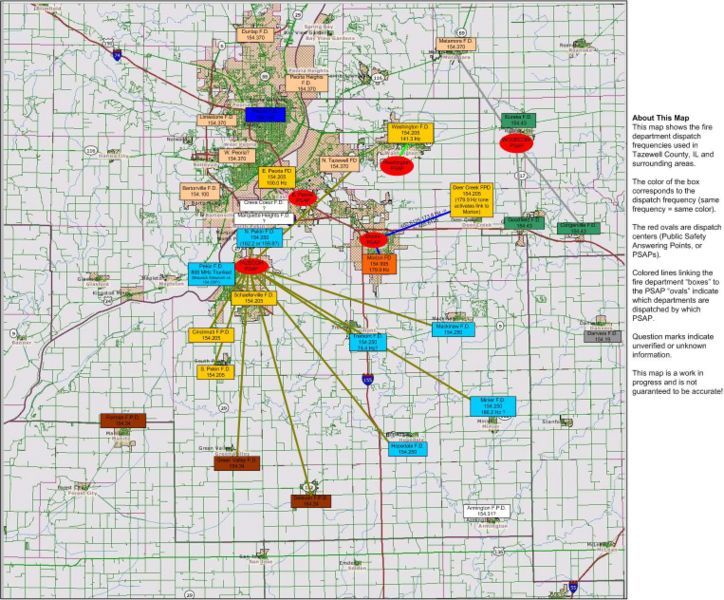
Tazewell County Fire Dispatch Map.JPG
From The RadioReference Wiki
Size of this preview: 724 × 600 pixels. Other resolutions: 290 × 240 pixels | 1,525 × 1,263 pixels.
Original file (1,525 × 1,263 pixels, file size: 458 KB, MIME type: image/jpeg)
Frequency and PL tone map for Tazewell County, IL
File history
Click on a date/time to view the file as it appeared at that time.
| Date/Time | Thumbnail | Dimensions | User | Comment | |
|---|---|---|---|---|---|
| current | 00:32, 16 May 2009 | | 1,525 × 1,263 (458 KB) | Cubn (talk | contribs) | Frequency and PL tone map for Tazewell County, IL |
- You cannot overwrite this file.
File usage
The following page uses this file: