Difference between revisions of "Individual CO DTRS Sites/Squaw"
From The RadioReference Wiki
Soundchaser (talk | contribs) m (change category) |
Soundchaser (talk | contribs) m (updated denials) |
||
| Line 3: | Line 3: | ||
*'''Counties covered:''' [[Clear_Creek_County_(CO)|Clear Creek]], [[Jefferson_County_(CO)|Jefferson]], [[Douglas_County_(CO)|Douglas]], [[Arapahoe_County_(CO)|Arapahoe]] | *'''Counties covered:''' [[Clear_Creek_County_(CO)|Clear Creek]], [[Jefferson_County_(CO)|Jefferson]], [[Douglas_County_(CO)|Douglas]], [[Arapahoe_County_(CO)|Arapahoe]] | ||
*'''Primary agencies:''' | *'''Primary agencies:''' | ||
| − | *'''Denied affiliations:''' Adams County, Poudre Fire Department, JeffCo Bldg | + | *'''Denied affiliations:''' Adams County, Poudre Fire Department, Poudre Schools, Poudre Valley Hosptial, JeffCo Bldg |
*'''Other notes:''' | *'''Other notes:''' | ||
Revision as of 19:32, 5 March 2011
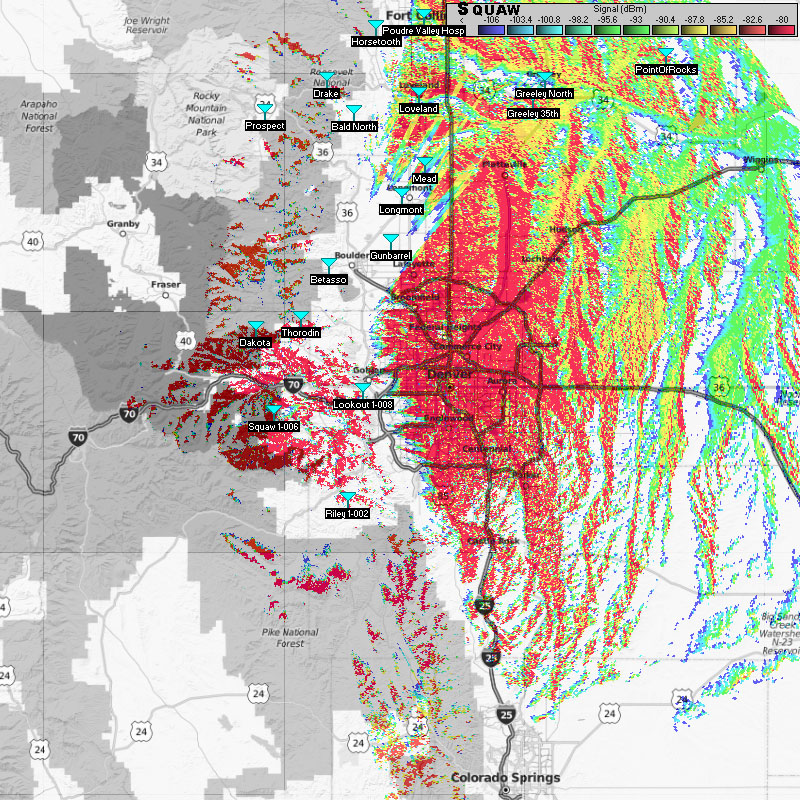
Squaw Mountain (1-006)
- County location: Clear Creek
- Counties covered: Clear Creek, Jefferson, Douglas, Arapahoe
- Primary agencies:
- Denied affiliations: Adams County, Poudre Fire Department, Poudre Schools, Poudre Valley Hosptial, JeffCo Bldg
- Other notes:
