Difference between revisions of "Kentucky Counties"
From The RadioReference Wiki
m (compass) |
|||
| (8 intermediate revisions by 3 users not shown) | |||
| Line 1: | Line 1: | ||
| + | http://www.digital-topo-maps.com/county-map/kentucky-county-map.gif<br>Map Courtesy of [http://www.digital-topo-maps.com/county-map/kentucky.shtml Digital-Topo-Maps.com] | ||
| + | |||
{| width="100%" style="vertical-align:top" | {| width="100%" style="vertical-align:top" | ||
| − | |width=" | + | |width="20%"| |
*[[Adair_County_(KY)|Adair]] | *[[Adair_County_(KY)|Adair]] | ||
*[[Allen_County_(KY)|Allen]] | *[[Allen_County_(KY)|Allen]] | ||
| Line 13: | Line 15: | ||
*[[Boyle_County_(KY)|Boyle]] | *[[Boyle_County_(KY)|Boyle]] | ||
*[[Bracken_County_(KY)|Bracken]] | *[[Bracken_County_(KY)|Bracken]] | ||
| − | *[[ | + | *[[Breathitt_County_(KY)|Breathitt]] |
*[[Breckinridge_County_(KY)|Breckinridge]] | *[[Breckinridge_County_(KY)|Breckinridge]] | ||
*[[Bullitt_County_(KY)|Bullitt]] | *[[Bullitt_County_(KY)|Bullitt]] | ||
| Line 25: | Line 27: | ||
*[[Casey_County_(KY)|Casey]] | *[[Casey_County_(KY)|Casey]] | ||
*[[Christian_County_(KY)|Christian]] | *[[Christian_County_(KY)|Christian]] | ||
| + | |width="20%"| | ||
*[[Clark_County_(KY)|Clark]] | *[[Clark_County_(KY)|Clark]] | ||
*[[Clay_County_(KY)|Clay]] | *[[Clay_County_(KY)|Clay]] | ||
| Line 31: | Line 34: | ||
*[[Cumberland_County_(KY)|Cumberland]] | *[[Cumberland_County_(KY)|Cumberland]] | ||
*[[Daviess_County_(KY)|Daviess]] | *[[Daviess_County_(KY)|Daviess]] | ||
| − | |||
*[[Edmonson_County_(KY)|Edmonson]] | *[[Edmonson_County_(KY)|Edmonson]] | ||
*[[Elliott_County_(KY)|Elliott]] | *[[Elliott_County_(KY)|Elliott]] | ||
| Line 50: | Line 52: | ||
*[[Hardin_County_(KY)|Hardin]] | *[[Hardin_County_(KY)|Hardin]] | ||
*[[Harlan_County_(KY)|Harlan]] | *[[Harlan_County_(KY)|Harlan]] | ||
| + | |width="20%"| | ||
*[[Harrison_County_(KY)|Harrison]] | *[[Harrison_County_(KY)|Harrison]] | ||
*[[Hart_County_(KY)|Hart]] | *[[Hart_County_(KY)|Hart]] | ||
| Line 62: | Line 65: | ||
*[[Kenton_County_(KY)|Kenton]] | *[[Kenton_County_(KY)|Kenton]] | ||
*[[Knott_County_(KY)|Knott]] | *[[Knott_County_(KY)|Knott]] | ||
| − | |||
*[[Knox_County_(KY)|Knox]] | *[[Knox_County_(KY)|Knox]] | ||
*[[Larue_County_(KY)|Larue]] | *[[Larue_County_(KY)|Larue]] | ||
| Line 75: | Line 77: | ||
*[[Logan_County_(KY)|Logan]] | *[[Logan_County_(KY)|Logan]] | ||
*[[Lyon_County_(KY)|Lyon]] | *[[Lyon_County_(KY)|Lyon]] | ||
| + | |width="20%"| | ||
*[[McCracken_County_(KY)|McCracken]] | *[[McCracken_County_(KY)|McCracken]] | ||
*[[McCreary_County_(KY)|McCreary]] | *[[McCreary_County_(KY)|McCreary]] | ||
| Line 80: | Line 83: | ||
*[[Madison_County_(KY)|Madison]] | *[[Madison_County_(KY)|Madison]] | ||
*[[Magoffin_County_(KY)|Magoffin]] | *[[Magoffin_County_(KY)|Magoffin]] | ||
| − | *[[ | + | *[[Marion_County_(KY)|Marion]] |
*[[Marshall_County_(KY)|Marshall]] | *[[Marshall_County_(KY)|Marshall]] | ||
*[[Martin_County_(KY)|Martin]] | *[[Martin_County_(KY)|Martin]] | ||
| Line 93: | Line 96: | ||
*[[Muhlenberg_County_(KY)|Muhlenberg]] | *[[Muhlenberg_County_(KY)|Muhlenberg]] | ||
*[[Nelson_County_(KY)|Nelson]] | *[[Nelson_County_(KY)|Nelson]] | ||
| − | |||
*[[Nicholas_County_(KY)|Nicholas]] | *[[Nicholas_County_(KY)|Nicholas]] | ||
*[[Ohio_County_(KY)|Ohio]] | *[[Ohio_County_(KY)|Ohio]] | ||
| Line 100: | Line 102: | ||
*[[Owsley_County_(KY)|Owsley]] | *[[Owsley_County_(KY)|Owsley]] | ||
*[[Pendleton_County_(KY)|Pendleton]] | *[[Pendleton_County_(KY)|Pendleton]] | ||
| + | |width="20%"| | ||
*[[Perry_County_(KY)|Perry]] | *[[Perry_County_(KY)|Perry]] | ||
*[[Pike_County_(KY)|Pike]] | *[[Pike_County_(KY)|Pike]] | ||
| Line 122: | Line 125: | ||
*[[Webster_County_(KY)|Webster]] | *[[Webster_County_(KY)|Webster]] | ||
*[[Whitley_County_(KY)|Whitley]] | *[[Whitley_County_(KY)|Whitley]] | ||
| − | *[[ | + | *[[Wolfe_County_(KY)|Wolfe]] |
*[[Woodford_County_(KY)|Woodford]] | *[[Woodford_County_(KY)|Woodford]] | ||
|} | |} | ||
| − | [[Category: | + | |
| + | ==Surrounding Counties== | ||
| + | {{Geographic Location | ||
| + | | Northwest = [[Illinois Counties]] | ||
| + | | North = [[Indiana Counties]]<br/>[[Ohio Counties]] | ||
| + | | Northeast = [[West Virginia Counties]] | ||
| + | | West = [[Missouri Counties]] | ||
| + | | Center = Kentucky Counties | ||
| + | | East = [[Virginia Counties]] | ||
| + | | Southwest = | ||
| + | | South = [[Tennessee Counties]] | ||
| + | | Southeast = | ||
| + | }} | ||
| + | |||
| + | |||
| + | |||
| + | |||
| + | Return to DB page: {{DB|st|21|Kentucky}}<br/> | ||
| + | Return to Wiki page: [[Kentucky (US)]]<br/> | ||
| + | |||
| + | [[Category:Kentucky]] | ||
Latest revision as of 09:19, 7 June 2015
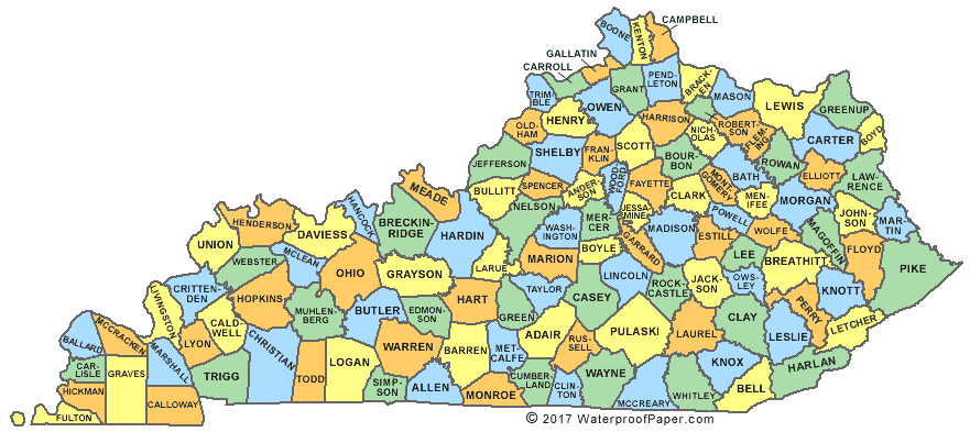
Map Courtesy of Digital-Topo-Maps.com
Surrounding Counties

|
Illinois Counties | Indiana Counties Ohio Counties |
West Virginia Counties |
|
| Missouri Counties | Virginia Counties | |||
| Tennessee Counties |
Return to DB page: Kentucky
Return to Wiki page: Kentucky (US)