Difference between revisions of "State of Colorado DTRS"
From The RadioReference Wiki
m (updated link to avoid redirect) |
|||
| Line 1: | Line 1: | ||
| − | {{ | + | {{Infobox_TRS_MultiCounty |
|SysName= State of Colorado DTRS | |SysName= State of Colorado DTRS | ||
|Flavor= [[Project 25]] Phase I | |Flavor= [[Project 25]] Phase I | ||
Revision as of 07:46, 2 February 2015
| System Name | State of Colorado DTRS |
| System Type | Project 25 Phase I |
| System ID | BEE07-D1C |
| Connect Tone | ? |
| Wide Area Communications Network | ? |
| Network Access Code | ? |
| TRBO Color Code | ? |
| NXDN RAN | |
| Band | 700 / 800 |
| County | Various |
| State | Colorado |
| Ownership | Public |
|
| |
| State of Colorado DTRS RR DB Entry | |
| State of Colorado DTRS Site Map from the RRDB | |
| Colorado Discussion Forum | |
|
| |
| MediaWiki | |
| QuickRef | |
| PDF Card | |
Welcome to the State of Colorado DTRS collaboration article, a Trunked Radio System located in Colorado.
This is where you, the user, may index any articles you develop for scanning related topics for this Trunked Radio System.
System Notes
- Colorado DTRS site information, including coverage maps
- Colorado DTRS Interstate Travel Reference
- Colorado DTRS Site Information (category)
Related Links
- The Story of the Colorado Statewide Digital Trunked Radio System (DTRS)
- Colorado State Patrol (CSP)
- CDOT Maintenance Patrols(PDF)
- CDOT Region 6 Maint Patrols (PDF)
- Division of Wildlife Map of District Wildlife Areas (PDF)
- Consolidated Communications Network of Colorado
- Pike's Peak Communications Network
- Trunktrackers and the Colorado DTRS
The image below is a link to a RadioReference custom Google map that depicts the approximate location of each site. After clicking on this link, you may zoom in to see the approximate location of the site, and some site details may be seen by clicking on a site's pushpin.
<a href="http://www.radioreference.com/apps/db/?action=siteMap&sid=329&type=rr"> <img border="0" width="435" height="326" alt="DTRS Tower Site Map" src="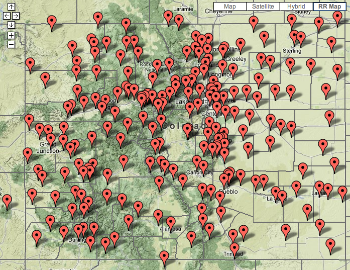 " /></a>
Here is a map of the current MAC regions. Click to see the full size view:
<a href="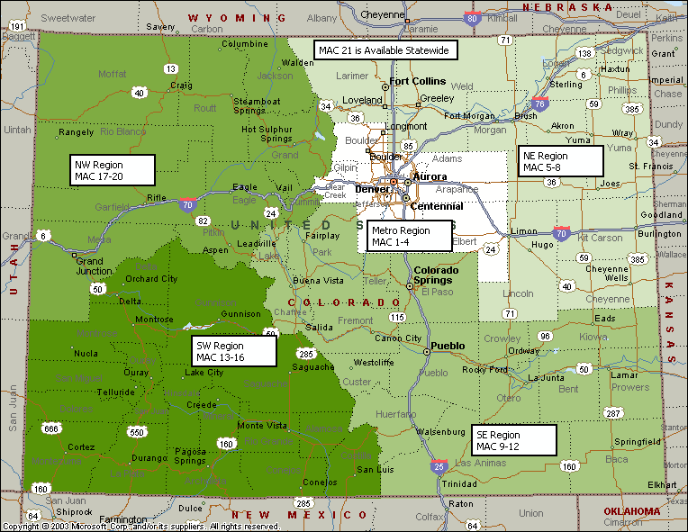 "><img border="0" width="435" height="326" alt="DTRS Mutual Aid Channel (MAC) Region Map" src="" /></a>
Here is a map of all the Colorado State Patrol Districts for reference. Click to see full size:
<a href="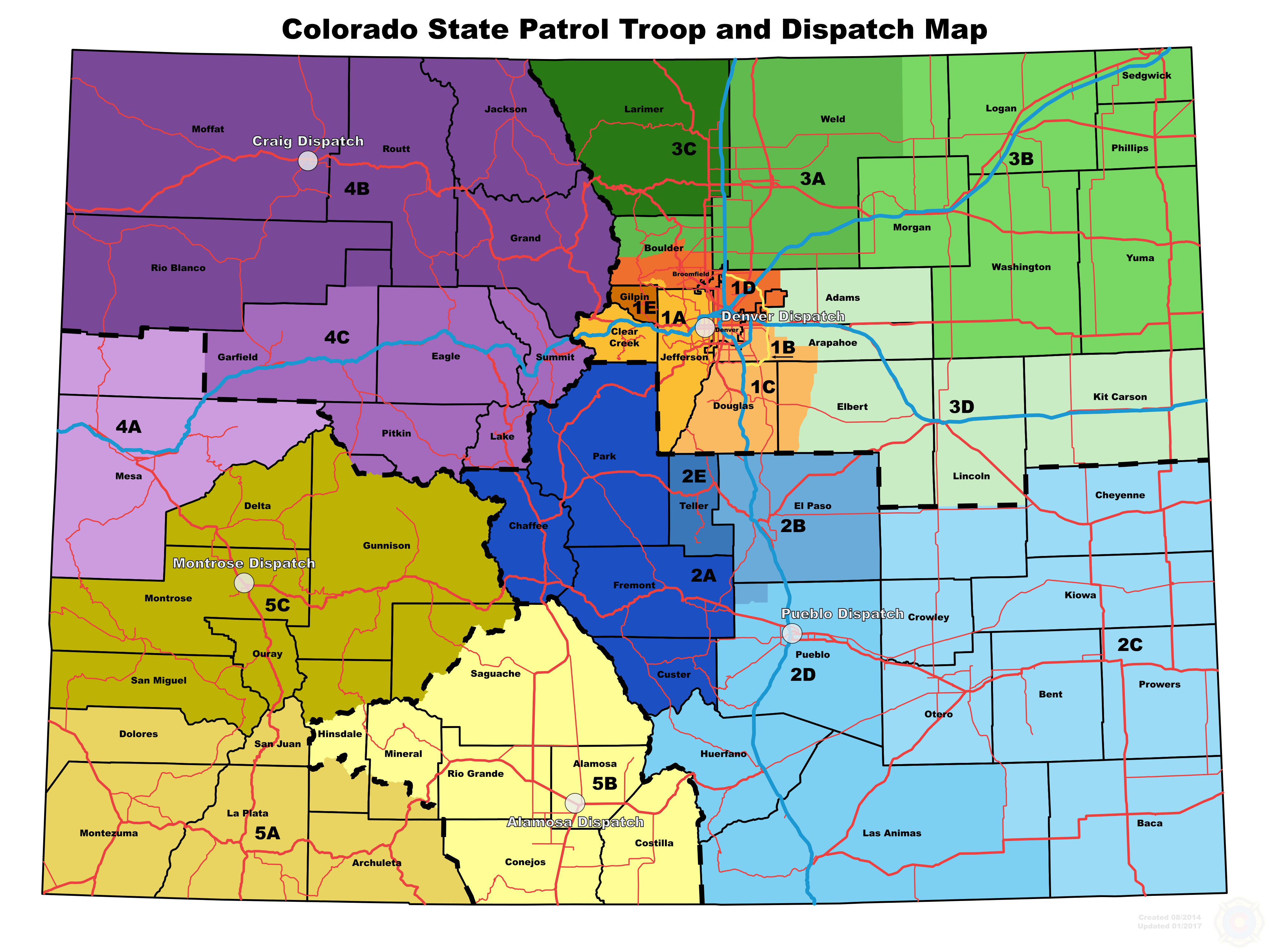 "> <img border="0" width="435" height="326" alt="Colorado State Patrol (CSP) Troop Map" src="" /></a>
Site specific information, such as site maps for the Denver and Colorado Springs areas, coverage maps and denials, can be found <a href="http://wiki.radioreference.com/index.php/Individual_CO_DTRS_Sites">here.</a>