State of Colorado DTRS
From The RadioReference Wiki
Template:MultiCounty Trunking Infobox
System Notes
- Colorado DTRS site information, including coverage maps
- Colorado DTRS Interstate Travel Reference
- Colorado DTRS Site Information (category)
Related Links
- The Story of the Colorado Statewide Digital Trunked Radio System (DTRS)
- Colorado State Patrol (CSP)
- CDOT Maintenance Patrols(PDF)
- CDOT Region 6 Maint Patrols (PDF)
- Division of Wildlife Map of District Wildlife Areas (PDF)
- Consolidated Communications Network of Colorado
- Pike's Peak Communications Network
- Trunktrackers and the Colorado DTRS
The image below is a link to a RadioReference custom Google map that depicts the approximate location of each site. After clicking on this link, you may zoom in to see the approximate location of the site, and some site details may be seen by clicking on a site's pushpin.
<a href="http://www.radioreference.com/apps/db/?action=siteMap&sid=329&type=rr"> <img border="0" width="435" height="326" alt="DTRS Tower Site Map" src="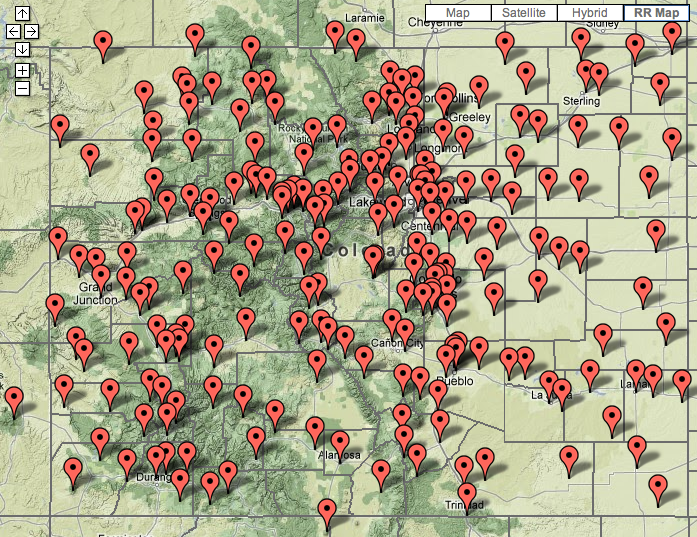 " /></a>
Here is a map of the current MAC regions. Click to see the full size view:
<a href="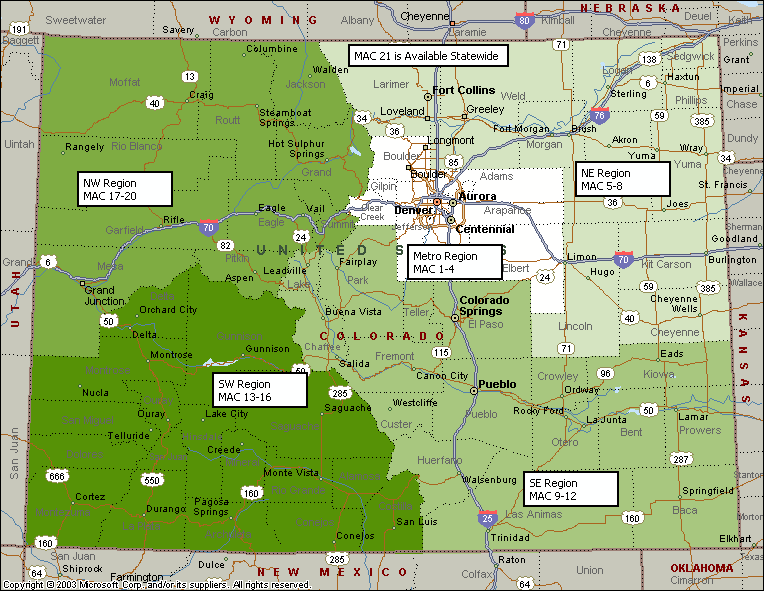 "><img border="0" width="435" height="326" alt="DTRS Mutual Aid Channel (MAC) Region Map" src="" /></a>
Here is a map of all the Colorado State Patrol Districts for reference. Click to see full size:
<a href="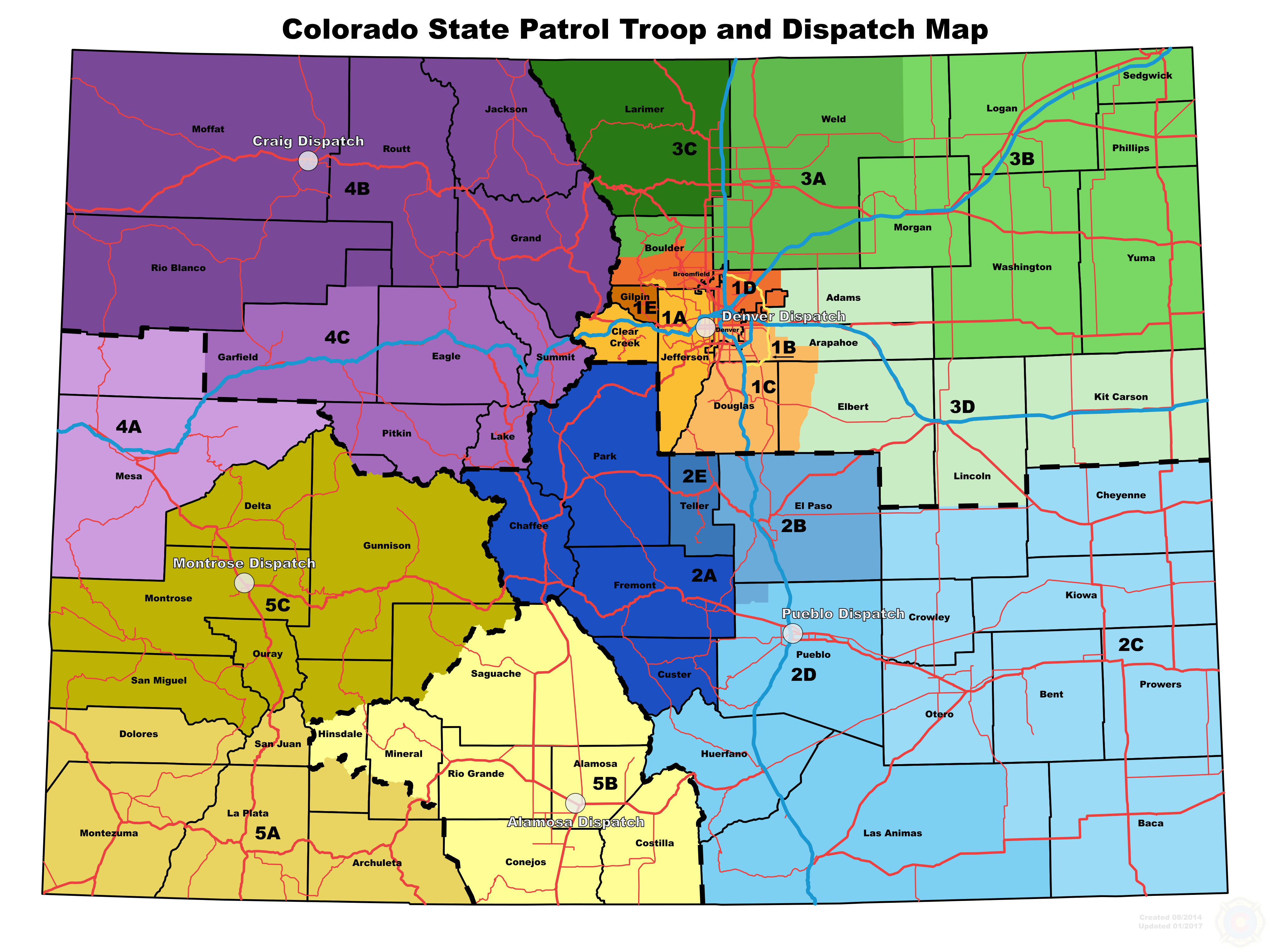 "> <img border="0" width="435" height="326" alt="Colorado State Patrol (CSP) Troop Map" src="" /></a>
Site specific information, such as site maps for the Denver and Colorado Springs areas, coverage maps and denials, can be found <a href="http://wiki.radioreference.com/index.php/Individual_CO_DTRS_Sites">here.</a>