File list
This special page shows all uploaded files.
| Date | Name | Thumbnail | Size | User | Description | Versions |
|---|---|---|---|---|---|---|
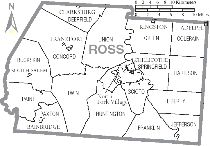
| 12:53, 9 May 2019 | Ross County Ohio.png (file) |  |
47 KB | Wa8pyr | Ross County map with townships | 1 |
| 18:49, 2 April 2019 | MTZVHF.pdf (file) | 401 KB | Rbuxton | From 2017 county emergency operations plan. | 1 | |
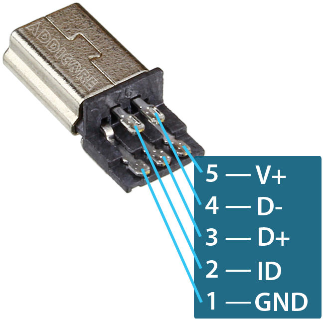
| 10:26, 28 March 2019 | SDS100-USB-Pinout.jpg (file) |  |
57 KB | Blantonl | Uniden SDS100 USB Pinout | 1 |
| 20:47, 16 March 2019 | MTZ FD Map.pdf (file) | 1.08 MB | Rbuxton | Montezuma County, Colorado, map of fire district boundaries. | 1 | |
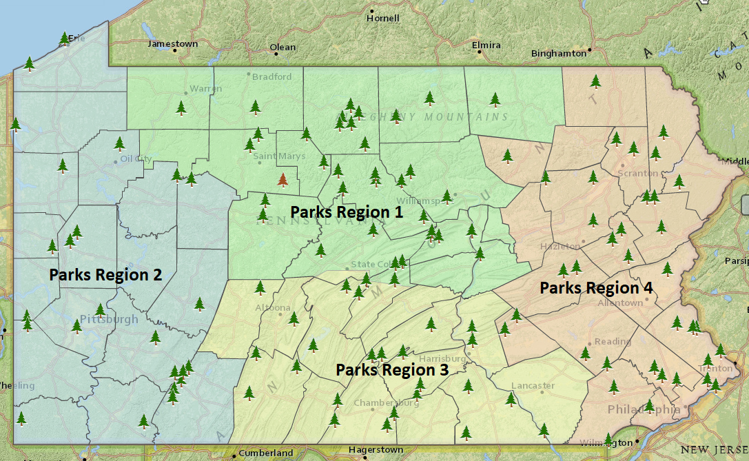
| 15:03, 25 February 2019 | Park Region Map.PNG (file) |  |
1.58 MB | HM1529 | 1 | |
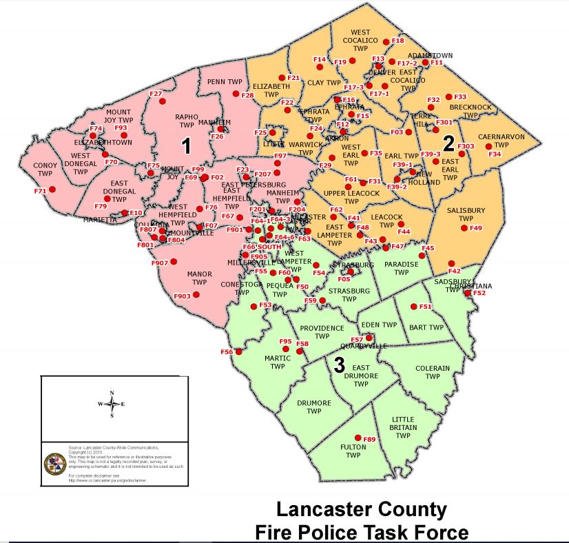
| 20:22, 18 February 2019 | FP Task Force Zones.JPG (file) |  |
128 KB | HM1529 | 1 | |
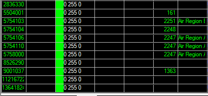
| 14:45, 11 February 2019 | Radio IDs on the PA 700Mhz Air- ground systems 2.png (file) |  |
10 KB | KB3KBR | This is a screen shot of all heard RIDS on the 700Mhz Air-Ground syatem as recieved from the Venango site. | 1 |
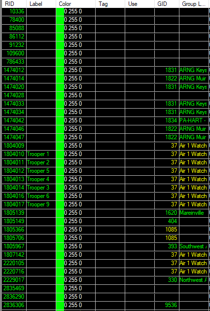
| 14:38, 11 February 2019 | Radio IDs on the PA 700Mhz Air- ground systems 1.png (file) |  |
34 KB | KB3KBR | This is a screen shot of all heard RIDS on the 700Mhz Air-Ground syatem as recieved from the Venango site. | 1 |
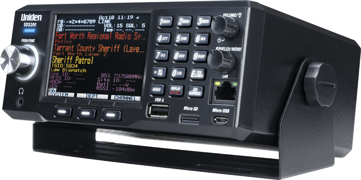
| 10:00, 10 January 2019 | Web UNIDEN-SDS200-LoQTR LEFT-rt.png (file) |  |
926 KB | Phyberoptics | Uniden SDS200 | 1 |
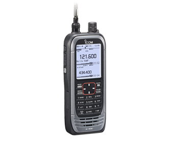
| 12:34, 12 December 2018 | IC-R30.jpg (file) |  |
21 KB | W2GLD | Reverted to version as of 14:57, 13 August 2018 | 5 |
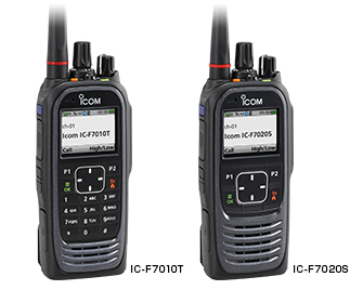
| 13:15, 11 December 2018 | IC-F7000 Portables.jpg (file) |  |
42 KB | W2GLD | ICOM IC-F7000 series portables | 1 |
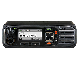
| 13:14, 11 December 2018 | IC-F7500 Mobiles.jpg (file) |  |
41 KB | W2GLD | ICOM IC-F7500 series mobiles | 1 |
| 22:48, 7 December 2018 | RS13 ChannelMap.png (file) |  |
19 KB | Gilligan | 1 | |
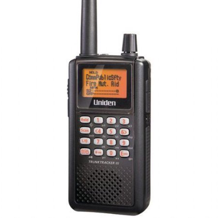
| 13:58, 21 November 2018 | Sds100.jpg (file) |  |
75 KB | Ronaldski | 1 | |
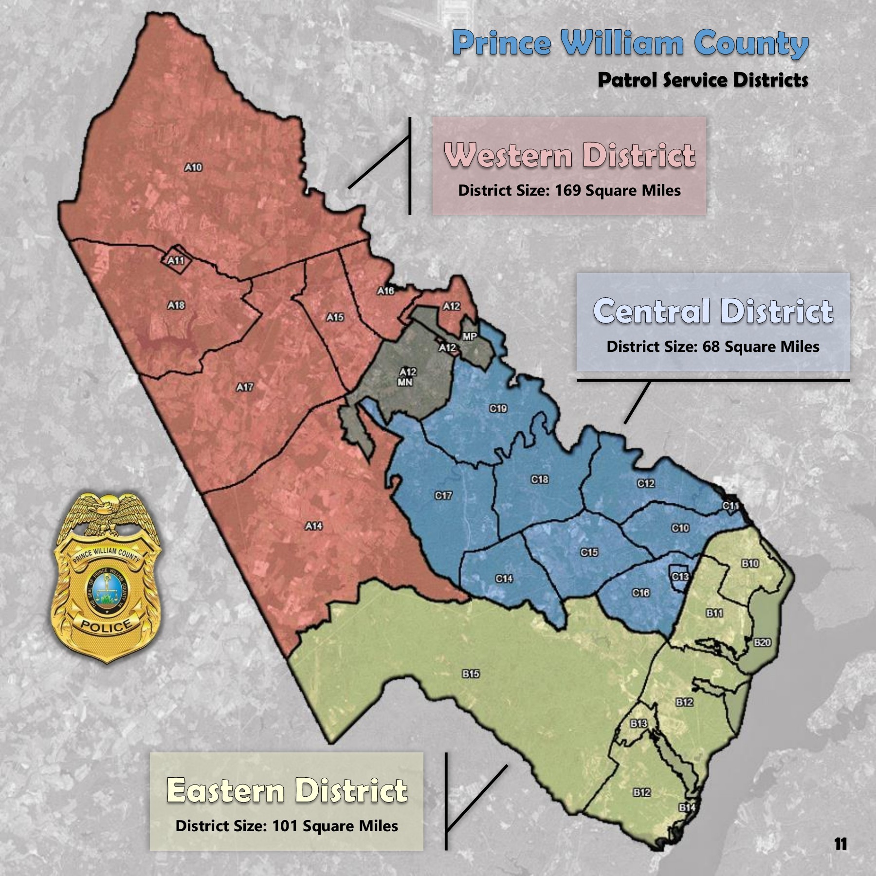
| 23:09, 5 November 2018 | PWCBEATS 2018.jpg (file) |  |
615 KB | Beastieboy101 | 1 | |
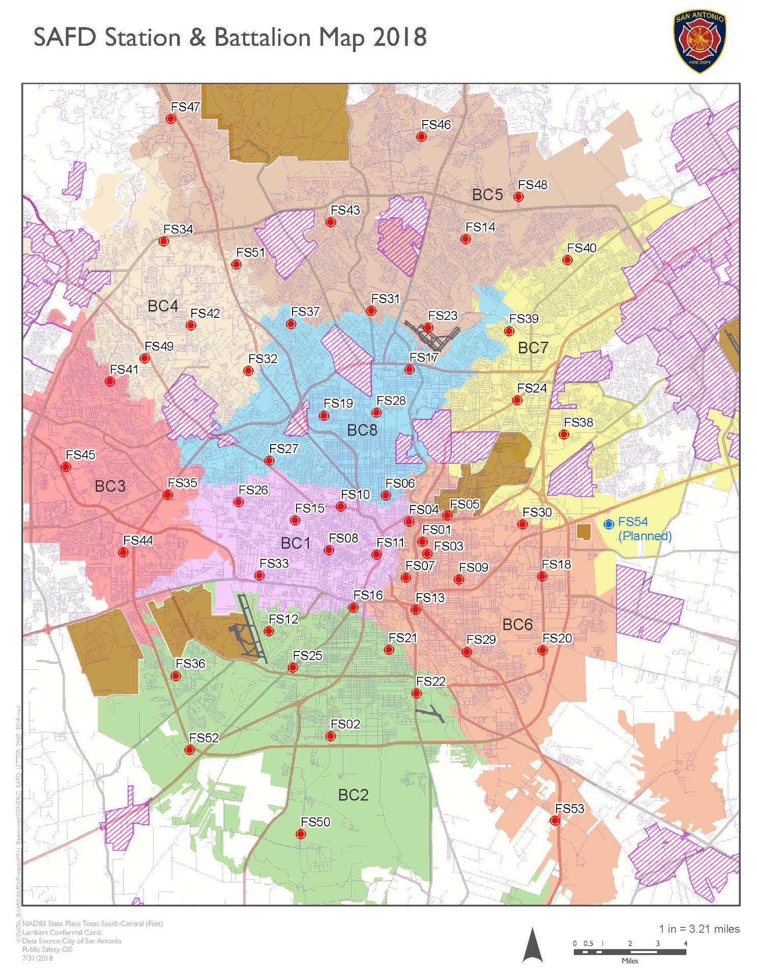
| 13:20, 21 September 2018 | SAFD StBat2018.jpg (file) |  |
996 KB | Blantonl | San Antonio Fire Department Stations and Battalions | 1 |
| 17:56, 8 September 2018 | Kenwood-tk380.jpg (file) |  |
140 KB | K7MFC | Kenwood TK-380 (UHF) with DTMF keypad | 1 |
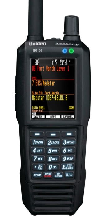
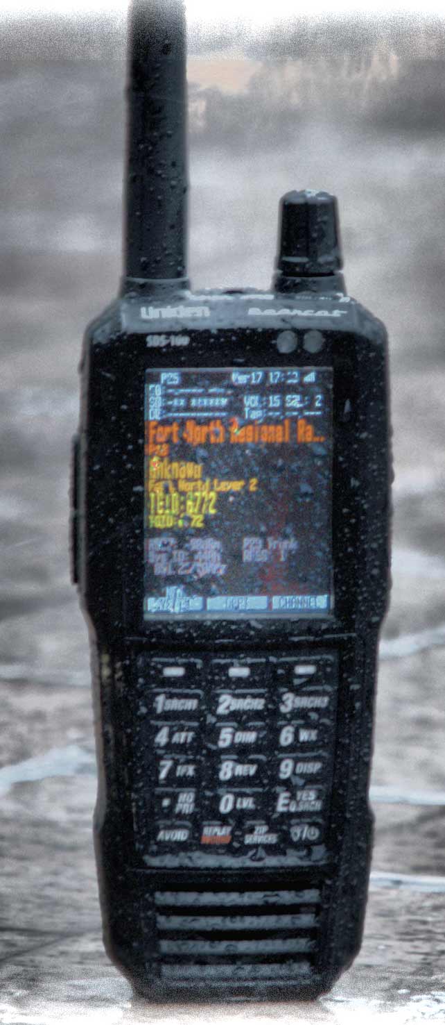
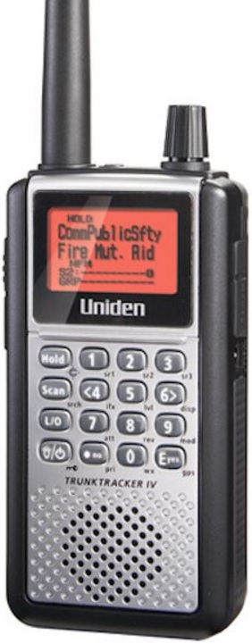
| 11:48, 16 August 2018 | SDS100Image.jpg (file) |  |
81 KB | KE4ZNR | SDS100 | 1 |
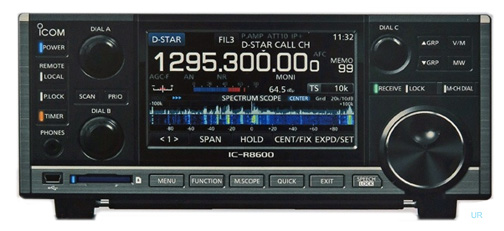
| 10:00, 13 August 2018 | IC-R8600.jpg (file) |  |
74 KB | W2GLD | ICOM IC-R8600 Receiver | 1 |
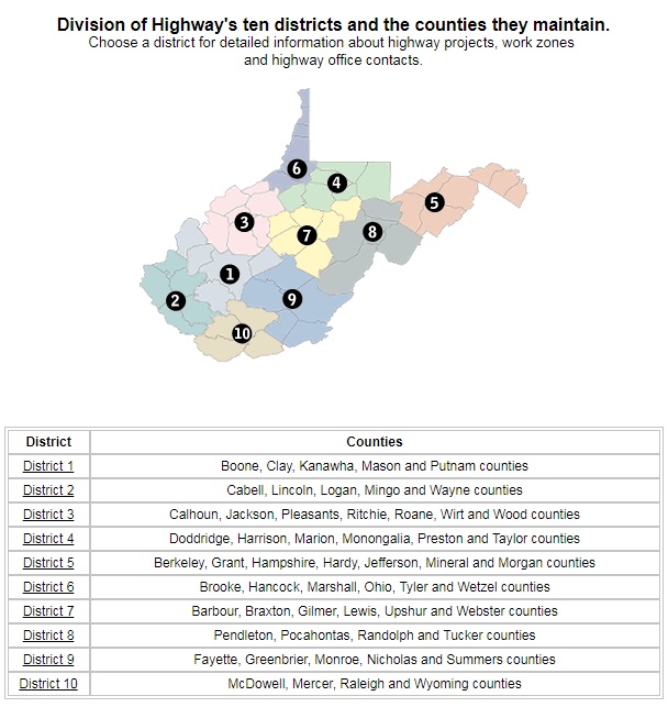
| 08:26, 1 August 2018 | WV DOH District Map.jpg (file) |  |
119 KB | Bm82557 | 1 | |
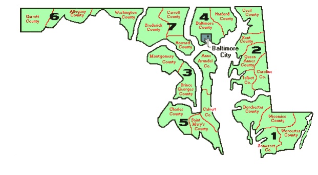
| 18:29, 31 July 2018 | Maryland SHA Districts Map.jpg (file) |  |
55 KB | Bm82557 | 1 | |
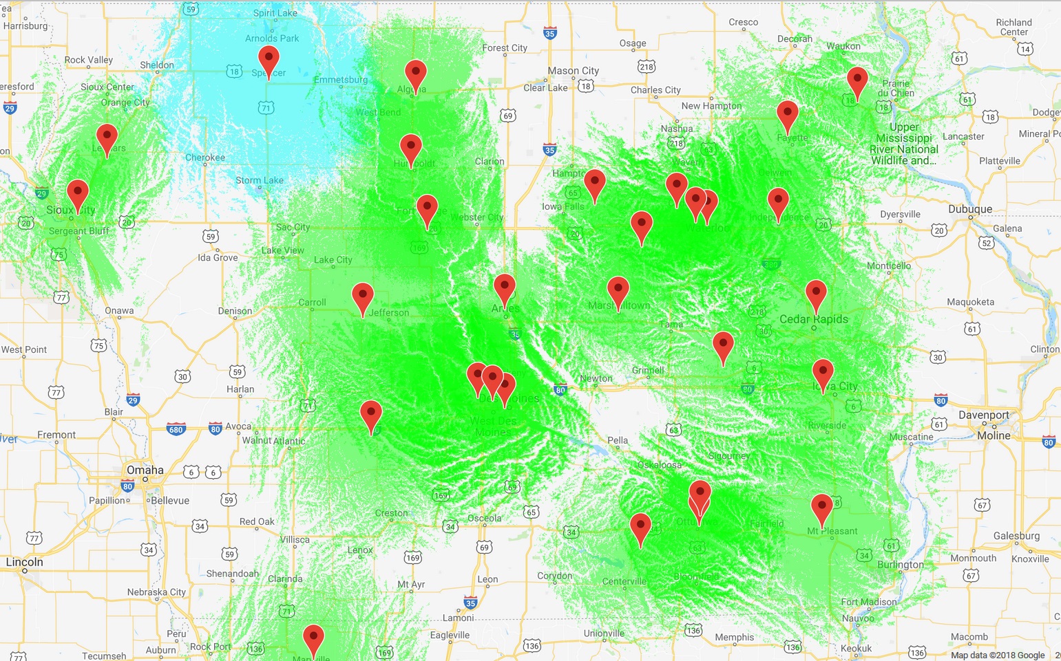
| 00:19, 9 July 2018 | IOWA DMR COVERAGE.jpg (file) |  |
721 KB | Timkilbride | Reverted to version as of 02:37, 17 July 2017 | 3 |
| 14:03, 6 June 2018 | ScanMacoupinCountyFBpageCover.png (file) |  |
273 KB | Starcom21 | 1 | |
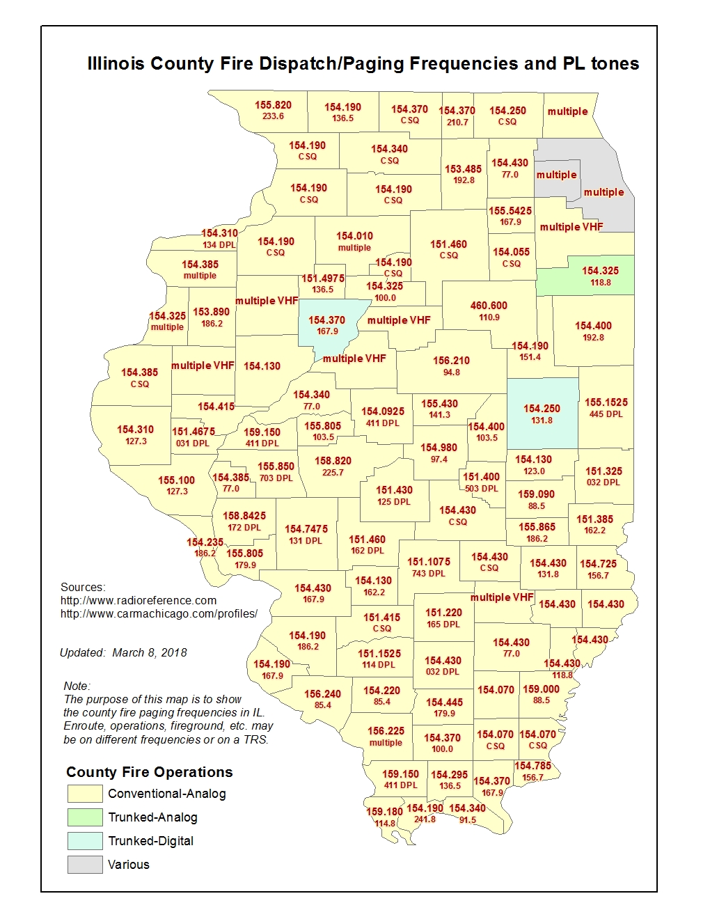
| 13:46, 12 February 2018 | IL County Fire Dispatch frequencies map.jpg (file) |  |
451 KB | Cubn | Multiple freq/tone updates | 14 |
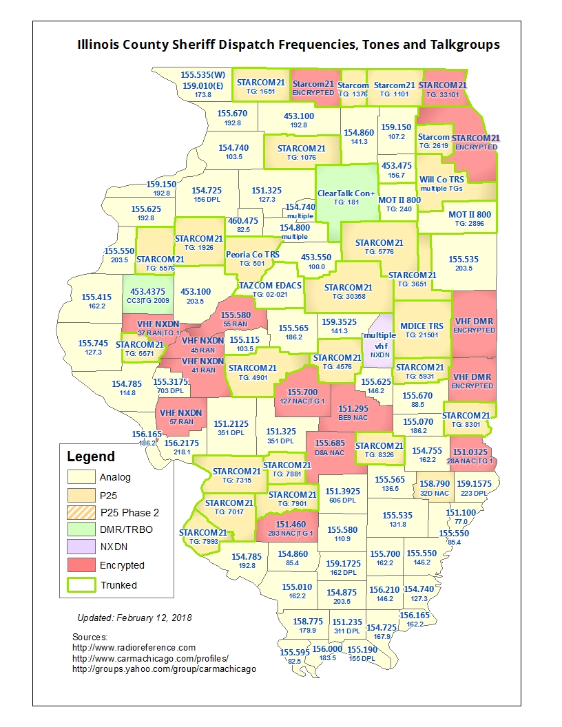
| 13:27, 12 February 2018 | IL County Sheriff Dispatch frequencies map.jpg (file) |  |
515 KB | Cubn | changed Greene Co to NXDN enc | 56 |
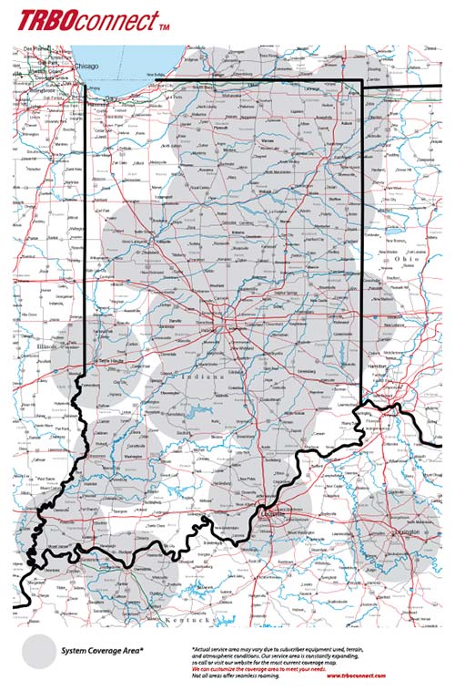
| 09:49, 29 January 2018 | TRBOconnect-map.jpg (file) |  |
93 KB | Wa8pyr | Coverage map for ERS-OCT TRBOconnect system | 1 |
| 22:57, 24 January 2018 | ScanMacoupin.gif (file) | 5 KB | Starcom21 | ScanMacoupin | 1 | |
| 23:46, 21 January 2018 | Hpd beat map.pdf (file) | 1.3 MB | N5ams | Houston Police Department Patrol Divisions Map | 1 | |
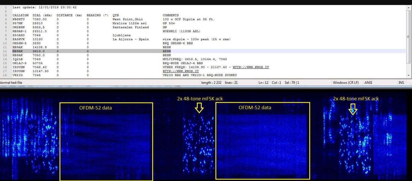
| 15:09, 13 January 2018 | VARA waterfall.JPG (file) |  |
108 KB | Ka3jjz | waterfall for newly identified HF dig mode | 1 |
| 14:00, 6 January 2018 | CHIRP tone programming.pdf (file) | 97 KB | Nd5y | updated image | 3 | |
| 20:27, 4 January 2018 | Kendall TX Fire Districts.pdf (file) | 384 KB | Rattlerbb01 | Map | 1 | |
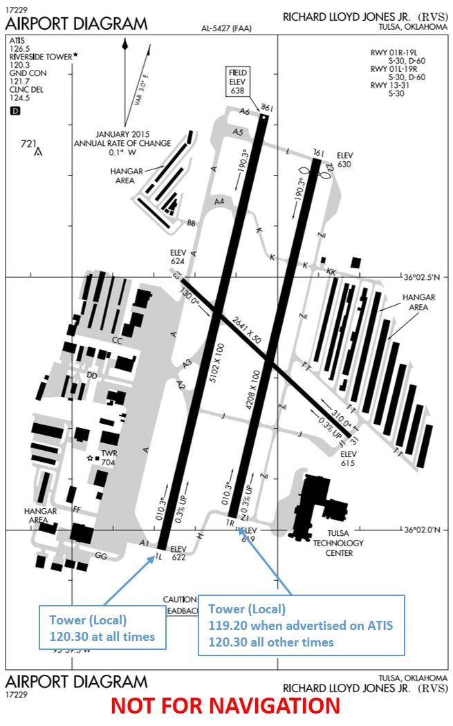
| 11:52, 30 December 2017 | KRVS Airport Diagram.jpg (file) |  |
117 KB | Andy51edge | 1 | |
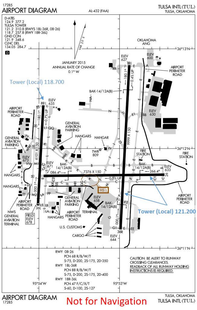
| 18:44, 28 December 2017 | KTUL Runway Freq Map.jpg (file) |  |
132 KB | Andy51edge | Relocated Label and eliminated artifact of Microsoft PowerPoint | 2 |
| 16:40, 28 December 2017 | Tulsa Airspace Map.jpg (file) |  |
128 KB | Andy51edge | Reverted to version as of 21:28, 28 December 2017 | 4 |
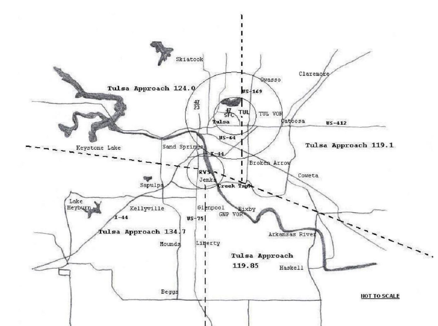
| 16:26, 28 December 2017 | Tulsa Approach Frequencies.jpg (file) |  |
128 KB | Andy51edge | 1 | |
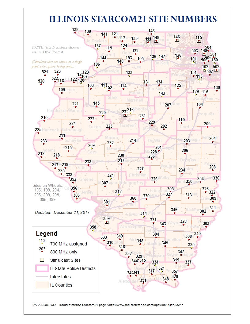
| 20:18, 21 December 2017 | Starcom21 Site Numbers Map.jpg (file) |  |
493 KB | Cubn | Cartographic changes (thickened interstates, added city boundaries, made county name font bigger, made towers more prominent and ISP boundaries less prominent) | 13 |
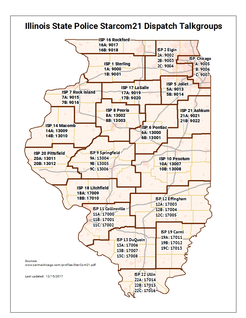
| 19:49, 21 December 2017 | ILStatePolice Dispatch Talkgroups Map.jpg (file) |  |
448 KB | Cubn | Map showing the dispatch talkgroups for the Illinois State Police | 1 |
| 21:20, 8 October 2017 | 410 VHF.jpg (file) |  |
365 KB | Kinglou0 | Coverage map of SCWCS/SS911 WA-410 VHF network | 1 |
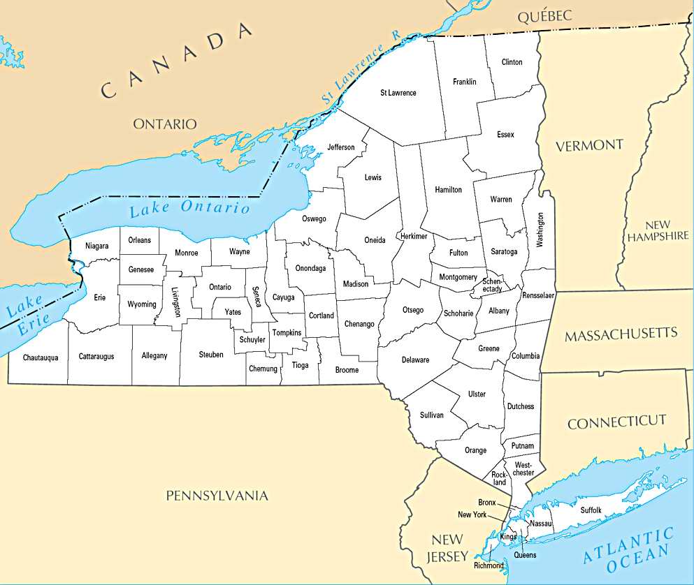
| 09:37, 7 October 2017 | NY County Map.jpg (file) |  |
78 KB | Nickthequick0 | 1 | |
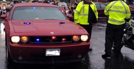
| 23:15, 1 October 2017 | HSOChallenger.jpg (file) |  |
43 KB | Stick0413 | Hopewell, VA Sheriff's Office Dodge Challenger & Slight Image of BMW Motorcycle | 1 |
| 23:13, 1 October 2017 | HSO2016Charger.jpg (file) |  |
11 KB | Stick0413 | Hopewell, VA Sheriff's Office 2016 Dodge Charger | 1 |
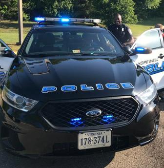
| 23:10, 1 October 2017 | HopewellPDPI.jpg (file) |  |
28 KB | Stick0413 | Hopewell, VA Ford PI | 1 |
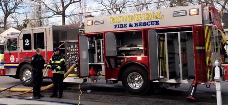
| 22:46, 1 October 2017 | HopewellEng2.jpg (file) |  |
24 KB | Stick0413 | Hopewell, VA Engine 2 | 1 |
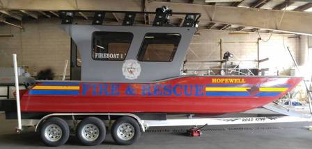
| 22:42, 1 October 2017 | HopewellFireBoat1.jpg (file) |  |
19 KB | Stick0413 | Hopewell VA Fireboat 1 | 1 |
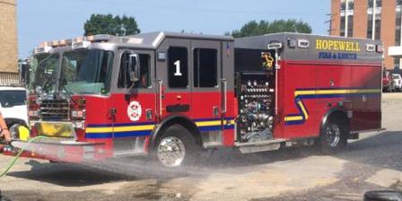
| 22:32, 1 October 2017 | HopewellEng1.jpg (file) |  |
20 KB | Stick0413 | Hopewell, VA Engine 1 | 1 |
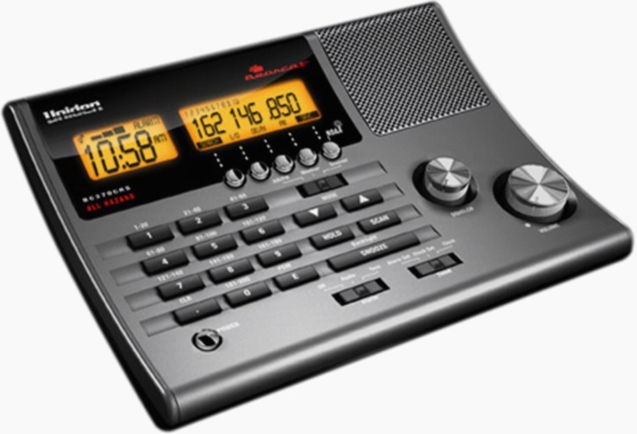
| 11:54, 24 September 2017 | Bc370crs.gif (file) |  |
121 KB | Darunimal | Uniden Bearcat BC370CRS Radio Scanner Enlargement | 2 |
| 17:14, 16 September 2017 | BCD396XT angle retouch.jpg (file) |  |
66 KB | Darunimal | 2 | |
| 17:02, 16 September 2017 | BC346XT.jpg (file) |  |
28 KB | Darunimal | 5 | |
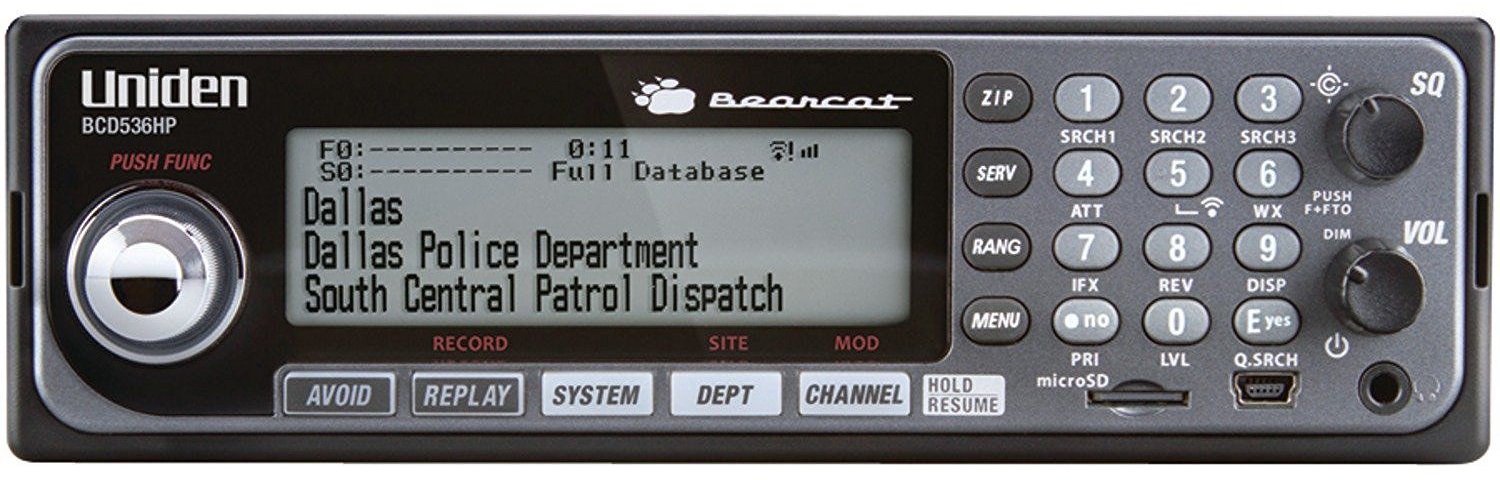
| 16:44, 16 September 2017 | BCD536HP.jpg (file) |  |
230 KB | Darunimal | 2 | |
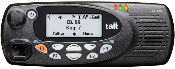
| 20:52, 22 August 2017 | Tait-tm9400.jpg (file) |  |
39 KB | Scanwi | 1 |